Law 26.639, also know as Ley de Glaciares and enacted in 2010, established in Argentina the Minimum Budgets Regime for the Preservation of Glaciers and the Periglacial Environment, legally cementing the idea that glaciers are strategic freshwater reserves and public goods. Starting in 2025–2026, the national government pushed forward a project for a comprehensive modification of this norm (File 0161-PE-2025), which obtained half-sanction in the Senate and approval from the Chamber of Deputies, generating strong political and social conflict.
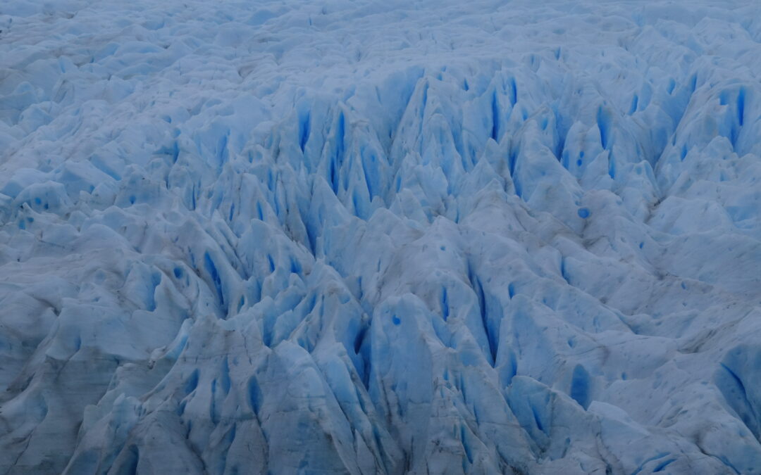
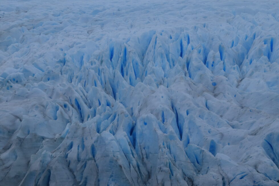
Karukinka Expedition (Fouque Glacier, 2025)
This article outlines the core content of the existing law, the main adopted modifications, the role of the provinces, as well as the social mobilizations and the interventions of Indigenous peoples—notably the Selk'nam jurist Antonela Guevara—who denounce the potential impacts of this reform (risks to water, ecosystems, and territorial rights).
Table of Contents
Law 26.639 (2010): content and scope
Purpose and principles
Article 1 of Law 26.639 sets the objective of establishing minimum budgets for the protection of glaciers and the periglacial environment, recognizing them as strategic reserves of water resources for human consumption, agriculture, watershed recharge, biodiversity protection, scientific research, and tourism. Glaciers are explicitly declared public goods.
The Library of Congress highlights that this law falls under the framework of Article 41 of the National Constitution (right to a healthy environment, national minimum budgets) and the General Environmental Law 25.675, which enshrines the principles of prevention, precaution, and non-regression.
Definitions: glacier and periglacial environment
Article 2 defines a glacier as any perennial ice mass, stable or slowly flowing, formed by the recrystallization of snow, regardless of its shape, dimension, or state of conservation; this includes rocky detrital materials and internal or superficial watercourses.
The periglacial environment is defined, in high mountains, as the area of frozen soils that acts as a water regulator, and in medium and low mountains, as the area with ice-saturated soils that plays the same regulatory role. These very broad definitions extend the scope of protection to forms of ice and frozen soils that go beyond just large visible glaciers.
National Glacier Inventory of Argentina (ING)
Articles 3 and 4 create the National Glacier Inventory, entrusted to the Argentine Institute of Nivology, Glaciology and Environmental Sciences (IANIGLA-CONICET), tasked with identifying all glaciers and periglacial landforms acting as water reserves, including their location, surface area, typology, and the variables necessary for their protection and monitoring.
The Legislative Dossier of the Library of Congress notes that Decree 207/2011 specified the organization of the ING by major glaciological regions (Desert, Central, Northern and Southern Patagonian Andes, Tierra del Fuego, and South Atlantic Islands) and mandated an update at least every five years.
Prohibited activities
Among its most important provisions, the law prohibits certain activities in glaciers and the periglacial environment, particularly:
mining and hydrocarbon exploration and exploitation;
the installation of industries;
the construction of works or infrastructure that could alter the natural dynamics of the ice or water quality (except for scientific research);
the storage or handling of contaminating or hazardous substances.
Any activity that may significantly affect these environments must be subject to a prior environmental impact assessment, in accordance with the General Environmental Law.
The 2025–2026 reform project: objectives and core modifications
Political context and stated objectives
In December 2025, the national executive branch submitted to the Senate Expediente 0161-PE-2025, aiming to amend Law 26.639, arguing the need to correct "interpretative flaws," lift legal uncertainties, and facilitate investments, particularly in mining. According to an analysis by Infobae, the executive presents the reform as a way to strengthen "environmental federalism" by giving provinces a greater role in managing their resources.
The project obtained 40 votes out of 72 in the Senate (40 in favor, 31 against, 1 abstention), with the support of part of the Radical Civic Union, Pro, and Peronist senators from mining provinces, before being passed to the Chamber of Deputies. In the lower house, the reform was ultimately approved by 137 votes in favor, 111 against, and 3 abstentions, and then sent to the executive for promulgation.
Redefinition of the inventory: "that act as reserves"
One of the most significant changes concerns Article 3 of the law, relating to the National Glacier Inventory. The new text, as described by the newspaper Ámbito, now stipulates that the ING will inventory glaciers and periglacial areas that "act as strategic reserves of water resources," instead of those that "fulfill the functions" of a reserve.
This substitution seems minor lexically, but the Library of Congress Dossier points out that it contributes to a re-definition of the extent of protected areas, by conditioning protection on the demonstration of an effective hydrological function rather than the mere presence of perennial ice. Provincial authorities are called upon to play a central role in this assessment.
Precautionary principle and possibility of subsequent exclusion
The reform introduces an Article 3 bis, which specifies, according to the text analyzed by Ámbito, that:
all glaciers and periglacial areas registered in the inventory will be considered part of the protected object until the competent authority verifies the non-existence of the hydrological functions defined in Article 1;
further on, it stipulates that when it is determined, based on technical-scientific studies, that a glacier or periglacial area "does not fulfill the intended functions," it may be considered excluded from the protected object.
We thus shift from a broad presumption of protection (any perennial ice mass in a periglacial environment) to a logic where the Inventory becomes a filtering tool, with the possibility of declassifying glacial units based on specific analyses.
Terminology: from "periglacial environment" to "periglacial landforms"
Several terminological modifications replace the expression "periglacial environment" with "periglacial landforms" (geoformas periglaciares) in the articles relating to the inventory and the competencies of authorities. For critics, this semantic substitution tends to fragment the object of protection (from the environment as a system to isolated landforms), which could reduce the territorial scope of the law.
Provincial competencies and the role of IANIGLA
The reform strengthens the mention of provincial authorities as "competent authorities," tasked with identifying, based on technical-scientific evidence, which glaciers and periglacial areas located in their territory fulfill certain hydrological functions. Where the previous version spoke of "sharing" information with IANIGLA, the new drafting replaces it with "notifying" the institute of the recorded ice bodies.
The Library of Congress Dossier indicates that these changes are at the heart of the debate on environmental non-regression: the fear is that provincial authorities subject to strong economic pressures might reclassify areas based on their hydrological functions, thereby reducing the extent of the protection regime.
Prohibited activities and environmental assessments
Article 6 (prohibited activities) is also amended. The new text maintains the catalog of prohibited activities (activities that "relevantly" alter the natural condition or hydrological functions, destruction, displacement, interference with ice advance, etc.), but now specifies that the severity of the alteration must be assessed "in the terms of Article 27 of the General Environmental Law 25.675," thus referring back to the environmental framework legislation.
The text confirms the obligation to subject any activity in glaciers and periglacial areas to environmental impact assessments, guaranteeing an instance of citizen participation in accordance with Articles 19 to 21 of the General Environmental Law. However, opponents argue that the reduction of the protected area makes these guarantees less effective.
Social mobilizations and territorial resistance
National mobilizations: "The Glacier Law is not to be touched"
The prospect of reforming Law 26.639 triggered a wave of mobilizations starting in late 2025, peaking during the debates in the Senate (February 2026) and the Chamber of Deputies (April 2026). Infobae and other Argentine media outlets reported massive demonstrations in Buenos Aires in front of the Congress, convened under the slogan "La Ley de Glaciares no se toca" ("The Glacier Law is not to be touched"), with a torchlight march and an artistic festival lasting until midnight.
Environmental organizations and citizen assemblies gathered for this day assert that the proposed changes endanger 7 million people and 36 watersheds deemed vital for various regions of the country, by opening the door to extractive activities in currently protected areas. Demonstrators insist that the reform "allows intervention in areas that the current law protects" and that it compromises access to water as a fundamental right.
Territorial mobilizations: the case of El Calafate
In El Calafate (Santa Cruz province), at the foot of the Perito Moreno glacier, mobilizations have followed one another: in February 2026, a new demonstration "in defense of the glaciers" was held simultaneously with the Senate vote, under the slogan "The Glacier Law is Not to Be Touched." According to local media Ahora Calafate, this was the fourth mobilization of the year 2026 in the city, with a march starting from Perito Moreno Square to the governor's official residence.
Organizers emphasize that "water and glaciers are non-negotiable" and announced further actions if the reform is approved, directly linking glacier protection to water security and the regional tourism development model.
Intervention of Indigenous peoples and the role of Antonela Guevara
A Selk'nam voice in the national debate
In this context, the jurist Antonela Guevara, lawyer for the Selk'nam community and a leading figure in the plurinational environmental campaign, became one of the most visible Indigenous voices in the debate over the Glacier Law. In an interview with Radio Provincia relayed by the media outlet Tarde pero Seguro, she stated that the modification of the law was decided "without social license and with a public hearing that was a farce," calling it "anti-regulatory" and "lacking real democracy."
Guevara denounces that more than 100,000 people who participated in the expanded consultation process were "silenced" and that the discussion is presented as purely technical, when "we are talking about water, about the present and future of life." She points out that the Selk'nam people have occupied the territory for over 10,000 years and asserts that the reform is intimately linked to commitments made by the government to the IMF and multinational corporations, rather than to the interest of citizens.
Glaciers, water, and prolonged genocide
In statements relayed on social media by Argentine Indigenous organizations, Antonela Guevara describes the modification of the law as a "new genocide" that threatens not only the glaciers but also the wetlands (humedales) and watersheds upon which Indigenous communities depend. She draws a connection between the current reform and local precedents, such as the salmon farming project in Tierra del Fuego, highlighting a similar logic of decisions made without genuine consultation and last-minute modifications.
Presenting herself as an "Indigenous woman and member of a people who have resisted for centuries," she insists that her participation in the national debate is not motivated by partisan affiliation, but by the defense of future generations, water, and ancestral territories.
Denounced potential impacts
Reduction of protected areas and risk of environmental regression
Analyses by the Library of Congress and Argentine economic media converge in stating that the reform "redefines the extent of protected spaces" by conditioning protection to glaciers and periglacial areas that demonstrate an effective hydrological function. This approach is perceived by many jurists and environmentalists as potentially regressive, contradicting the principle of non-regression enshrined in Argentine environmental doctrine.
Specifically, the fear is that small glaciers, buried ice zones, or frozen soils that play a water storage and regulation role—but are difficult to characterize—could be excluded from the specific regime, paving the way for mining, energy, or infrastructure projects.
Mining pressure and socio-environmental conflicts
Articles from La Nación and Infobae recall that one of the explicit goals of the reform is to "enable mining investments," particularly in copper and lithium, in areas hitherto considered protected by Law 26.639. The Andean provinces with a strong extractive focus (San Juan, Catamarca, Jujuy, Mendoza, etc.) occupy a central place in this debate, with some of their representatives having voted in favor of the reform in the Senate.
Mobilized organizations denounce that by weakening the perimeter of protected spaces, the reform risks intensifying existing socio-environmental conflicts surrounding large high-mountain mining projects, by reducing the legal instruments available to local communities and municipalities opposing them.
Threats to water and wetlands (humedales)
Actors in the "La Ley de Glaciares no se toca" campaign insist that the discussion is not just about visible ice, but the entire water cycle: aquifers, wetlands, catchments, and seasonal regulation. By limiting protection to glaciers and periglacial areas whose hydrological function is proven, the reform could, according to them, neglect complex hydrological systems whose contribution is not immediately quantifiable.
Antonela Guevara and other Indigenous spokespersons emphasize that these environments are intimately linked to the survival of their communities and their cosmologies, meaning that their alteration amounts to a new form of territorial and cultural violence.
CÁMARA DE DIPUTADOS DE LA NACIÓN ARGENTINA. Proyecto de modificación de la Ley 26.639: tratamiento parlamentario 2025–2026 [online]. Buenos Aires: HCDN, 2026 https://www.hcdn.gob.ar/
SENADO DE LA NACIÓN ARGENTINA. Dictamen y votación del proyecto de reforma de la Ley de Glaciares [online]. Buenos Aires: Senado de la Nación, 2026 https://www.senado.gob.ar/
TARDE PERO SEGURO. Antonela Guevara: “La modificación de la Ley de Glaciares se hizo sin licencia social” [online]. Argentina, April 8, 2026. https://tardeperoseguro.com.ar/?p=52515
ORIGINARIOS.AR. Antonela Guevara: intervenciones sobre la reforma de la Ley de Glaciares [online]. Argentine, s. d. https://originarios.ar/
Karukinka will be represented by three members: Mirtha Salamanca (Selk’nam community), José German González Calderón (Yagan community) and Lauriane Lemasson (co‑founder and scientific coordinator). The colloquium will take place at the University of Montpellier, providing a privileged scientific and institutional framework for the presentation of Karukinka’s field‑based toponymy program in southern Patagonia and Tierra del Fuego.
This participation places Karukinka at the heart of a reflection on inclusive toponymy – that is, on the role of place names in the recognition of Indigenous languages, identities, and territories. The association’s work in the channels and fjords of Patagonia has long combined nautical exploration, archival research, and oral history, with the aim of restoring and re‑circulating the original Indigenous toponyms of the region.
In Montpellier, this project will be presented as a concrete example of how toponymy, understood not only as a technical or administrative matter, but as a symbolic act, can contribute to understand better the geographic space and to rehabilitate part of the Indigenous memory. The presence of Mirtha Selk’nam Salamanca and José German González Calderón, as representatives of peoples whose languages and territories were long invisibilized or erased, will give special weight to these words.
Karukinka’s participation in this UNESCO‑framed colloquium also highlights the interdisciplinary and transnational dimensions of its program: links between geography, anthropology, linguistics, history, cartography, and environmental science. By bringing the Patagonian and Fuegian landscapes into the university amphitheater, the association contributes to bridging field work and academic discourse, and to making the southern natives worlds more visible in the international scientific landscape.
The colloquium will thus be an opportunity to share the association’s methodology of collecting, verifying, and restoring place names, as well as to discuss the ethical and practical challenges of working with Indigenous peoples and state institutions. These reflections are intended to support the re‑indigenization of the toponymy of Patagonia and the Cape Horn Biosphere Reserve, and, more broadly, to inspire similar initiatives in other regions where the Indigenous presence has been historically neglected.
In this way, attending the UNESCO Inclusive Toponymy Colloquium in Montpellier is not only a scientific and institutional event for Karukinka, but also a continuation of its long‑standing commitment to the memory and heritage of Indigenous peoples, and to the re‑reading of the map from the perspective of the communities who have lived there for millenias.
The Southern Cross (Crux, Cruz del Sur or Croix du Sud) is one of the most famous, emblematic and culturally rich constellations in the starry sky of the southern hemisphere. Although it is the smallest of the 88 modern constellations, its history, its stellar composition, and its crucial role for southern navigation make it a fascinating subject of study.
Astronomical features
The Southern Cross is not technically a constellation in origin, but an asterism (a distinctive pattern drawn by particularly bright stars). It is now recognized as the constellation of the Cross (Crux). It consists of four main stars that form the ends of the cross, often completed by a fifth, smaller star located between the right arm and the foot of the cross.
Acrux (Alpha Crucis): This is the brightest star in the constellation and the 12th brightest star in the night sky. Located at the base of the cross, it is actually a multiple star system situated about 320 light‑years from Earth, with a combined apparent magnitude of 0.76.
Mimosa (Beta Crucis): Located on the left (western) arm of the cross, this is the second‑brightest star. It lies at about 280 light‑years and has a magnitude of 1.25.
Gacrux (Gamma Crucis): At the top of the cross, Gacrux is a red giant of spectral class M3.5 III. At only 88.6 light‑years, it is the nearest red giant to the Sun and the largest of the five stars. Its magnitude is 1.64.
Imai (Delta Crucis): This star forms the right (eastern) arm of the cross. Its apparent magnitude is 2.79 and it lies 345 light‑years away.
Ginan (Epsilon Crucis): Although often omitted in the strict shape of the cross, this star of magnitude 3.58 lies between Acrux and Imai, at 230 light‑years.
History and mythology
Indigenous cultural significance
Long before Europeans, the Southern Cross held a central place in the cultures of the southern hemisphere:
Aboriginal Australians: The stars of the cross appear in many Dreamtime stories and served as a calendar and seasonal guide. In certain traditions, the Cross and the “Dark Nebula” (a dark nebula nearby) form the head of the Celestial Emu.
Māori of New Zealand: In Māori culture, the Cross is known as Te Punga (“the anchor”), linked to the great canoe (the Milky Way) of Tama‑rereti.
Incas: The Inca Empire knew it as Chakana (the “stair‑cross”), a deep spiritual and cosmological symbol connecting the underworld, the earthly world and the divine.
European discovery
In antiquity, the Southern Cross was visible from the Mediterranean. The Greeks, including Ptolemy, regarded it as part of the constellation Centaurus. Because of the precession of the equinoxes (the slow movement of the Earth’s rotational axis), it gradually slipped below the European horizon and was forgotten.
It was “rediscovered” during the great European maritime expeditions at the dawn of the 16th century. The Venetian navigator Alvise Cadamosto noted it in 1455, calling it the carro dell’ostro (“southern chariot”), although his drawing was imprecise. The Portuguese astronomer and physician João Faras is generally credited with being the first European to draw it correctly in May 1500, from the coasts of Brazil. The Florentine navigator Amerigo Vespucci also described it in a letter in 1503.
An emblem of southern territories
Beyond its astronomical and nautical function, the Southern Cross has become a major emblem, serving as an identity marker for the extreme southern territories of the American continent. Its representation conveys a deep geographical and memorial rooting.
It thus appears at the heart of the official symbols of Patagonia and the Fuegian archipelago.
On the flag of the Chilean region of Magallanes and Chilean Antarctica, the white constellation stands out against a deep‑blue background, above snowy peaks and a golden steppe, symbolizing the southern position of the region.
Across the border, the flag of the Argentine province of Tierra del Fuego, Antarctic and South Atlantic Islands likewise displays the five stars of the Southern Cross tilted on a blue field, here associated with the silhouette of an albatross in flight, an allegory of freedom and local marine fauna.
In both cases, the Southern Cross functions as the seal of a shared belonging to the southern world and its maritime history.
In a more free‑flowing, contemporary vein, the Southern Cross appears even in the visual identity of our association, Karukinka. Without seeking the rigor of an official emblem, the logo pays it a clear tribute. This choice is no accident: it is an invitation to travel, a discreet reminder of our sub‑Antarctic fields of exploration and of our attachment to both maritime and Indigenous knowledge in this land at the end of the world.
An invaluable navigation tool
The major historical importance of the Southern Cross lies in its use for oceanic navigation. In the northern hemisphere, Polaris points precisely to the celestial north pole. The southern hemisphere lacks such a bright star near the pole, which made nighttime orientation complex for early sailors.
How to find the south celestial pole?
The Southern Cross serves as a “pointer” toward the south celestial pole. Mariners and navigators use a simple geometric method:
Draw an imaginary line joining Gacrux (the top of the cross) to Acrux (the base).
Extend this line downward by about 4.5 times the distance separating these two stars.
This imaginary point in the sky lies very close to the south celestial pole.
To confirm this point, navigators rely on two very bright neighboring stars, Alpha and Beta Centauri (the “Pointers”). By drawing a line perpendicular to the midpoint of the segment joining these two Pointers, the intersection of this line with the one descending from the Cross gives the exact location of the south celestial pole.
This technique was essential for Polynesian navigators during their incredible transoceanic voyages. During the first circumnavigation (1519–1522), Magellan’s expedition also learned and used these techniques based on the Southern Cross to navigate the vast expanse of the Pacific and the Southern Ocean. Argentine gauchos similarly used it to orient themselves at night across the vastness of the Pampa and Patagonia.
Today, the importance of the Southern Cross is such that it has become a national emblem. It features prominently on the flags of several nations in the southern hemisphere, including Australia, New Zealand (which displays only the four main stars), Brazil, Papua New Guinea and the Solomon Islands.
The association Cape Horn au Long Cours and the website Cap‑Horniers Français now represent one of the most valuable independent resources for understanding the epic of large French merchant sailing ships and the seafarers who crossed Cape Horn. Through meticulous, volunteer‑driven research, the site documents vessels, voyages and crews, restoring a voice to these long‑distance sailors whose memory might otherwise have remained confined to archives and a few museum cases.
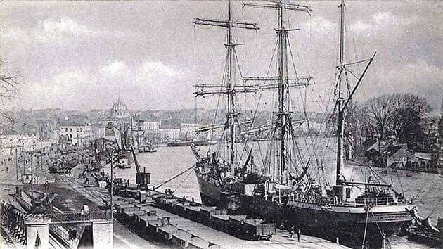
Nantes Port at the end of the 19th century (Quai de la Fosse) Le Coat Collection
A living memory of French Cape Horners
The term “Cape Horners” (or cap‑horniers) refers both to the large merchant sailing ships and the sailors who rounded Cape Horn between roughly the mid‑19th century and the 1920s, sailing between Europe and ports in the Pacific Ocean. These three‑ or four‑masted steel windjammers faced extreme conditions—fierce winds, heavy seas and freezing cold—especially when they beat against the prevailing westerlies to pass from east to west around the Horn.
For over a century, until the 1920s, the Cape Horn route was one of the great arteries of global maritime trade: French sailing ships carried guano and nitrates from Chile and Peru, cereals from Australia and California, lumber from North America, metals and nickel ore, among many other cargoes. Long before steam power and the Panama Canal, these tall ships shaped the commercial networks of the era, leaving behind a legacy of courage and endurance.
The Cape Horn au Long Cours association and its roots
The association Cap Horn au Long Cours (CHLC) inherits its spirit from the International Association of Cape Horn Captains (AICH), originally the Amicale Internationale des capitaines au long cours Cap‑Horniers, now dissolved along with the last generation of sailing‑ship masters who created it. Carrying on that legacy, CHLC has as its mission “to preserve and make known the heritage of the Cape Horners,” whether ships, routes, trades or human itineraries.
To fulfill this mission, the association launched and maintains the website caphorniersfrancais.fr, entirely devoted to French merchant sailors who sailed around Cape Horn under sail. The site states a clear, ambitious goal: to document, in the longer term, all the voyages of all the French Cape‑Horn sailors on all the French merchant sailing ships that rounded the Horn.
Independent, volunteer‑based documentation work
The work behind Cap‑Horniers Français is carried out in a fully independent, volunteer‑led manner. The team gathers and cross‑checks multiple sources: shipping company archives, logbooks, crew lists, travel journals, family photographs, private letters, and corrections or additions sent by descendants of sailors.
The site’s authors openly acknowledge the “monumental” scope of the task and the fact that it will take years of work, inviting the public to contribute documents, personal memories, or any corrections to existing entries. This participatory approach turns the project into a genuinely collaborative maritime‑history endeavor, where families, local historians and enthusiasts progressively enrich a unique documentary database.
Ships, voyages, crews: a growing corpus of documentation
One of the site’s main strengths is its effort to reconstruct, vessel by vessel and voyage by voyage, the itineraries and the lists of mariners aboard. The stated aim is to move Cape Horners beyond being anonymous silhouettes in old photographs and to see them as individual men, identifiable by name and placed back in the context of their long‑distance campaigns.
The site also highlights narratives and first‑hand accounts, such as the story of Captain Abel Guillou of the three‑masted steel ship Bretagne, wrecked at Cape Horn in August 1900 after two and a half months of battling the elements, with the crew later rescued by the British four‑masted windjammer Maxwell. These stories give concrete flesh to the dangers of the Cape Horn route and illustrate the values of courage, resilience and solidarity that the association wishes to transmit as part of the Cape‑Horners’ heritage.
Getting Cape Horners out of the museums
CHLC does not limit itself to an online database; it also seeks “to get Cape Horners out of museums” by bringing their stories directly to the public through conferences, temporary exhibitions, and various events held across France. These outreach activities rely on the association’s research to tell the history of long‑distance sailors beyond the display of objects, placing the human dimension—words, experiences and personal trajectories—back at the heart of the narrative.
This itinerant mediation helps reconnect port cities and maritime regions with their Cape‑Horn sailing heritage, especially in the towns and ports that played a significant role in the sail‑trade economy. It also offers descendants of sailors a space where they can rediscover traces of their ancestors and understand the concrete context of their voyages.
A major historiographical and heritage contribution
From a scholarly perspective, the work of Cap‑Horniers Français fills a gap between the “official” history of merchant shipping (statistics, fleet data, major trade routes) and the lived, often under‑documented history of crews at the individual level. By reconstructing voyages one by one and identifying the sailors, the association produces a fine‑grained micro‑history of sailing around Cape Horn.
This approach makes it possible to study recruitment networks, regional origins, the rhythm of voyages, long or short careers, wrecks and homecomings, and more broadly how the global economy of nitrates, cereals or timber translated into concrete human trajectories. It further provides a valuable resource for researchers in social history, maritime geography, port studies or maritime anthropology.
Cape Horn, a strategic node in global sail‑trade routes
To understand the association’s importance, it is essential to recall Cape Horn’s role in global maritime networks before the era of steam and the Panama Canal. From the late 15th century onward, and more intensively from the 19th century, powers seeking new maritime routes for spices, and later guano, nitrates and other raw materials, pushed their fleets south of the Americas.
Throughout the 19th and early 20th centuries, French Cape‑Horn windjammers regularly sailed between Europe and the Pacific, rounding Cape Horn twice a voyage in many cases. These routes were crucial for the nitrate and cereal trades, but they also demanded exceptional seamanship in the “Furious Fifties” and “Roaring Forties,” which explains the enduring prestige attached to Cape‑Horn sailors.
Nantes, a major ship‑owning port and Horn‑route hub
Within this story, Nantes occupies a special place as a major ship‑owning port and shipbuilding center on the Loire estuary. In the 19th century, shipyards around Nantes—including the Chantiers de la Loire and Dubigeon—built large steel sailing ships intended for long‑distance trade, including routes toward the Pacific and the Horn.
Nantes’ port landscape developed around the quays of the Loire, the activities of ship‑owners, river barge traffic, and large merchant vessels operating in an increasingly global economy. The presence of a Rue des Cap‑Horniers in Nantes symbolically underscores the city’s historic link with the sailors who departed on these extreme voyages.
The research carried out by Cap‑Horniers Français helps reconnect these port‑city realities with individual lives: many of the Cape‑Horn sailors, officers and captains featured on the site were from Nantes, Loire‑Atlantique, or other Atlantic ports, their careers scattered across registers, logbooks, and family testimonies that the association brings to light.
Saint‑Nazaire, an oceangoing gateway to the Horn
With the rise of the Port of Saint‑Nazaire in the middle of the 19th century under the Second Empire, the Loire estuary gained a modern oceangoing outport that gradually expanded and complemented the facilities further upstream. Created in 1856, Saint‑Nazaire became a key element of the greater Nantes–Saint‑Nazaire maritime port, featuring docks, dry docks, and later major shipyards.
Although Saint‑Nazaire is now best known for large‑scale shipbuilding, including cruise liners, its origins lie in a broader maritime and long‑distance economy, including the transit and outfitting of sailing ships bound for the Atlantic and the Pacific. At the height of the sail‑ship era, the Nantes–Saint‑Nazaire port complex formed one of France’s main gateways toward the South Atlantic, the Pacific, and therefore the Cape Horn route.
The work of Cap‑Horniers Français—by documenting ship by ship the campaigns to the Pacific—helps highlight this dimension: one can follow vessels built or owned in the region, crews recruited from coastal villages along the Loire, and the long journeys that ultimately led them to round Cape Horn.
A resource for researchers, institutions and families
The site is freely accessible and serves as a premier‑quality resource for historians, students, maritime museums, but also for genealogists and families seeking to trace an ancestor’s seafaring career. The fine‑grained level of information—ship names, campaign dates, itineraries, onboard narratives, testimonies—allows for both detailed and cross‑cutting kinds of research.
By making this corpus available, Cap‑Horniers Français also contributes to the valorization of maritime heritage for local authorities, ports, and memory‑related sites, which can draw on the data for exhibitions, urban routes, commemorations, or educational projects. In doing so, the association positions itself as a bridge between archives, territories and the wider public.
A call for contributions and the future of the Cape‑Horn legacy
With full awareness of the immensity of the task, the association emphasizes that this work is evolving and incomplete, inviting anyone who possesses documents, photos, notebooks, crew lists, or family stories to contact them and help enrich and correct the published information. This openness underlines the collective nature of the project: the history of Cape Horners is no longer reserved for specialists alone, but becomes a shared memory to which everyone can contribute.
At a time when commercial sailing has vanished before the rise of mechanical propulsion, this independent research stands as a bulwark against the forgetting of a maritime world now gone, yet one that has shaped French port cities, estates and coastal cultures from Nantes and Saint‑Nazaire to the distant shores of the Pacific. By rigorously documenting Cape‑Horn sailing ships and their crews, Cap‑Horniers Français provides an irreplaceable tool for understanding this history and transmitting it to future generations.
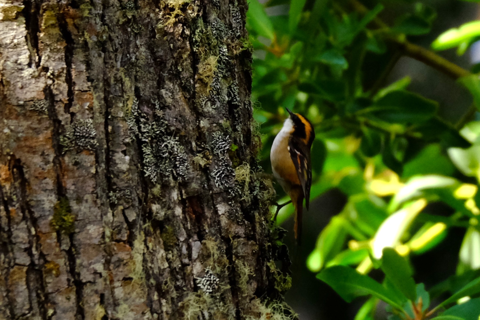
The genus Aphrastura (family Furnariidae) groups together small insectivorous passerines endemic to the southwestern part of South America. It historically comprises two species: the thorn‑tailed rayadito (Aphrastura spinicauda, synallaxis rayadito or espinoso rayadito), widely distributed in the temperate forests of Chile and southern Argentina, and the Masafuera rayadito (Aphrastura masafuerae), microendemic to Alejandro Selkirk Island in the Juan Fernández Archipelago.
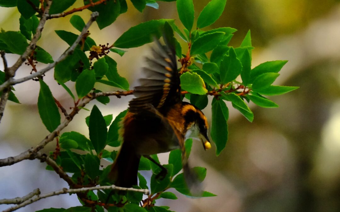
Rayadito (Aphrastura spinicauda) photographed during a Karukinka expedition in the channels of the Cape Horn Biosphere Reserve (Chile, April 2025).
The rayaditos (in Yagán: tachikatchina) play a central role in the biology of southern temperate forests, where A. spinicauda is one of the most abundant tree‑cavity birds (and one of the most vocal!) in the Nothofagus forests, up to the southernmost limits of the Cape Horn Biosphere Reserve.
Within this subantarctic context, the recent discovery of the subantarctic rayadito (Aphrastura subantarctica) in the Diego Ramírez archipelago, to the southwest of Cape Horn, has revealed a remarkable case of island diversification within a treeless environment.
Table of contents
Distribution, diversity and ecosystems
Recent studies on the community of cavity‑using birds show that A. spinicauda is one of the most abundant passerines in southern temperate forests, with densities exceeding 9 individuals per hectare and a strong dependence on cavities excavated by the Magellanic woodpecker (Campephilus magellanicus). In contrast, A. subantarctica inhabits an herbaceous archipelago dominated by Poa flabellata and uses ground cavities or the structures of seabird nests for breeding, in the absence of terrestrial mammalian predators.
Morphology, ecology and behaviour
A. spinicauda is a small passerine of about 12 g, with a long, slender tail employed in its acrobatic movements on trunks and branches. Its streaked, brown‑reddish plumage provides excellent camouflage against bark and foliage, and it feeds primarily on insects and larvae, exploring bark and understory vegetation.
A. subantarctica, on the other hand, averages 16 g, with a longer bill, heavier legs, a shorter tail and a behaviour focused close to the ground, reflecting adaptation to a wind‑exposed, herbaceous habitat.
The behaviour of the rayadito in Yagán territory is illustrated by these words from Ursula Calderon: “Tachikatchina is a bird that sings in the mountains during the day, warning that someone is hidden: a wicked man, a sorcerer. It thus announces to the walker the presence of these people, or of a dog, of a cat… in short, of someone hidden. Its calls, when they sing together, are frightening, tsch‑tsch‑tsch, since they do not announce anything good” (p. 70, réf. 10).
Rayadito or Tachikatchina, photographed in April 2025 in Caleta Borracho (sailing expedition through the Patagonian channels, Chile).
Genetics, speciation and conservation
Genetic analyses show a clear differentiation between A. spinicauda and A. subantarctica, which justifies proposing A. subantarctica as a new emblematic species of subantarctic biodiversity. This distinction, combined with morphological and behavioural differences, places the Diego Ramírez archipelago as a natural laboratory of speciation and conservation, now protected by the Diego Ramírez–Drake Passage Marine Park.
For A. spinicauda, the conservation of old‑growth, cavity‑rich forests and the preservation of the Magellanic woodpecker population are essential to maintain the structure of rayadito populations within the Cape Horn Biosphere Reserve.
Sources :
Rozzi, R. et al. (2022). “The Subantarctic Rayadito (Aphrastura subantarctica), a new bird species on the southernmost islands of the Americas”. Scientific Reports 12, 13957. https://doi.org/10.1038/s41598-022-17985-4
Rozzi, R. et al. (2023). “The subantarctic rayadito (Aphrastura subantarctica), a new bird species on the southernmost islands of the Americas (repositorio UChile version)”. Repositorio UChile. https://repositorio.uchile.cl/handle/2250/194760
Ramírez‑D’Crego, R. (2022). “The Subantarctic Rayadito (Aphrastura subantarctica), a new bird species on the southernmost islands of the Americas”. CECS research‑related article. https://ramirodcrego.com/papers/article29/
Zenodo (2022). Dataset “The Subantarctic Rayadito (Aphrastura subantarctica), a new bird species on the southernmost islands of the Americas”. Morphological and genetic data. https://zenodo.org/records/6983420
Rozzi, R. et al. (2022). “The Subantarctic Rayadito (Aphrastura subantarctica), a new bird species on the southernmost islands of the Americas”. PMC version (NIH‑NIHMS). https://pmc.ncbi.nlm.nih.gov/articles/PMC9418250/
Rozzi, R. et al. (2022). Taxonomic description of Aphrastura subantarctica (Wikispecies).
Marine, R. H. et al. (2022). “The extreme rainfall gradient of the Cape Horn Biosphere Reserve”. Science of the Total Environment ou équivalent (étude de biodiversité et de rayaditos dans les canaux).
Rozzi, R. et al. (2018). “Marine biodiversity at the end of the world: Cape Horn and Diego Ramírez islands”. PLOS ONE ou revue équivalente, décrivant la diversité des îles Diego Ramírez et la contexte écologique.
Rozzi, R. et al. (2017). "Guia Multi-Etnica de Aves de los Bosques Subantarticos de Sudamérica". Ediciones Universidad de Magallanes.
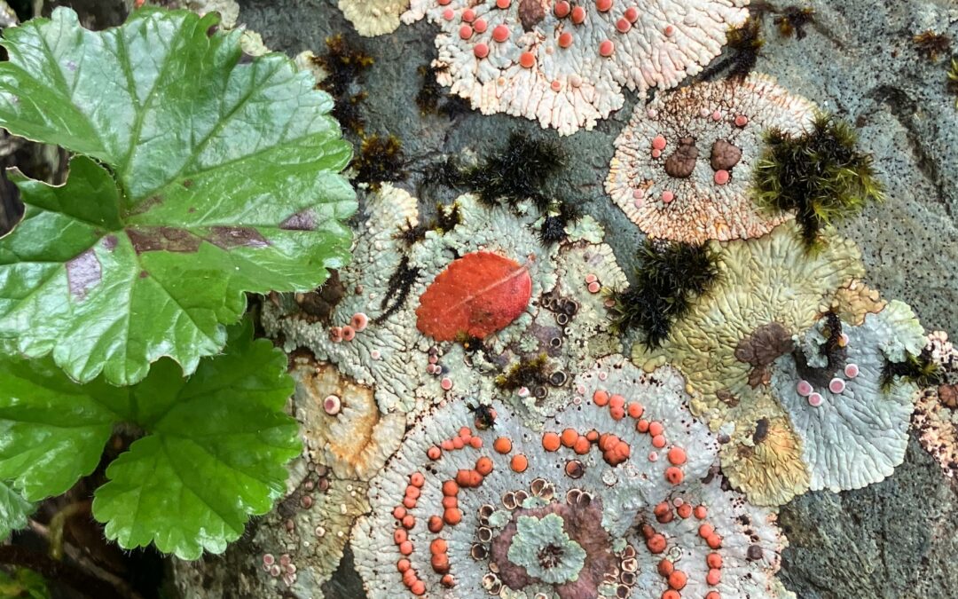
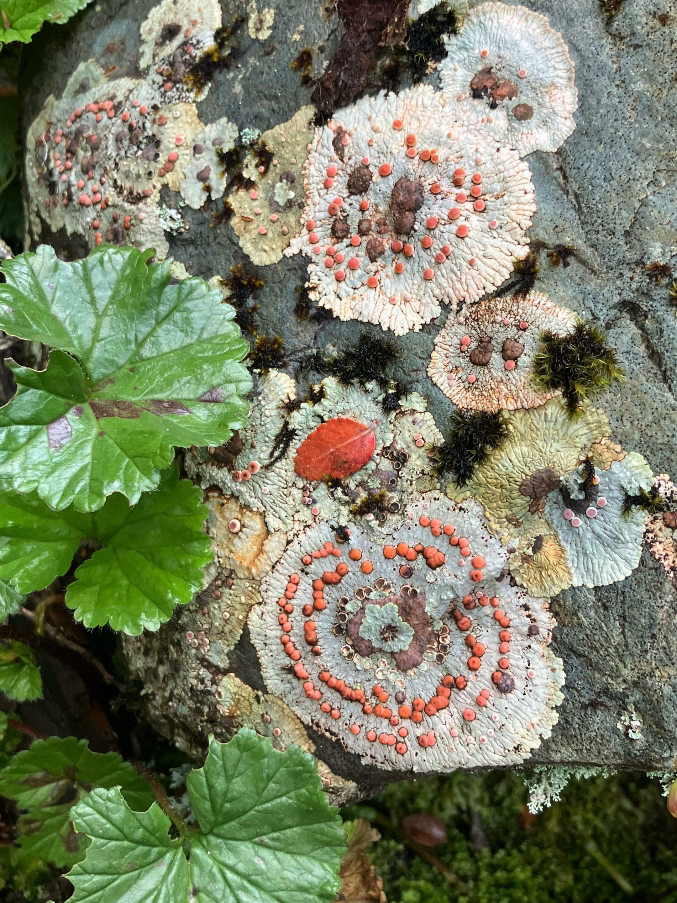
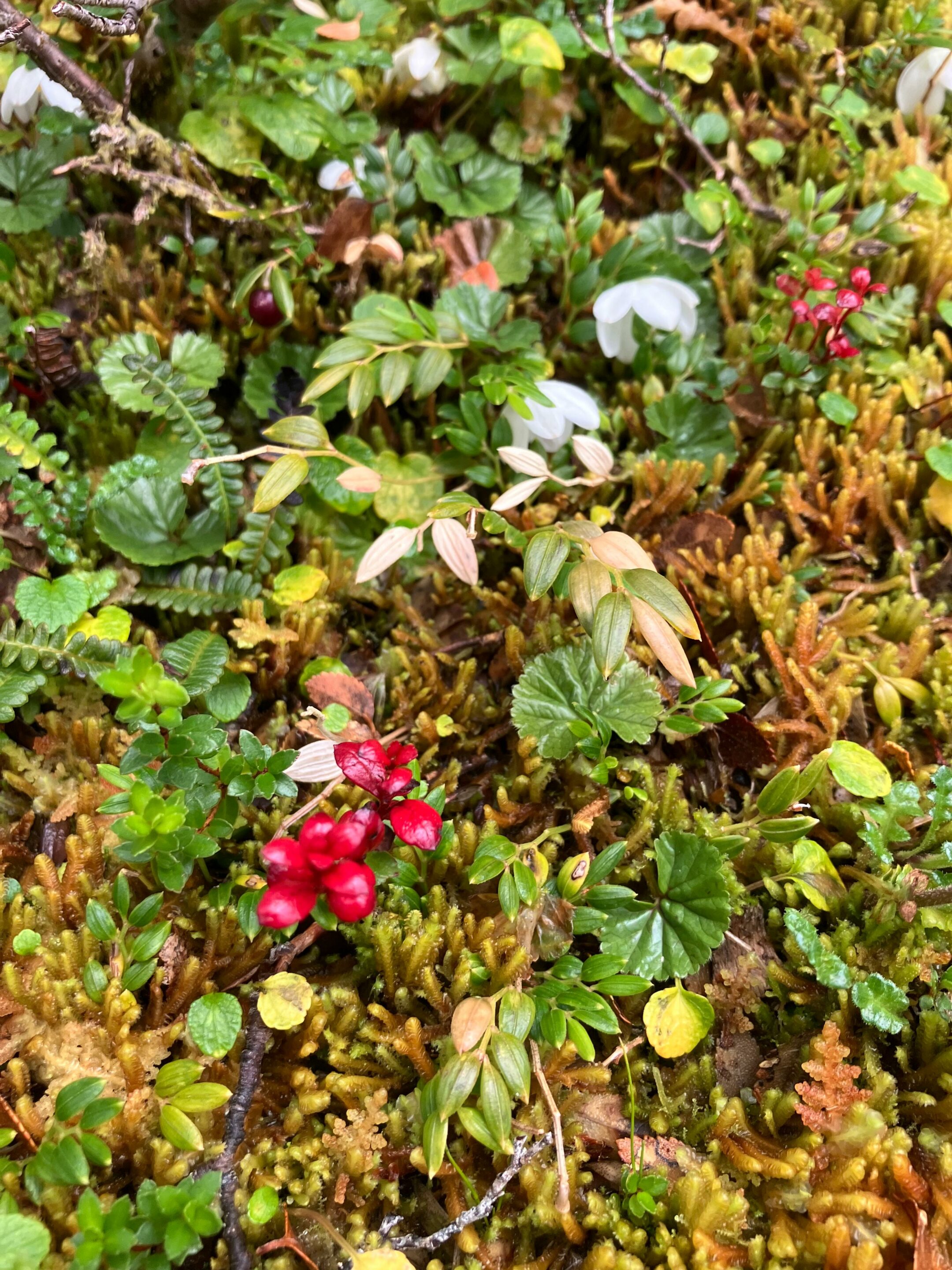
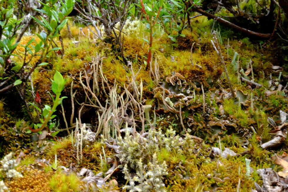
In southern Patagonia, within the Cape Horn Biosphere Reserve, lichens and bryophytes turn trunks, rocks, and peat bogs into true “miniature forests” that can only be discovered by leaning in with a hand lens.
This cryptogamic diversity reaches an exceptional level on Navarino Island, where work carried out by the Omora Ethnobotanical Park team has shown that more than 5% of the world’s bryophyte species are concentrated on less than 0.01% of the Earth’s surface, including a large proportion of endemic species. To this richness in mosses and liverworts is added a remarkable lichen flora, recently inventoried, which confirms the status of the Cape Horn Biosphere Reserve as a global hotspot for non-vascular organisms.
Placopsis lambii and Gunnera magellanica, seen in one arm of Tres Brazos bay (Karukinka's expedition "Biosphere Reserve of cape Horn", February 2026)
A hotspot at the end of the world
Navarino Island and the subantarctic region of Magallanes lie in a zone of humid temperate forests swept by winds, where abundant rainfall and cool temperatures favor the proliferation of mosses, liverworts, and lichens. This ecoregion has been identified as a global center of bryophyte diversity, with about 818 species recorded in the Magallanes region, which play a key role in nutrient regulation and water quality. Lichens also reach remarkable diversity there: an intensive floristic study on Navarino Island recorded 416 taxa of lichens and related fungi, including species new to science.
The forests of Navarino are located in one of the cleanest-rain regions on the planet, and the abundance of lichens sensitive to air pollution reflects the low contaminant load of the local air. This sensitivity makes lichens good bioindicators of air quality, a point often emphasized in the educational activities of Omora Park and in communication about the Biosphere Reserve.
Even in this relatively preserved region, bryophyte and lichen communities remain vulnerable to repeated trampling, hydrological changes, and the long-term effects of climate change on precipitation and temperature regimes. Disturbances caused by introduced species, such as the North American beaver, which profoundly modifies waterways and peat bogs in the region, can indirectly alter the substrates and microclimatic conditions needed by these miniature forests.
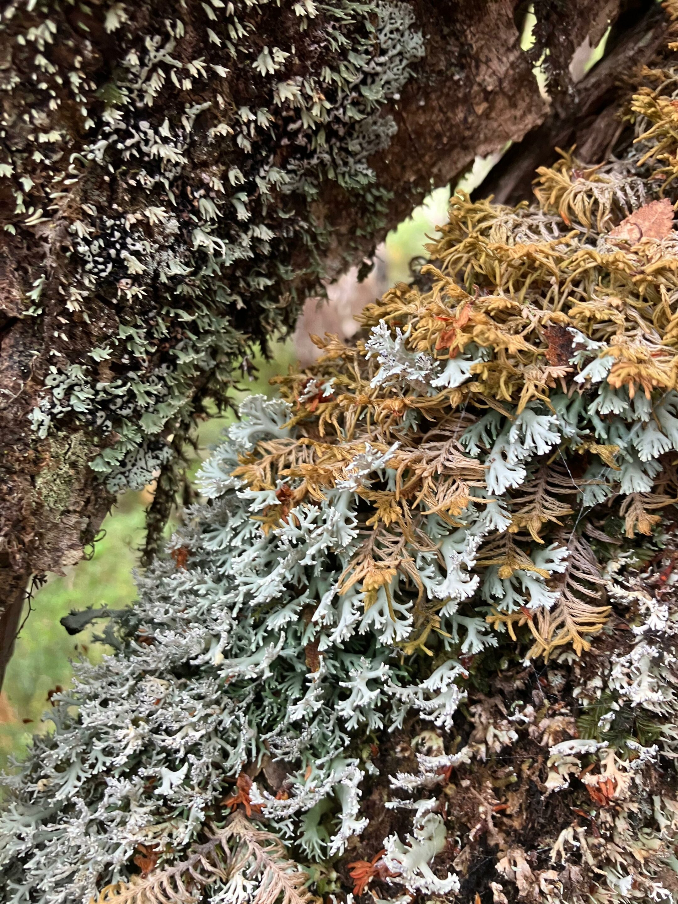
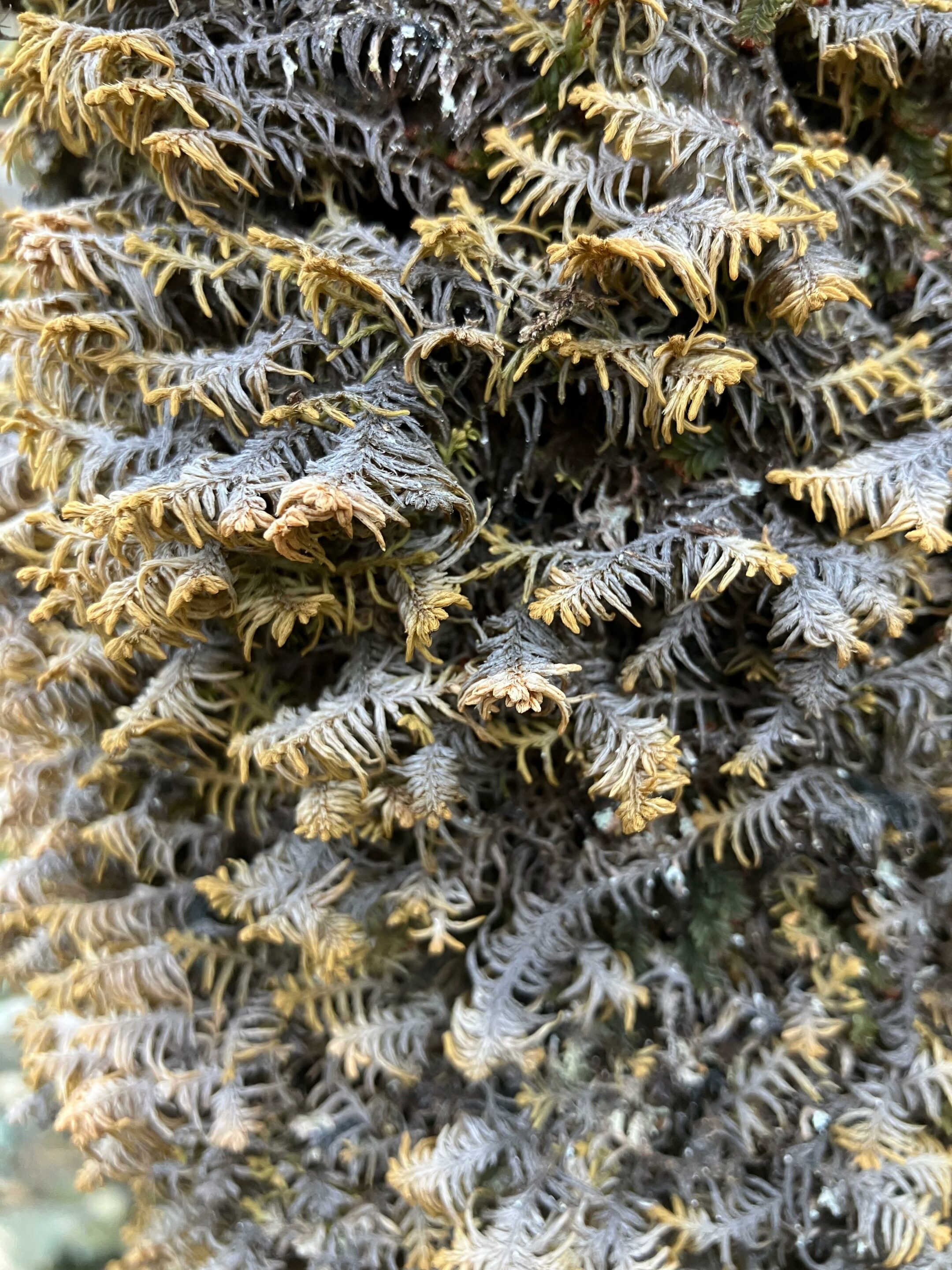
Bunodophoron patagonicum (Expedition Karukinka February 2026, Gordon island, Biosphere Reserve of cape Horn)
Bryophytes and lichens: discreet but essential protagonists
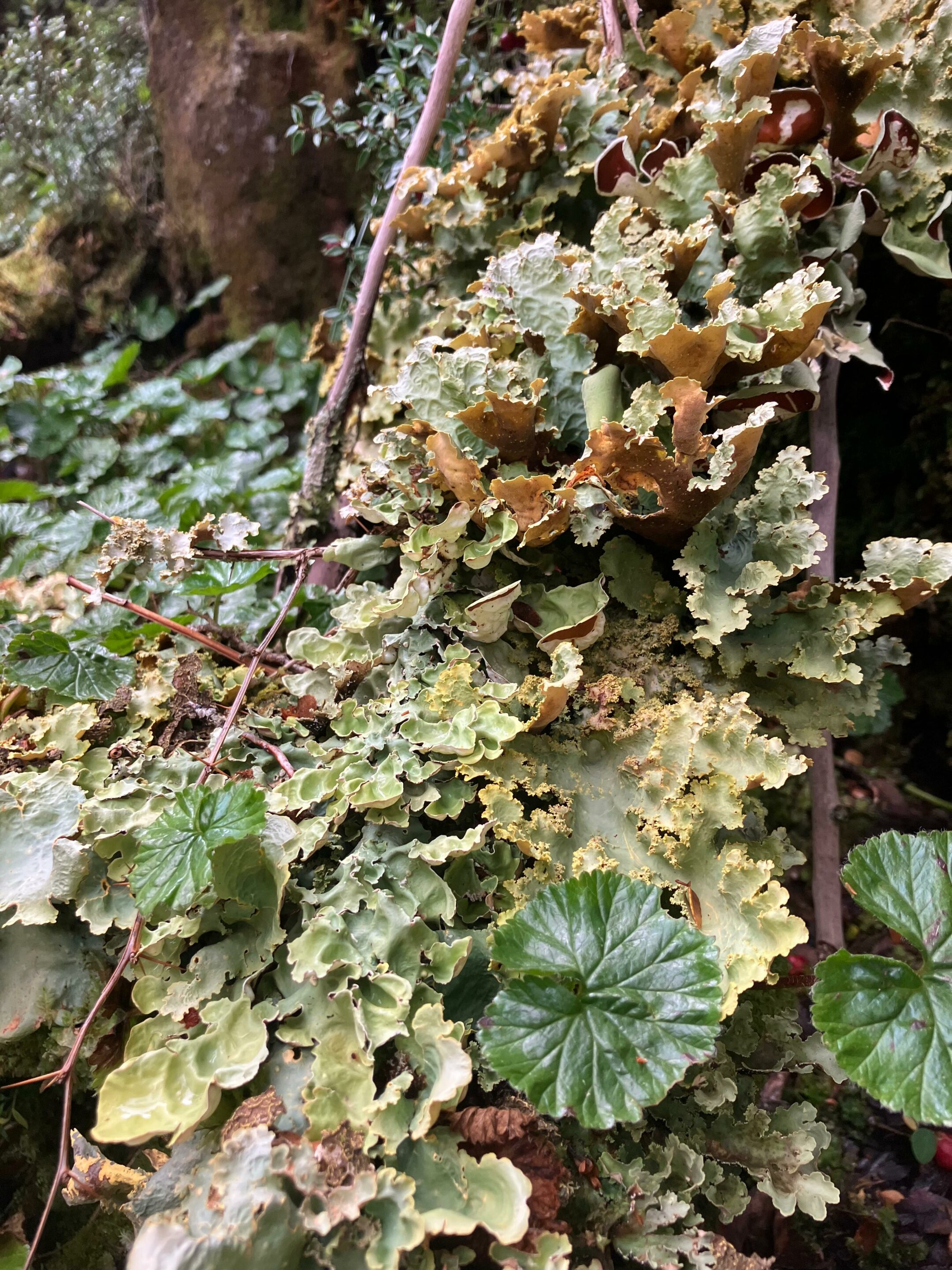
Bryophytes—mosses, liverworts, and hornworts—are small non-vascular plants, lacking roots and complex conducting tissues, yet they colonize trunks, soils, and rocks extensively in subantarctic forests. Lichens, long-lasting symbioses between a fungus and an alga or cyanobacterium, form crusts, leafy rosettes, or shrubby tufts that cover Nothofagus bark, dead wood, stones, and even moss cushions already in place. Together, these two groups make Cape Horn one of the places with the highest densities of non-vascular organisms in the world, to the point where a single tree can host more than a hundred epiphytic species.
Gunnera magellanica, Lepidozia chordulifera and Blechnum pennamarina, photographed during an expedition Karukinka in Tres Brazos Bay (Gordon island, Cape Horn Biosphere Reserve, Chile, February 2026)Plagiochila elata (expedition Karukinka February 2026, cape Horn province, Chile)
Bryophytes and lichens in southern Patagonia are poikilohydric, meaning they tolerate strong drying and can suspend their metabolism, resuming it rapidly once rehydrated, which makes them especially resistant to freeze–thaw cycles. Many species develop protective pigments and thick structures that reduce damage from UV radiation, wind, and direct exposure, especially in Magellanic tundra and coastal environments. These functional traits explain why, at the highest elevations of Navarino or on wind-swept shores, the dominant organisms are moss cushions and crustose or shrubby lichens.
Miniature forests
To make this richness perceptible beyond scientific circles, Ricardo Rozzi and colleagues proposed the metaphor of the “bosques en miniatura del Cabo de Hornos,” miniature forests formed by mosses, liverworts, lichens, and the microfauna that lives there. The practice of observing these small landscapes with a hand lens, pausing for a long time in front of a trunk or rock, turns a walk into a detailed natural history exploration of worlds that are usually invisible.
Lypocodium s.l. on the right (Tres Brazos bay, Cape Horn Biosphere Reserve, expedition Karukinka February 2026)
Miniature forests are not only vegetal: they also shelter a diverse microfauna of insects, mites, nematodes, and other invertebrates that feed, reproduce, and take refuge in moss and lichen cushions. These organisms contribute to the fragmentation of organic matter, the mineralization of nutrients, and sometimes the dispersal of spores and propagules, adding several trophic levels to what, to the naked eye, looks like a simple green or gray carpet.
Ecological roles in forests and bogs
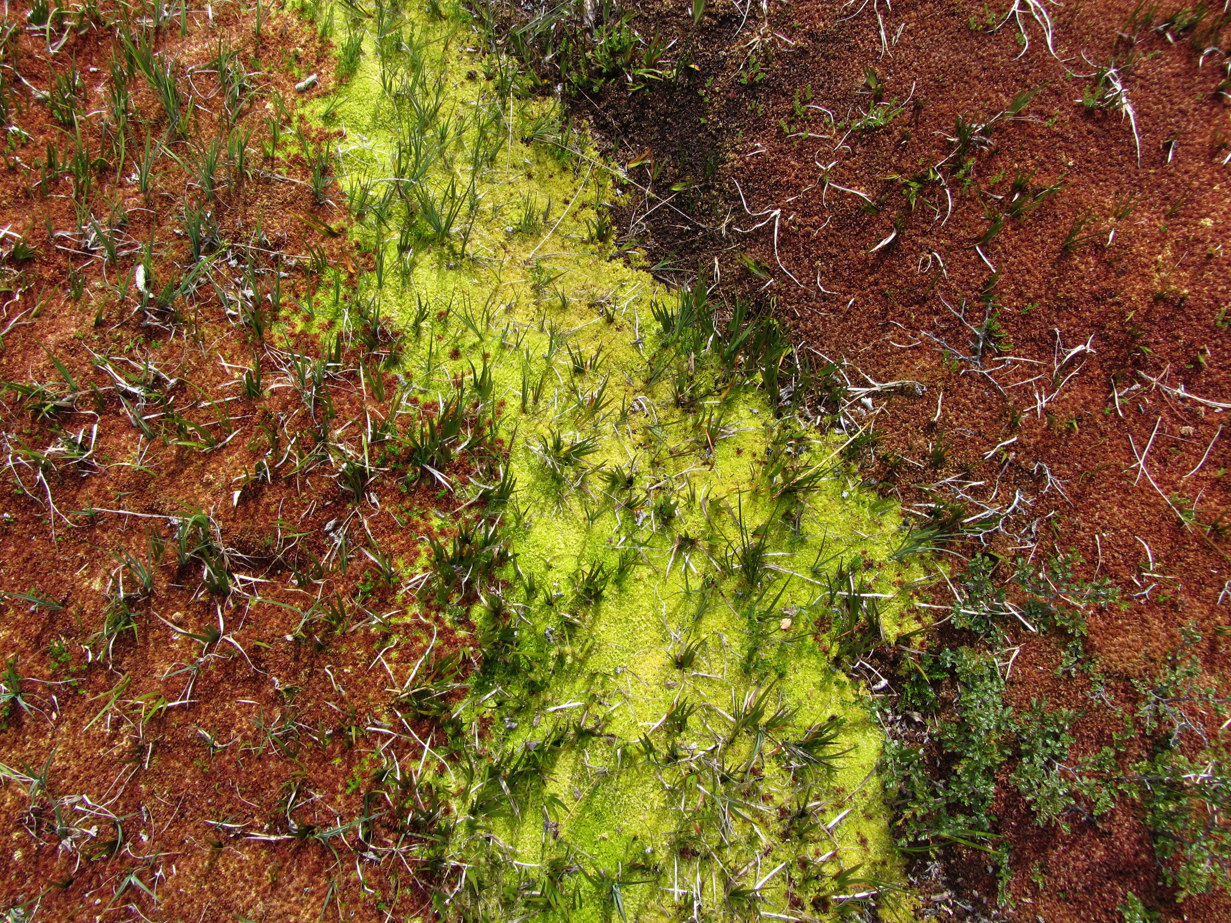
In humid subantarctic forests, bryophytes and lichens form thick mantles on trunks, rocks, and the ground, capable of retaining large amounts of water and regulating local humidity. This water-retention capacity makes them natural sponges that soften the impact of frequent rainfall, limit erosion, and stabilize microhabitats for many invertebrates and microorganisms.
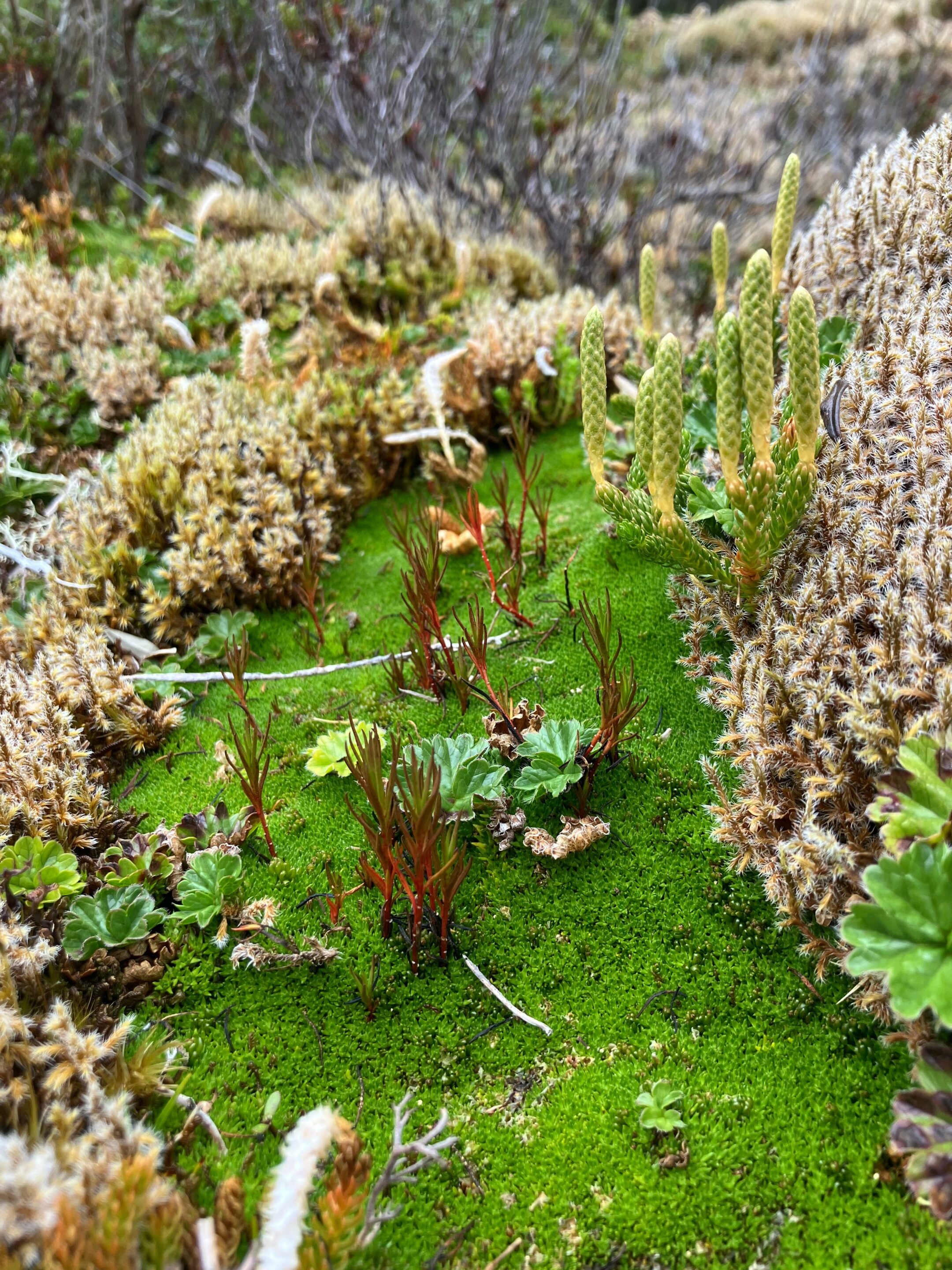
In peat bogs, bryophytes—especially sphagnum-type mosses and related forms—structure the matrix that accumulates organic matter in saturated environments, storing both water and large amounts of carbon.
Sphagnum, Baie Tres Brazos (cape Horn biosphere reserve, fueguian channels, Chile, expedition Karukinka, February 2026)
Lichens also play a pioneering role on bare rocks, glacial moraines, and coastal outcrops, where they initiate soil formation by physically and chemically altering the substrate. By retaining particles and moisture, these pioneer communities gradually create micro-niches favorable to the later establishment of mosses and then vascular plants.
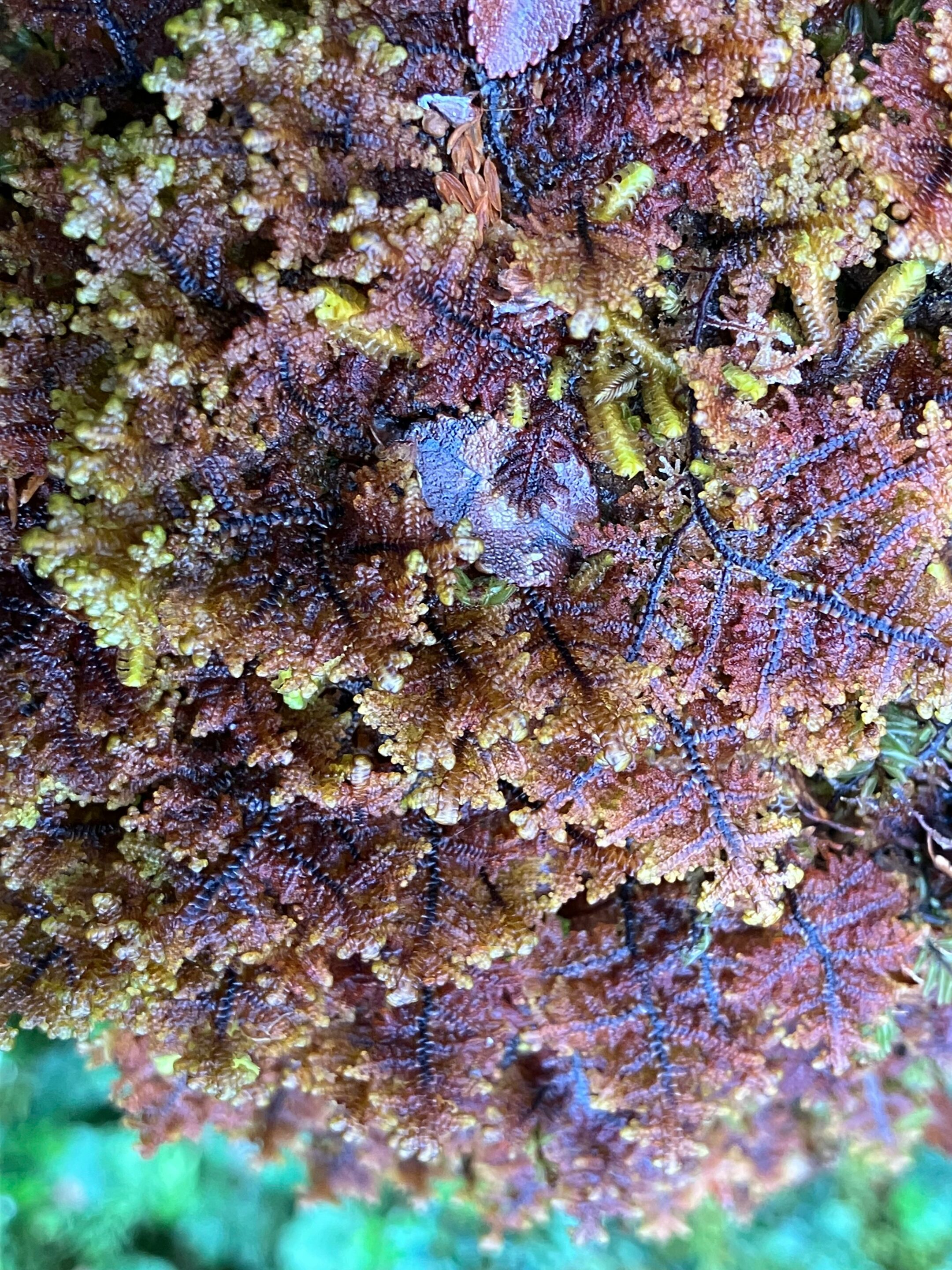
Emblematic mosses and lichens
Among bryophytes, the moss Lepyrodon lagurus is often cited as an emblematic species of Omora Park, where it forms velvety mats on tree trunks and contributes to the luxuriant appearance of humid forests. This type of epiphytic moss retains rainwater, offers micro-refuges to a variety of invertebrates, and sometimes hosts lichens that settle on its surface, further increasing the complexity of the miniature forest.
Among lichens, the large tufts of Usnea, the “old man’s beards” hanging from Nothofagus branches, clearly illustrate the relationship between air purity and the vigor of lichen populations. The cushions and small trumpets of Cladonia that cover some soils or dead wood, as well as newly described species such as Candelariella magellanica, testify to the originality of Navarino’s lichen flora.
Miniature forest photographed during a trekking between Lëm and Wulaia (Navarino island, Chile) in February 2020 (Lauriane Lemasson)Sphagnum and liverworts (expedition in Tierra del Fuego, Lauriane Lemasson, March 2013)
Hand-lens ecotourism
To highlight and protect this discreet biodiversity, the Omora Park team developed the concept of “Ecoturismo con lupa,” a hand-lens ecotourism that places the discovery of mosses, liverworts, and lichens at the center of the experience. Coined by Ricardo Rozzi and colleagues, the term refers to a niche tourism practice in the Cape Horn Biosphere Reserve, where visitors are invited to observe the “miniature forests” and understand their ecological role. Marked trails welcome small groups equipped with hand lenses, accompanied by guides who combine natural history, ecology, and ethical reflection on biocultural conservation.
This ecotourism model has been supported by projects aimed at developing scientific and educational tourism in the region, seeking to connect local economic benefits, environmental education, and the protection of subantarctic ecosystems. The documentary Viaje Invisible. Ecoturismo con Lupa illustrates this approach by following guided visits that immerse the public in the detailed contemplation of Cape Horn’s miniature forests.
Gackstroemia magellanica (Endemic liverwort of the Cape Horn Biosphere Reserve (Karukinka expedition, February 2026))Gunnera magellanica – lichens Pseudocyphellaria berberina, Pseudocyphellaria frecineti, and Pseudocyphellaria granulata – Nephroma antarcticum (Karukinka expedition, Tres Brazos Bay, Cape Horn Biosphere Reserve, February 2026)
Biocultural conservation and education
Omora Park and its partners defend a “biocultural conservation” approach, linking biodiversity protection to the recognition of local cultures, especially Yaghan tradition and the communities of Puerto Williams. Bryophytes and lichens then become mediators for reflecting on the links between ways of life, environmental ethics, and responsibility toward ecosystems, notably through the “field environmental philosophy” proposed by Rozzi and colleagues.
Schools in Puerto Williams include the observation of miniature forests in their educational activities so that children recognize the global value of the biodiversity in their territory. This local appropriation helps counter “biocultural homogenization,” a concept that refers to the tendency to forget discreet organisms and lose the cultural knowledge and meanings associated with them.
Our thanks to Ricardo Rozzi and José German Gonzalez Calderon for their help in identifying the bryophytes from our images.
Short bibliography
Etayo, J., Sancho, L. G., Gómez-Bolea, A., Søchting, U., Aguirre, F., & Rozzi, R. (2021). Catalog of lichens (and some related fungi) from Navarino Island, Cape Horn Biosphere Reserve, Chile. Anales del Instituto de la Patagonia, 49.
Goffinet, B., Rozzi, R., Massardo, F., et al. (2012). Miniature Forests of Cape Horn: Ecotourism with a Hand Lens. University of North Texas Press.
Rozzi, R. (coord.) (n.d.). Ecoturismo con lupa en el Parque Omora. Universidad de Magallanes. Editorial presentation and book notice.
Cape Horn Center (CHIC). Ecoturismo con lupa: a way to discover the miniature forests of lichens and mosses.
Instituto de Ecología y Biodiversidad / Universidad de Magallanes. Omora Ethnobotanical Park – institutional presentation of the biological station.
Rozzi, R., et al. (2008). Patterns of species richness in sub-Antarctic plants and implications for conservation.
Documentary Viaje Invisible. Ecoturismo con Lupa. Omora Ethnobotanical Park, 2013.
Cultivating a Garden of Names in the Cape Horn Biosphere Reserve. Study on biocultural conservation, bryophytes and lichens, and environmental education.