The genus Aphrastura (family Furnariidae) groups together small insectivorous passerines endemic to the southwestern part of South America. It historically comprises two species: the thorn‑tailed rayadito (Aphrastura spinicauda, synallaxis rayadito or espinoso rayadito), widely distributed in the temperate forests of Chile and southern Argentina, and the Masafuera rayadito (Aphrastura masafuerae), microendemic to Alejandro Selkirk Island in the Juan Fernández Archipelago.
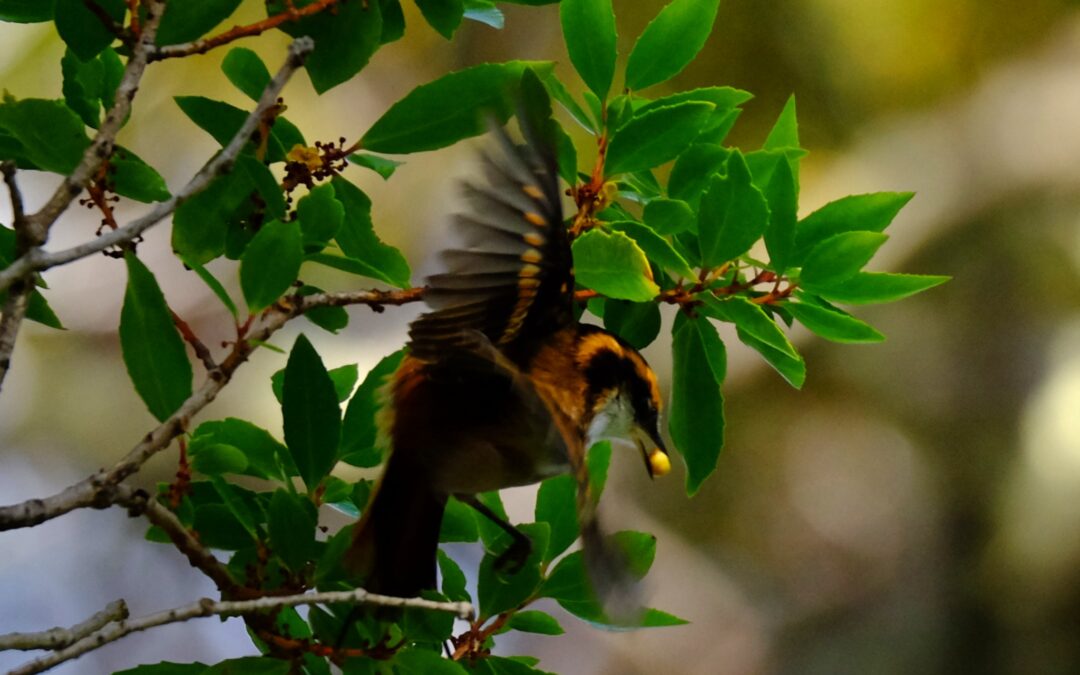
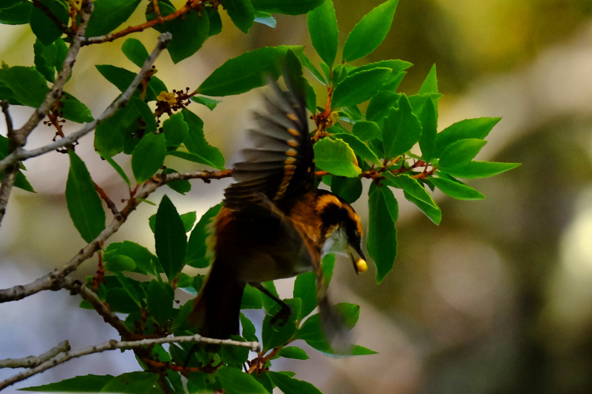
Rayadito (Aphrastura spinicauda) photographed during a Karukinka expedition in the channels of the Cape Horn Biosphere Reserve (Chile, April 2025).
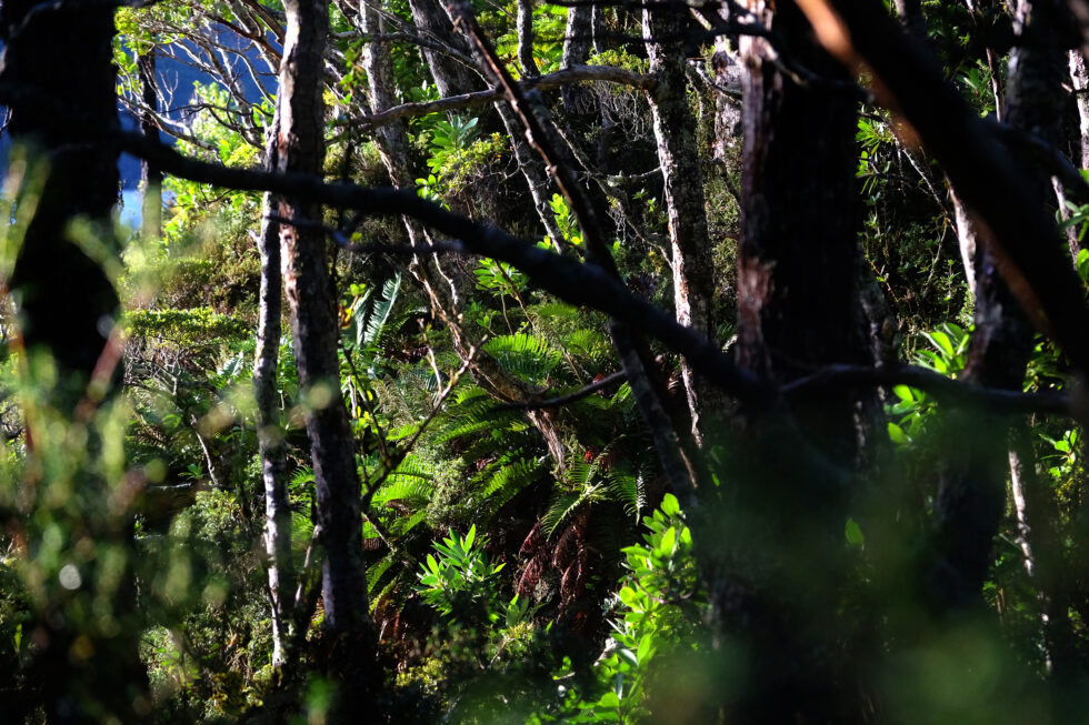
The rayaditos (in Yagán: tachikatchina) play a central role in the biology of southern temperate forests, where A. spinicauda is one of the most abundant tree‑cavity birds (and one of the most vocal!) in the Nothofagus forests, up to the southernmost limits of the Cape Horn Biosphere Reserve.
Within this subantarctic context, the recent discovery of the subantarctic rayadito (Aphrastura subantarctica) in the Diego Ramírez archipelago, to the southwest of Cape Horn, has revealed a remarkable case of island diversification within a treeless environment.
Table of contents
Distribution, diversity and ecosystems
Recent studies on the community of cavity‑using birds show that A. spinicauda is one of the most abundant passerines in southern temperate forests, with densities exceeding 9 individuals per hectare and a strong dependence on cavities excavated by the Magellanic woodpecker (Campephilus magellanicus). In contrast, A. subantarctica inhabits an herbaceous archipelago dominated by Poa flabellata and uses ground cavities or the structures of seabird nests for breeding, in the absence of terrestrial mammalian predators.
Morphology, ecology and behaviour
A. spinicauda is a small passerine of about 12 g, with a long, slender tail employed in its acrobatic movements on trunks and branches. Its streaked, brown‑reddish plumage provides excellent camouflage against bark and foliage, and it feeds primarily on insects and larvae, exploring bark and understory vegetation.
A. subantarctica, on the other hand, averages 16 g, with a longer bill, heavier legs, a shorter tail and a behaviour focused close to the ground, reflecting adaptation to a wind‑exposed, herbaceous habitat.
The behaviour of the rayadito in Yagán territory is illustrated by these words from Ursula Calderon: “Tachikatchina is a bird that sings in the mountains during the day, warning that someone is hidden: a wicked man, a sorcerer. It thus announces to the walker the presence of these people, or of a dog, of a cat… in short, of someone hidden. Its calls, when they sing together, are frightening, tsch‑tsch‑tsch, since they do not announce anything good” (p. 70, réf. 10).
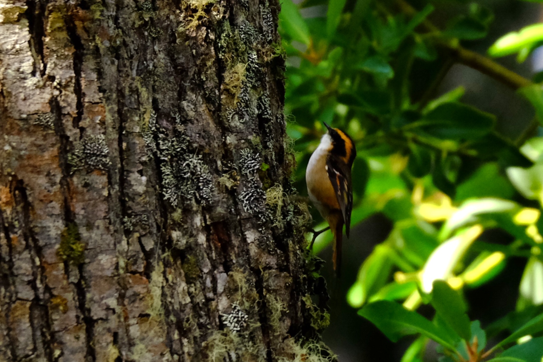
Rayadito or Tachikatchina, photographed in April 2025 in Caleta Borracho (sailing expedition through the Patagonian channels, Chile).
Genetics, speciation and conservation
Genetic analyses show a clear differentiation between A. spinicauda and A. subantarctica, which justifies proposing A. subantarctica as a new emblematic species of subantarctic biodiversity. This distinction, combined with morphological and behavioural differences, places the Diego Ramírez archipelago as a natural laboratory of speciation and conservation, now protected by the Diego Ramírez–Drake Passage Marine Park.
For A. spinicauda, the conservation of old‑growth, cavity‑rich forests and the preservation of the Magellanic woodpecker population are essential to maintain the structure of rayadito populations within the Cape Horn Biosphere Reserve.
Sources :
Rozzi, R. et al. (2022). “The Subantarctic Rayadito (Aphrastura subantarctica), a new bird species on the southernmost islands of the Americas”. Scientific Reports 12, 13957. https://doi.org/10.1038/s41598-022-17985-4
Rozzi, R. et al. (2023). “The subantarctic rayadito (Aphrastura subantarctica), a new bird species on the southernmost islands of the Americas (repositorio UChile version)”. Repositorio UChile. https://repositorio.uchile.cl/handle/2250/194760
Ramírez‑D’Crego, R. (2022). “The Subantarctic Rayadito (Aphrastura subantarctica), a new bird species on the southernmost islands of the Americas”. CECS research‑related article. https://ramirodcrego.com/papers/article29/
Zenodo (2022). Dataset “The Subantarctic Rayadito (Aphrastura subantarctica), a new bird species on the southernmost islands of the Americas”. Morphological and genetic data. https://zenodo.org/records/6983420
Rozzi, R. et al. (2022). “The Subantarctic Rayadito (Aphrastura subantarctica), a new bird species on the southernmost islands of the Americas”. PMC version (NIH‑NIHMS). https://pmc.ncbi.nlm.nih.gov/articles/PMC9418250/
Rozzi, R. et al. (2022). Taxonomic description of Aphrastura subantarctica (Wikispecies).
Marine, R. H. et al. (2022). “The extreme rainfall gradient of the Cape Horn Biosphere Reserve”. Science of the Total Environment ou équivalent (étude de biodiversité et de rayaditos dans les canaux).
Rozzi, R. et al. (2018). “Marine biodiversity at the end of the world: Cape Horn and Diego Ramírez islands”. PLOS ONE ou revue équivalente, décrivant la diversité des îles Diego Ramírez et la contexte écologique.
Rozzi, R. et al. (2017). "Guia Multi-Etnica de Aves de los Bosques Subantarticos de Sudamérica". Ediciones Universidad de Magallanes.
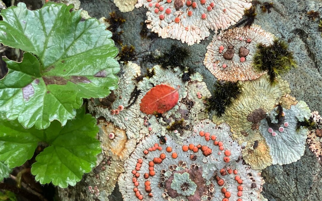
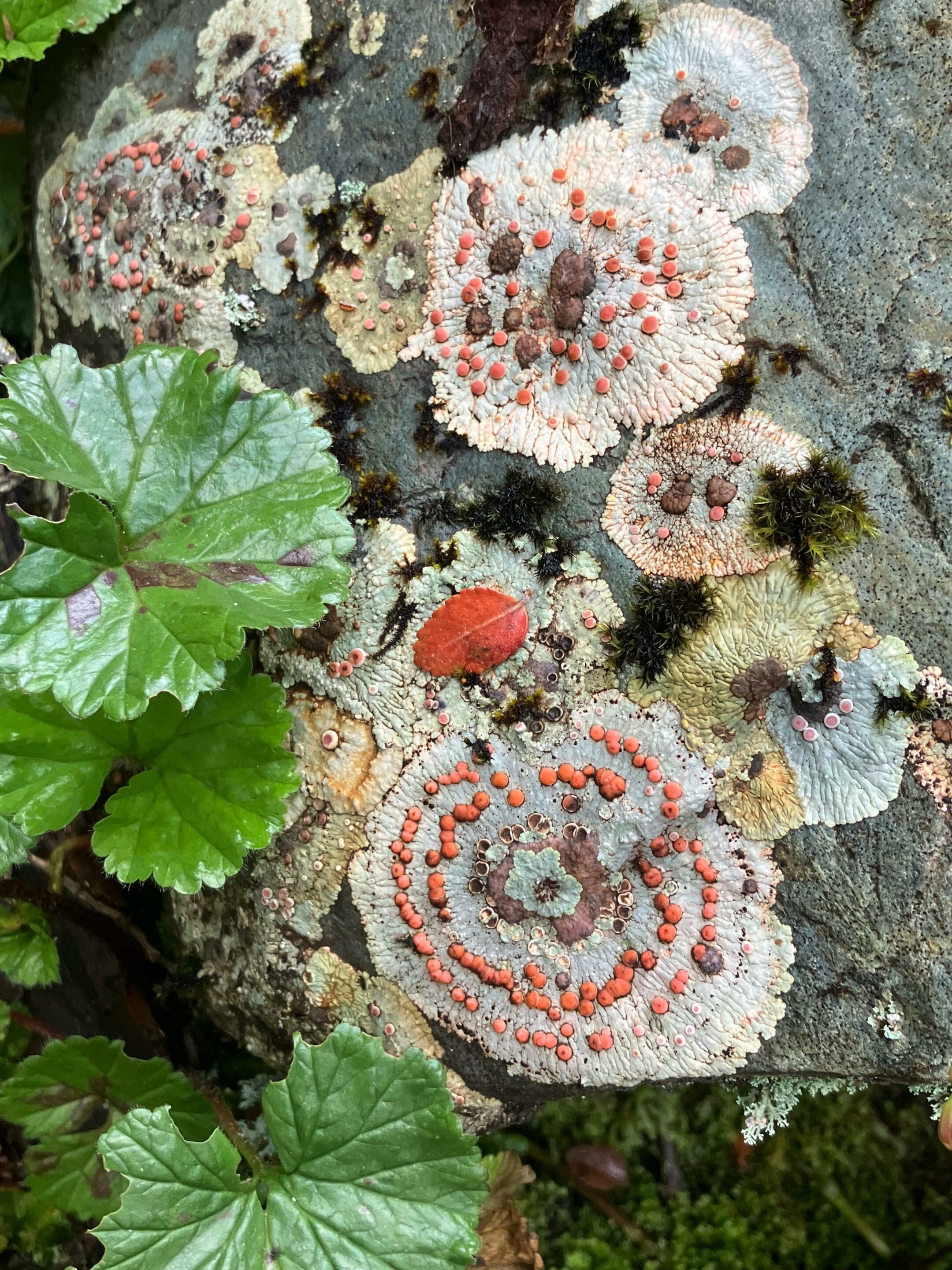
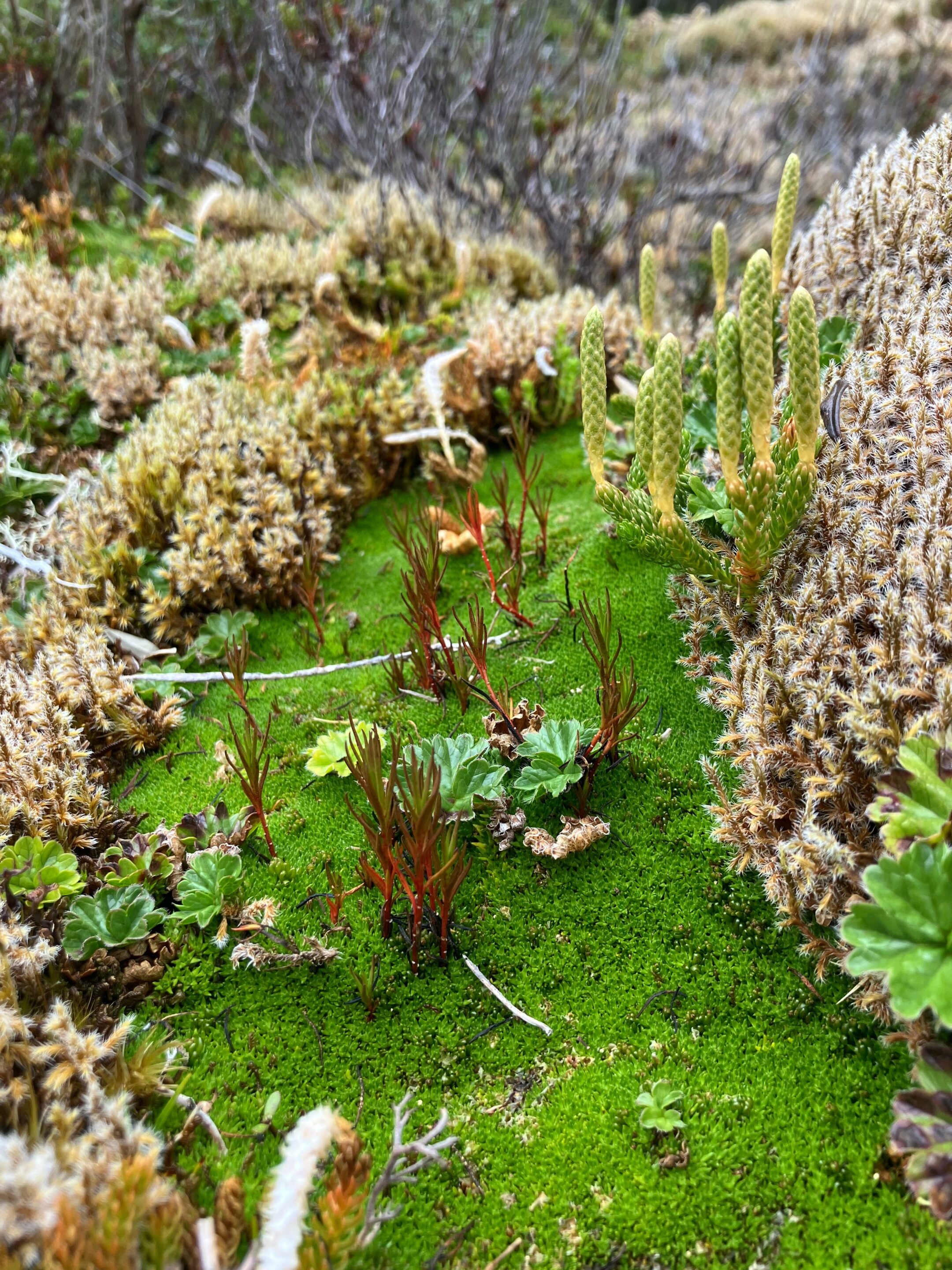
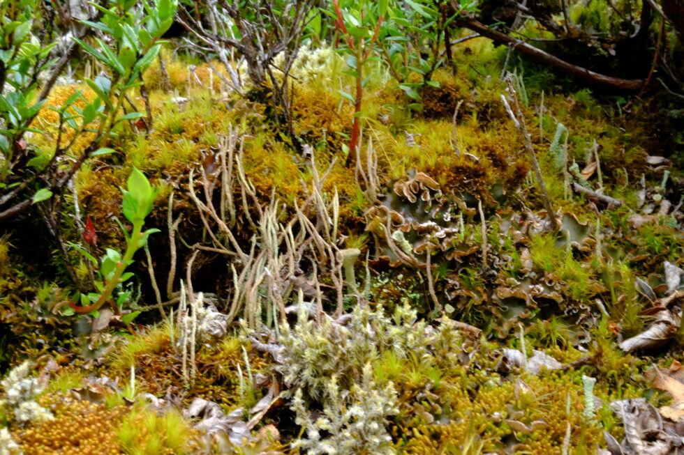
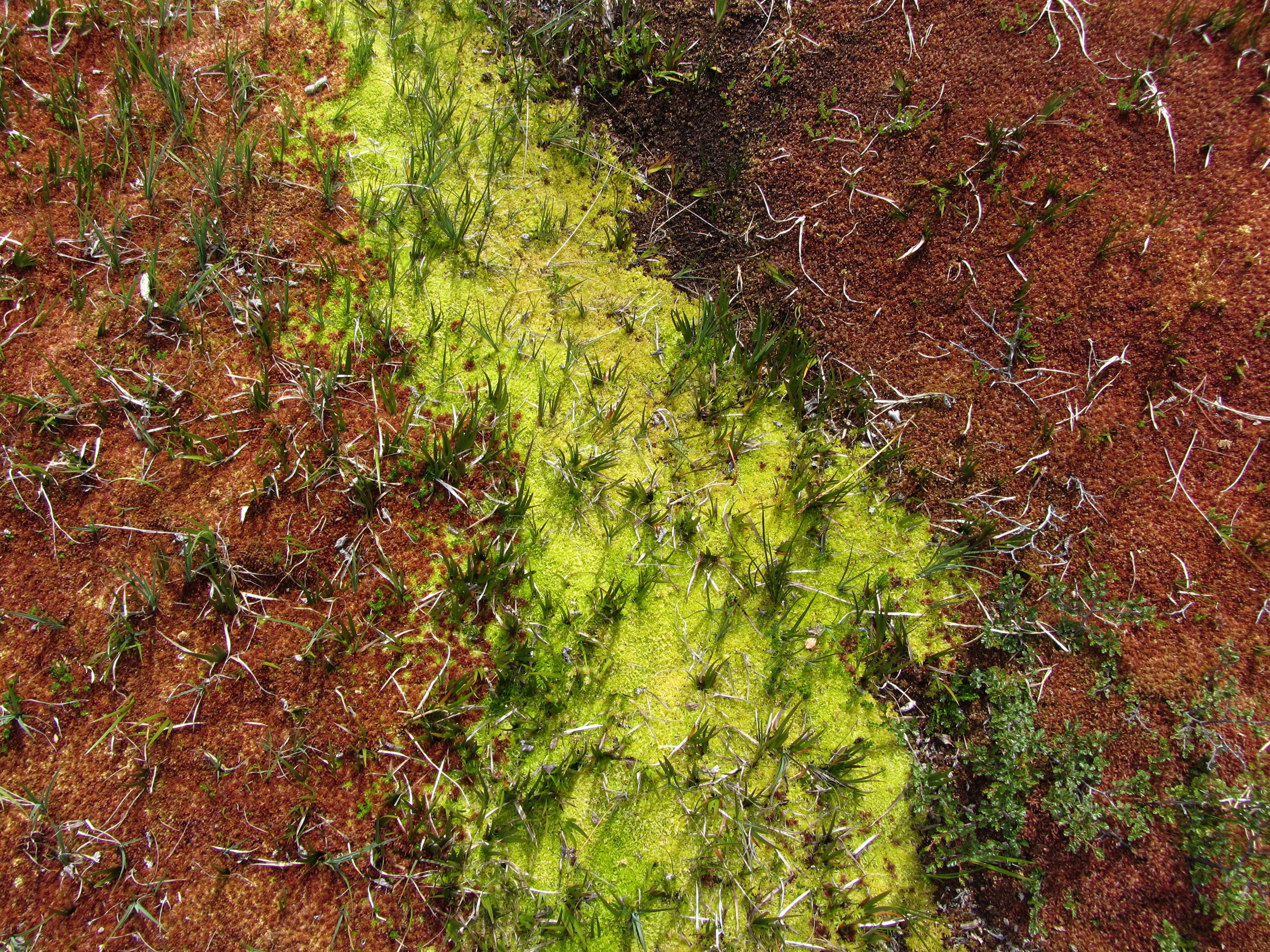
In southern Patagonia, within the Cape Horn Biosphere Reserve, lichens and bryophytes turn trunks, rocks, and peat bogs into true “miniature forests” that can only be discovered by leaning in with a hand lens.
This cryptogamic diversity reaches an exceptional level on Navarino Island, where work carried out by the Omora Ethnobotanical Park team has shown that more than 5% of the world’s bryophyte species are concentrated on less than 0.01% of the Earth’s surface, including a large proportion of endemic species. To this richness in mosses and liverworts is added a remarkable lichen flora, recently inventoried, which confirms the status of the Cape Horn Biosphere Reserve as a global hotspot for non-vascular organisms.
Placopsis lambii and Gunnera magellanica, seen in one arm of Tres Brazos bay (Karukinka's expedition "Biosphere Reserve of cape Horn", February 2026)
A hotspot at the end of the world
Navarino Island and the subantarctic region of Magallanes lie in a zone of humid temperate forests swept by winds, where abundant rainfall and cool temperatures favor the proliferation of mosses, liverworts, and lichens. This ecoregion has been identified as a global center of bryophyte diversity, with about 818 species recorded in the Magallanes region, which play a key role in nutrient regulation and water quality. Lichens also reach remarkable diversity there: an intensive floristic study on Navarino Island recorded 416 taxa of lichens and related fungi, including species new to science.
The forests of Navarino are located in one of the cleanest-rain regions on the planet, and the abundance of lichens sensitive to air pollution reflects the low contaminant load of the local air. This sensitivity makes lichens good bioindicators of air quality, a point often emphasized in the educational activities of Omora Park and in communication about the Biosphere Reserve.
Even in this relatively preserved region, bryophyte and lichen communities remain vulnerable to repeated trampling, hydrological changes, and the long-term effects of climate change on precipitation and temperature regimes. Disturbances caused by introduced species, such as the North American beaver, which profoundly modifies waterways and peat bogs in the region, can indirectly alter the substrates and microclimatic conditions needed by these miniature forests.
Bunodophoron patagonicum (Expedition Karukinka February 2026, Gordon island, Biosphere Reserve of cape Horn)
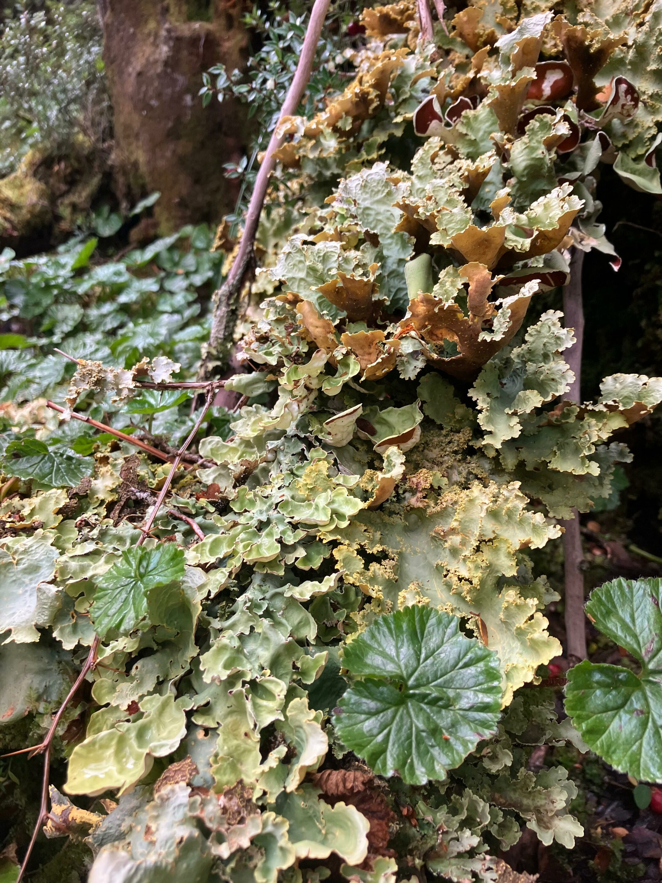
Bryophytes and lichens: discreet but essential protagonists
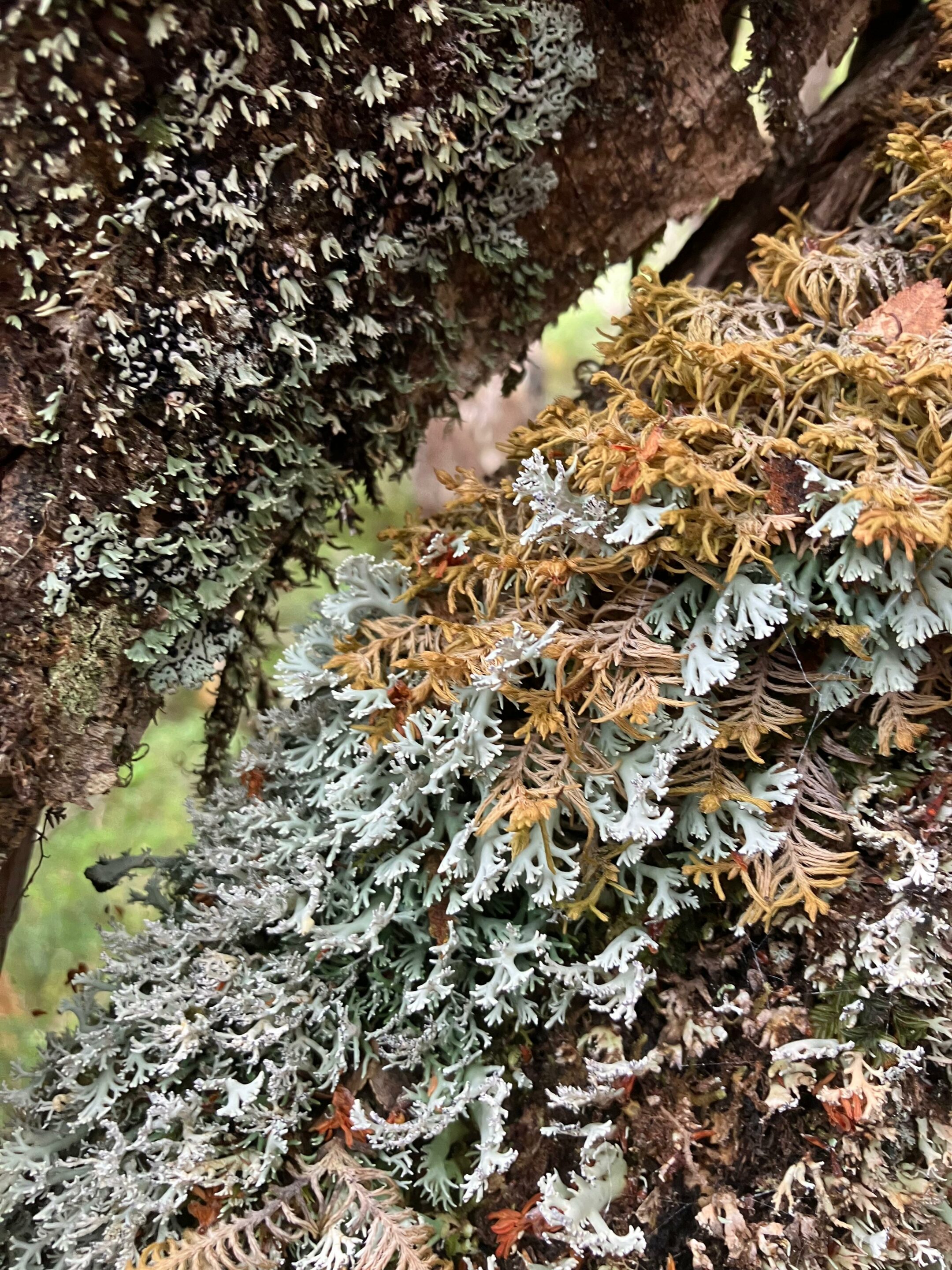
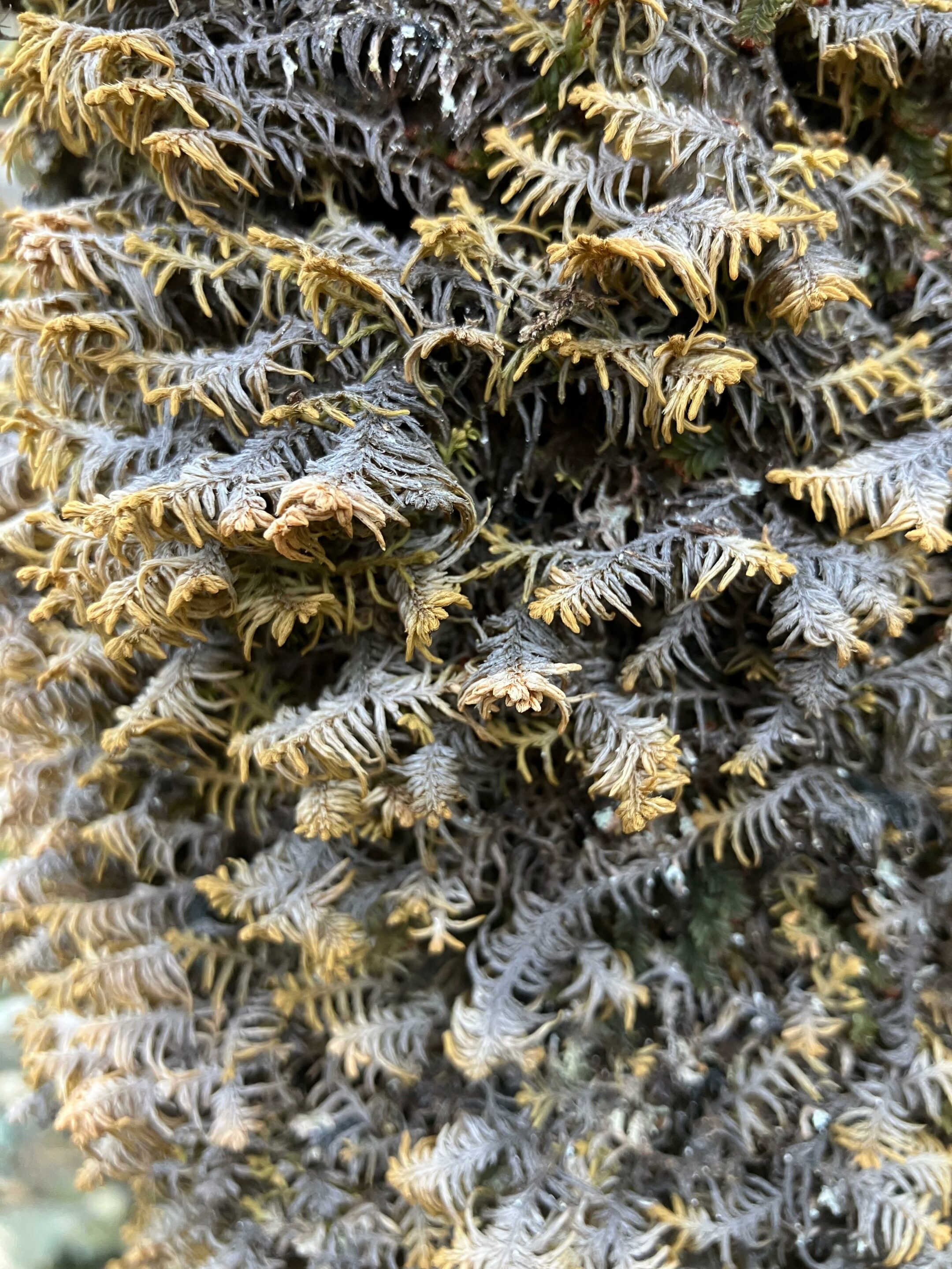
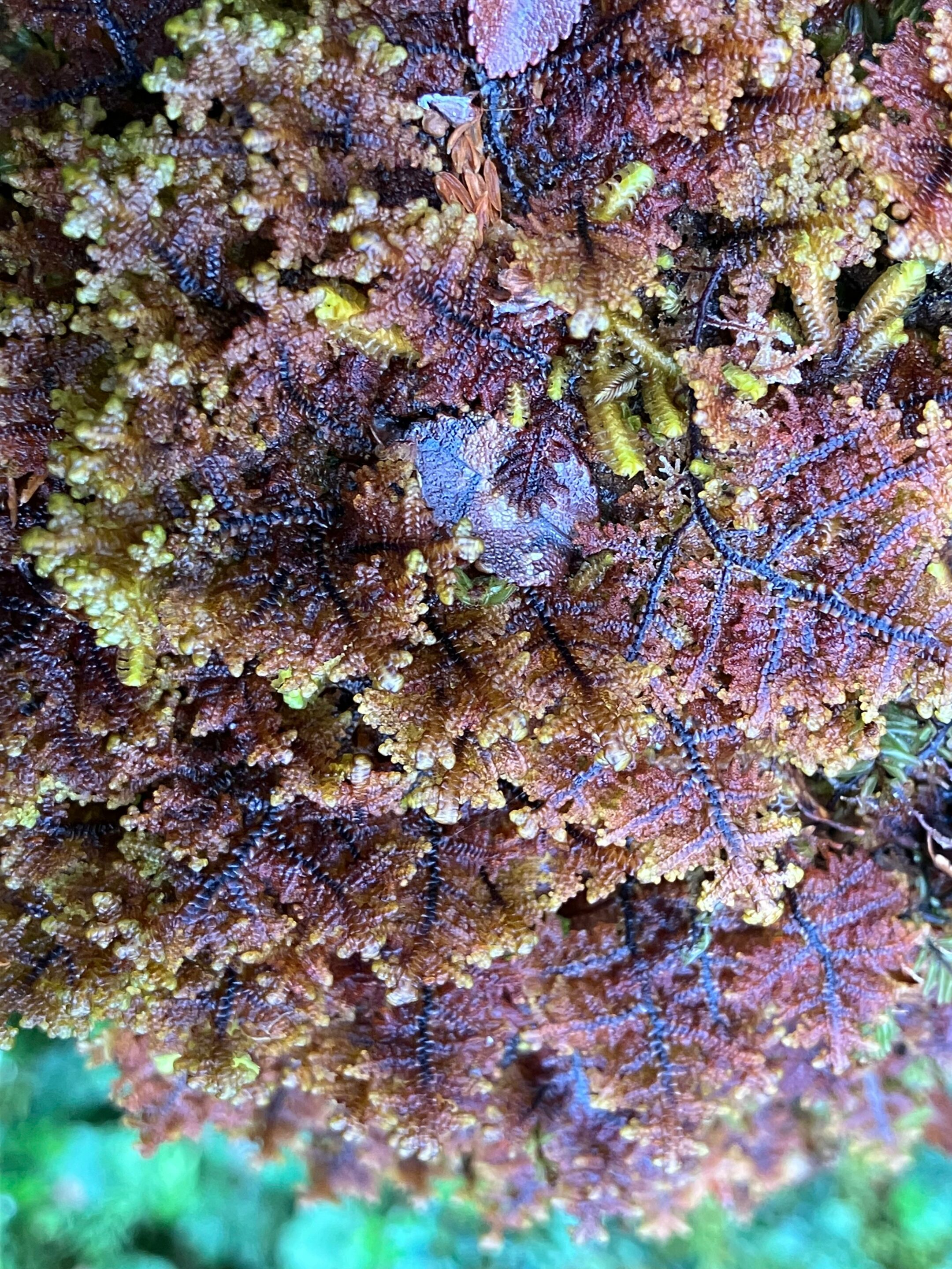
Bryophytes—mosses, liverworts, and hornworts—are small non-vascular plants, lacking roots and complex conducting tissues, yet they colonize trunks, soils, and rocks extensively in subantarctic forests. Lichens, long-lasting symbioses between a fungus and an alga or cyanobacterium, form crusts, leafy rosettes, or shrubby tufts that cover Nothofagus bark, dead wood, stones, and even moss cushions already in place. Together, these two groups make Cape Horn one of the places with the highest densities of non-vascular organisms in the world, to the point where a single tree can host more than a hundred epiphytic species.
Gunnera magellanica, Lepidozia chordulifera and Blechnum pennamarina, photographed during an expedition Karukinka in Tres Brazos Bay (Gordon island, Cape Horn Biosphere Reserve, Chile, February 2026)Plagiochila elata (expedition Karukinka February 2026, cape Horn province, Chile)
Bryophytes and lichens in southern Patagonia are poikilohydric, meaning they tolerate strong drying and can suspend their metabolism, resuming it rapidly once rehydrated, which makes them especially resistant to freeze–thaw cycles. Many species develop protective pigments and thick structures that reduce damage from UV radiation, wind, and direct exposure, especially in Magellanic tundra and coastal environments. These functional traits explain why, at the highest elevations of Navarino or on wind-swept shores, the dominant organisms are moss cushions and crustose or shrubby lichens.
Miniature forests
To make this richness perceptible beyond scientific circles, Ricardo Rozzi and colleagues proposed the metaphor of the “bosques en miniatura del Cabo de Hornos,” miniature forests formed by mosses, liverworts, lichens, and the microfauna that lives there. The practice of observing these small landscapes with a hand lens, pausing for a long time in front of a trunk or rock, turns a walk into a detailed natural history exploration of worlds that are usually invisible.
Lypocodium s.l. on the right (Tres Brazos bay, Cape Horn Biosphere Reserve, expedition Karukinka February 2026)
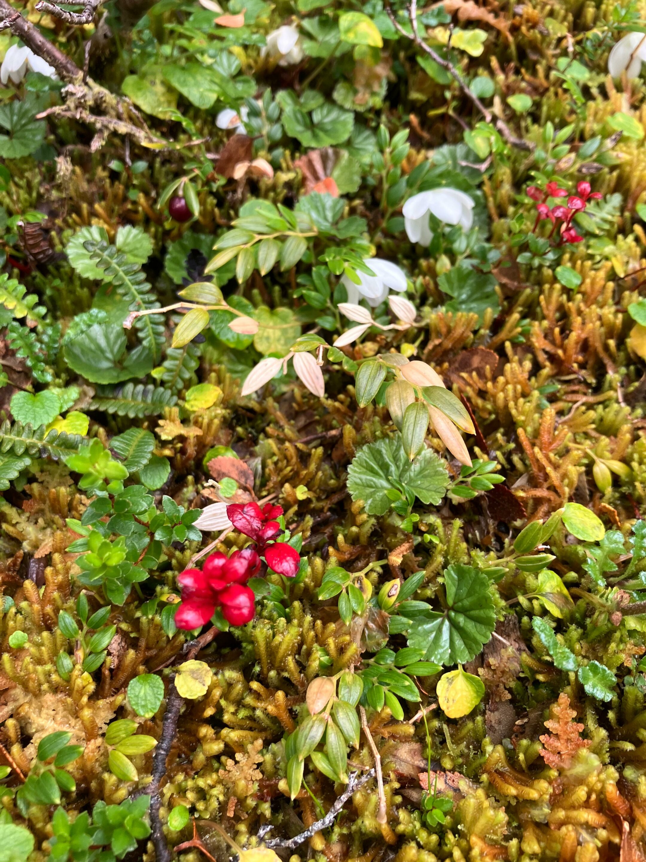
Miniature forests are not only vegetal: they also shelter a diverse microfauna of insects, mites, nematodes, and other invertebrates that feed, reproduce, and take refuge in moss and lichen cushions. These organisms contribute to the fragmentation of organic matter, the mineralization of nutrients, and sometimes the dispersal of spores and propagules, adding several trophic levels to what, to the naked eye, looks like a simple green or gray carpet.
Ecological roles in forests and bogs
In humid subantarctic forests, bryophytes and lichens form thick mantles on trunks, rocks, and the ground, capable of retaining large amounts of water and regulating local humidity. This water-retention capacity makes them natural sponges that soften the impact of frequent rainfall, limit erosion, and stabilize microhabitats for many invertebrates and microorganisms.
In peat bogs, bryophytes—especially sphagnum-type mosses and related forms—structure the matrix that accumulates organic matter in saturated environments, storing both water and large amounts of carbon.
Sphagnum, Baie Tres Brazos (cape Horn biosphere reserve, fueguian channels, Chile, expedition Karukinka, February 2026)
Lichens also play a pioneering role on bare rocks, glacial moraines, and coastal outcrops, where they initiate soil formation by physically and chemically altering the substrate. By retaining particles and moisture, these pioneer communities gradually create micro-niches favorable to the later establishment of mosses and then vascular plants.
Emblematic mosses and lichens
Among bryophytes, the moss Lepyrodon lagurus is often cited as an emblematic species of Omora Park, where it forms velvety mats on tree trunks and contributes to the luxuriant appearance of humid forests. This type of epiphytic moss retains rainwater, offers micro-refuges to a variety of invertebrates, and sometimes hosts lichens that settle on its surface, further increasing the complexity of the miniature forest.
Among lichens, the large tufts of Usnea, the “old man’s beards” hanging from Nothofagus branches, clearly illustrate the relationship between air purity and the vigor of lichen populations. The cushions and small trumpets of Cladonia that cover some soils or dead wood, as well as newly described species such as Candelariella magellanica, testify to the originality of Navarino’s lichen flora.
Miniature forest photographed during a trekking between Lëm and Wulaia (Navarino island, Chile) in February 2020 (Lauriane Lemasson)Sphagnum and liverworts (expedition in Tierra del Fuego, Lauriane Lemasson, March 2013)
Hand-lens ecotourism
To highlight and protect this discreet biodiversity, the Omora Park team developed the concept of “Ecoturismo con lupa,” a hand-lens ecotourism that places the discovery of mosses, liverworts, and lichens at the center of the experience. Coined by Ricardo Rozzi and colleagues, the term refers to a niche tourism practice in the Cape Horn Biosphere Reserve, where visitors are invited to observe the “miniature forests” and understand their ecological role. Marked trails welcome small groups equipped with hand lenses, accompanied by guides who combine natural history, ecology, and ethical reflection on biocultural conservation.
This ecotourism model has been supported by projects aimed at developing scientific and educational tourism in the region, seeking to connect local economic benefits, environmental education, and the protection of subantarctic ecosystems. The documentary Viaje Invisible. Ecoturismo con Lupa illustrates this approach by following guided visits that immerse the public in the detailed contemplation of Cape Horn’s miniature forests.
Gackstroemia magellanica (Endemic liverwort of the Cape Horn Biosphere Reserve (Karukinka expedition, February 2026))Gunnera magellanica – lichens Pseudocyphellaria berberina, Pseudocyphellaria frecineti, and Pseudocyphellaria granulata – Nephroma antarcticum (Karukinka expedition, Tres Brazos Bay, Cape Horn Biosphere Reserve, February 2026)
Biocultural conservation and education
Omora Park and its partners defend a “biocultural conservation” approach, linking biodiversity protection to the recognition of local cultures, especially Yaghan tradition and the communities of Puerto Williams. Bryophytes and lichens then become mediators for reflecting on the links between ways of life, environmental ethics, and responsibility toward ecosystems, notably through the “field environmental philosophy” proposed by Rozzi and colleagues.
Schools in Puerto Williams include the observation of miniature forests in their educational activities so that children recognize the global value of the biodiversity in their territory. This local appropriation helps counter “biocultural homogenization,” a concept that refers to the tendency to forget discreet organisms and lose the cultural knowledge and meanings associated with them.
Our thanks to Ricardo Rozzi and José German Gonzalez Calderon for their help in identifying the bryophytes from our images.
Short bibliography
Etayo, J., Sancho, L. G., Gómez-Bolea, A., Søchting, U., Aguirre, F., & Rozzi, R. (2021). Catalog of lichens (and some related fungi) from Navarino Island, Cape Horn Biosphere Reserve, Chile. Anales del Instituto de la Patagonia, 49.
Goffinet, B., Rozzi, R., Massardo, F., et al. (2012). Miniature Forests of Cape Horn: Ecotourism with a Hand Lens. University of North Texas Press.
Rozzi, R. (coord.) (n.d.). Ecoturismo con lupa en el Parque Omora. Universidad de Magallanes. Editorial presentation and book notice.
Cape Horn Center (CHIC). Ecoturismo con lupa: a way to discover the miniature forests of lichens and mosses.
Instituto de Ecología y Biodiversidad / Universidad de Magallanes. Omora Ethnobotanical Park – institutional presentation of the biological station.
Rozzi, R., et al. (2008). Patterns of species richness in sub-Antarctic plants and implications for conservation.
Documentary Viaje Invisible. Ecoturismo con Lupa. Omora Ethnobotanical Park, 2013.
Cultivating a Garden of Names in the Cape Horn Biosphere Reserve. Study on biocultural conservation, bryophytes and lichens, and environmental education.
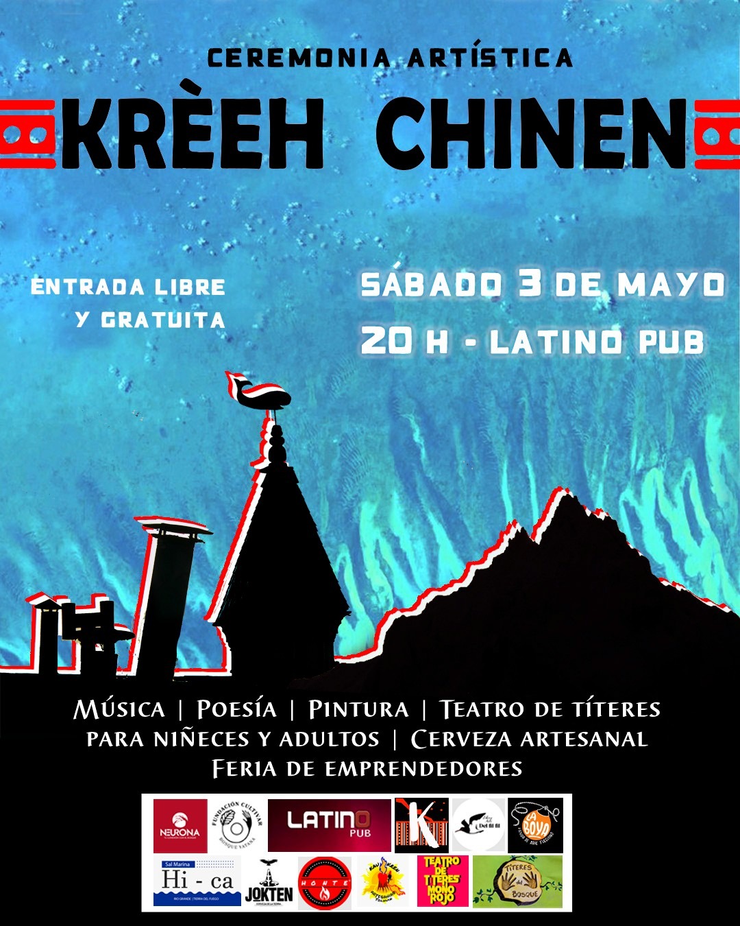
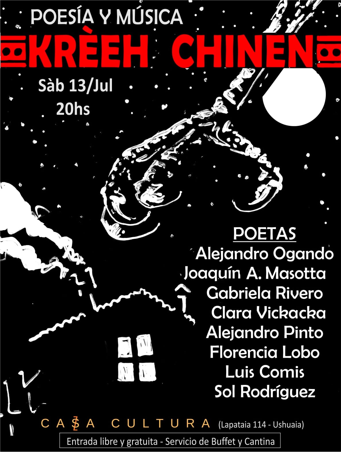
The crew of Milagro will be present, as a partner, at the 5th edition of the Kreeh Chinen Festival!
This event, which we have supported since its creation, will be held on November 29 at Restobar Punto de Encuentro in Tolhuin (province of Tierra del Fuego, Argentina).
The Festival: a place of artistic gathering
The Kreeh Chinen Festival, a Selk'nam word meaning "clinging to the moon" according to its founders, aims to bring together artists, poets, writers, musicians, and painters from throughout Tierra del Fuego province. Each of the three major cities in the province is represented, and the initiative was designed to foster independent, solidarity-based artistic exchange open to local initiatives: producers, artisans, and small organizations are invited to participate. The previous edition, already supported by Karukinka, underscores this collective and ambitious dimension: "The idea is to make visible the regional, environmental, and cultural themes of indigenous peoples," explain in unison two of the organizers, Lauriane Lemasson, a French researcher, and Alejandro Pinto, writer and poet from Río Grande.
Why Karukinka is associated with it
The Karukinka Association, founded with the ambition to "build the missing bridge between Europe and Tierra del Fuego," has been committed for many years to indigenous peoples and heritage projects in the region. The partnership with Kreeh Chinen thus naturally aligns with its mission:
To promote cultural expressions from southern Argentina (Tierra del Fuego) in their authenticity, independence, and diversity.
To strengthen connections between local actors (artists, artisans, indigenous communities) and a broader public, beyond borders.
To contribute to an event that highlights not only art but also environmental, cultural, and heritage themes linked to the indigenous peoples of the region.
What is planned for November 29, 2025
At Restobar Punto de Encuentro in Tolhuin, you will be able to discover:
Musicians coming from throughout Tierra del Fuego province,
Poets and writers sharing stories, voices, and local imaginaries,
Painters and visual artists displaying their works,
A moment of sharing and encounter, in the spirit of Kreeh Chinen, which values both art, local engagement, and cooperation.
This 5th edition of the Kreeh Chinen Festival will once again allow us to celebrate art, culture, and solidarity in Tierra del Fuego. We will share more details about this event with you soon!
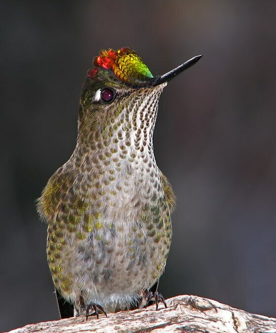
Today we share with you a Yagan story dedicated to the hummingbird, told by Úrsula Calderón and Cristina Calderón in 2001 in Mejillones Bay (Navarino Island, Chile). It was published on pages 170 and 171 of the book Guia Multi-Etnica de Aves de los bosques subantárticos de Sudamérica (2017) and translated from Spanish to English by the Karukinka association.
The Chilean hummingbird Sephanoides sephaniodes
The Yagan story of the hummingbird
“Once, when birds were still humans, a severe drought struck the Cape Horn region and its inhabitants were dying of thirst. The cunning fox (cilawáia, the Magellan fox) found a lagoon and, without telling anyone, built a fence around it with umush branches (calafate in Yagan) so that no one could enter. Hidden there, he drank plenty of water alone, only caring for himself.
After some time, others discovered the lagoon's existence and, as a group, they went to ask cilawáia for some water. But he didn’t even want to listen to their pleas and brusquely expelled them. The people's condition worsened by the moment, and in their despair, they remembered omora. They sent a message to this small occasional visitor who, in similar past shortages, had saved their lives.
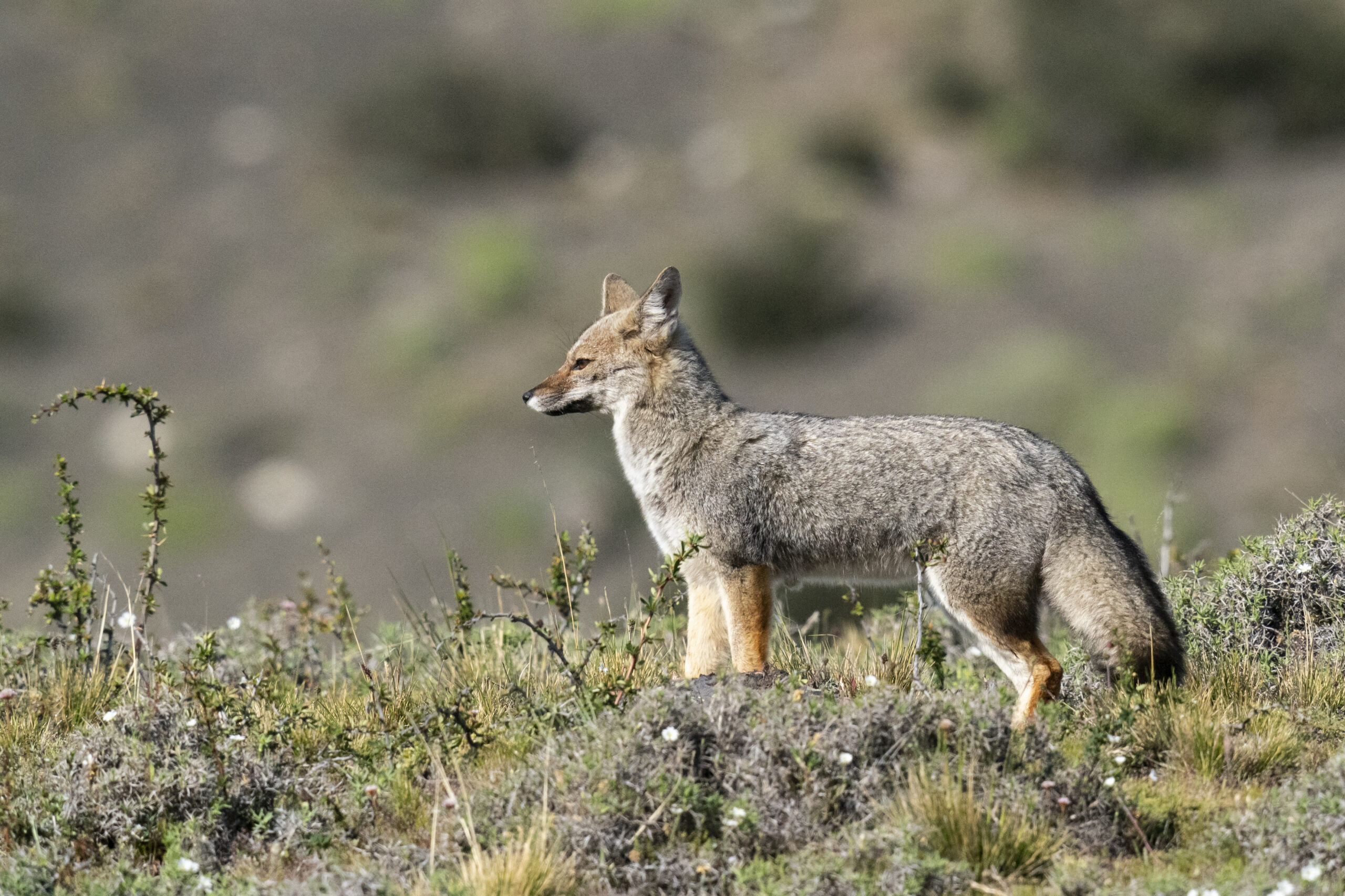
The Magellanic fox (Lycalopex griseus, cilawáia)
The hummingbird, or little omora, was always ready to help and came very quickly. Although weakened, this tiny creature (human or spirit) is braver and more fearless than any giant. Upon arrival, people told him in detail what had happened about the great shortages. Omora, upon hearing what happened, became indignant and flew to the place where cilawáia was. Selfish, the fox confronted him. And omora said: ‘Listen! Is it true what others told me? You have access to a lagoon, and you refuse to share your water with others. Do you know that if you don't give them water, they will die of thirst?’ The fox replied: ‘What do I care? This lagoon has very little water, just enough for me and some close relatives.’
Hearing this, omora became furious and, without answering cilawáia, he returned to the camp.
He thought hard and, hastily, rose holding his staff and returned to where cilawáia was. On the way, omora collected several sharp stones, and when close enough to the fox, he shouted: ‘Will you finally share the water with everyone?’ The selfish cilawáia answered: ‘Let them die of thirst. I can’t give water to each one of them, or else my family and I will starve.’
Omora was so furious he could not restrain himself and leapt with his staff, killing the fox with the first blow.
The others watching came running happily to the place, broke the fence, approached the lagoon, and began to drink to quench their thirst — all of the water. Some birds who arrived late barely managed to wet their throats. Then, the wise little owl sirra (grandmother of omora) said to the birds who had arrived late: ‘Go collect mud from the bottom of the lagoon and fly to the tops of the mountains, above which you must sprinkle.’
The little birds and their balls of mud created vertical springs that originated the watercourses cascading from the mountains, forming small streams and large rivers running through ravines. When everyone saw this, they were extremely happy and all drank large amounts of fresh and pure water, which was much better than the lagoon water that the selfish cilawáia guarded. Now everyone was saved. To this day, all these watercourses flow from the mountains and provide exquisite water. Since then, no one should die of thirst.”
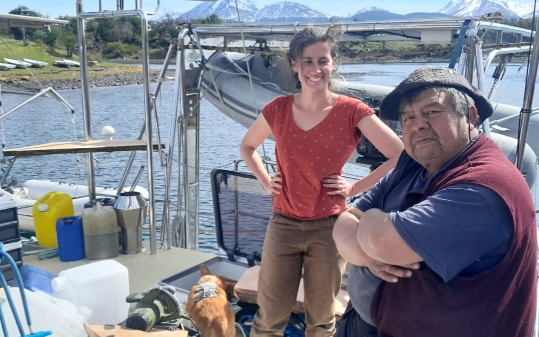
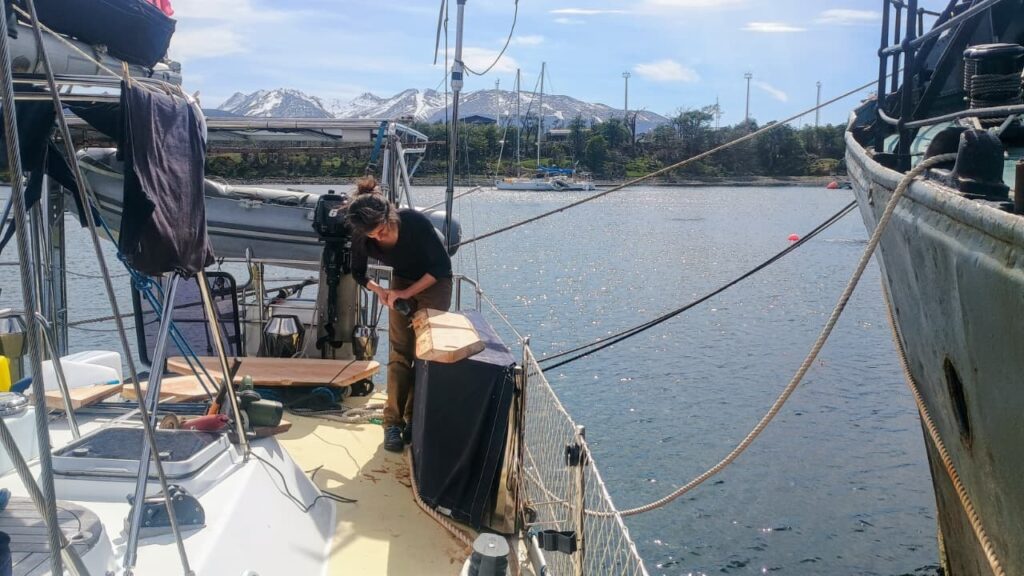
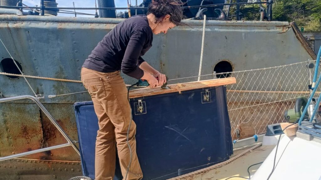
On Monday, October 27, the Milagro resonated with the sound of coigüe wood and tools. With José, crew member and godparent of the boat, we dedicated the day to a traditional woodworking session to craft two new work surfaces from coigüe wood. These new fittings, now installed at the stern of the sailing vessel, will be used to clean fish and lift nets outside, in perfect harmony with the sea and the wind. On board, the scent of freshly cut wood mingled with that of changing tides. The finishing touches were done with an axe, a vibrating saw, and finally a grinder.
Heritage of the Yagan people
Among the Yagans, people of the channels of Tierra del Fuego, woodworking holds an essential place. Originating from a culture intimately linked to water and cold, the Yagans shape wood for everything: canoes, tools, shelters. Their know-how is based on a keen sense of the material, capable of transforming a wet log into a light boat or a rough plank into a durable work surface. By reviving these ancestral gestures, although supplemented by modern tools, we pay homage to this millenary maritime culture, which saw in every piece of wood a fragment of the landscape, a trace of the link between humans and nature.
Lauriane and José aboard Milagro, with a first coigüe wood work surface on the starboard aft balcony.
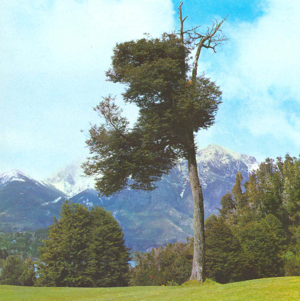
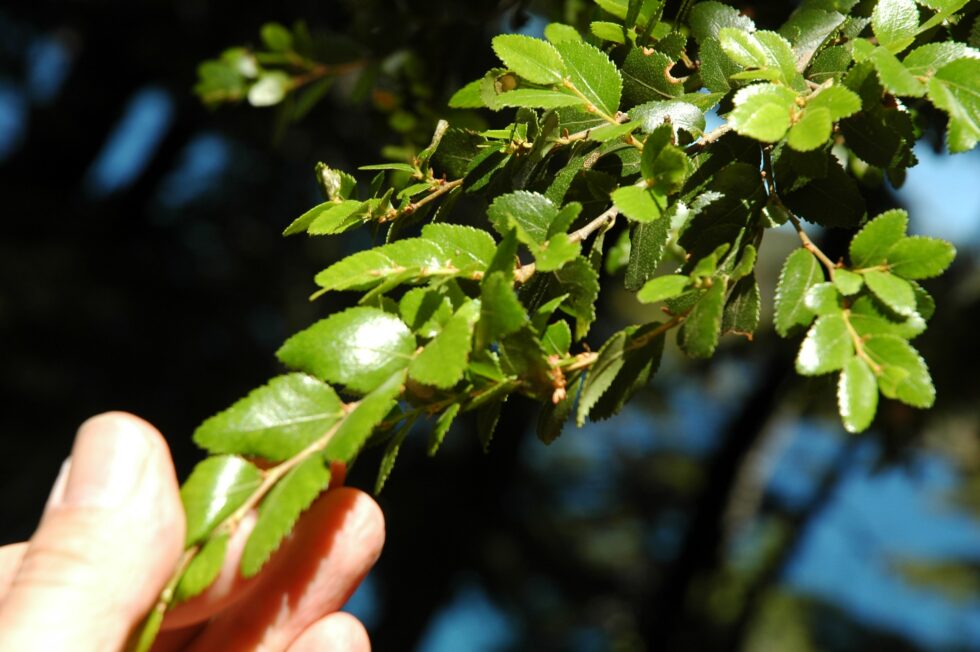
Coigüe wood, the strength of Southern Chile
The coigüe (Nothofagus dombeyi) is a emblematic tree of the temperate forests of southern Chile and Patagonia. Its wood, dense and strong, is distinguished by a clear and warm tint, perfect for marine works. It is a species that withstands moisture well and ages gracefully, developing a soft patina over the seasons. Working with coigüe means handling a living material, rooted in the same earth and winds that the Milagro sails through. This noble wood, over 60 years old in the case of what we used, was shaped here in the traditional way so that the boat continues its journey respecting the traditions and nature surrounding it.
Coigüe leaves (Valerio Pillar de Porto Alegre, Brazil — DSC_7172.JPGUploaded by pixeltoo, CC BY-SA 2.0, https://commons.wikimedia.org/w/index.php?curid=10393830)
The study proposes a collaboration model between ancestral Mapuche knowledge and ecological science, demonstrating that nature conservation requires listening to, respecting, and working alongside indigenous communities.
Temuco, October 23, 2025. (diariomapuche.cl) – A study published by the scientific journal Ecology & Evolution highlights the contribution of the Mapuche people to the understanding and protection of biodiversity in southern Chile. The research, titled "Listening Deeply to Indigenous People: A Collaborative Perspective and Reflection Between a Mapuche Machi and Ecologists", proposes a paradigm shift in ecological science: moving from consulting communities to co-producing knowledge alongside them.
The work was developed by a group of scientists and a machi from the Conguillío territory, who shared knowledge, experiences, and reflections on the impacts of industrial projects—forestry and hydroelectric—on the Truful-Truful river basin, one of the ecosystems most affected by extractivism in Wallmapu.
"The machi and the ecologists show us that listening deeply to indigenous peoples is not a symbolic act, but a condition for understanding the life of the territory," the study states.
Ancestral Mapuche knowledge and science with two eyes
The team applied the "Two-Eyed Seeing" approach, a framework that integrates Western scientific vision with Mapuche cosmovision. In this way, two ways of knowing the world are articulated: one based on ecological data and another on the spiritual and territorial experience that sustains the Mapuche relationship with itrofil mongen (biodiversity).
The article identifies historical barriers between academia and indigenous peoples—such as mistrust, knowledge extractivism, and inequality in decision-making—but also shows concrete paths for collaboration, respect, and reciprocity.
The territory speaks
The research documents how exotic plantations and hydroelectric projects have altered medicinal species, water courses, and cultural practices linked to küme mongen (good living). Against this, the study proposes that indigenous communities participate as co-managers and co-researchers, recognizing their territorial and spiritual authority over the ecosystems they inhabit.
The publication concludes that without indigenous peoples there will be no effective nature conservation, and that integrating their knowledge and rights into public policy is an urgent task in the face of the global climate crisis.
"Wallmapu does not only conserve biodiversity: it conserves memory, language, and spirituality. Listening deeply to its inhabitants is also listening to the earth," the statement summarizes.
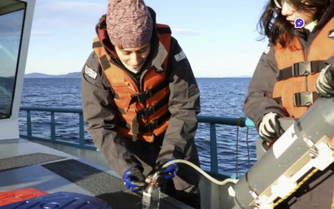
A study conducted by Conicet in the Beagle Channel could be a turning point for aquaculture production in Tierra del Fuego. The analysis of variables such as water temperature, salinity, and oxygen concentration aims to lay the foundations for the first industrial-scale mussel farm in Ushuaia, as part of a project led by Newsan Food. #mussels Beagle Channel
The study is led by Irene Schloss, a specialist in biological oceanography, with a team from the Southern Scientific Research Center (Cadic). The researchers are studying environmental conditions in areas near Puerto Almanza, where mussels already grow naturally, and evaluating other areas with production potential. This species is native to the Beagle Channel and has great potential for regional aquaculture.
The work is part of a High-Level Technological Service (STAN) requested by Newsan Food, which has been developing fishing activities in the province for 15 years and, in the last five years, has made progress in aquaculture for domestic supply according to a sustainable model. Last February, the company led by Rubén Cherñajovsky launched the first national production of industrial mussels.
“Mussels are sensitive marine organisms that require optimal environmental conditions to grow and thrive. It is therefore essential to understand and evaluate the environment in which their cultivation is planned, to ensure the long-term success of the productive activity,” explains Schloss.
The study considers key environmental and biological variables: temperature, salinity, oxygen and ammonium concentration, presence of chlorophyll and phytoplankton, with an emphasis on toxin-producing species (red tide). All this aims to determine whether the conditions in the channel are suitable for the development of this industry.
“Studying the marine environment of the Beagle Channel is important for many reasons, but it is even more valuable that these studies can have a real impact on productive activities in the southernmost region of the continent. When we work together, everyone wins: better decisions are made and science translates into concrete results for society,” adds the researcher.
For field operations, the Scientific Research Vessel (BIC) Shenu serves as a base for navigation and surveys, with a monthly campaign at five coastal stations between Puerto Almanza and the east of Gable Island, opposite Puerto Williams (Chile). The project plans twelve campaigns until October. The ship is equipped with multiparameter instruments (CTD, light and chlorophyll sensors) as well as equipment for storing and processing samples taken at depths of between 5 and 8 meters, which are then analyzed in Cadic's laboratories.
On the Newsan Food side, director Fabio Delamata explains: “The company's objective is to conduct a study of the marine environment to consolidate the creation of an aquaculture development hub based on sustainability, environmental protection, and an industrial perspective. Working with Conicet means relying on data and information to achieve a solid, reliable, and long-term result.”
The company has invested nearly $10 million in cultivation lines, boats, and harvesting and seeding platforms, as well as an operational hub in Puerto Almanza. The overall plan calls for a $17 million investment to expand production with new collection and breeding lines.
The project aims to meet local demand, which fluctuates between 300 and 400 tons of mussels per year, currently imported from Chile, and to open the door to exports. Last summer, Newsan sent a batch of 10 tons of mussels cultivated in the Beagle Channel to Buenos Aires, whole, frozen, and pre-cooked in the channel's water.
The results of Conicet's research could not only diversify Tierra del Fuego's productive matrix, but also generate employment and raise environmental awareness in the community. “This would strengthen environmental awareness as an alternative for diversifying the productive matrix and encourage sustainable development in Almanza,” emphasize Cadic members.
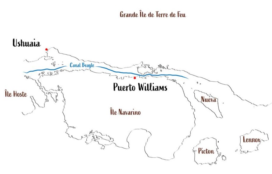
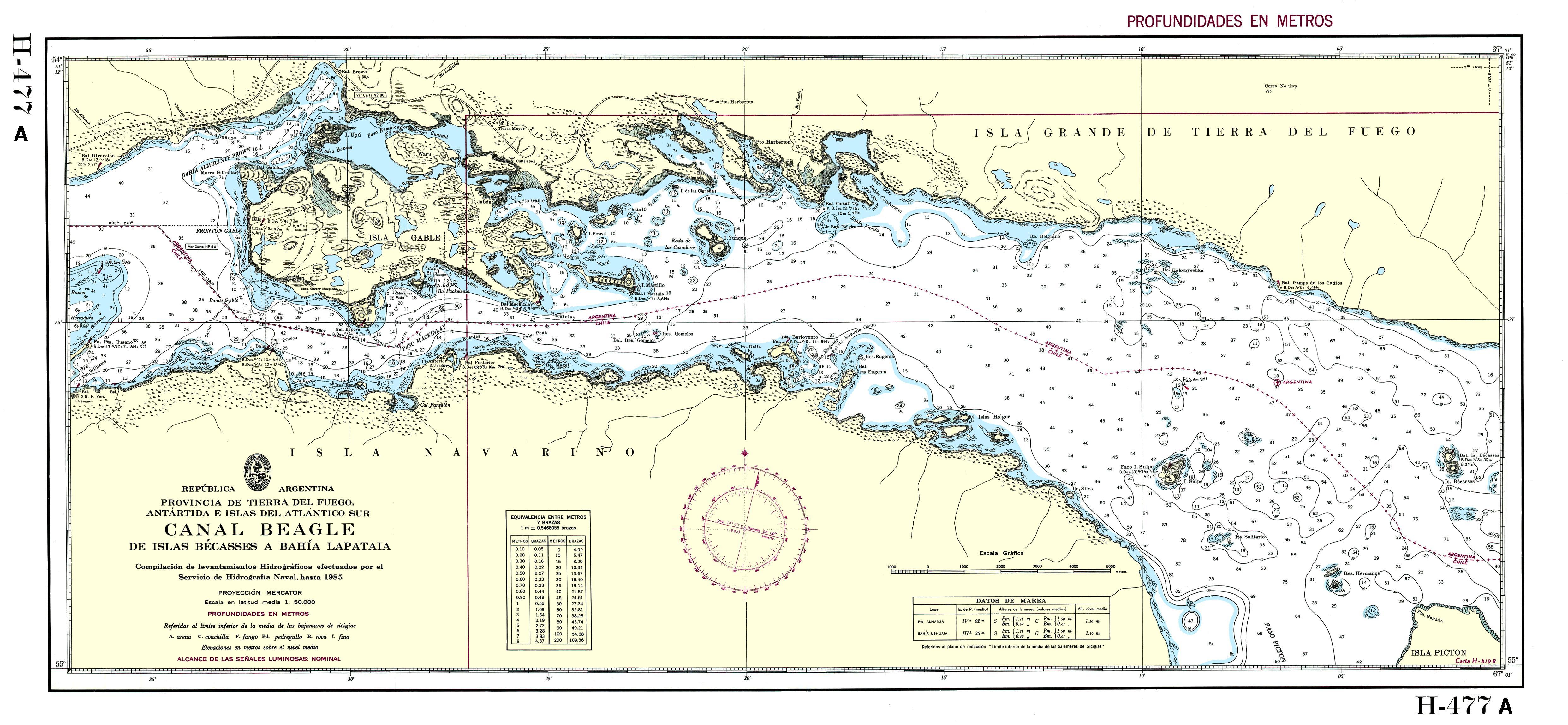
The Beagle Channel, known to the Yaghan people as Onashaga (“channel of the Ona hunters,” i.e., their Selk'nam neighbors from Tierra del Fuego), is one of the planet’s outstanding maritime passages. This interoceanic strait, approximately 270 kilometers long, connects the Atlantic and Pacific oceans at the very southern tip of South America, separating the main island of Tierra del Fuego from an archipelago of smaller islands between 54°50′ and 55°00′ south latitude.
The east part of the Beagle channel (c) Karukinka
For us, who regularly sail these legendary waters, Onashaga—the Beagle Channel—means much more than a simple maritime passage: it’s a world of its own, where two oceans meet and where seven millennia of Yagan navigation still resonate.
Table des matières
The genesis of the landscape: a glacial heritage
When ice sculpted the channels
The formation of the Beagle Channel is a prime example of Quaternary glacial sculpting, which has shaped one of the most spectacular southern hemisphere landscapes. During repeated Pleistocene glaciations, glaciers hundreds of meters thick excavated valleys like Carbajal and Lake Kami (Fagnano), creating the region’s complex topography.
Photography of the Carbajal Valley by Lauriane Lemasson, during the 2013 expedition in Argentine Tierra del Fuego
The glacier responsible for forming the Beagle Canal moved from west to east, fed by the Darwin Range, where glaciers and snowfields—remnants of this genesis—can still be seen today. This glacial process left behind moraine deposits in the shallower areas, especially around Gable Island and off the Ushuaia Bay, creating today's bathymetric complexities.
The tectonic structure underlying the channel is a longitudinal tectonic valley, later modified by glacial action. The combination of tectonic and glacial processes resulted in a morphology with semi-isolated basins as deep as 400 meters, separated by shallow topographic sills that control water mass circulation.
A complex submarine architecture
The Beagle Channel’s bathymetry reveals a complex architecture dominated by a series of shallow sills, dividing the channel into several distinct micro-environments. In the western sector, the Diablo Island sill (approx. 50 meters deep) and the Fleuriais Bay sill (about 100 meters) separate the northwestern and southwestern branches from the central sector.
This bathymetric setup generates a complex circulation system, with sills acting as barriers that limit the exchange of deep water masses, creating micro-environments with distinctive physical, chemical, and biological properties.
It is this diversity of habitats that makes the Beagle Channel such a rich and unique ecosystem, as explained by Centro IDEAL researchers who have studied these waters for years.
East part of the Beagle channel
Hydrographic system
The meeting of oceans
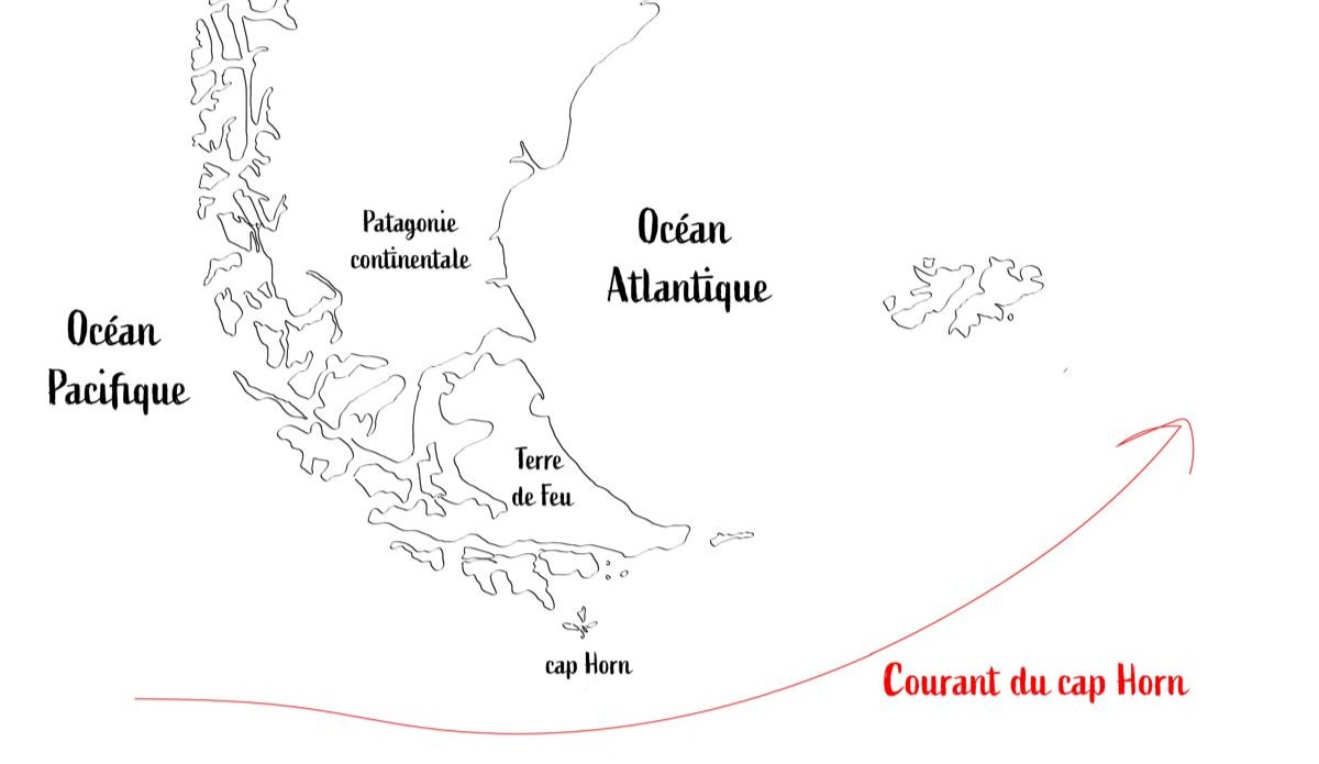
The Beagle Canal acts as an interoceanic corridor that facilitates the transport of surface waters from the Pacific to the Atlantic, a flow mainly driven by the difference in sea level between the two oceans and the influence of strong westerly winds within the Antarctic Circumpolar Current.
The Cape Horn current is the primary source of water entering the channel, bringing subantarctic water (SAAW) at depths greater than 100 meters along the edge of the Patagonian Pacific shelf. This water enters via a submarine canyon at the western mouth of the channel, characterized by temperatures of 8–9°C, salinity above 33, and relatively low oxygen concentrations.
Map illustrating the Cape Horn current (c) Karukinka
Waters that tell the story of the climate
Freshwater input from the Darwin Cordillera icefield generates a two-layer system, with a pronounced pycnocline separating vertical phytoplankton fluorescence. This estuarine water is cold (4–6°C), nutrient-poor, and highly oxygenated.
Time series analyses reveal that the annual cycle explains 75–89% of ocean temperature variability, while the atmospheric cycle explains 53% of its variability.
These data allow us to understand how the channel reacts to climate change, emphasize oceanographers monitoring these waters.
A sanctuary for marine biodiversity
The realm of marine mammals
The channel hosts an exceptional diversity of marine mammals, internationally recognized as an important marine mammal area (IMMA), covering 26,572 km² from the channel to Cape Horn. This area is home to at least eleven primary marine mammal species, plus eight supporting species.
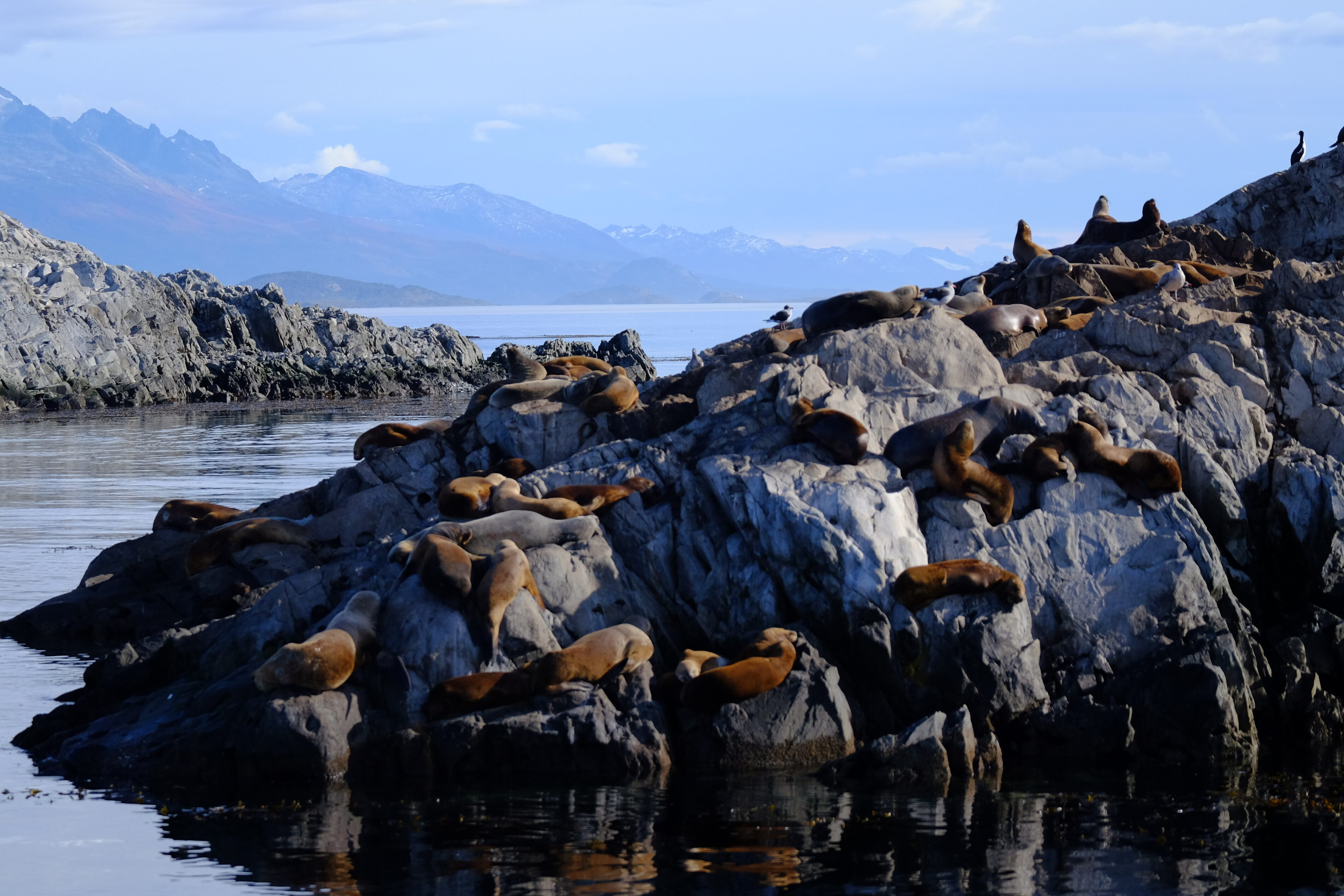
Among the year-round resident species are three small cetaceans: the Peale’s dolphin (Lagenorhynchus australis), the dusky dolphin (L. obscurus), and the Burmeister’s porpoise (Phocoena spinipinnis), along with two pinnipeds: the South American sea lion (Otaria byronia) and the South American fur seal (Arctocephalus australis).
Colony of South American fur seals in the Beagle Channel, near Ushuaia Bay, photographed in April 2025 during a sailing expedition
We have had the chance to observe these Peale’s dolphins during our voyages across Patagonia’s channels, from the channel’s eastern mouth to Cook Bay at its southwestern end. Their close association with kelp forests is fascinating: they undertake 40.5% of their feeding and 14.3% of their hunting behaviors there.
The underwater kelp forests
The underwater forests of Macrocystis pyrifera, locally known as “cachiyuyos,” are among the channel’s most important ecosystems, extending from the Valdés Peninsula to Tierra del Fuego. These forests provide a critical habitat, acting as nursery grounds, refuges, and feeding areas for an exceptionally diverse range of marine species.
Doctoral research by Adriana Milena Cruz Jiménez revealed the complexity of fish assemblages associated with these forests, examining various strata: the lower area at the holdfast and the mid-water area at the fronds.
The ichthyological diversity found in these kelp forests highlights their vital role in marine biodiversity, explains this specialist.
A delicate balance under threat
The pattern of nutrient distribution in the Beagle Channel varies distinctly among its water masses. The system is notably nitrate-limited, with an N:P ratio of 8.42, consistent across all water masses. This directly influences the channel’s primary productivity.
Phytoplankton biomass is generally moderate and limited to the upper pycnocline in the western sector, while mixing over sills disrupts stratification, pushing phytoplankton cells beneath the photic zone, which can limit primary production.
Local scientists insist that understanding these mechanisms is crucial to preserving the unique balance of this ecosystem.
The Yagan cultural heritage: the Onashaga (Beagle) Channel
Seven millennia of navigation
The name Onashaga means “channel of the Ona hunters” in the Yagan language and reflects the profound connection between this maritime people and these waters for around 7,000 years. The Yagan developed a nomadic culture based entirely on exploiting marine resources and constant navigation of the Fuegian archipelago, adapting to an environment Europeans found utterly inhospitable.
When we sail these waters, we still feel the presence of those ancient navigators, as our crew members testify. Their traditional territory extended from the southern coast of the main Tierra del Fuego island (Onaisin) to the Cape Horn archipelago, including the Onashaga. This toponym is one of the many native place names erased from official maps by colonization, which we must now reclaim to restore meaning rooted in the land’s first inhabitants.
The channel as an archaeological witness
Archaeological evidence along the Beagle Channel reveals human occupation stretching back millennia, with shell middens, lithic tool workshops, fish traps, and ancient campsites.
Notable archaeological sites include evidence of ancient Yagan settlement at places like Wulaia Bay on Navarino Island, indicating occupation over 7,000 years ago.
The legacy of great explorations
In the footsteps of Darwin and FitzRoy
The channel is named after HMS Beagle, the British ship that conducted the first hydrographic survey of southern South America’s coasts from 1826 to 1830. The European discovery of the channel occurred in April 1830, when the Beagle was anchored in Orange Bay (southeast Hoste Island).
During the second expedition (1831–1836), FitzRoy brought along Charles Darwin as a self-financed naturalist. Darwin saw his first glaciers there in January 1833, writing in his journal: “It is almost impossible to imagine anything more beautiful than the beryl-blue of these glaciers, especially contrasted with the dead white of the upper snow stretches.”
And to travel there regularly... it is always a wonder! Patagonia sailing expedition, February 2025 (Karukinka)
Darwin’s meticulous observations of the region’s geology, fauna, and indigenous populations provided key evidence for his understanding of adaptation and geographic species distribution.
The channel thus became one of the seminal natural laboratories in the history of natural sciences.
From mapping to geopolitical conflict
The hydrographic surveys by Captain FitzRoy and crew laid the groundwork for modern navigation in the region, followed by those from the Cape Horn Scientific Mission. However, this mapping precision also revealed the strategic importance of the channel, which would become a historic source of geopolitical tensions between Chile and Argentina.
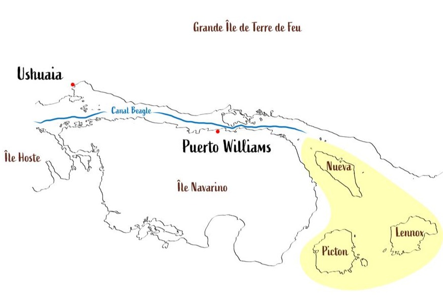
The Beagle conflict of 1978 brought the nations to the brink of war over three small islands—Picton, Lennox, and Nueva—whose sovereignty would determine control over vast maritime territories. The dispute was resolved by papal mediation, with Pope John Paul II playing a crucial role, leading to the treaty of peace and friendship of 1984.
In yellow, the islands involved in the Beagle Conflict of 1978
Modern science in the service of knowledge
A monitored natural laboratory
Today, the channel is one of the best-studied subantarctic marine systems, serving as a comprehensive regional sentinel of global change. Since October 2016, Chile’s Austral University’s Centro IDEAL has conducted annual hydrographic transects from the western end to Yendegaia Bay.
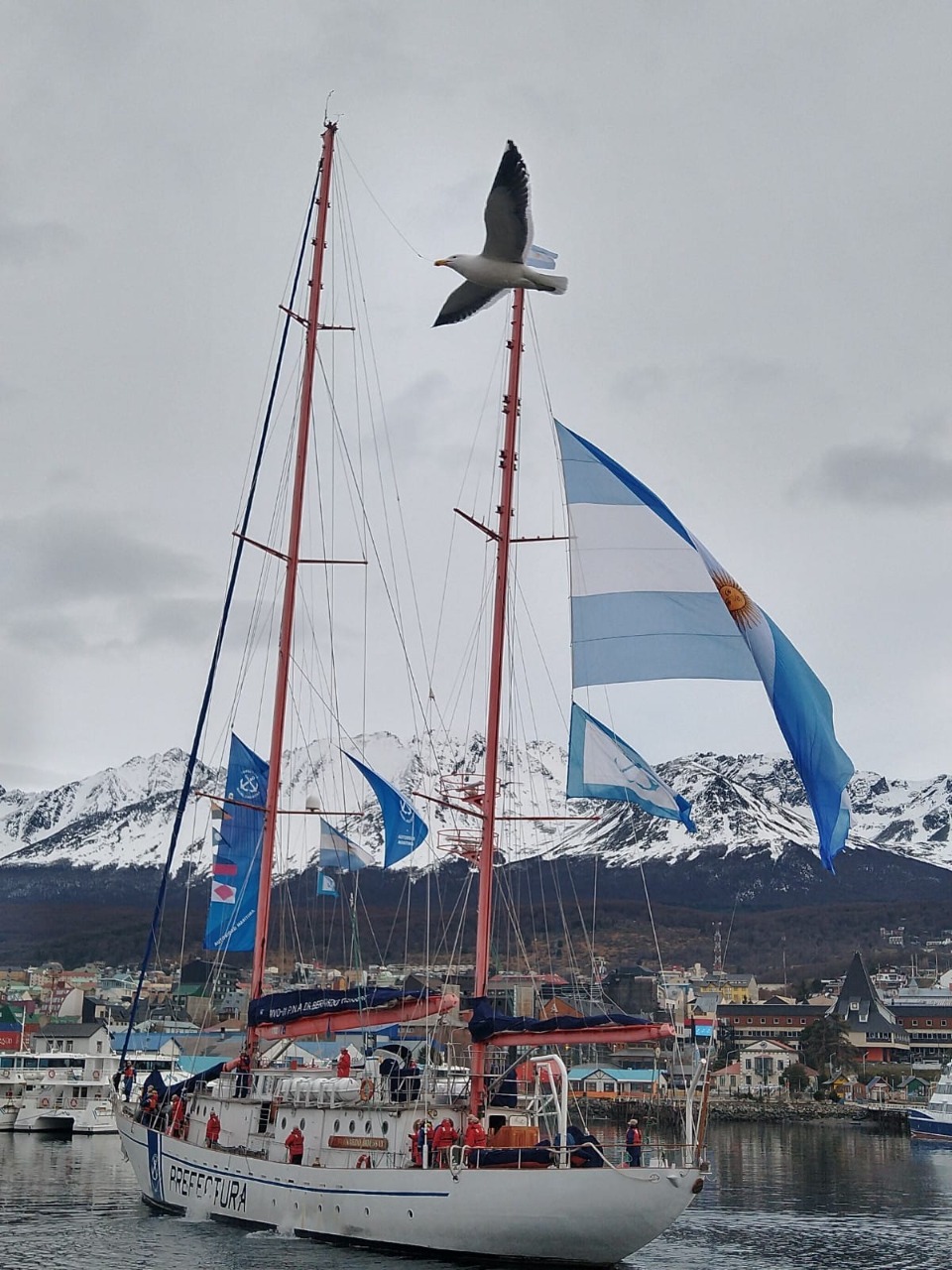
A major milestone was achieved in July–August 2017 with the first complete, high-resolution oceanographic survey along the entire channel, carried out through cooperation between Centro IDEAL and an Argentine expedition on the research vessel Bernardo Houssay. This international collaboration generated, for the first time, a complete hydrographic section of the channel, say the researchers involved.
The sailing vessel Bernardo Houssay, of the Argentine Naval Prefecture, upon its arrival at the port of Ushuaia in 2021 (source)
Unique scientific challenges
Research in the Beagle Channel faces unique challenges due to its remote location, complex geomorphology, and shared jurisdiction between Chile and Argentina, historically limiting coordinated research. Future needs include studies on processes within each semi-enclosed basin and implementation of coupled atmosphere-ocean-glacier models to determine residence times.
Such research is crucial to understanding how this ecosystem will respond to future climate change.
Threats and conservation issues
The challenges of climate change
This channel faces unprecedented threats from climate change: rising temperatures, shifting precipitation patterns, and ocean acidification, all threatening the ecosystem’s delicate balance. Glacier retreat has accelerated dramatically in recent decades, altering freshwater contributions and potentially affecting marine productivity.
Changes have already been observed during our expeditions: the retreat of glaciers between 2018 and 2025 left a lasting impression. Scientists closely monitor these changes, using the region as a natural laboratory to understand wider impacts of climate change.
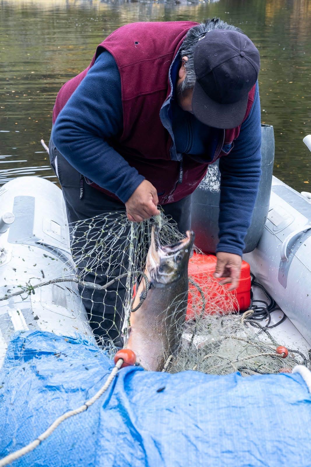
The salmon farming controversy
The expansion of the salmon farming industry into the region has been categorically rejected by organizations grouped within the Forum for the Conservation of the Patagonian Sea, which express concern over potentially catastrophic and irreversible damage to one of the region’s most precious marine ecosystems.
We strongly support this position: the channel’s pristine waters are home to one of the world’s greatest biodiversity reserves, with great heterogeneity in coastal-marine habitats containing numerous understudied marine invertebrates and vertebrates. Introduction of non-native species such as salmon is considered “terrible and risky” for this ecosystem by leading researchers. Fish-farm salmon escapes upstream have led to “wild salmon” appearing in the Cape Horn Biosphere Reserve, now threatening endemic species such as robalo.
An example of a salmon caught by José near the northern arm of the Beagle Channel during one of our sailing expeditions in 2025 (photo Christine Stein, Karukinka Association
A challenge of international and multicultural preservation and cooperation
Since 2005, in order to preserve this natural marvel, most islands south of the Beagle are part of the Cape Horn Biosphere Reserve, managed by UNESCO, CONAF, and the Chilean Navy. This designation acknowledges the ecosystem's outstanding importance and establishes long-term conservation frameworks.
We believe that preserving Yagan culture and integrating their ancestral knowledge is essential to understanding and protecting this unique ecosystem. Including Yagan traditional ecological knowledge in contemporary environmental management represents an opportunity to develop innovative approaches to conservation. Knowledge of navigation, climate observation, marine resources, and seasonal cycles forms a scientific heritage of great value, complementing modern research methodologies.
Bibliography
Scientific sources
Ferreyra, G. & González, H. “General hydrography of the Beagle Channel, a subantarctic interoceanic passage at the southern tip of South America.” Frontiers in Marine Science, September 30, 2021.
Marine Mammal Protected Areas Task Force. “Beagle Channel to Cape Horn IMMA – Marine Mammal Protected Areas Task Force.” Marine Mammal Habitat, March 18, 2024.
Lodolo, E., Menichetti, M. & Tassone, A. “Shallow architecture of Fuegian Andes lineaments based on marine geophysical data.” Andean Geology, vol. 45, no. 1, 2018.
Institutional publications
Yaghan’s, explorers and settlers.Museo Yaganusi, Government of Chile. PDF document, 2021.
Canal Beagle sin salmoneras.Mar Patagónico, regional declaration, 2024.
The Beagle Channel free from salmon farming.Mar Patagónico, regional statement, 2024.
Phytoplankton biodiversity and water quality in the Beagle Channel, Argentina, 2017–2021.Government of Argentina, PDF document.
Articles
El Rompehielos. “The importance of marine biodiversity in the Beagle Channel.” January 29, 2020.
Radio del Mar. “Beagle Channel is a key research ecosystem for marine biology.” May 22, 2023.
Centro IDEAL. “Scientists unravel the structure of the Beagle Channel.” November 11, 2021.
Audiovisual docs
“Discovery of the Beagle Channel.”YouTube, June 20, 2021.
“The importance of marine biodiversity in the Beagle Channel.”YouTube, January 29, 2020.
Conservation organizations
Rewilding Chile. “Beagle Channel: exploring the end of the world.” September 3, 2023.
Rewilding Chile. “Canal Beagle: explorando el confín del mundo.” September 3, 2023.
Table of content : sailing patagonian channels part 1
Tuesday, January 28, 2025: Departure of the sailing expedition in the Chilean Patagonian Channels
A tough wake-up this morning; the night was short and the previous day was busy, as always before an 18-day sailing expedition in the Cap Horn biosphere reserve, the southern Chilean fjords : provisioning, supply runs… a host of things that, of course, can only be done last minute in Ushuaia!
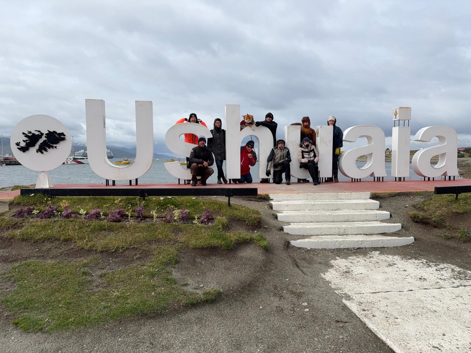
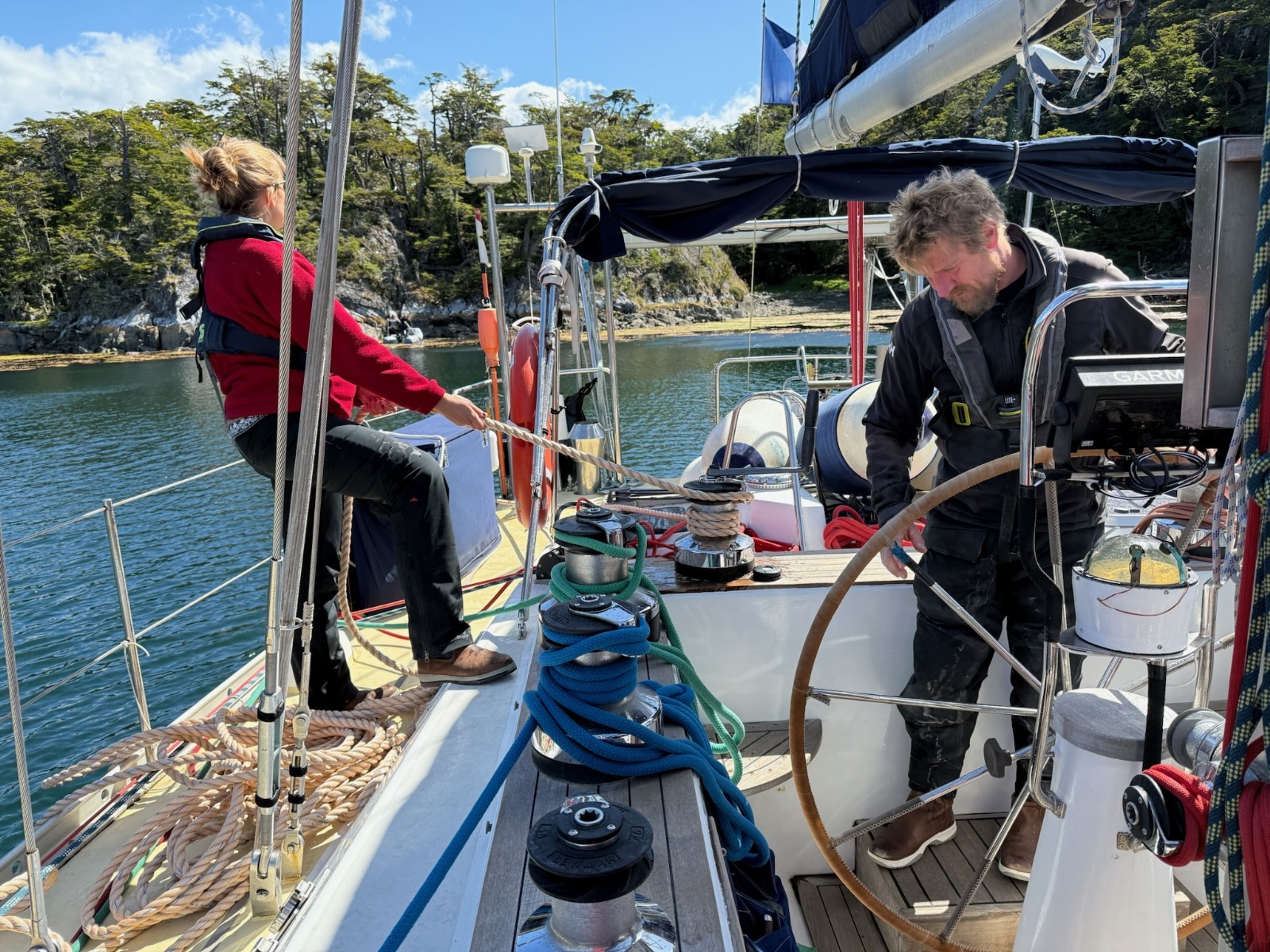
The crew of Milagro, association Karukinka, in Ushuaia (Photo Pascal Madert)
So, 8 a.m., breakfast, and quite a crowd for this breakfast. Yesterday, we welcomed 5 new crewmates: Annick and Jacques, the Gers natives aboard, Pascal from Grenoble, Alain from Vannes, and Françoise from Paris; their common point: they’re all happy retirees! With Aude, who simply refuses to leave the boat, Damien, Lauriane, and myself, that makes 9 crew members!
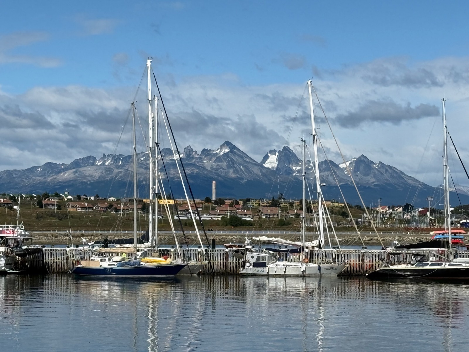
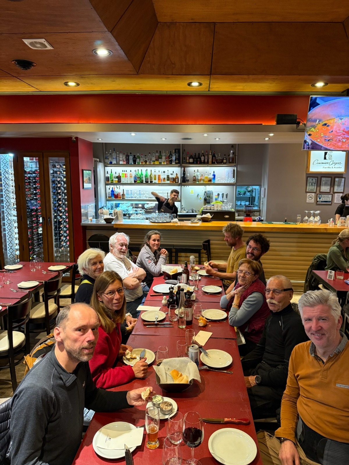
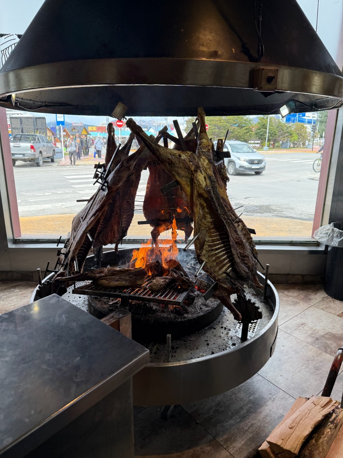
Sailiboats at the pontoon in Ushuaia Nautical club (P. Madert)Departure dinner ! (P. Madert)The traditional fuegian asado (lamb) (P. Madert)
Once everyone is settled, the ritual begins: completing formalities with the local authorities in Ushuaia. For every trip, you have to visit the naval prefecture, immigration, and customs, both on the Argentinian and Chilean side! After this, we get a standard inspection, as often happens, such as at Bahia San Blas during our offshore cruise along the Argentinian Patagonia from Buenos Aires. Usually, it’s mainly a check of the boat’s papers, communication, and safety equipment… and it always goes smoothly!
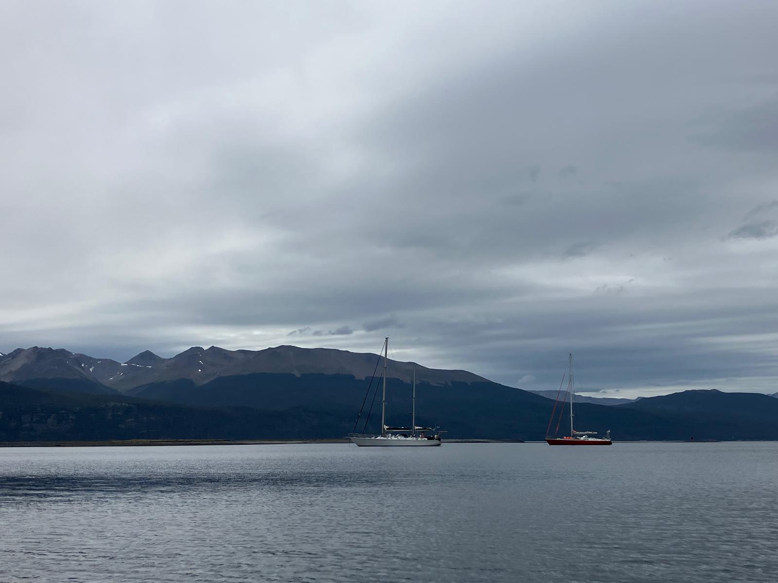
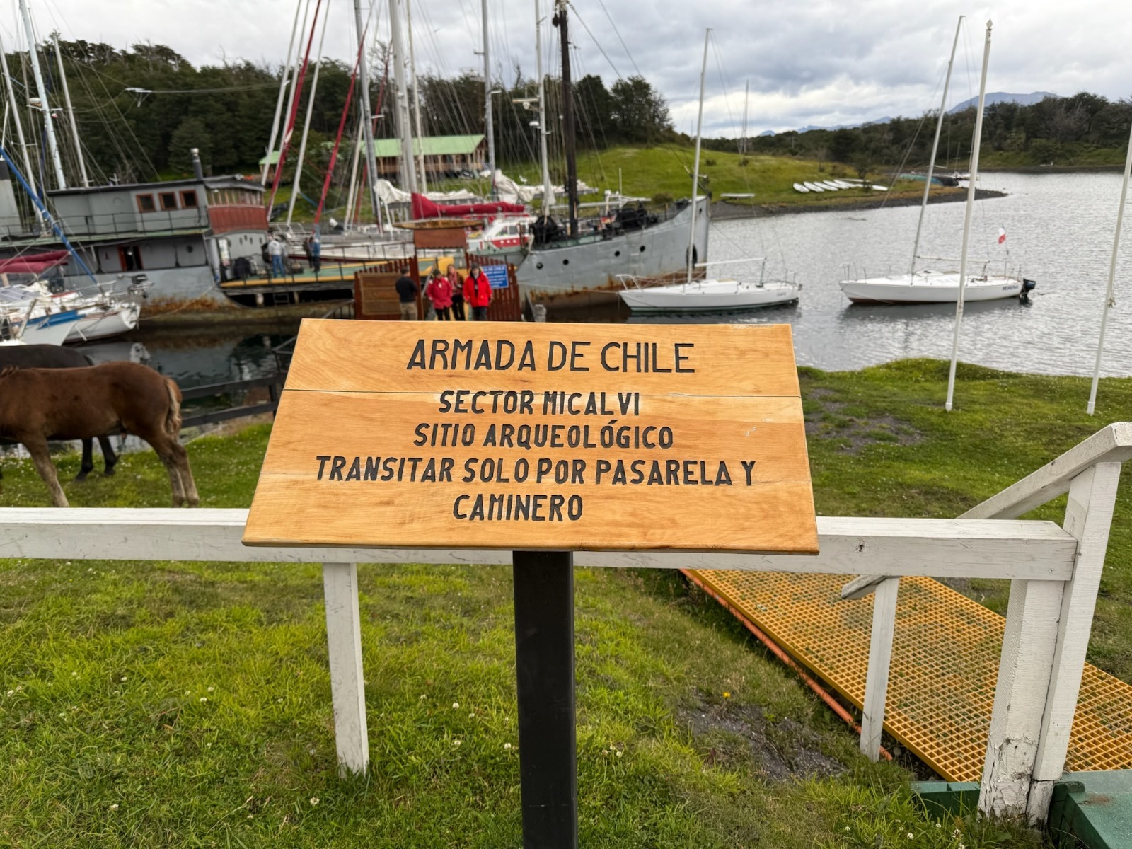
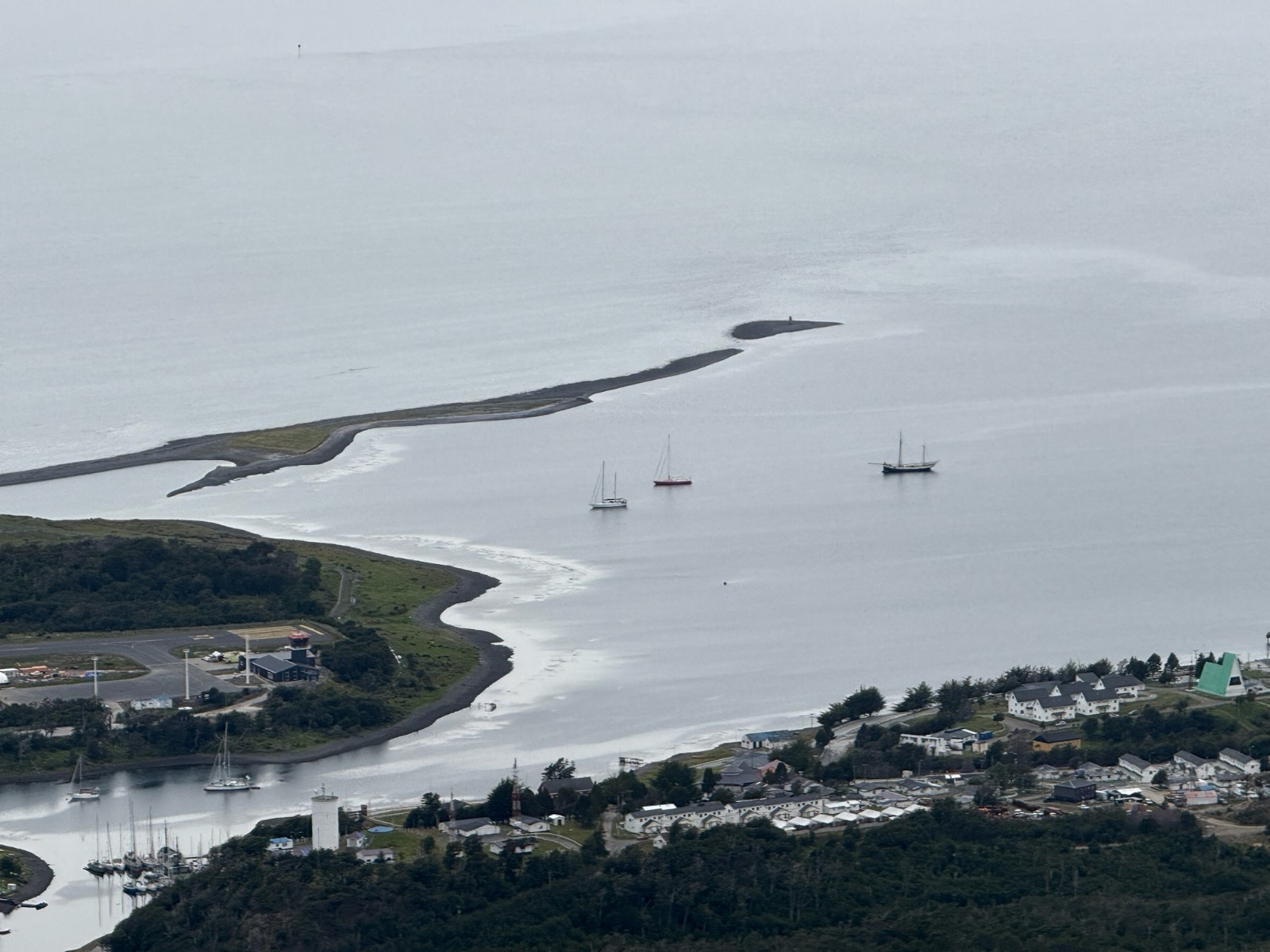
With all these requirements, we don’t leave Ushuaia until 1 p.m., arriving at Puerto Williams, the southernmost city in the world, on Navarino Island (province of Cape Horn and Chilean Antarctic), after a smooth crossing. We anchor in front of the city, as there is no space at the fishing port, and near the famous Micalvi, the pontoon-boat and historic local heritage known to sailors passing through before heading further south. A bit later, another French sailboat, which has been in the region a long time, anchors next to us: the Podorange.
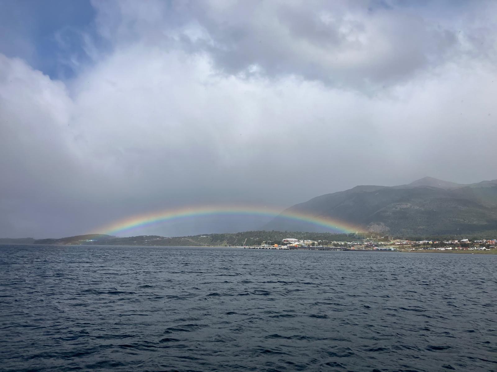
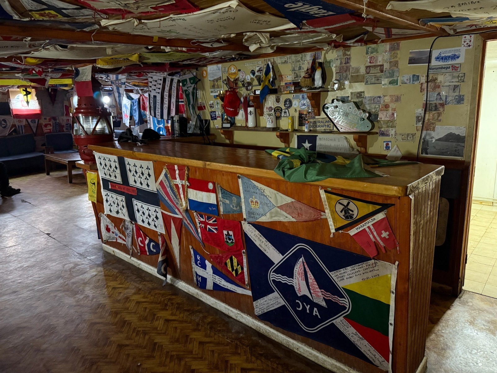
The sailing yachts Milagro and Podorange anchoring in Puerto Williams bay (Cabo de Hornos, Chili)Rainbow over the city of Puerto WilliamsThe Micalvi marina (P. Madert)The inside of the Micalvi, several tens of sailing expeditions represented (P. Madert)The end of the world ! (P. Madert)Puerto Williams, city of the Cape Horn and Chilean Antarctic region (P. Madert)
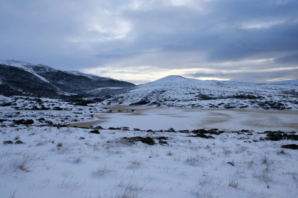
Wednesday, January 29, 2025: Awaiting formalities → hiking on Navarino Island!
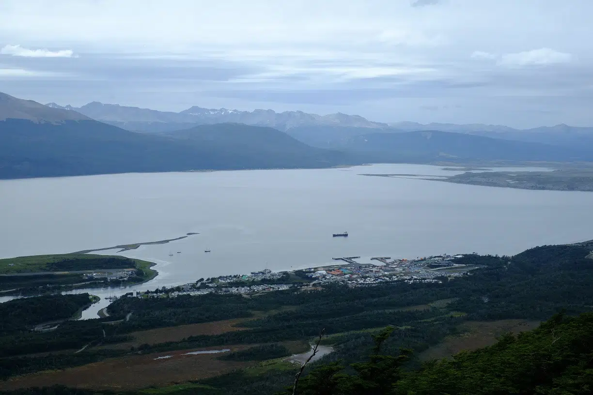
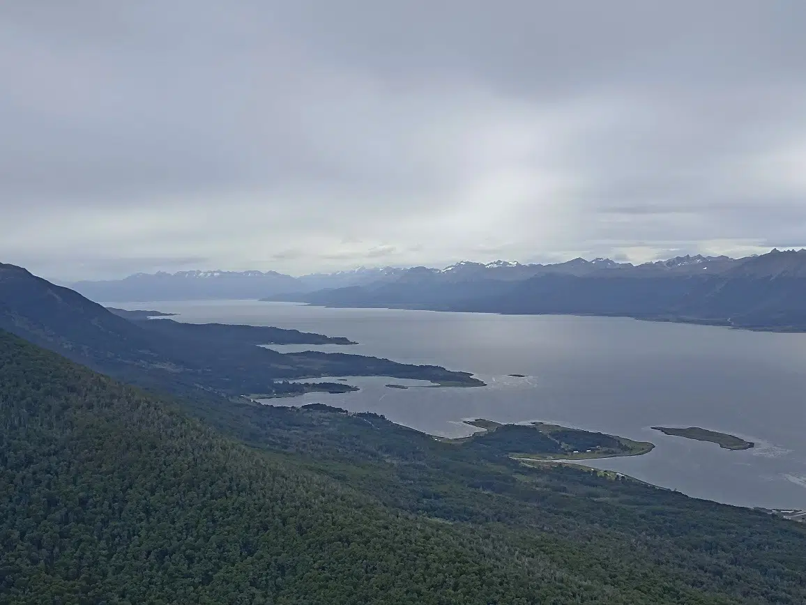
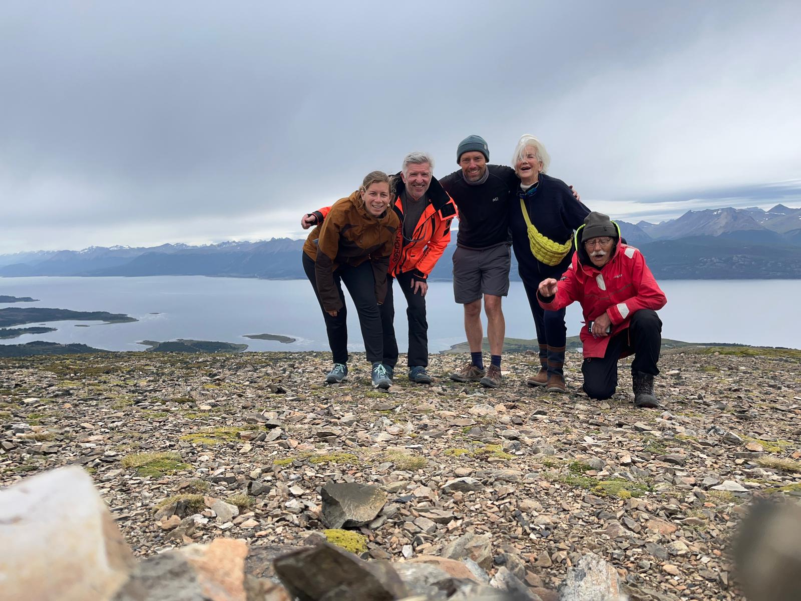
This morning, and since we’re in Chile, it’s back to entry formalities with the various authorities. So, a day on land for everyone: Lauriane and Damien tackle the paperwork marathon, Alain and Annick go for a walk along the Beagle Channel shore, and Pascal, Françoise, Jacques, Aude, and I set out to climb the “school” summit above the village: Cerro Bandera. This 600m peak offers a panoramic view of the surroundings.
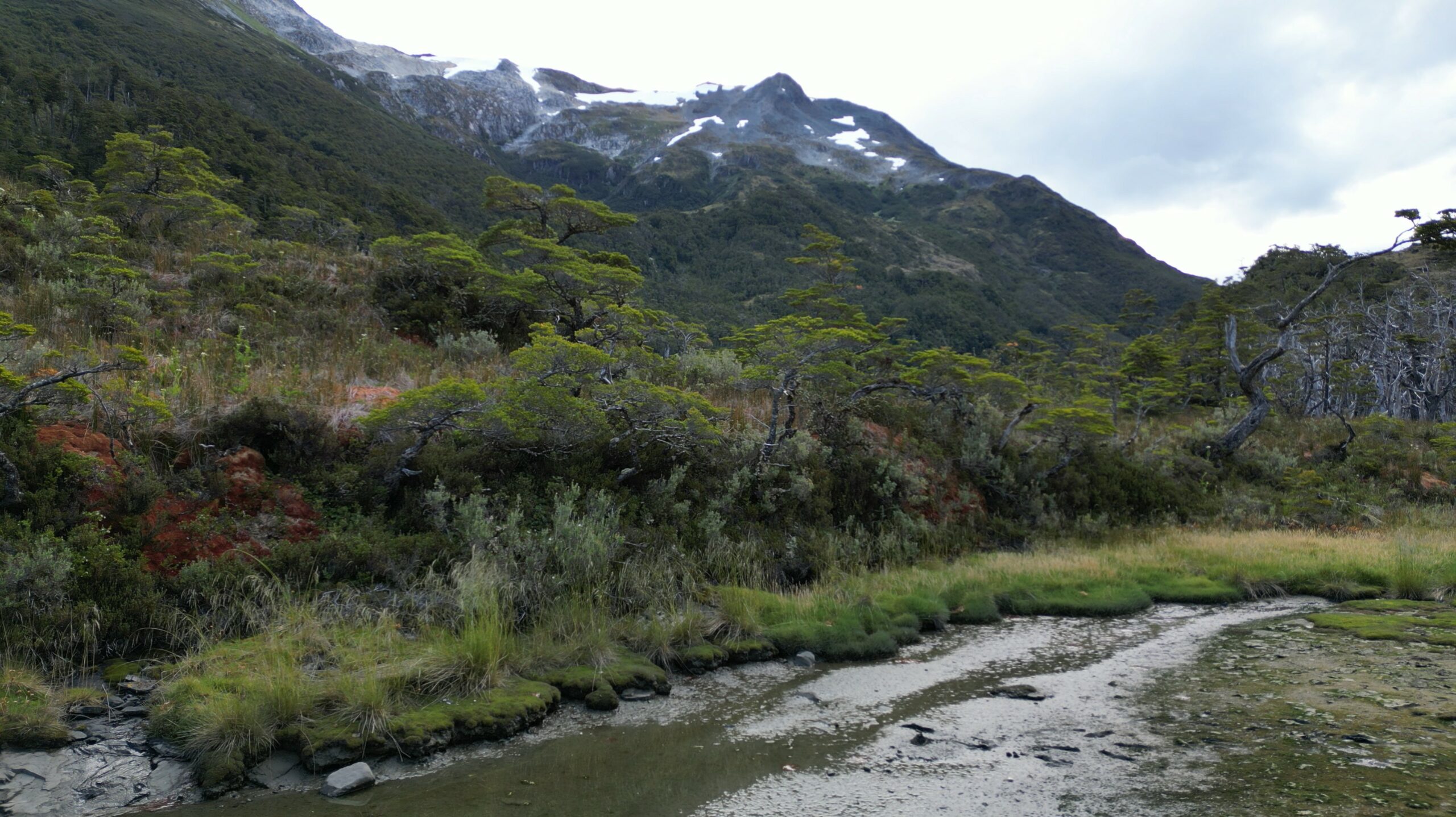
Access to this summit is an exception in the region: it’s one of the few with a well-maintained, marked trail, making the climb easy. Most of the time elsewhere, you have to find your own way – nature is everywhere and only reveals itself after real effort!
It’s a beautiful ascent, pleasant after leaving a 4x4 track: we cross remarkable Fuegian forest, then low, dense shrubs battered by winds, before reaching the bare mineral zone, where only moss survives – nearing the summit. The sky is overcast but calm, and visibility excellent. From various points, you admire, at different elevations, the channel and surrounding peaks…
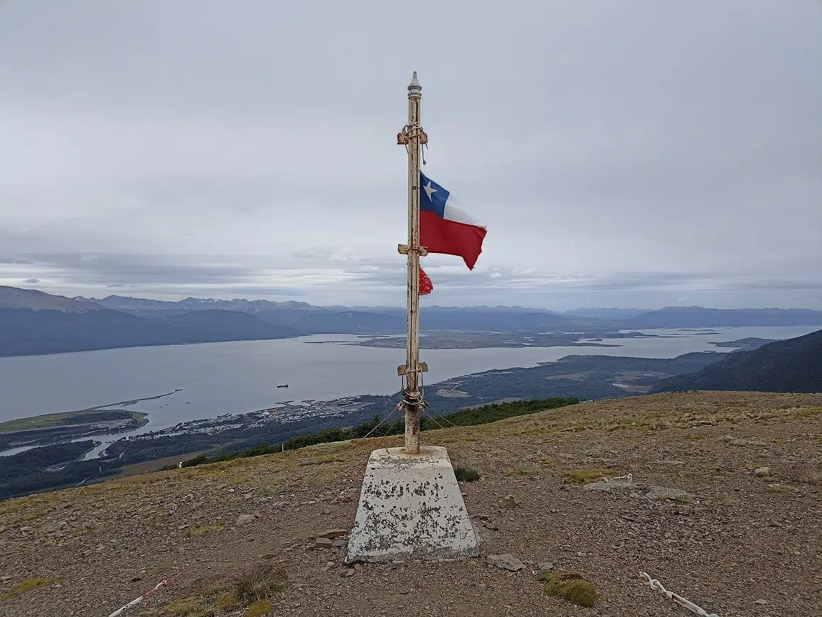
View of Puerto WilliamsIn the middle, on the left side : our Milagro ! (P. Madert)The Onashaga (Beagle channel) separating Navarino island and Tierra del Fuego islandThe summit of the cerro BanderaPart of the crew at the summit of Cerro Bandera (Navarino island, Chile) Photo Aude Grillault-LarocheThe flora on the summit of cerro Bandera (P. Madert)
Everyone climbs at their own pace and meets at the top, marked by a cairn capped with a Chilean flag. From the summit, you see various trails suggesting many multi-day hikes to explore this island; it’s quite stirring…!
The kind weather means we have a picnic and a restorative nap, before heading back down the same way, ending up in a cozy tea room. Back on board by 6:30 p.m. for a quiet evening after a great walk.
Thursday, January 30, 2025: heading west in the Beagle channel, toward Hoste island
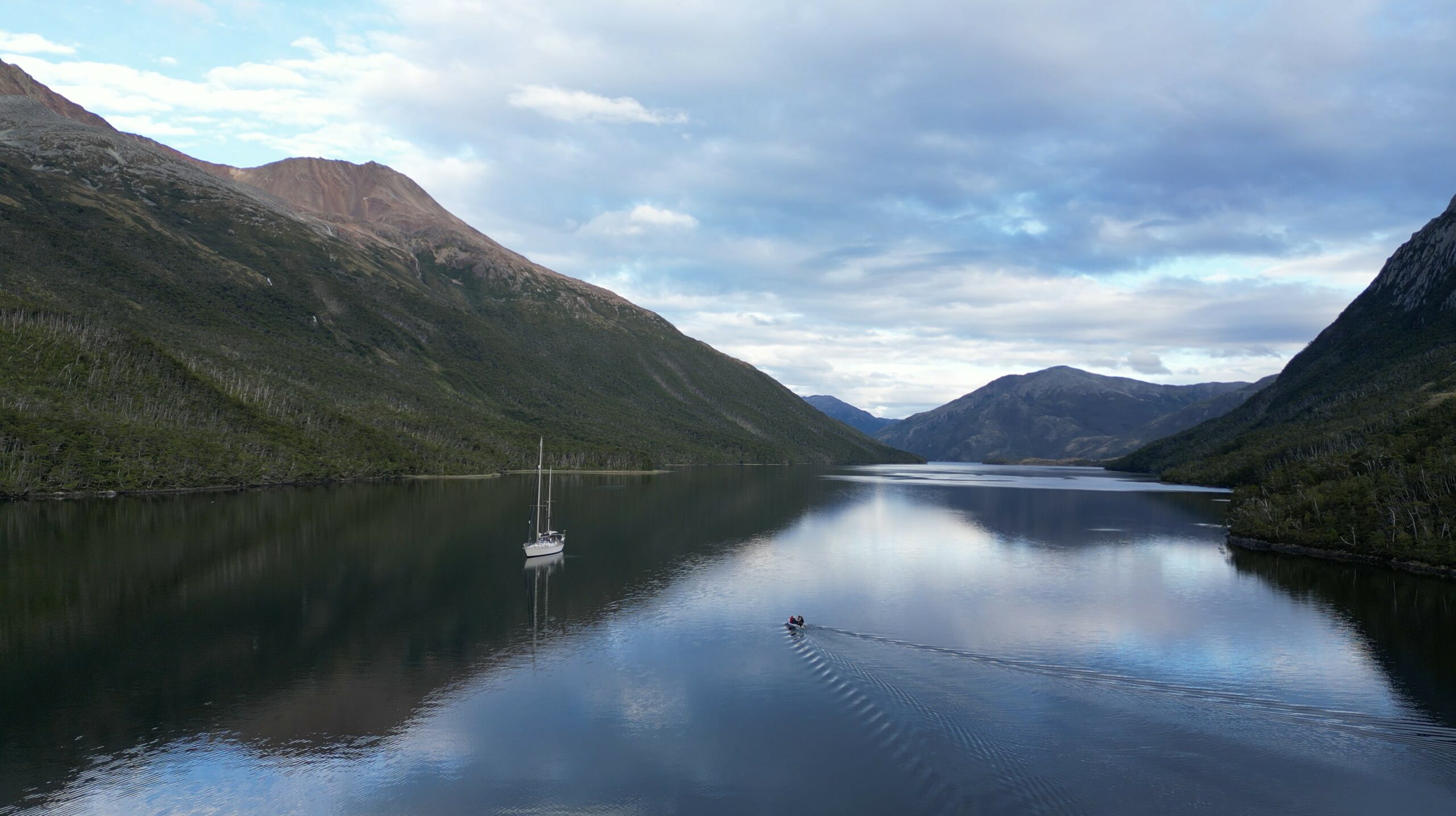
Up at 6 a.m., departing at 7 a.m., we have a long way to go: we head west again, pass Ushuaia and continue to Hoste Island. Sailing is calm, motoring for lack of wind. In early afternoon comes a surprise: the wind picks up, stormy, gusts up to 45 knots, the Beagle Channel reveals its bad-weather face, and it’s impressive. Only one sensible solution instead of motoring head-on: take cover.
We head for Caleta Letier (Dumas Peninsula, Hoste Island, Chilean fjords). The place is beautiful, a small, well-protected bay with forest trailing right to the shore. Anchoring, though, is less idyllic… The anchor doesn’t catch – so much kelp on the bottom that it’s impossible; it comes up covered with mountains of kelp and a bit of mud. Everything has to be cut away before trying again—exhausting and messy!! Finally, success: Milagro is secure at anchor! Phew!!
Some lines on land to secure the anchoring in the caleta (P. Madert)et on reprend le mou à bord, sans laisser la tension sur le winch en fin de manoeuvre ! (P. Madert)
Good thing too, because the unforecast storm is fierce: gusts at 40 knots, strong and sudden, tip Milagro on its side, sheltering in the bay. In the channel it’s worse: gusts top 50 knots, the water turns white, wave crests are blown into a whiteout over the sea. The Chilean Navy bans navigation for now, and Ushuaia and Puerto Williams ports close.
Anchorage in the caleta Letier (Hoste island, Cape Horn and Chilean Antarctica province, 30/01/2025)
The place is harsh but gorgeous: coves, forest, and mountains everywhere….
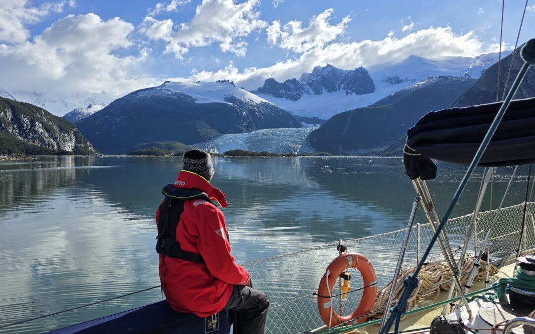
Friday, January 31, 2025: First glimpse of the Darwin Cordillera glaciers and anchoring in a bay on Gordon Island
8 a.m.: a morning stroll on deck – magnificent! The wind is down, even the channel is calm. A delicious moment of peace, alone at the end of the caleta.
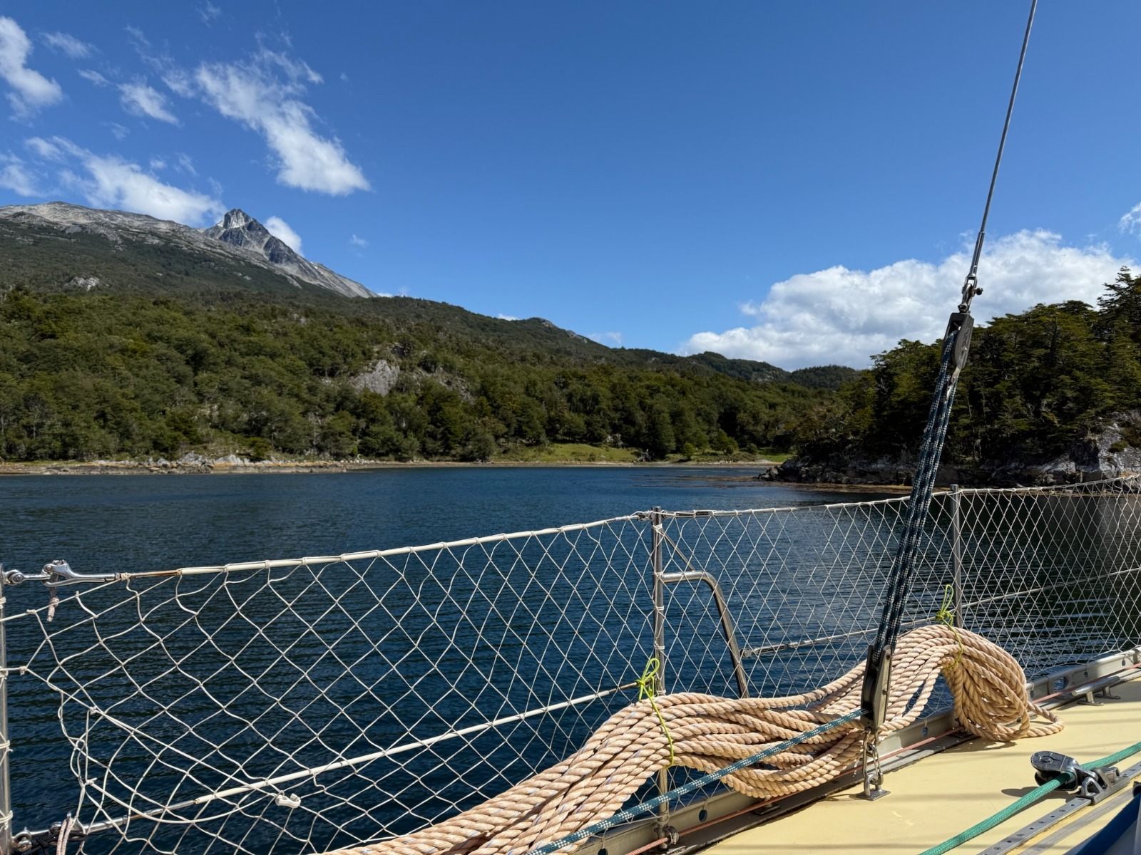
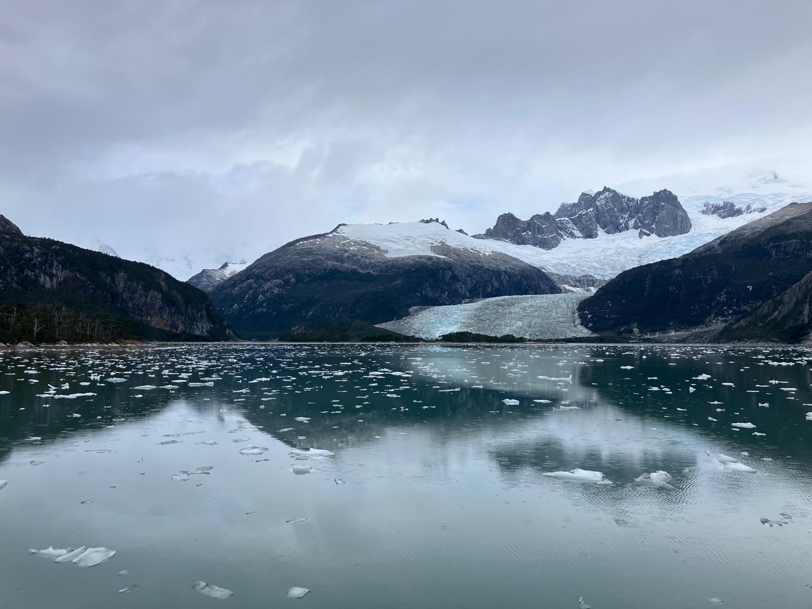
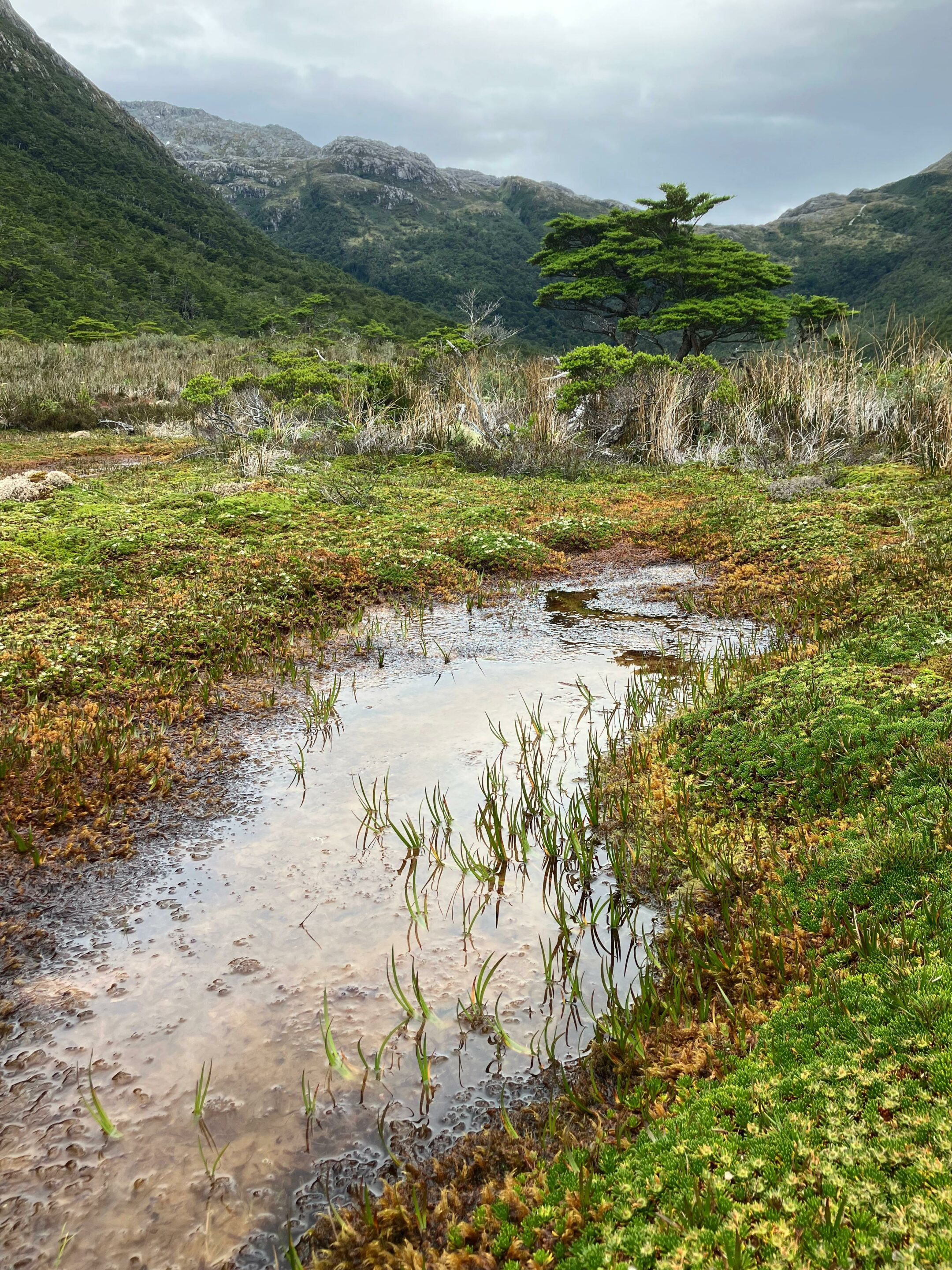
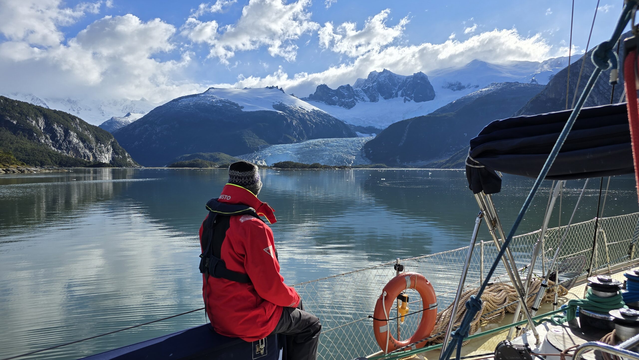
We head west, Hoste Island to port, Tierra del Fuego to starboard, and in the distance, Darwin Range glaciers sparkle in the sun. The scenery is breathtaking – channels bordered by dense Fuegian subantarctic forest, mountains, and glacier-topped peaks. It’s extraordinary to be in one of the last places on Earth where nature reigns and humans are nearly absent.
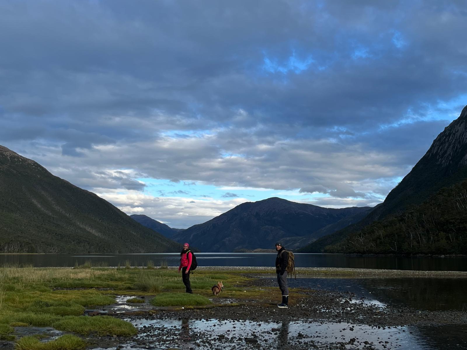
We enter the southern arm of the channel; Hoste Island remains to port, and now, to starboard, the Gordon Island coast follows Tierra del Fuego. We pass tall glaciers, hugely diminished by climate change: like the mountains, polar zones are most affected…. We turn into an unmapped fjord and follow it up several km to anchor at its end, beneath a waterfall and a stream from a melting glacier. The glacier towers above, fresh and grand: we are in Caleta Eva Luna. The place is sublime, and the joy on Lauriane’s face – who recorded sounds and took photos here in 2018 – says it all.
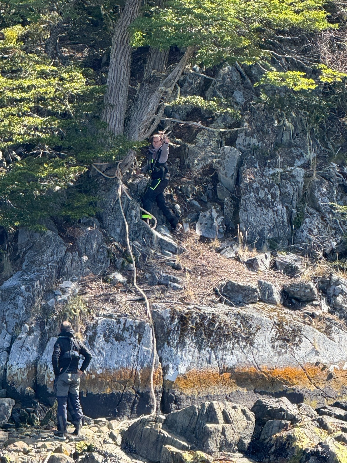
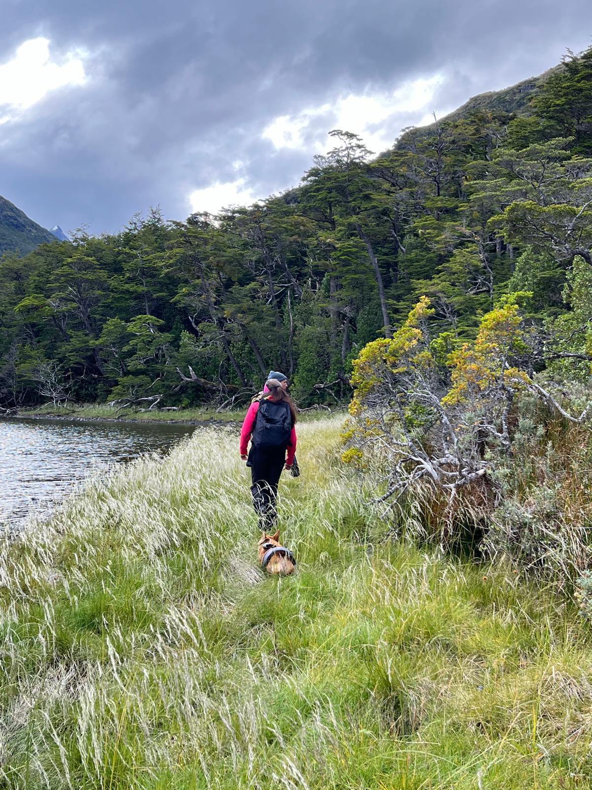
Walking in Eva Luna bay (Gordon island, Chile, 2025)Walk in Eva Luna Bay (Biosphere Reserve of Cape Horn, Chile, 2025)The subantarctic fuegian forest in Eva Luna bay (january 2025)And to see the same place in the middle of autumn photographed by Lauriane (mid-May 2018)
A short walk along the shore takes me back years too: the dense, impenetrable Fuegian forest, the waterlogged boggy ground, all as I remember. Toupie, our faithful four-legged mascot, delights in playing fetch with abundant sticks on the shore!
The sailing yacht Milagro anchored in Caleta Eva Luna, Gordon island, province of cape Horn and Chilean Antarctica, January 2025
It’s a quiet night; we rest up to keep going west tomorrow… To be continued in the next post ;-)
Karukinka, a non profit organization in Patagonia, invites you to write the next chapters of this unique epic — where maps still read “unmapped.” Joining Karukinka is more than joining an association: it’s embarking on an exceptional human and maritime adventure, reconciling modern exploration with ancestral memory.
Our association now gathers a hundred members of 12 different nationalities, united by a passion for extreme lands and a strong commitment to Indigenous cultural preservation. Whether you are an experienced sailor, scientist, artist, or simply fascinated by wide spaces and just causes, Karukinka offers the unique chance to join sailing expeditions and a cartographic exploration project that will make history.
The Darwin Cordillera represents one of the last wild frontiers of our planet, a mountain range of striking beauty yet formidable hostility, located at the far southwestern tip of Chilean Tierra del Fuego.
On 12 February 1834, Captain Robert FitzRoy names a mountain range at the southwestern tip of Chilean Tierra del Fuego in honour of Charles Darwin's 25th birthday. Darwin himself never sets foot there. He observes it from the deck of HMS Beagle, through the Beagle Channel, and senses — correctly — that it will resist exploration for a very long time.
Until 2011, when six French military alpinists completed its first integral crossing, the Darwin Cordillera remained one of the last "white rectangles" on world maps.
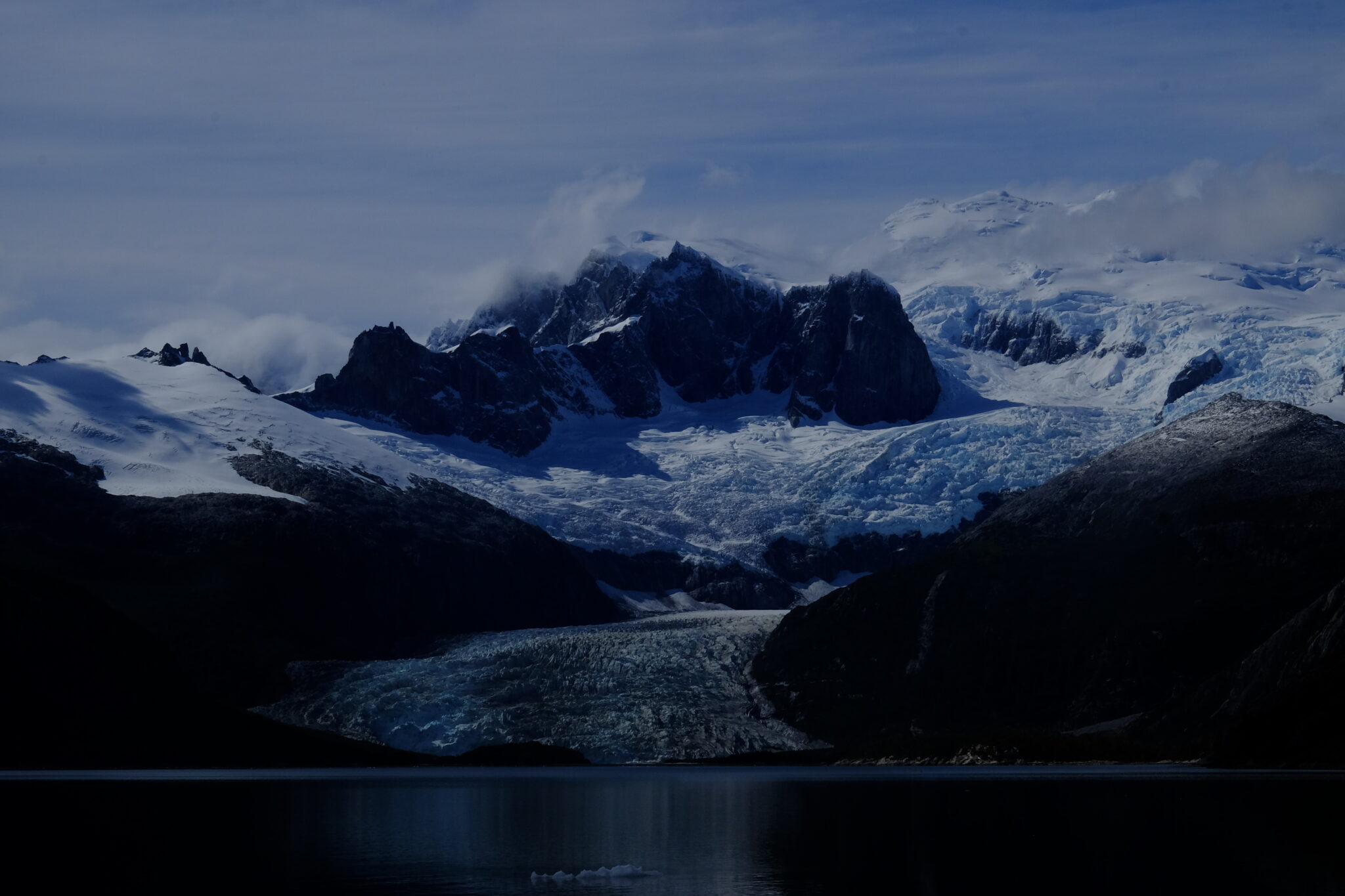
A glacier view in Pia fjord, Darwin cordillera, during a sailing expedition in the patagonian channels (February 2025)
1. Geography and geology
The cordillera extends 170 km west to east and 60 km north to south, between 54°15' and 54°50' south latitude. It is surrounded by water on three sides: the Almirantazgo Canal to the north, the Beagle Channel to the south, the Cockburn Canal to the west. Only its eastern edge, near the Argentine–Chilean border, remains connected to land.
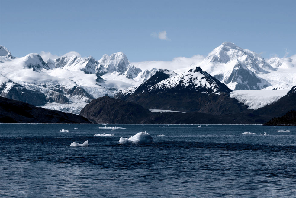
Its highest point is Mount Shipton (2,469 m) — not Mount Darwin (2,438 m), a confusion that persisted for decades following Eric Shipton's 1961 expedition. The ice field covers 2,300 km², equivalent to the combined area of all Alpine glaciers, making it Chile's third-largest freshwater reserve after the Northern and Southern Patagonian Ice Fields.
The massif is built around a high-grade metamorphic complex — kyanite and sillimanite schists formed during the closure of the Rocas Verdes basin in the Cretaceous. These minerals signal extreme pressures and temperatures in the crust, making this the only ensemble of its kind in the southern Andes. The opening of the Drake Passage 45 million years ago subsequently shifted the local tectonic regime to transpressive.
Among the dozens of glaciers in the massif, the Marinelli Glacier is the most studied and most active. It stretches from the cordillera to Ainsworth Bay in the Almirantazgo Fjord. Between 1913 and 2011, its front retreated 15 km — one of the highest retreat rates documented globally for a glacier of this type.
The Darwin Cordillera constitutes a natural laboratory for studying ocean–atmosphere–cryosphere interactions at southern high latitudes. Field data feed directly into global climate models.
Panoramic view of Marinelli Glacier with snow-capped peaks and growlers (Darwin Cordillera, wikipedia)
Extreme climate: the Roaring Fifties
Westerly winds are constant. In the Roaring Fifties, their average annual speed reaches 70 km/h. Williwaws — katabatic gusts tumbling down slopes without warning, a Kawésqar word — can exceed 250 km/h. Annual precipitation exceeds 3,000 mm, mostly as snow at altitude. Visibility collapses in minutes.
FitzRoy called these conditions a "wicked divinity." One hundred and fifty years of failed exploration attempts proved him right.
One of the patagonian glaciers of the Cordillera Darwin during a sailing expedition in the channels (Karukinka Association, Chile, 2025)
Average temperature varies between 0 and 5°C during the cold season (southern winter) and between 5 and 10°C during the warm season (southern summer). These relatively slight thermal variations reflect the moderating influence of the ocean, but mask the constant cooling effect of wind that considerably lowers the perceived temperature.
4. Biodiversity
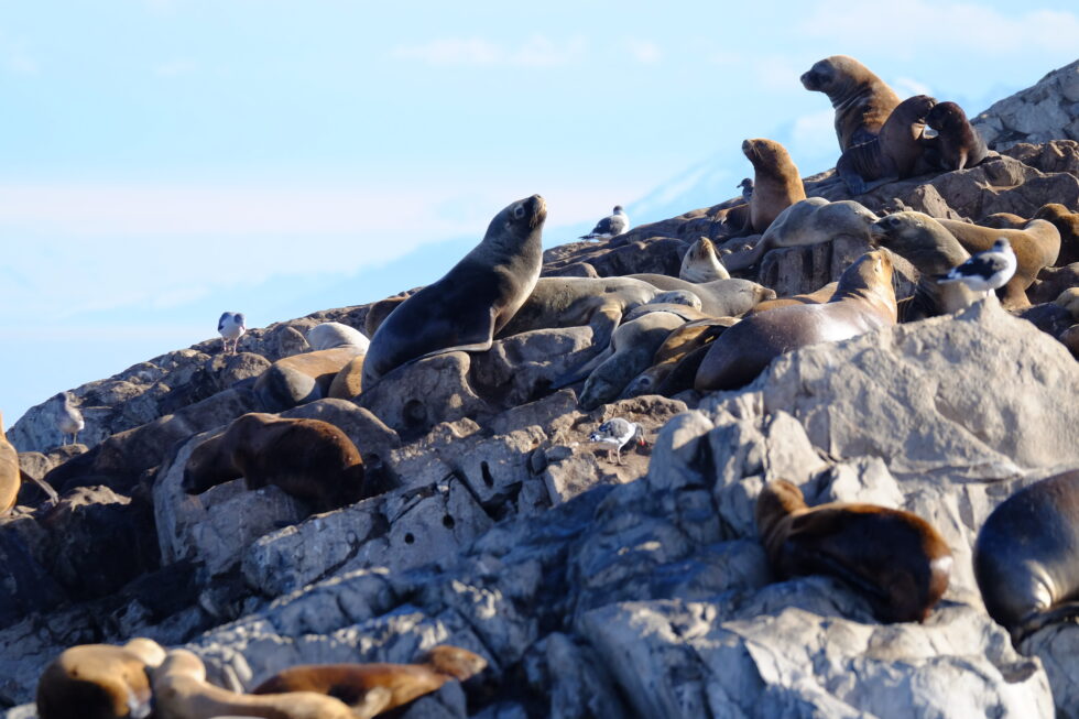
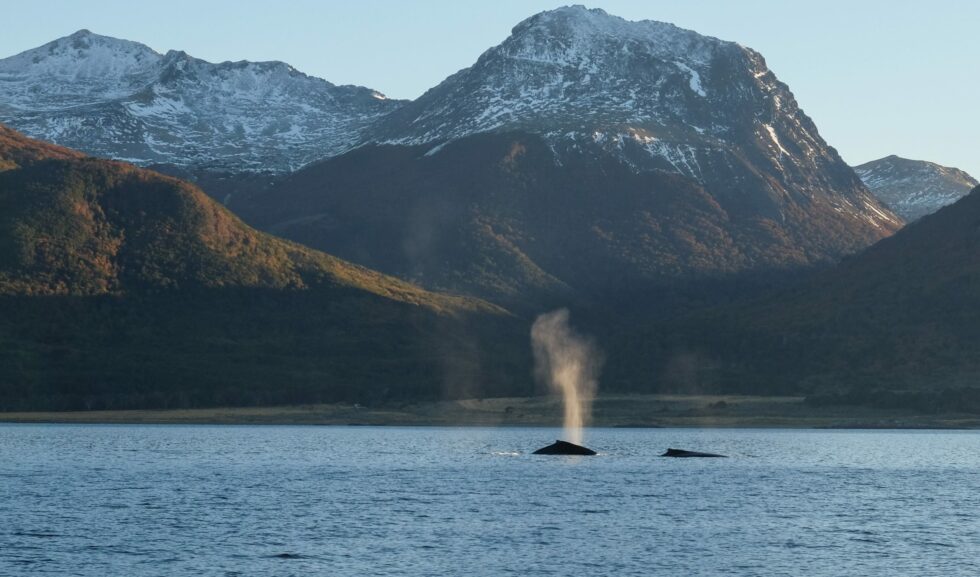
Fauna. Nutrient-rich fjord waters support humpback and southern right whales. Sea lions, elephant seals and leopard seals frequent the rocky coasts. Over 90 bird species have been recorded, including the Andean condor (wingspan up to 3 m) and, remarkably, the only colony of king penguins (Aptenodytes patagonicus) located outside Antarctica and the subantarctic islands.
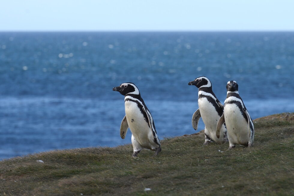
Small group of Magellanic penguins (pingüinos) in insular Patagonia
Colony of fur sea lions in the Beagle Channel (Karukinka sailing expedition 2025)
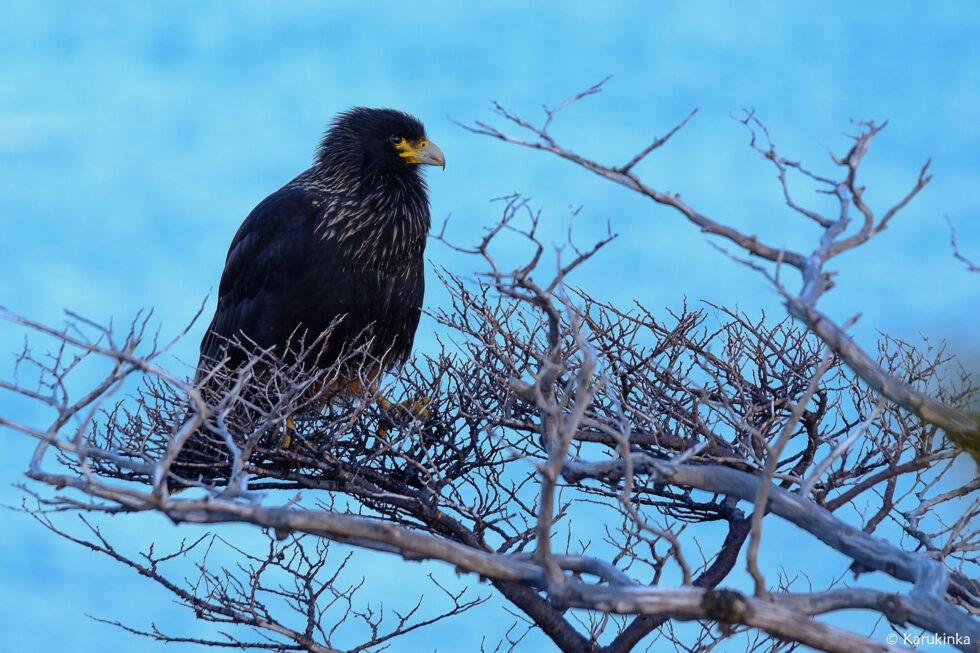
A black Carancho (Reserve of Cape Horn, April 10, 2025, during a sailing expedition at Cape Horn and in the Patagonian channels)
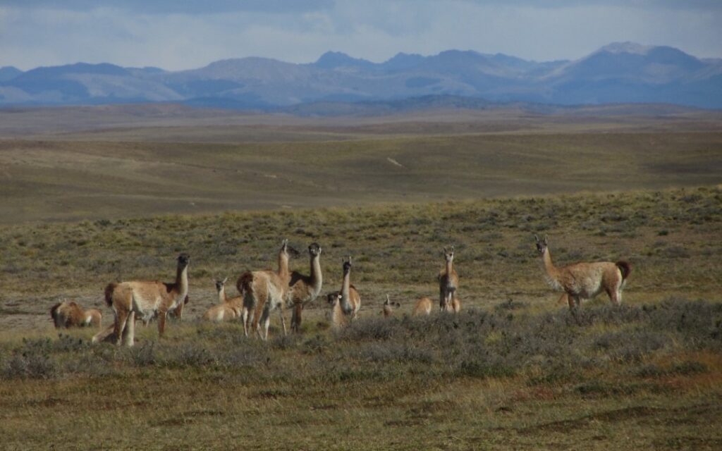
Two southern right whales in the Beagle Channel (2018)Herd of guanacos (Lama guanicoe) during an expedition of the Karukinka association in Tierra del Fuego (2018)
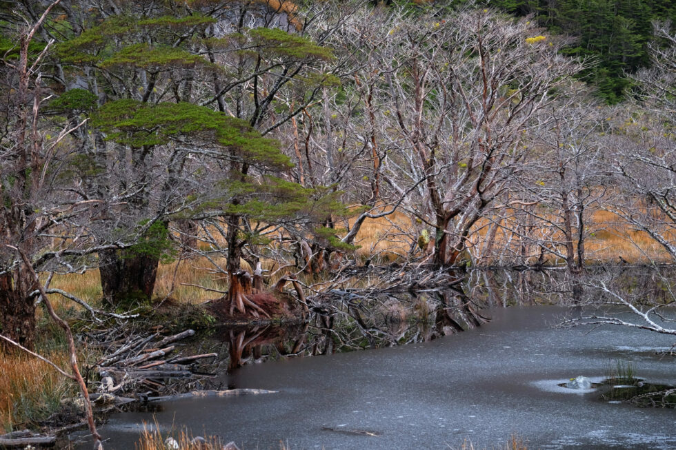
On land, the guanaco (Lama guanicoe) roams the least exposed zones. Canadian beavers, introduced in the 1940s, have colonised tens of thousands of hectares, their dams altering watercourse hydrology and threatening Nothofagus forest integrity.
Beaver dam on Hoste Island (Cape Horn Biosphere Reserve, Chile, autumn-winter expedition 2018)
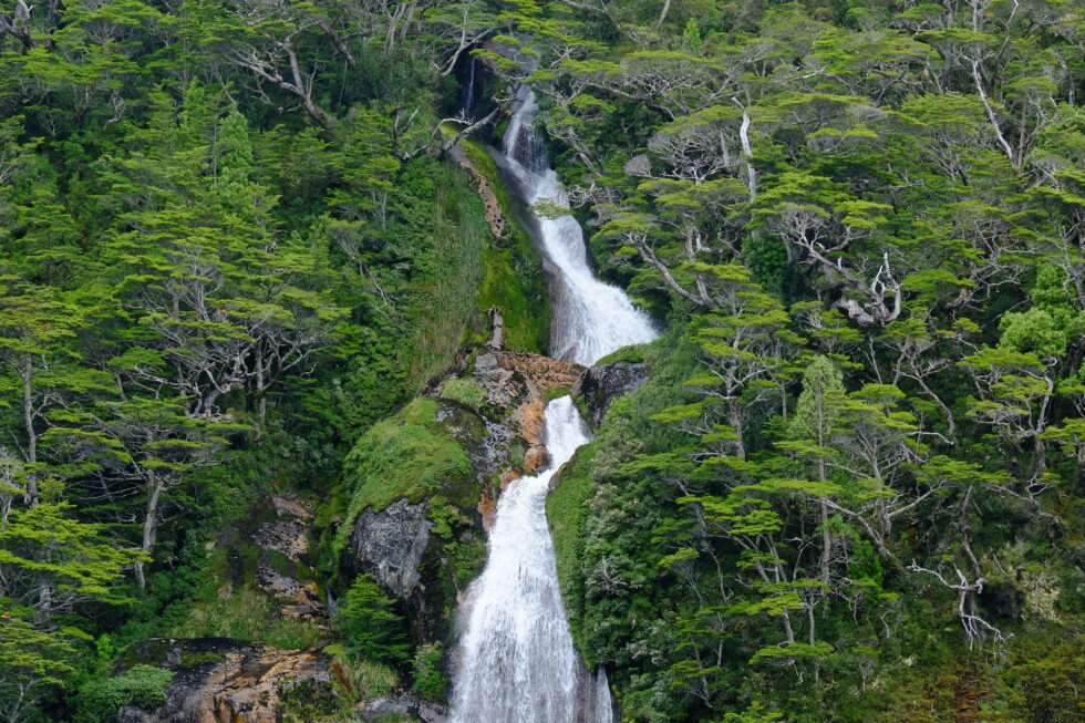
Magellanic forest photographed during a sailing expedition in Patagonia (Beagle Channel, Cape Horn Biosphere Reserve, Chile, 2025)
Vegetation of the Magellanic forest (Cape Horn Biosphere Reserve, 2018)
Vegetation. Lenga (N. pumilio) dominates up to 700 m altitude. Above that threshold, the same species grows as wind-sculpted dwarfs — same genetics, drastically reduced form. Higher still, Magellanic tundra takes over: mosses, lichens, Azorella, Bolax. Beneath the forest canopy, Drosera uniflora (a carnivorous plant) and several endemic orchid species signal the severe nutrient poverty of the soils.
Tundra landscape in the Cape Horn Biosphere Reserve (winter expedition 2018)
A transition zone marks the boundary between the forest tier and the alpine tier, where vegetation consists principally of mosses and lichens capable of resisting desiccating winds and negative temperatures. This Magellanic tundra constitutes a unique ecosystem, harboring highly specialized plant species.
5. First explorers
Father Alberto de Agostini, an Italian Salesian missionary, was the first to seriously penetrate the massif, between 1910 and 1960. His photographs — the first images of the cordillera's interior — and some twenty books on Patagonia constitute a foundational scientific and ethnographic heritage. The national park that protects the massif bears his name.
Alberto de Agostini and his climbing companions, pioneers of mountaineering in the Cordillera Darwin at the beginning of the 20th century.
In 1961, British alpinist Eric Shipton, with Chileans Eduardo García, Francisco Vivanco and Cedomir Marangunic, believed he had made the first ascent of Mount Darwin. The team had in fact climbed a higher summit to the north-west — the future Mount Shipton (2,469 m). The confusion was resolved in 1970 by a New Zealand expedition, whose proposed names were accepted by Chilean geographic authorities.
6. The GMHM first crossing (2011)
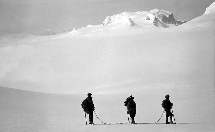
On 6 October 2011, six alpinists from the French Military High Mountain Group (GMHM) in Chamonix completed the first integral crossing of the Darwin Cordillera.
The team — Captain Lionel Albrieux (expedition leader), Lieutenant Didier Jourdain, Master Sergeant Sébastien Bohin, Staff Sergeant François Savary, Corporal Sébastien Ratel and civilian climber Dimitri Munoz — set off from the western slope on 6 September, fully self-sufficient, hauling 75 kg of equipment each on pulkas tested in Norway.
In 30 days they covered 150 km as the crow flies (250 actual km), with no reliable map since 1954. On the ridge facing Mount Darwin, a 5 km arête narrowed at times to 40 cm. Winds regularly reached 150 km/h. The team progressed at times on all fours, occasionally lying flat.
The documentary film On Darwin's Edge, made from footage shot by the team, was released on 30 October 2013.
7. Protection and challenges
Alberto de Agostini National Park, created on 22 January 1965 (Supreme Decree No. 80), covers 1,460,000 hectares — Chile's third-largest protected area. In 2005, it was incorporated into the UNESCO Cape Horn Biosphere Reserve, placing the cordillera among the planet's 24 most pristine ecoregions.
Three challenges dominate the conservation agenda: documented glacier retreat (Marinelli: –15 km over one century), the spread of Canadian beavers, and growing cruise ecotourism pressure toward the glaciers — which requires careful management, particularly around fragile, unenclosed Yagan archaeological sites on the coastline.
One of the many fjords of Alberto de Agostini National Park (sailing expedition, Patagonian Channels, Chile, 2025)


![[Sailing Patagonian channels] Sébastien’s Logbook part 1](https://karukinka.eu/wp-content/uploads/2025/08/Caleta-eva-luna_012025_Karukinka4-1080x675.jpg)