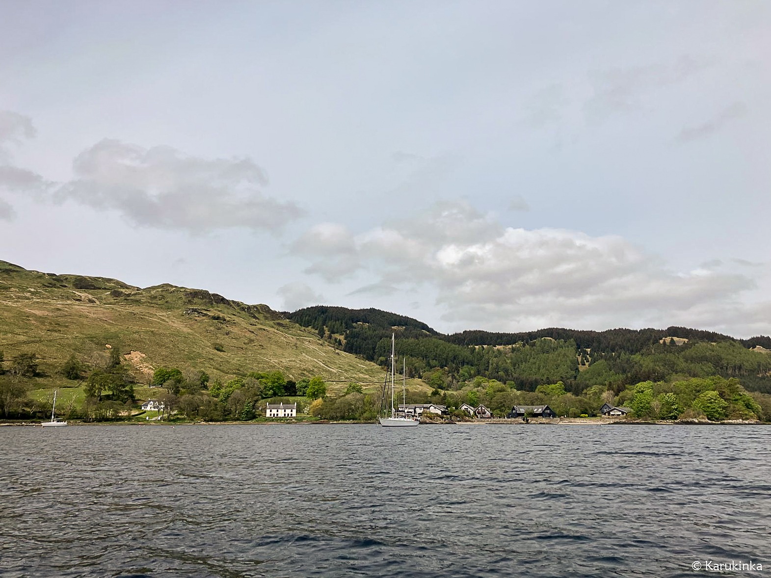
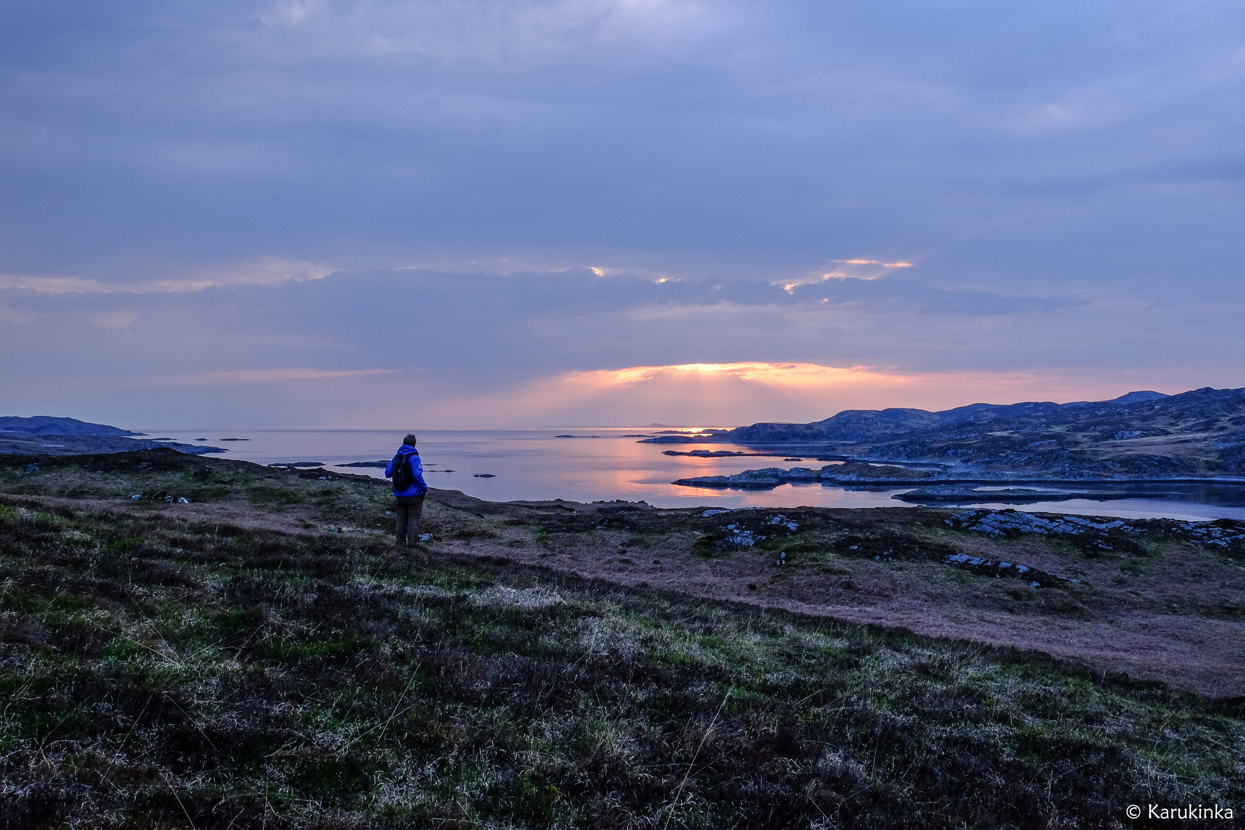
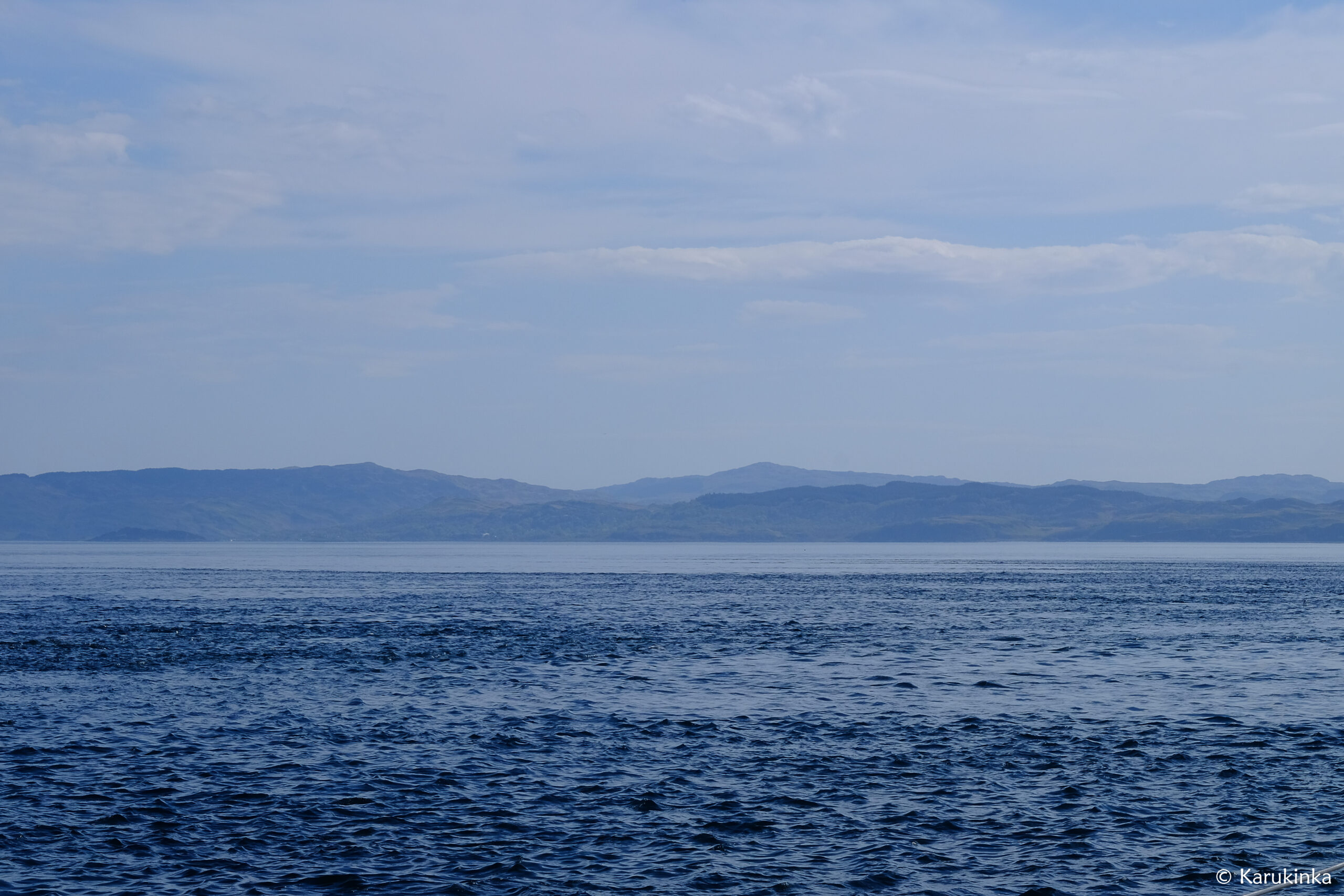
It was at the end of the day that we arrived quietly under sail at the eastern end of Loch Melfort, dropping anchor in a very sticky muddy bottom (for the chain and the bridge too, by the way…). As soon as we arrive, Damien receives a call from one of his friends and former student, Christian, on his way from Leeds to join us on board for the evening! Passionate about Scotland, he is an inexhaustible source of ideas for places to visit, each more remote, interesting and wild than the last. The paper maps and those on the tablet were gradually found to be filled with small additional points and annotations. Added to this is a small list of books to consult… Enough to satisfy our desire to explore and learn for weeks or even months…!
The next morning, upon arrival at the small pontoon of the Kilmelfort hotel before heading with Christian towards Oban for a supply of fresh produce, a second nice surprise awaits us: the meeting with Vicky and Margaret, both busy on their magnificent little sailboat. We were thinking of taking the bus back from Oban, but in the end it was Vicky who would pick us up directly from the supermarket! During this winding journey between lochs and hills, we invite him and Margaret to come and visit our “huge sailboat”, which belongs to the Karukinka association. Questions follow about the why and how of the association, the ship, Lauriane’s research and our coming to Scotland… and she tells us that she is a researcher in medieval history at the University of Glasgow.
It was after lunch the next day that she came to give us a magnificent gift: several hours of medieval Scottish history lessons in the Milagro square! Supporting map, historical references, information on the hidden history of places and settlement dynamics,… we don’t miss a thing. “History here was made by navigators, under sail”. This remark, full of common sense given the morphology of the places, reminds us that indeed, the exchanges of ideas, cultural influences, battles, invasions from all sides, colonization processes, waves of religious reforms, technological developments,… existed thanks to sailing (and rowing…).
Our route (North Cape to Cape Horn), from Brittany to Norway via Ireland and Scotland, is none other than that of a major axis of exchange for thousands of years. Celtic then Roman presence, first Christian missions (6th century), tribal wars between the Picts and other groups, Viking invasions, clan functioning very anchored in Scottish culture… Each island, from the Hebrides to the Shetlands, carries with it loaded histories of wind and spray that erosion gradually erases from our sight but that archives carefully kept over the centuries save from oblivion. It’s a real painstaking effort that Vicky Gunn and many researchers in Scottish history are carrying out to understand the territory at different times. They give meaning to what surrounds us, from megaliths to castle ruins, inviting us to research more and more.
Milagro’s library has once again been expanded with a few additional works, not to mention those that Vicky plans to recommend that we have on board, and it is shortly that a Gaelic-English dictionary will be on board to help us to understand what the names of the places we navigate mean. An appointment is made: on our next visit to Loch Melfort, we will definitely go to visit Vicky and Margaret!
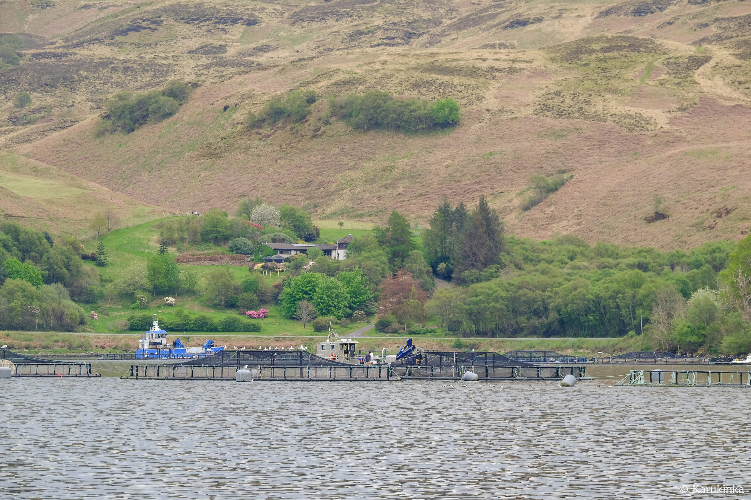
Before resuming our journey north, last weekend, it was time for a reunion for Damien: the return to Kames Fish Farm. He came anxiously to introduce himself at the farm reception: after 20 years without news, would the managers of this family business still be there? Could the farm have been bought by Norwegian companies, like many Scottish fish farms? Damien introduces himself and that’s when a man in his thirties shakes his hand: Andrew, the one with whom Damien had taken care of the rabbits, played video games with his brother Charles and him,… when he was very little! Andrew immediately calls his father, Stuart, the entrepreneur behind this farm and with whom Damien worked. A few minutes later, he arrives and shows us around the hatchery, the office for remote control of the security of the cages scattered throughout the islands, the distribution of food by clicking behind a screen, the selection of specimens most suited to adapt to climate change… Always in search of improvement, he also tells us that he had to face a health disaster that struck his farm several years ago (foot-and-mouth disease from Norway), the forcing us to slaughter all of our salmon rather than falling into the widely documented excesses of farm abuses. Kames therefore no longer raises salmon as it did 20 years ago, but trout, and in dizzying numbers: when Damien worked there, the farm sold between 200 and 300 tonnes of salmon per year, and today it More than 3000 tonnes of trout are exported to the USA.
We leave Loch Melfort in our wake, with a new chapter opening in the bow of Milagro: heading for Mull!
—
PS: We like Scotland so much that we have chosen to review our program to stay there longer and simplify the arrival of those who want to join us, without struggling with logistics. You will therefore see (here) that we are offering 5 simplified one-week stays from next Saturday: departure and arrival Oban! From Glasgow (direct flights from Paris, Nantes, Bordeaux, Lyon, etc.) it takes 3 hours by direct train or bus in the Highlands (a journey within a journey!) to reach us at the port of Oban. For those who would like to avoid flying, this destination is also accessible by train from France (allow 12 hours from Paris).
In short, if you need help to organize yourself, we are not a travel agency but we are here to help you and will be delighted to welcome you to share these places where, as shown in our last little video at the Treshnish Isles : there are no crowds!
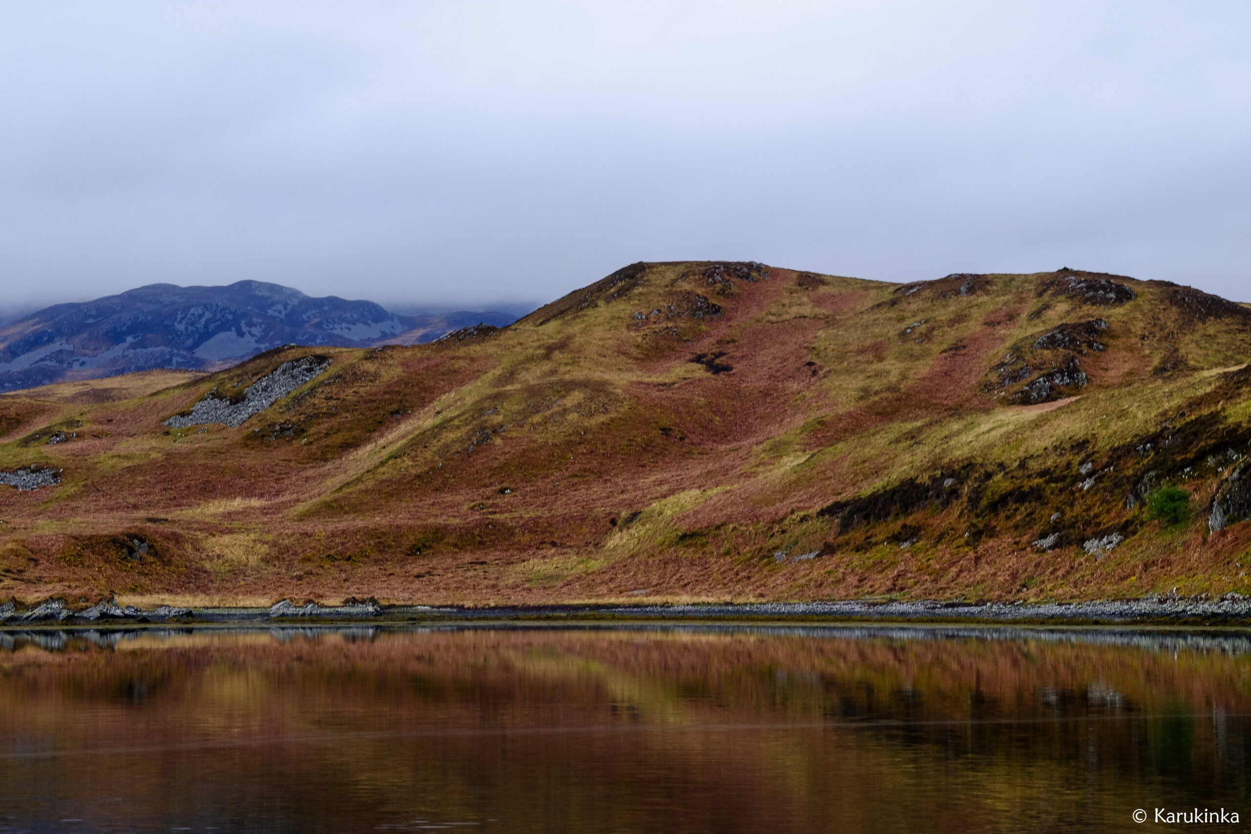
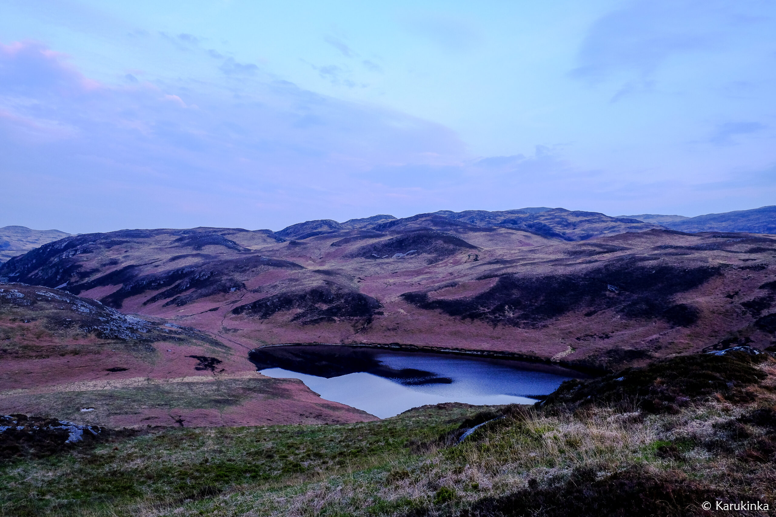
Nice and safe in a loch on the west coast of Jura, we wait for the bad weather to go away and take advantage of the stopover to go for a walk, read and rest.
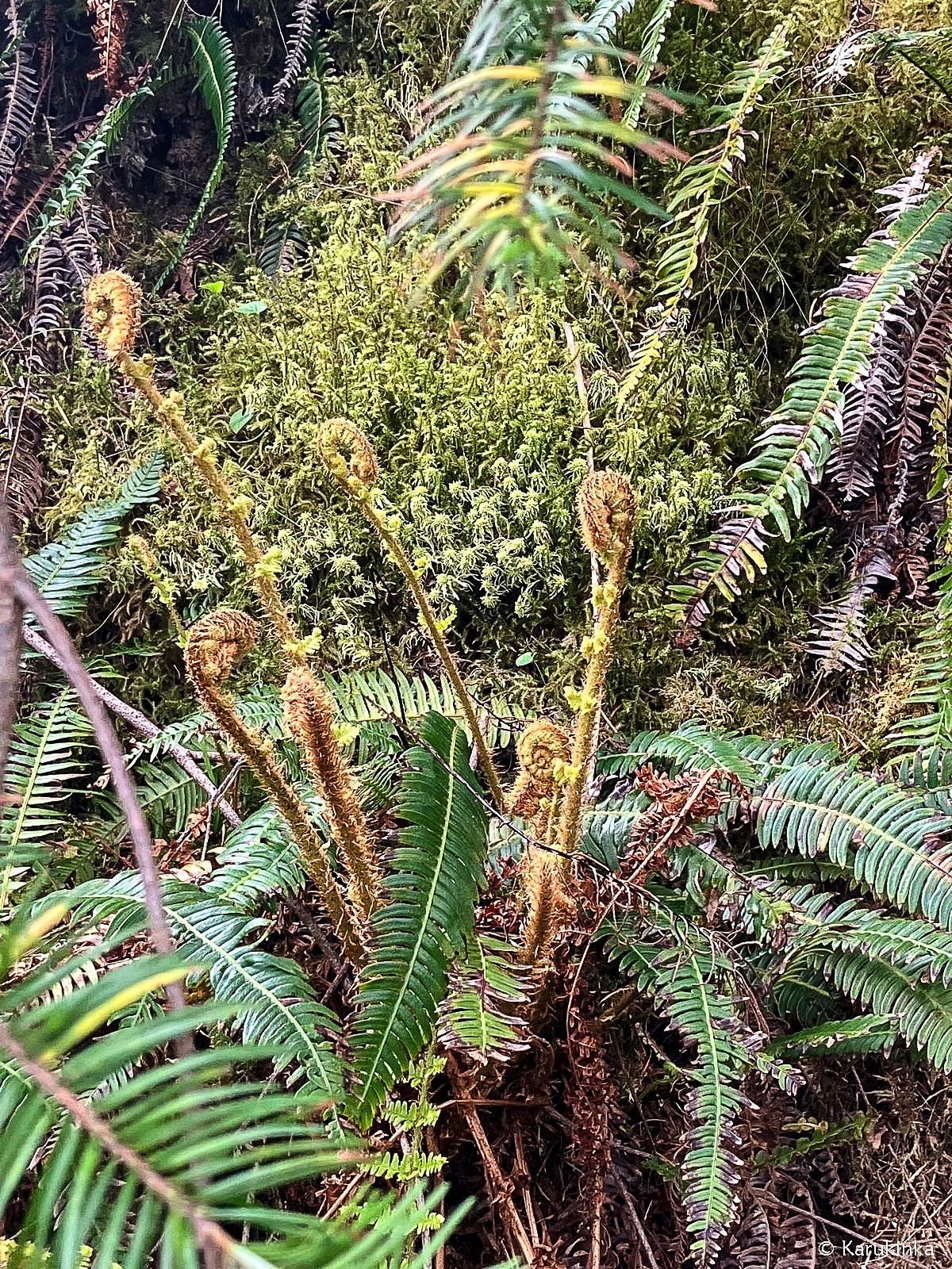
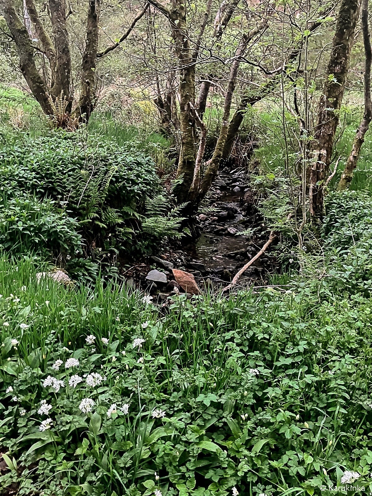
The plants which are usually ochre by the end of winter are currently going through their spring mutation and progressively turning into green. The ferns unfold gradually, and entire fields of blue flowers form a decorative patch under the horizon. The barnacle geese and the terns also make a stop with us in this loch and add to this sound landscape with the cries of the pheasants, the back and forth of the deer, the cormorants, the otters and the singing cuckoo. Bestowed with two bothies (unguarded refuges), this loch is also heaven for hikers who leave with just a tent and backpack from Craighouse harbour, the only village where the ferry calls at. Among a few hiking ideas for next time, we will keep in mind the Three Paps, the three main peaks of the island that are Beinn an Òir (the gold mountain in Gaelic, 785 m), Beinn Shiantaidh (the sacred mountain in Gaelic, 755 m) and Beinn a’ Chaolais (the mountain of the Strait in Gaelic, 734 m). As for the pronunciation, well, we’ll leave it to you!
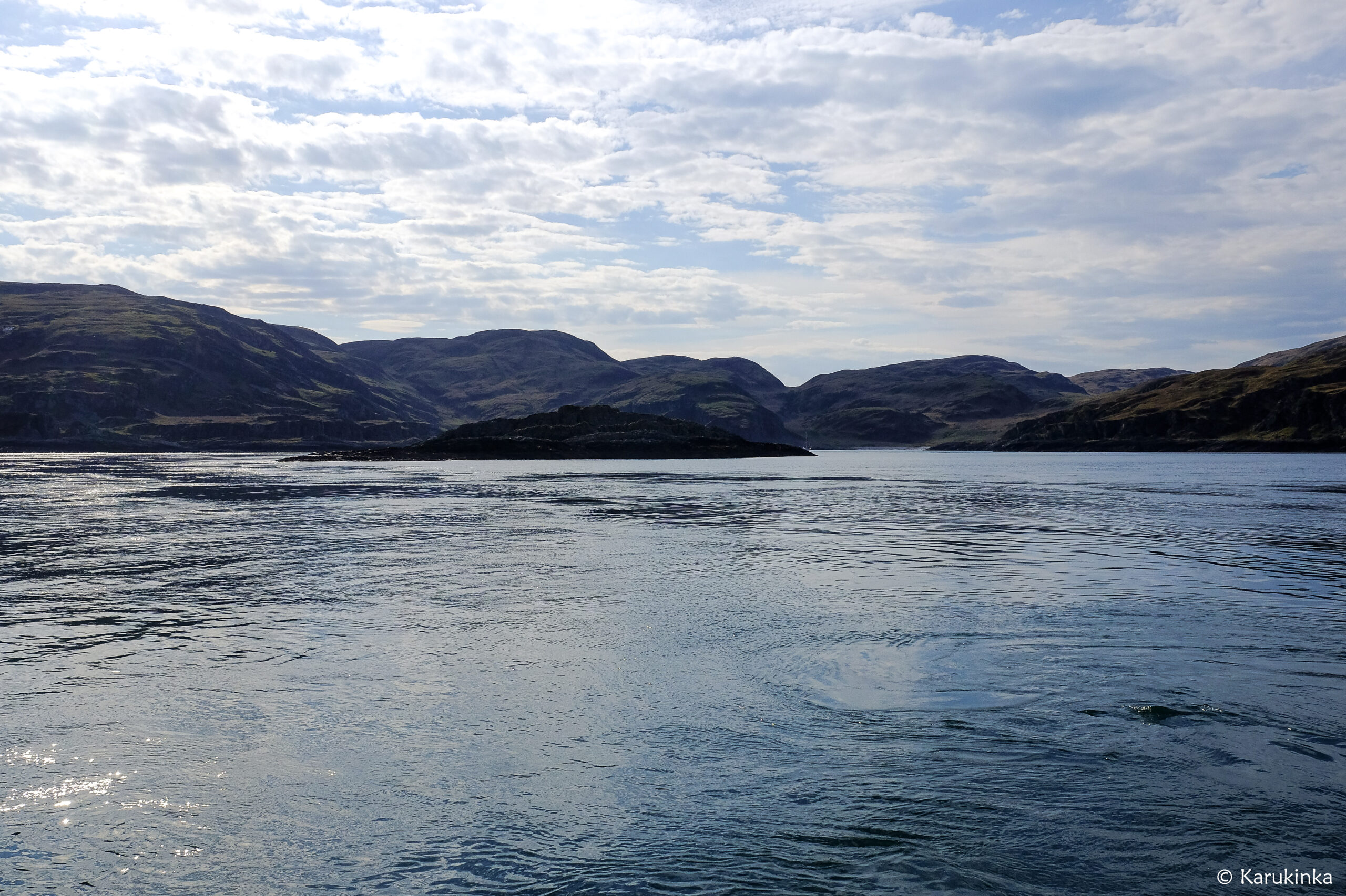
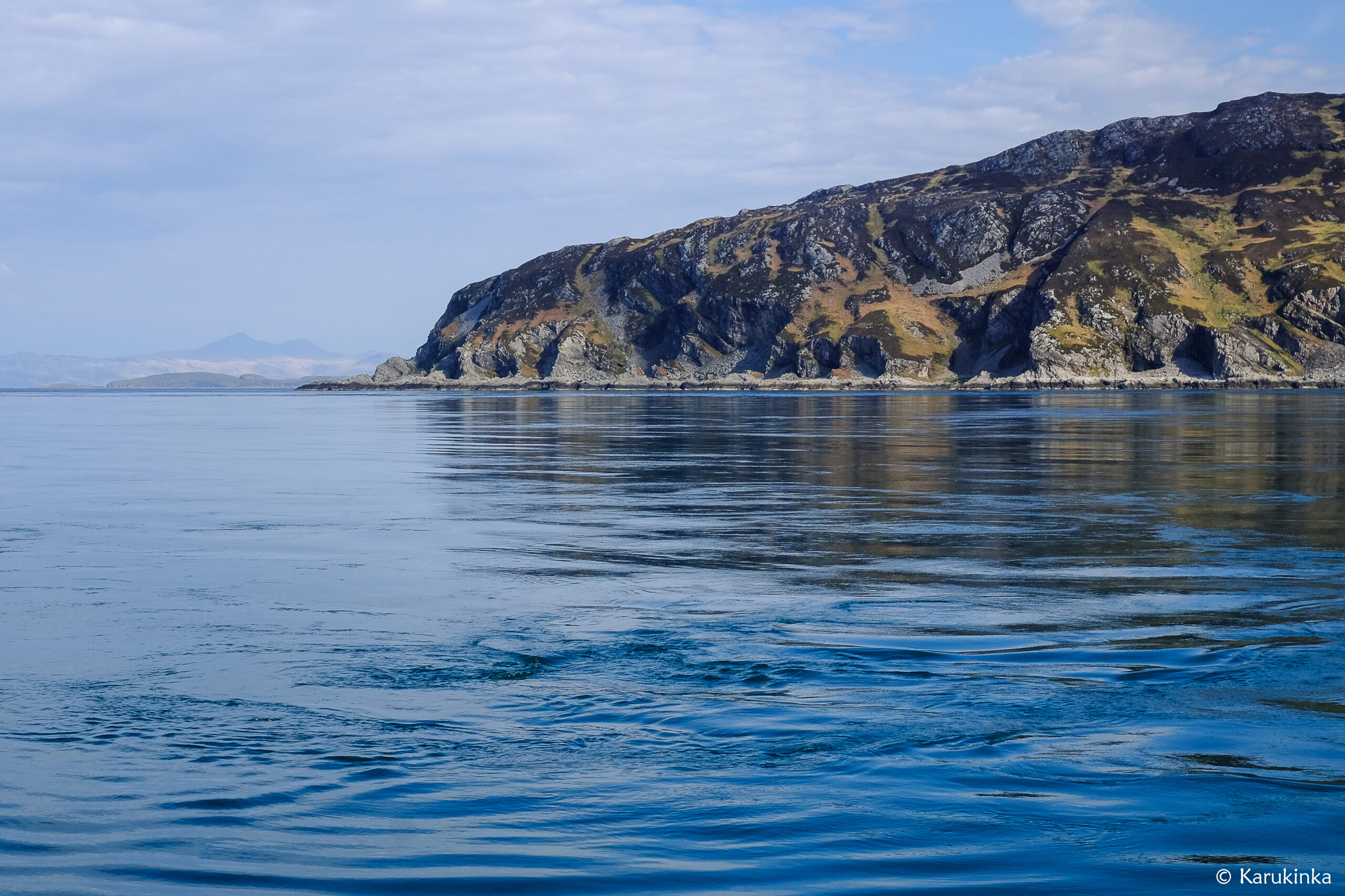
After this stopover, we resumed our route northbound. Our main goal was to anchor in a loch south of the isle of Mull, but the wind chose a different direction, and we eventually decided to change course and get closer to a mythical place, and not just for the sailors: Corryvreckan.
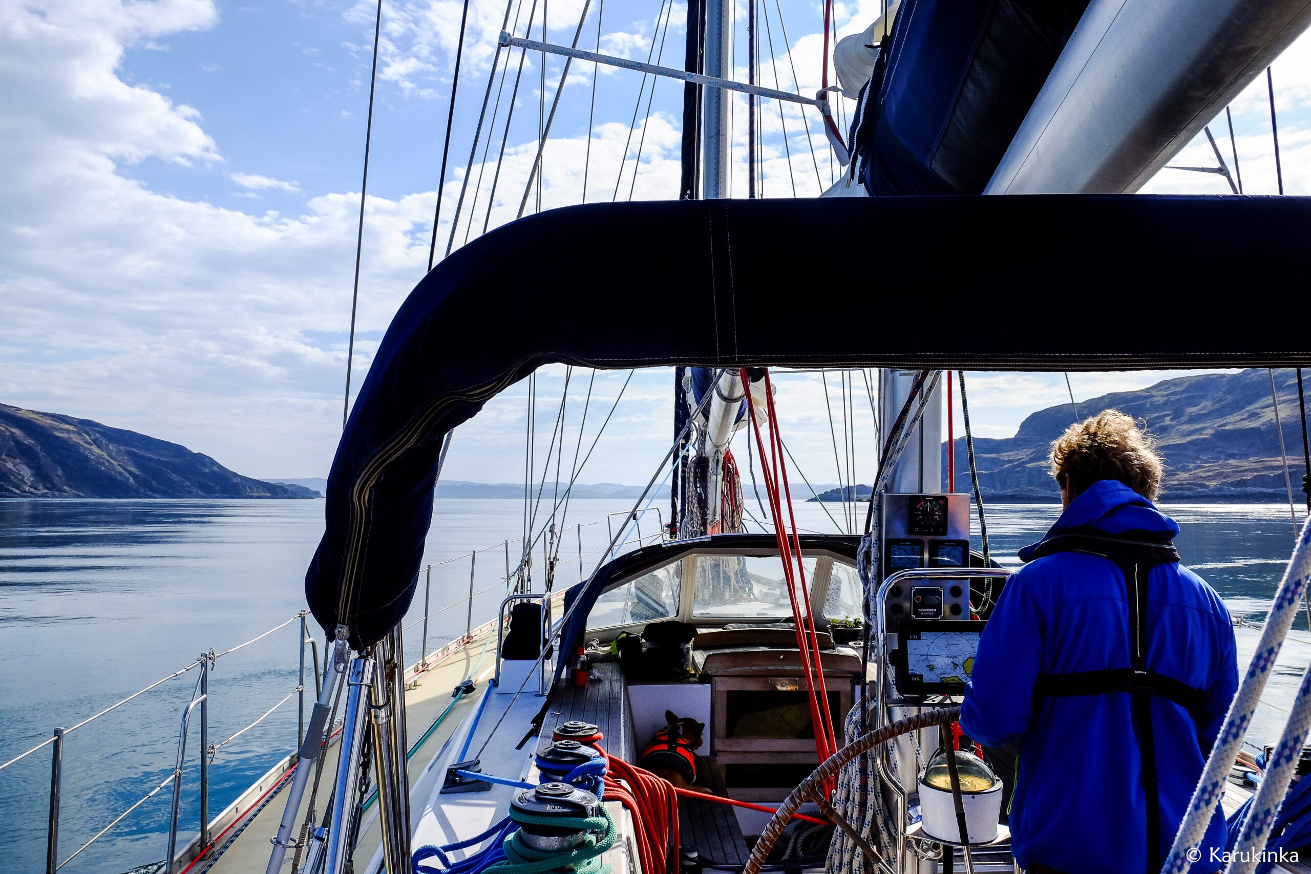
At the end of the afternoon, sail still raised, (NE wind scale 6 and choppy sea) and after checking the tide schedule three times and reading pretty much all the information around us (!), we slowly navigated towards the Strait and carried out, despite crossed currents, small swirls and other swells, towards the only mooring place of North Jura: Bagh Gleann nam Muc (The Pigs Bay).
The good weather conditions and the still are giving all of us time to imagine the same route under bad weather. The mooring at night was as peaceful as could be, after this beautiful sunset, safe from the wind.
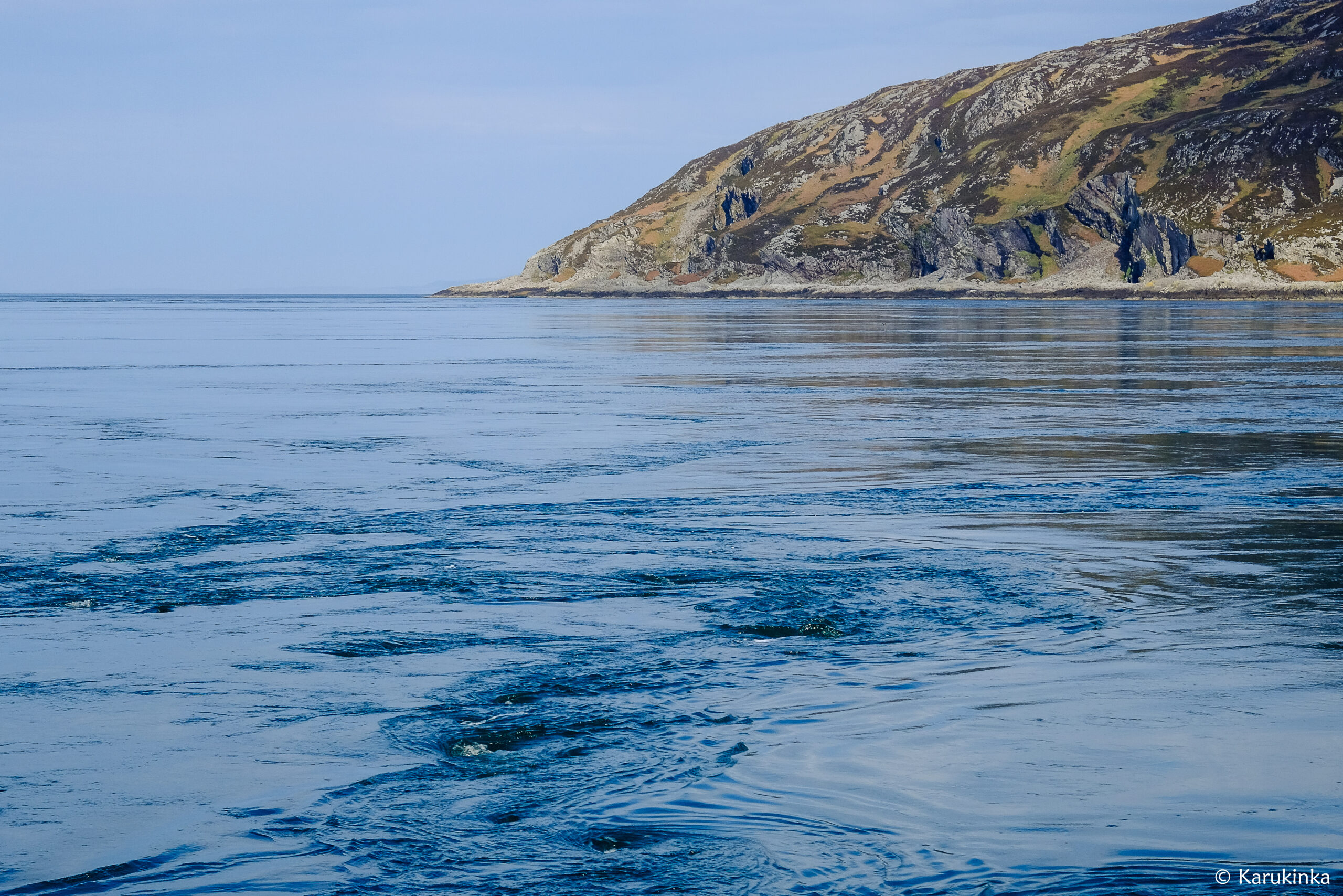
The bad reputation of this Strait, approximately one nautical mile long, can be explained by several factors:
The shape of the bottoms: just imagine a great canyon under water and put a column in it (like finally reaching the top of Dibona for the mountain hikers who are reading this), which suddenly deepens the area from 50 to 220 m, into … 29m. This is where “eddies” or swirls are created, making Corryvreckan cave the 3rd biggest maelstrom in the world.
The impacts of the tides: you need to add the strong tide currents in this area as it is directly facing the Atlantic Ocean. The current can reach up to 8 knots, so if you don’t run the numbers correctly, on top of not going where you planned to, you might end up further than your starting point.
The impacts of the wind: if a wind blowing contrary to the current is added to the impacts of the tide, then it’s even worse because on top of not going forward (at best) or going backward (most probably the case), you will face waves going over 9 metres, and then, yay, you won your ticket on the Milagro, and you can tell us about it all in details !
And finally, as featured in pop culture and literature, stories of this place don’t usually omen anything good if the numbers aren’t run correctly. Here are a few examples: the grunting noise of the cave could be heard at more than 10 kms at worst times; for those who read Jules Verne, a quick look into Rayon Vert will transport you into this place just for a chapter; times and times again in history, the locals are said to have encouraged the enemy ships to come to this place to have them disappeared; and then the time when George Orwell navigated over here just before finishing 1984, his masterpiece, only a few metres from the Strait: Barnhill located on the east coast of Jura.
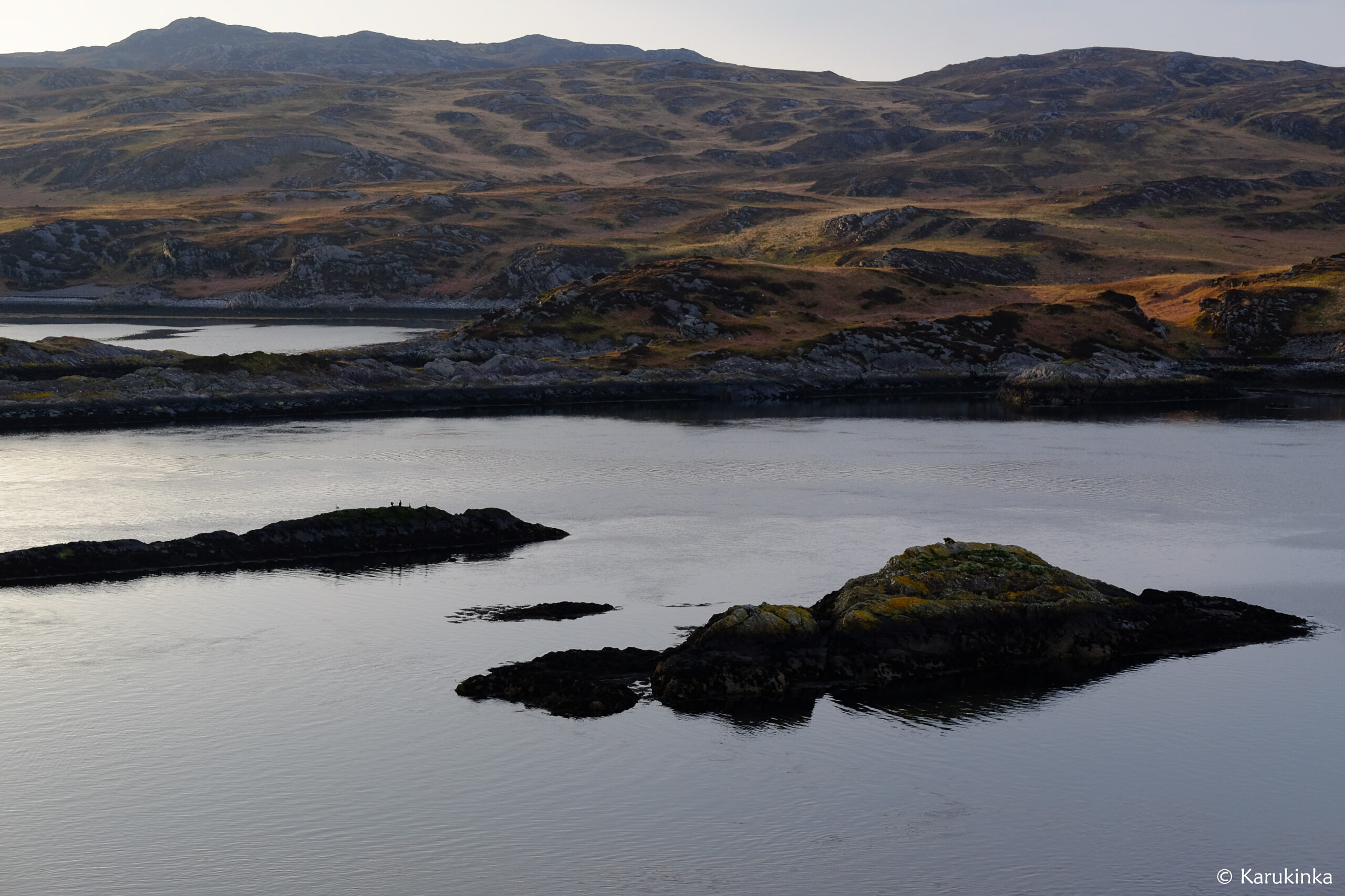
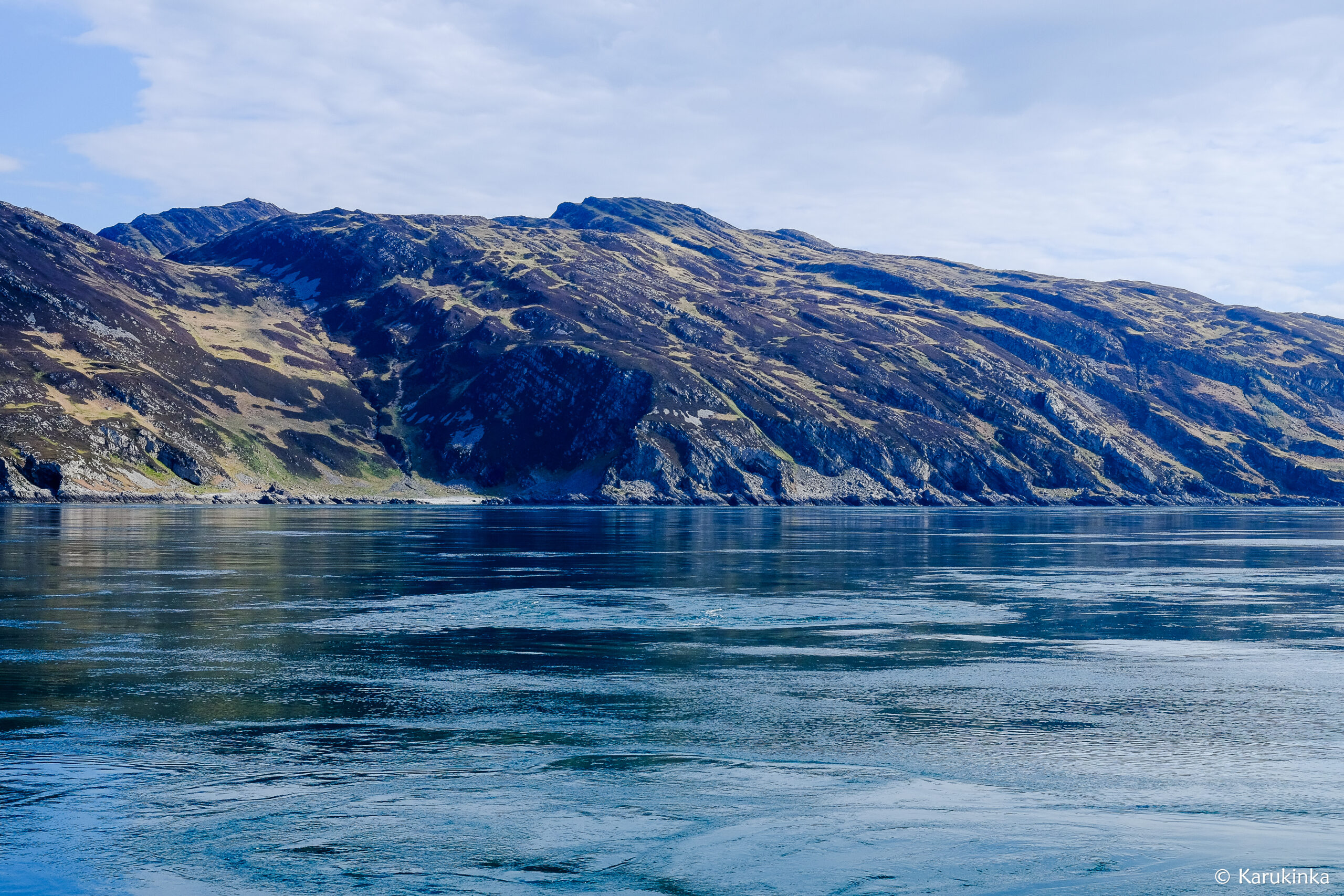
To sum it all, as you may have gathered, we have studied the matter a little bit before deciding to go ahead, and it is with even bigger precautions than the day before that we raised sail early in the morning and engaged into the crossing from west to east. The conditions were good and as anticipated, the main swirls fairly active on the northern side of the Strait. We were supposedly at the right time of the tide, and yet the crossing currents, at times, imposed the route to the Milagro and its 45 tons. Far away from any danger and far from going at full speed as a way to systematically struggle against it, it was quite fascinating to feel these movements (but also quite stressful for the helmsman). The murres were swept away by the current yet seemed happy to travel without any effort, sometimes plunging their neck in to catch passing food. From each side, the landscape showed cruel conditions: peeled off rock tainted with lichens and herbs and absolutely no grove of trees. It was only when we left that a small house perched on top of Scarba island appeared port side. Our decision was made: come back and experiment it under bad weather while sheltered inside the ship.
A few photos of this crossing under the sun and changing lights:
After stopping at Craobh Haven harbour, we head towards Loch Melfort, where Damien will see Kames Fish Farm fishing farm again.
After letting a serious gust of wind pass, we are heading towards Scotland. The forecast is good: NE wind 3 to 5, occasionally 6, with fine to slightly rough seas and good visibility despite rare rain.
We leave Belfast Bay, leaving the town of White Head and its lighthouse, the Black Head, on our port side.
We hoist the mainsail while reefing as a precaution, hoist the mizzen high and unfurl the yankee and staysail. The cliffs overlooked by green pastures, as well as the numerous anchorages in small bays marked on the map, pass by and invite us to return for more time to Northern Ireland. The next time !
Around 4 p.m., 20-22 knots hit us head on, which was not expected. We reduce, mainsail 2 reefs, mizzen 1 reef, staysail 2/3 and a little piece of yankee to continue, upwind, to pass Rathlin Island and the Altacarry Head lighthouse, with lots of current and “eddies ” (swirls).
A bit stubborn we insist in the direction of Loch Indaal, taking a series of tacks to reach the west. Then the flashes of the lighthouse left in our wake appear, reminding us that night will soon arrive. Reluctant to drop anchor at night, and tired of persisting at 3 knots with the current becoming really contrary this time, we resigned ourselves to heading north, towards Kilnaughton Bay. The Scottish courtesy flag is now raised for several months!
We drop anchor in Scotland, in Islay, near the Flying Dutchman, an old 28m sailboat and the next day the discovery of the surrounding landscape is magical: white sand beach, hills with ocher and gray hues,… and the smoke of the Port Ellen Malthouse on our starboard side. All this just for us, Milagro being all alone in this large bay. Port Ellen is the name of the village but also that of an old distillery which closed several decades ago and which is now dedicated to preparing malt for the surrounding distilleries (there are nine on Islay). The few bottles of Port Ellen whiskey that have been preserved now sell for sometimes astronomical prices.
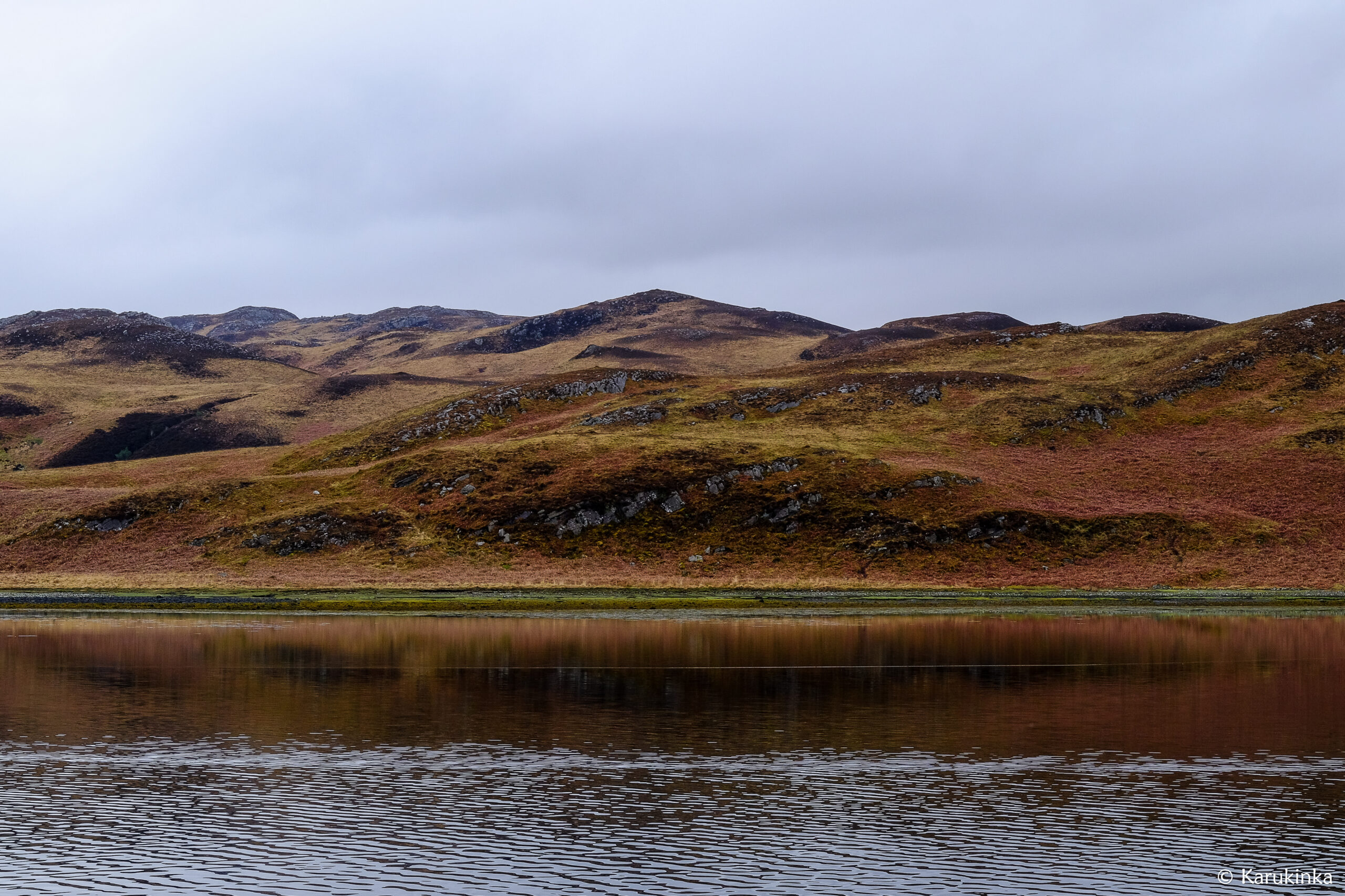
We took advantage of this stopover to hike several times in the surrounding area, of which here are some images:
[#3 Ireland - Scotland 2024] From Bangor (Belfast Lough) to Port Charlotte 25
And also, to visit the surroundings of Laophraig under a sky as beautiful as it is threatening which made us choose the Port Ellen pub facing the beach, rather than continuing towards Lagavullin Bay and Ardberg Bay:
[#3 Ireland - Scotland 2024] From Bangor (Belfast Lough) to Port Charlotte 38
Two days later we weigh anchor, determined to reach Loch Indaal, near Bruidladdich. The forecast promises us a certain slowness under sail (2 to 4 Beaufort) and we therefore make part of the journey under motor, leaving on our starboard side the cliffs of the Oa peninsula and the 20m high monument named Mull of Oa, dedicated to the memory of American shipwrecked in 1918, during the First World War.
At the end of the afternoon we arrive at our destination and leave Milagro alone in this immense bay, north of Port Charlotte, between Bruidladdich and Bowmore, names which immediately appeal to lovers of peated Scottish whisky!
After a brief stopover in Dún Laoghaire, the official stamp on the passport of the animal Toupie (which gives him the right to travel to the United Kingdom) and the passage of a gale, Milagro and his crew set off again. towards the north, in scattered areas. rain and wind W to SW 4 to 6 Beaufort. Under 2-reef mainsail, 1-reef mizzen and Yankee, Milagro sails at 6.5 knots, leaving the Baily lighthouse in her wake.
In the evening the wind drops seriously and the choice is made to enter Carlington Bay (Carlington Lough, on the border between Ireland and the United Kingdom), to drop anchor in front of the village of Greencastle. The entrance is narrow via the north channel and the markings are not always lit after dark. After a night slalom between the mooring buoys (thanks to the flashlight!), we drop anchor a short distance from a pontoon used by fishermen and maritime pilots dedicated to going up the river to the ports of Warrenpoint and Newry.
The next morning we discovered the ruins of the castle which overlook the village. We learned a few hours later, during the visit, that it was built in the 13th century and that it was the scene of numerous clashes. Around us are green hills and meadows, and a blue sky which contrasts with the weather information from France received from our loved ones: in Nantes, it’s raining!
After britton pancakes and chocolate-banana cake, we set off again to anchor in front of the small port of Kilkeel. No wind and no swell, enough to make us forget that we are sleeping in a boat! The next morning, same thing: calm. We will have the nice surprise, a few days later, to discover that while we were sorting out a small detail on the Mainsail, Stuart Pirie took a beautiful image of Milagro and completed his profile on Marine Traffic!
We choose to move forward despite the absence of wind, the objective being to be in Bangor that same evening. So we go back to the engine near the coast to enjoy the landscape and Damien then devotes himself to replace two reefing lines which crossed each other in the boom. Among the things seen that day, the St John’s Point lighthouse, the entrance to Donnaghadee harbor with its church and colorful houses, large gray dolphins escorting us into Donnaghadee Sound, under a sunset, into Belfast Lough.
After sunset and a brief stop at the diesel pontoon, we moor in the Bangor marina. The next day a strong gale is forecast, we will stay sheltered!
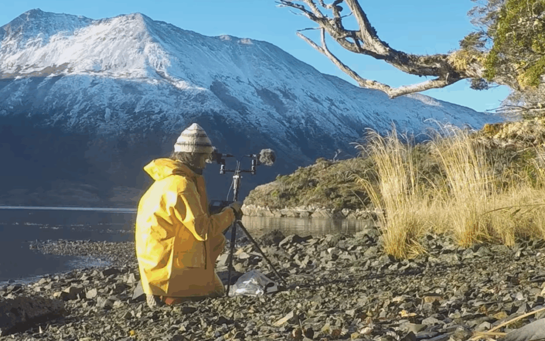
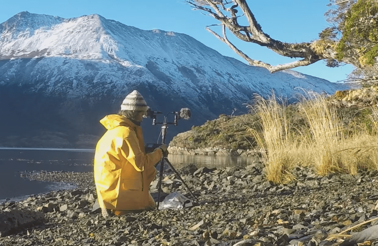
Ethno-acoustician Lauriane Lemasson is passionate about the relationships that peoples weave with their sonic environment. Her profession drives her, microphone in hand, to brave the harsh expanses of Patagonia. Her goal: to better understand the settlement dynamics and cultural sources of inspiration of the Indigenous peoples who once inhabited these remote regions before being decimated.
A land of silence and infinite spaces. In this Argentine Patagonian pampa, stretching out as if it would never end, people are few and not very talkative. There is no point in asking for directions. Apart from a few shaggy sheep who themselves seem to wonder what they're doing there, there is no one left to answer in these places.
In any case, south of 53° South, once past the bustling Strait of Magellan (or Magellan Strait), there is hardly more than a single real road on this gigantic archipelago that is Tierra del Fuego: Ruta No. 3, a licorice-colored ribbon winding from north to south, linking the town of Rio Grande to the port of Ushuaia. Otherwise, this antipode—one of the least populated in the southern cone of South America—consists of vast steppes speckled with dark lakes, unassailable mountains, and forests thrown to the margins of the ocean.
All on Foot
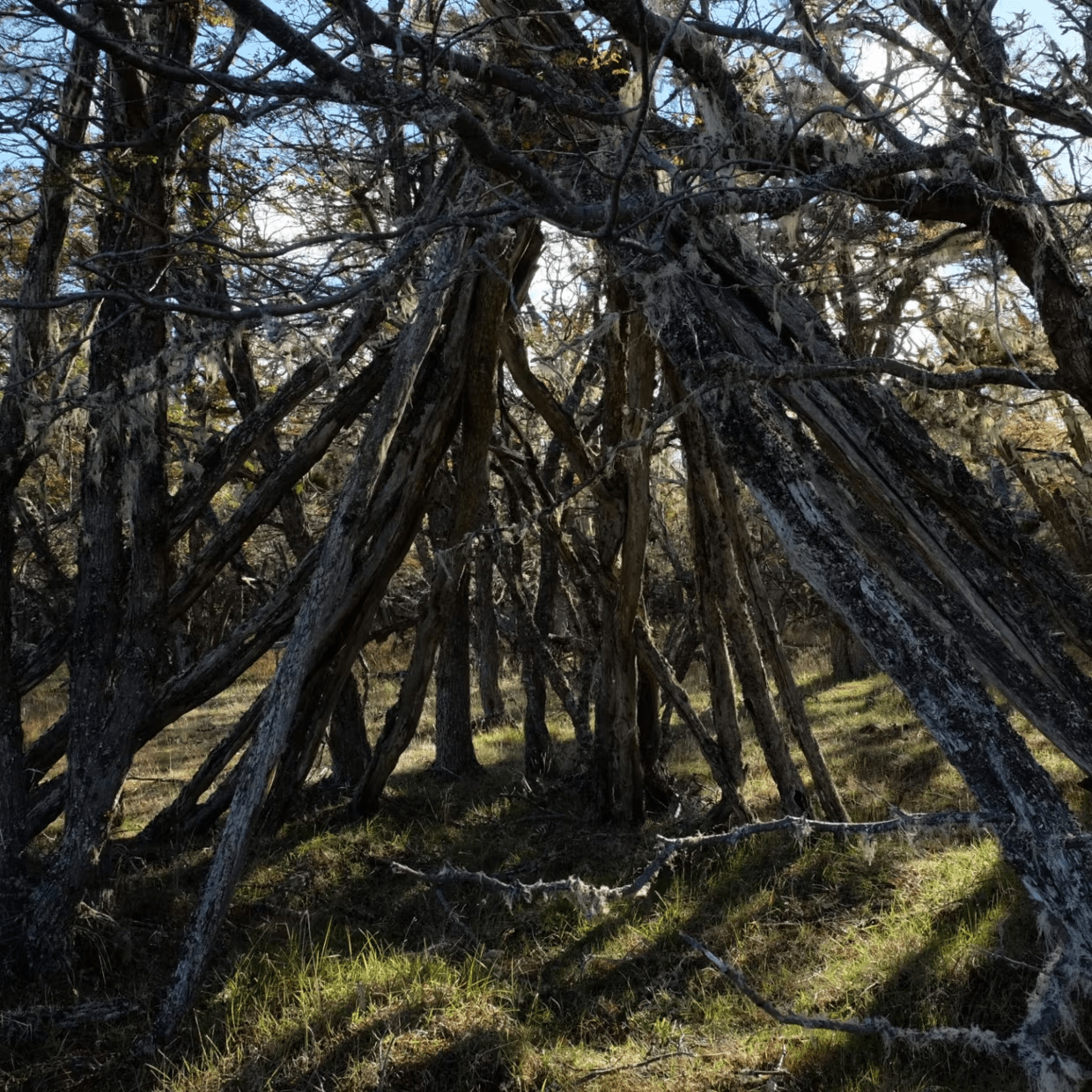
And to make matters worse, everywhere there are gnarled, half-bent shrubs twisted by the gusts, impenetrable thickets, lines of rusty barbed wire, and endless fences that seem to conspire to block access to the vast private estancias that still checker most of this land. That’s the setting: a void as staggering as it is hostile. And no welcoming committee.
Yet it is in this complicated land that Lauriane Lemasson, 30 years old, has chosen to lose herself, alone, for months on end, traveling only on foot and always off the main marked road. This strong-willed young Breton woman has stepped over obstacles and ignored prohibitions in order to go “where no one goes anymore,” except for the gauchos. In short, a true wandering adventure. And in complete autonomy, burdened with a 25-kilo backpack in which Lauriane packed her gasoline stove, enough provisions to last between seven and nineteen days without resupply depending on the journey, her tent, her sleeping bag, her trusty Leica camera, her notebooks, and above all a host of microphones and recording equipment.
A Compass and a Map
She often forgot to look for shelter for the night—“in any case, most of the time there wasn’t any,” she recalls—and on her first escape, our tireless walker didn’t even have a GPS, just a compass and a good old 1:750,000 scale map. The goal of these rough outings? “To capture the sounds of the Patagonian landscapes,” she answers quite seriously. A strange quest, an unusual plan.
Because here, apart from the gusts that sometimes whistle so loudly they can make you deaf, silence and contemplation reign. “Very quickly, you realize that this space is inhabited by a thousand little sounds that truly sketch out the soundscapes I’m chasing,” Lauriane admits. The timid cries of birds, the plaintive creaking of trees in the storm, the grunting of sea lions, the distant cracking of glaciers… The slightest echo becomes, for our explorer, a kind of company.
The Violence of the Elements
“During my first journey across Tierra del Fuego,” she recalls, “over three and a half months of wandering, I met, outside urban areas, only three people: two estancieros, ranch workers who couldn’t believe they were seeing a Frenchwoman walking alone in the area, and an old Argentinian, a retiree who became my friend. He has since passed away, but he lived in isolation and welcomed me into his home without hesitation one day when the weather was very bad…”
Rain, snow, storms, blazing sun, sweltering heat, or chills rising from Antarctica… This region has always faced the violence and magic of the elements. Before it was discovered by the West during Magellan’s expedition in 1512, medieval portolan charts summed up the area with a few uncertain notes: “fogs,” “end of the world,” “anti-land.” But it takes more than that to throw off our adventurer. Because Lauriane is not just an explorer. And she’s certainly not a female Don Quixote chasing impossible windmills.
A doctoral student at the Sorbonne, she conducts her sonic explorations as part of a rigorous, multidisciplinary thesis in ethnomusicology and acoustics. This unprecedented research project, which she began in 2011, is based on an initial intuition that she continues to test during her expeditions in Tierra del Fuego: “My explorations between Rio Grande and Ushuaia, in the Corazón de la Isla provincial reserve near Lake Fagnano, on the Beagle Channel, and through the Cape Horn biosphere reserve are all founded on a conviction. The sounds of these places (soundscapes) can still teach us things about the Amerindian peoples who once inhabited them—provided we listen carefully to what they have to say,” she explains. Just as every corner of the planet has its particular smell, colors, and temperatures, an ambiance is also shaped by its acoustics.
“Everyone has experienced this,” the scientist points out. “Whether you are in front of a mountain, in a forest, in a desert, or at the center of an ancient theater, the soundscape influences how we occupy and perceive a place. This is what I try to understand, adding the filters of history, geography, and anthropology.”
From this perspective, analyzing the acoustic dimension of an archaeological site, an ancient Amerindian camp, or a sanctuary where shamanic rituals once took place makes it possible to better explain the past, or even to reconstruct part of the environment and culture of those who lived there.
Microphone in Hand, Ears on Alert
The researcher has traveled more than 2,000 kilometers on foot, driven by a single goal: to once again hear the echoes of the first Fuegian peoples, these Patagonian natives who are now virtually unknown to the general public. “Most books and articles on the subject claim that these Amerindians, who arrived in Tierra del Fuego more than 10,000 years ago, disappeared long ago,” Lauriane protests. “But from my very first trip, I realized the reality was quite different: descendants of these Indigenous peoples—exterminated by European colonists or forcibly assimilated into Hispanic culture—are still very much alive, whether in Argentina or Chile. Nor have their cultures and languages, though certainly threatened with imminent disappearance after years of being disregarded, been erased from memory.”
Based on this realization, the young researcher's quest took on an even greater sense of urgency. Supported in her work by the ethnologist and Arctic explorer Jean Malaurie—a legendary figure in the world of extreme adventure—Lauriane multiplied her sound recordings and acoustic tests. On this land now emptied of its first inhabitants, she uncovered forgotten campsites, as well as 2,500 hut locations. She even managed to reconstruct the original Amerindian place names of these sites, which had been replaced by the names given by the Spanish. All this painstaking work now allows Lauriane to suggest that in these ancestral societies, which were entirely oriented toward nature, shamanic chants and rituals were mainly inspired by the sounds made by animals, trees, waves, and winds.
Meeting the Yagans
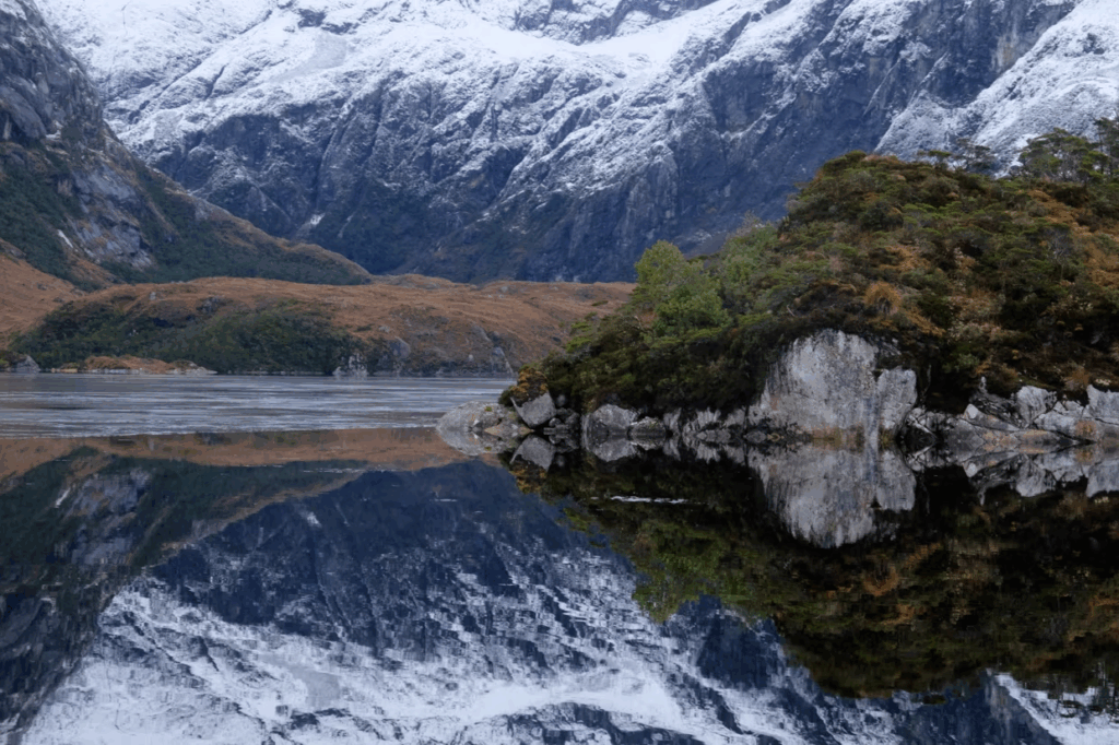
The ethno-acoustician also set out to meet the last speakers of the Yagan, Haush, and Selknam languages in Argentina and Chile. This brought to life the accounts left by the few anthropologists who, at the start of the last century, took an interest in these Indigenous peoples—such as the missionary Martin Gusinde, who, in the 1920s, quickly set aside his evangelizing mission to immerse himself passionately in the daily life of the tribes. In 2018, during a new journey, Lauriane decided to focus her research precisely on the Yagans studied by Gusinde. This time, her destination was the Beagle Channel (Onashaga in the Yagan language). Unlike the Selknams and Haushs, who were hunter-gatherers, the Yagans lived on the water. They were nomads of the channels, traveling in long canoes and subsisting mainly on shellfish, which, according to old accounts, were harvested from icy depths by nearly naked women divers. The atmosphere changed entirely. This expedition took place in a maritime Tierra del Fuego, livelier and even windier than before, where the Atlantic and Pacific oceans meet head-on, often creating dramatic weather conditions.
A little further south of the Beagle Channel lies Cape Horn, renowned as the “official homeland of seasickness.” Then there are the famous caletas—fjords with spongy shores and trees draped in long strands of lichen, inlets carved out by glaciers thousands of years ago. These labyrinths wind westward, beyond Ushuaia, then along the Pacific coast of Chilean fjords and all the way to the Chiloé Archipelago. “Sailing is the only way if you want to land on the islets and coves scattered everywhere,” Lauriane notes. “My initial idea was to wander by canoe like the Yagans, but technically the expedition was too complex and very risky.” So, she joined a French family as a crew member on a sailboat for a three-month expedition. They stocked up and set sail from Ushuaia, then crossed the closely monitored border waters patrolled by the Chilean navy for a first stop in the world’s southernmost port: Puerto Williams, on Chile’s Navarino Island, a major center of Yagan culture. From there, they headed west, zigzagging through the two arms of the Beagle and exploring the shores on foot to catalog the campsites.
For this journey, the acoustician improved her sound investigation tools: microphones capable of recording in all directions, the latest recorders, meticulous protocols, and… a simple wooden box! Bought at a hardware store in Ushuaia, the object is the size of a shoebox. By tapping on its lid, like a drum, it produces a sharp, loud noise that resonates in the emptiness—perfect for testing the echo of a place and analyzing how sound travels through a given site. Inspired by the protocol developed in 1967 by François Canac (a French scientist who worked notably on the acoustics of Roman amphitheaters), this kind of box test helps better understand sites once occupied by the first inhabitants.
A Crucial Discovery
After leaving the boat, Lauriane returned to the steppes for two more months of solitary research. Then, last April, during her latest expedition, she made her most important discovery in the center of Tierra del Fuego. She headed to the Ewan I site, once used by the Selknam for the Hain initiation ritual for young adults. Studied by the anthropology and archaeology laboratory of Cadic (the Southern Center for Scientific Research in Ushuaia), the site still has a ceremonial hut standing, dated to 1905. “There,” Lauriane recounts, “I was able to carry out acoustic tests to understand the placement of this hut. Located on the edge of an old clearing, Ewan I actually functions like an amphitheater, where sounds (songs, words, cries) are absorbed, conducted, or deflected by the terrain. It is likely that these effects were not accidental but were considered in the choice of the ritual site to ensure the ceremony went smoothly.” This sheds new light on the acoustician’s university thesis. “Tomorrow, we’ll be able to explain other sacred sites by analyzing how they resonate,” she says enthusiastically, already thinking about her next trip. It will be soon, and perhaps aboard her own little sailboat. “I dream of crossing the Atlantic,” confides our Breton. Before once again setting course south, toward that Fuegian land that still has so many sonic nuances to whisper to her.
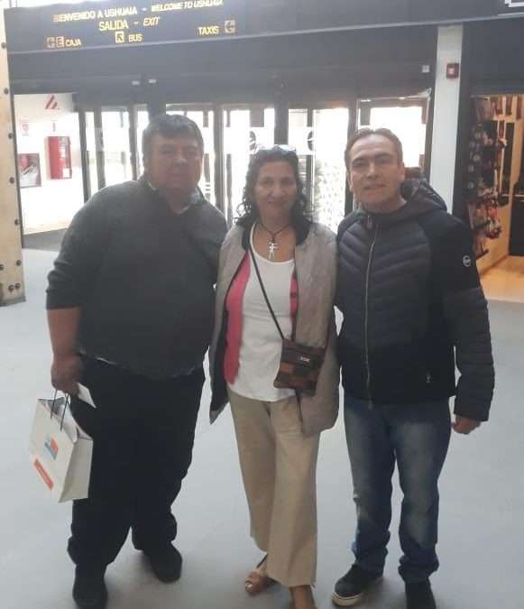
Representantes de las comunidades de pueblos originarios de Tierra del Fuego viajan a Francia a exponer sobre sus culturas ancestrales, en el marco del mes de la ciencia y la cultura que se desarrolla en ese país. El 2019 fue declarado por la ONU el Año internacional de las Lenguas Indígenas, con el fin de difundir su importante aporte a la cultura de los pueblos.
La secretaria de Relaciones Internacionales Cecilia Fiocchi destacó la presencia en Francia de los representantes de las comunidades originarias: “Es un orgullo para todos los fueguinos que integrantes de las comunidades originarias puedan participar de eventos internacionales como este, que es impulsados por investigadores de la Universidad de la Sorbona y del Centro Nacional de Investigaciones Científicas, instituciones académicas francesas de gran prestigio”. “Es una oportunidad para visibilizar las culturas ancestrales de nuestra provincia” valoró.
Mirtha Salamanca, integrante de la comunidad selk´nam de Río Grande, Víctor Vargas, integrante del pueblo yagán de Ushuaia y José González Calderón, de la comunidad yagán de Puerto Williams viajan a Francia a exponer sobre las culturas ancestrales originarias de Tierra del Fuego.
Mirtha Salamanca es integrante del Consejo Nacional de Pueblos Indígenas, como representante del pueblo selk´nam. “Viajaremos a Francia invitados por investigadores de ese país, para visibilizar allí nuestra cultura ancestral y complementar una serie de investigaciones que estamos realizando sobre nuestro pueblo. Además de participar como expositores en charlas y conferencia en distintas partes del país, podremos visitar los archivos de Anne Chapman, quien fue una gran investigadora de nuestra cultura y complementar los estudios que nosotros venimos realizando para dar a conocer nuestra cosmovisión. Tenemos la esperanza de que esto promueva el arraigo a nuestra tierra y el derecho a la identidad originaria” expresó.
Por su parte, Víctor Vargas es autor del libro “Mi Sangre Yagán”, editado en 2017 por la Editora Cultura Tierra del Fuego y trabaja en el Museo del Fin del Mundo de Ushuaia, desde donde promueve mediante charlas e investigaciones, la cultura e historia de su pueblo. “Esto se trata de unir el pasado con el presente. Los yaganes son la comunidad humana que habitó de forma permanente la parte más al sur de todo el continente.
En cuanto a José González Calderón, reside en Puerto Williams, Chile y cabe destacar que es sobrino de Cristina Calderón, quien fue declara tesoro humano vivo, ya que es la última hablante nativa viva de su lengua yagán. Este año, ha sido declarado por la ONU el año internacional de las lenguas indígenas.

![[#6 – Ireland – Scotland 2024] Stopover at Loch Melfort](https://karukinka.eu/wp-content/uploads/2024/05/Loch-Melfort_Karukinka_052024-3-1080x675.jpg)

![[#5 Northbound – 2024] From Jura to Loch Melfort via Corryvreckan](https://karukinka.eu/wp-content/uploads/2024/05/N-Islay_Jura_042024-10-1080x675.jpg)
![[#3 Ireland – Scotland 2024] From Bangor (Belfast Lough) to Port Charlotte](https://karukinka.eu/wp-content/uploads/2024/05/IMG_3050-1080x675.jpeg)
 to Port Charlotte 1 Séjour voilier écosse, Séjour voilier Norvège, Croisière voilier Ecosse, Croisière voilier Norvège, Cap Nord à la voile, Sailing Norway, Sailing Scotland, Blue Water sailing, Stage voile hauturier, stage de voile côtier, sailing hébrides, voilier hébrides, navegar escocia, navegar noruega, navegar por los fiordos, velero escocia, velero noruega, navegar en finnmark, navegar en escocia, navegar en las hebridas, navegar costa oeste escocia, velero islas escocia, navegar islas escocia, sailing scottish islands, naviguer iles écossaises,")
 to Port Charlotte 2 Séjour voilier écosse, Séjour voilier Norvège, Croisière voilier Ecosse, Croisière voilier Norvège, Cap Nord à la voile, Sailing Norway, Sailing Scotland, Blue Water sailing, Stage voile hauturier, stage de voile côtier, sailing hébrides, voilier hébrides, navegar escocia, navegar noruega, navegar por los fiordos, velero escocia, velero noruega, navegar en finnmark, navegar en escocia, navegar en las hebridas, navegar costa oeste escocia, velero islas escocia, navegar islas escocia, sailing scottish islands, naviguer iles écossaises,")
 to Port Charlotte 3 Séjour voilier écosse, Séjour voilier Norvège, Croisière voilier Ecosse, Croisière voilier Norvège, Cap Nord à la voile, Sailing Norway, Sailing Scotland, Blue Water sailing, Stage voile hauturier, stage de voile côtier, sailing hébrides, voilier hébrides, navegar escocia, navegar noruega, navegar por los fiordos, velero escocia, velero noruega, navegar en finnmark, navegar en escocia, navegar en las hebridas, navegar costa oeste escocia, velero islas escocia, navegar islas escocia, sailing scottish islands, naviguer iles écossaises,")
 to Port Charlotte 4 Séjour voilier écosse, Séjour voilier Norvège, Croisière voilier Ecosse, Croisière voilier Norvège, Cap Nord à la voile, Sailing Norway, Sailing Scotland, Blue Water sailing, Stage voile hauturier, stage de voile côtier, sailing hébrides, voilier hébrides, navegar escocia, navegar noruega, navegar por los fiordos, velero escocia, velero noruega, navegar en finnmark, navegar en escocia, navegar en las hebridas, navegar costa oeste escocia, velero islas escocia, navegar islas escocia, sailing scottish islands, naviguer iles écossaises,")
 to Port Charlotte 5 Séjour voilier écosse, Séjour voilier Norvège, Croisière voilier Ecosse, Croisière voilier Norvège, Cap Nord à la voile, Sailing Norway, Sailing Scotland, Blue Water sailing, Stage voile hauturier, stage de voile côtier, sailing hébrides, voilier hébrides, navegar escocia, navegar noruega, navegar por los fiordos, velero escocia, velero noruega, navegar en finnmark, navegar en escocia, navegar en las hebridas, navegar costa oeste escocia, velero islas escocia, navegar islas escocia, sailing scottish islands, naviguer iles écossaises,")
 to Port Charlotte 19 Séjour voilier écosse, Séjour voilier Norvège, Croisière voilier Ecosse, Croisière voilier Norvège, Cap Nord à la voile, Sailing Norway, Sailing Scotland, Blue Water sailing, Stage voile hauturier, stage de voile côtier, sailing hébrides, voilier hébrides, navegar escocia, navegar noruega, navegar por los fiordos, velero escocia, velero noruega, navegar en finnmark, navegar en escocia, navegar en las hebridas, navegar costa oeste escocia, velero islas escocia, navegar islas escocia, sailing scottish islands, naviguer iles écossaises,")
 to Port Charlotte 23 Séjour voilier écosse, Séjour voilier Norvège, Croisière voilier Ecosse, Croisière voilier Norvège, Cap Nord à la voile, Sailing Norway, Sailing Scotland, Blue Water sailing, Stage voile hauturier, stage de voile côtier, sailing hébrides, voilier hébrides, navegar escocia, navegar noruega, navegar por los fiordos, velero escocia, velero noruega, navegar en finnmark, navegar en escocia, navegar en las hebridas, navegar costa oeste escocia, velero islas escocia, navegar islas escocia, sailing scottish islands, naviguer iles écossaises,")
 to Port Charlotte 24 Séjour voilier écosse, Séjour voilier Norvège, Croisière voilier Ecosse, Croisière voilier Norvège, Cap Nord à la voile, Sailing Norway, Sailing Scotland, Blue Water sailing, Stage voile hauturier, stage de voile côtier, sailing hébrides, voilier hébrides, navegar escocia, navegar noruega, navegar por los fiordos, velero escocia, velero noruega, navegar en finnmark, navegar en escocia, navegar en las hebridas, navegar costa oeste escocia, velero islas escocia, navegar islas escocia, sailing scottish islands, naviguer iles écossaises,")
![[#2 Ireland – Scotland 2024] From Dublin to Bangor (Belfast Lough)](https://karukinka.eu/wp-content/uploads/2024/05/Donaghadee_0420242-1080x675.jpg)
 1 Séjour voilier écosse, Séjour voilier Norvège, Croisière voilier Ecosse, Croisière voilier Norvège, Cap Nord à la voile, Sailing Norway, Sailing Scotland, Blue Water sailing, Stage voile hauturier, stage de voile côtier, sailing hébrides, voilier hébrides, navegar escocia, navegar noruega, navegar por los fiordos, velero escocia, velero noruega, navegar en finnmark, navegar en escocia, navegar en las hebridas, navegar costa oeste escocia, velero islas escocia, navegar islas escocia, sailing scottish islands, naviguer iles écossaises,")
 2 Séjour voilier écosse, Séjour voilier Norvège, Croisière voilier Ecosse, Croisière voilier Norvège, Cap Nord à la voile, Sailing Norway, Sailing Scotland, Blue Water sailing, Stage voile hauturier, stage de voile côtier, sailing hébrides, voilier hébrides, navegar escocia, navegar noruega, navegar por los fiordos, velero escocia, velero noruega, navegar en finnmark, navegar en escocia, navegar en las hebridas, navegar costa oeste escocia, velero islas escocia, navegar islas escocia, sailing scottish islands, naviguer iles écossaises,")
 3 Séjour voilier écosse, Séjour voilier Norvège, Croisière voilier Ecosse, Croisière voilier Norvège, Cap Nord à la voile, Sailing Norway, Sailing Scotland, Blue Water sailing, Stage voile hauturier, stage de voile côtier, sailing hébrides, voilier hébrides, navegar escocia, navegar noruega, navegar por los fiordos, velero escocia, velero noruega, navegar en finnmark, navegar en escocia, navegar en las hebridas, navegar costa oeste escocia, velero islas escocia, navegar islas escocia, sailing scottish islands, naviguer iles écossaises,")
 4 Séjour voilier écosse, Séjour voilier Norvège, Croisière voilier Ecosse, Croisière voilier Norvège, Cap Nord à la voile, Sailing Norway, Sailing Scotland, Blue Water sailing, Stage voile hauturier, stage de voile côtier, sailing hébrides, voilier hébrides, navegar escocia, navegar noruega, navegar por los fiordos, velero escocia, velero noruega, navegar en finnmark, navegar en escocia, navegar en las hebridas, navegar costa oeste escocia, velero islas escocia, navegar islas escocia, sailing scottish islands, naviguer iles écossaises,")
 5 Séjour voilier écosse, Séjour voilier Norvège, Croisière voilier Ecosse, Croisière voilier Norvège, Cap Nord à la voile, Sailing Norway, Sailing Scotland, Blue Water sailing, Stage voile hauturier, stage de voile côtier, sailing hébrides, voilier hébrides, navegar escocia, navegar noruega, navegar por los fiordos, velero escocia, velero noruega, navegar en finnmark, navegar en escocia, navegar en las hebridas, navegar costa oeste escocia, velero islas escocia, navegar islas escocia, sailing scottish islands, naviguer iles écossaises,")
 6 Séjour voilier écosse, Séjour voilier Norvège, Croisière voilier Ecosse, Croisière voilier Norvège, Cap Nord à la voile, Sailing Norway, Sailing Scotland, Blue Water sailing, Stage voile hauturier, stage de voile côtier, sailing hébrides, voilier hébrides, navegar escocia, navegar noruega, navegar por los fiordos, velero escocia, velero noruega, navegar en finnmark, navegar en escocia, navegar en las hebridas, navegar costa oeste escocia, velero islas escocia, navegar islas escocia, sailing scottish islands, naviguer iles écossaises,")
 7 Séjour voilier écosse, Séjour voilier Norvège, Croisière voilier Ecosse, Croisière voilier Norvège, Cap Nord à la voile, Sailing Norway, Sailing Scotland, Blue Water sailing, Stage voile hauturier, stage de voile côtier, sailing hébrides, voilier hébrides, navegar escocia, navegar noruega, navegar por los fiordos, velero escocia, velero noruega, navegar en finnmark, navegar en escocia, navegar en las hebridas, navegar costa oeste escocia, velero islas escocia, navegar islas escocia, sailing scottish islands, naviguer iles écossaises,")