Karukinka will be represented by three members: Mirtha Salamanca (Selk’nam community), José German González Calderón (Yagan community) and Lauriane Lemasson (co‑founder and scientific coordinator). The colloquium will take place at the University of Montpellier, providing a privileged scientific and institutional framework for the presentation of Karukinka’s field‑based toponymy program in southern Patagonia and Tierra del Fuego.
This participation places Karukinka at the heart of a reflection on inclusive toponymy – that is, on the role of place names in the recognition of Indigenous languages, identities, and territories. The association’s work in the channels and fjords of Patagonia has long combined nautical exploration, archival research, and oral history, with the aim of restoring and re‑circulating the original Indigenous toponyms of the region.
In Montpellier, this project will be presented as a concrete example of how toponymy, understood not only as a technical or administrative matter, but as a symbolic act, can contribute to understand better the geographic space and to rehabilitate part of the Indigenous memory. The presence of Mirtha Selk’nam Salamanca and José German González Calderón, as representatives of peoples whose languages and territories were long invisibilized or erased, will give special weight to these words.
Karukinka’s participation in this UNESCO‑framed colloquium also highlights the interdisciplinary and transnational dimensions of its program: links between geography, anthropology, linguistics, history, cartography, and environmental science. By bringing the Patagonian and Fuegian landscapes into the university amphitheater, the association contributes to bridging field work and academic discourse, and to making the southern natives worlds more visible in the international scientific landscape.
The colloquium will thus be an opportunity to share the association’s methodology of collecting, verifying, and restoring place names, as well as to discuss the ethical and practical challenges of working with Indigenous peoples and state institutions. These reflections are intended to support the re‑indigenization of the toponymy of Patagonia and the Cape Horn Biosphere Reserve, and, more broadly, to inspire similar initiatives in other regions where the Indigenous presence has been historically neglected.
In this way, attending the UNESCO Inclusive Toponymy Colloquium in Montpellier is not only a scientific and institutional event for Karukinka, but also a continuation of its long‑standing commitment to the memory and heritage of Indigenous peoples, and to the re‑reading of the map from the perspective of the communities who have lived there for millenias.
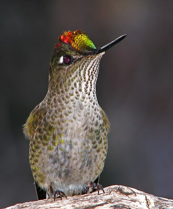
The genus Aphrastura (family Furnariidae) groups together small insectivorous passerines endemic to the southwestern part of South America. It historically comprises two species: the thorn‑tailed rayadito (Aphrastura spinicauda, synallaxis rayadito or espinoso rayadito), widely distributed in the temperate forests of Chile and southern Argentina, and the Masafuera rayadito (Aphrastura masafuerae), microendemic to Alejandro Selkirk Island in the Juan Fernández Archipelago.
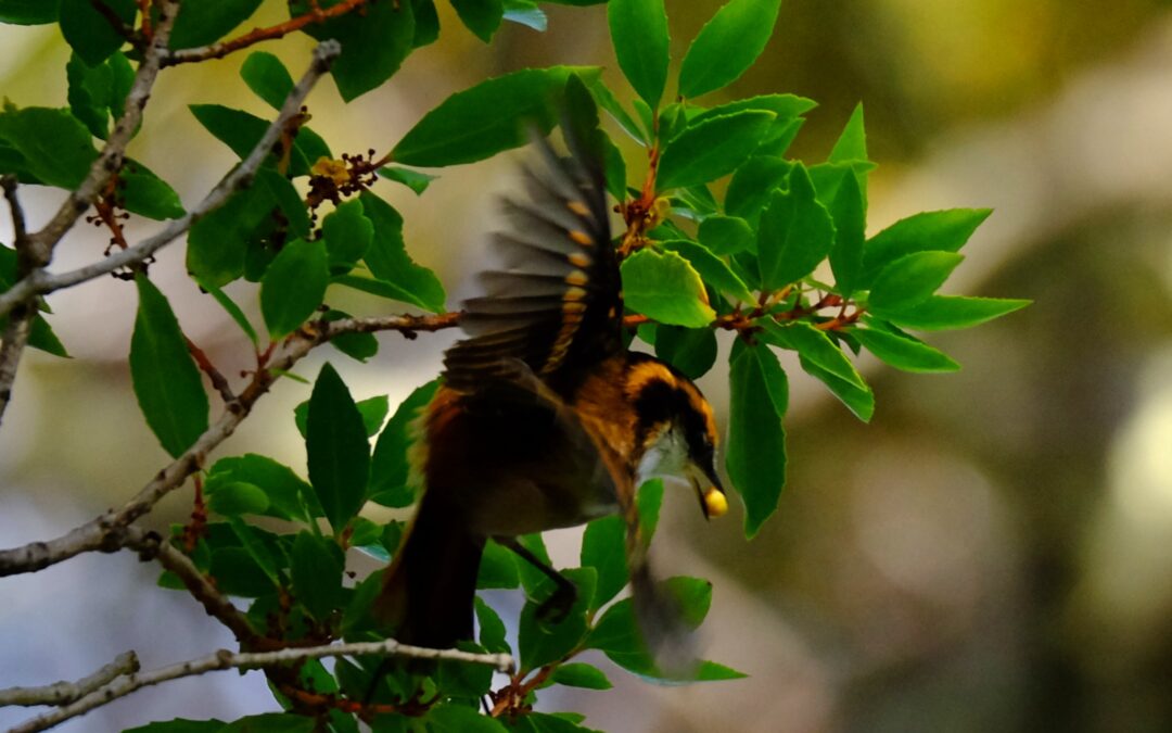
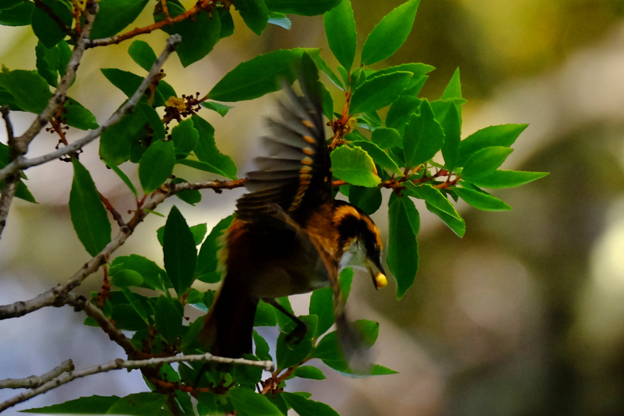
Rayadito (Aphrastura spinicauda) photographed during a Karukinka expedition in the channels of the Cape Horn Biosphere Reserve (Chile, April 2025).
The rayaditos (in Yagán: tachikatchina) play a central role in the biology of southern temperate forests, where A. spinicauda is one of the most abundant tree‑cavity birds (and one of the most vocal!) in the Nothofagus forests, up to the southernmost limits of the Cape Horn Biosphere Reserve.
Within this subantarctic context, the recent discovery of the subantarctic rayadito (Aphrastura subantarctica) in the Diego Ramírez archipelago, to the southwest of Cape Horn, has revealed a remarkable case of island diversification within a treeless environment.
Table of contents
Distribution, diversity and ecosystems
Recent studies on the community of cavity‑using birds show that A. spinicauda is one of the most abundant passerines in southern temperate forests, with densities exceeding 9 individuals per hectare and a strong dependence on cavities excavated by the Magellanic woodpecker (Campephilus magellanicus). In contrast, A. subantarctica inhabits an herbaceous archipelago dominated by Poa flabellata and uses ground cavities or the structures of seabird nests for breeding, in the absence of terrestrial mammalian predators.
Morphology, ecology and behaviour
A. spinicauda is a small passerine of about 12 g, with a long, slender tail employed in its acrobatic movements on trunks and branches. Its streaked, brown‑reddish plumage provides excellent camouflage against bark and foliage, and it feeds primarily on insects and larvae, exploring bark and understory vegetation.
A. subantarctica, on the other hand, averages 16 g, with a longer bill, heavier legs, a shorter tail and a behaviour focused close to the ground, reflecting adaptation to a wind‑exposed, herbaceous habitat.
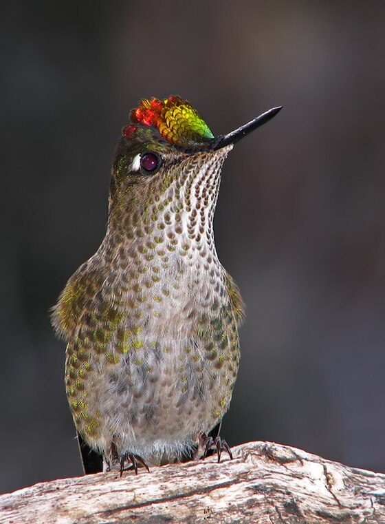
The behaviour of the rayadito in Yagán territory is illustrated by these words from Ursula Calderon: “Tachikatchina is a bird that sings in the mountains during the day, warning that someone is hidden: a wicked man, a sorcerer. It thus announces to the walker the presence of these people, or of a dog, of a cat… in short, of someone hidden. Its calls, when they sing together, are frightening, tsch‑tsch‑tsch, since they do not announce anything good” (p. 70, réf. 10).
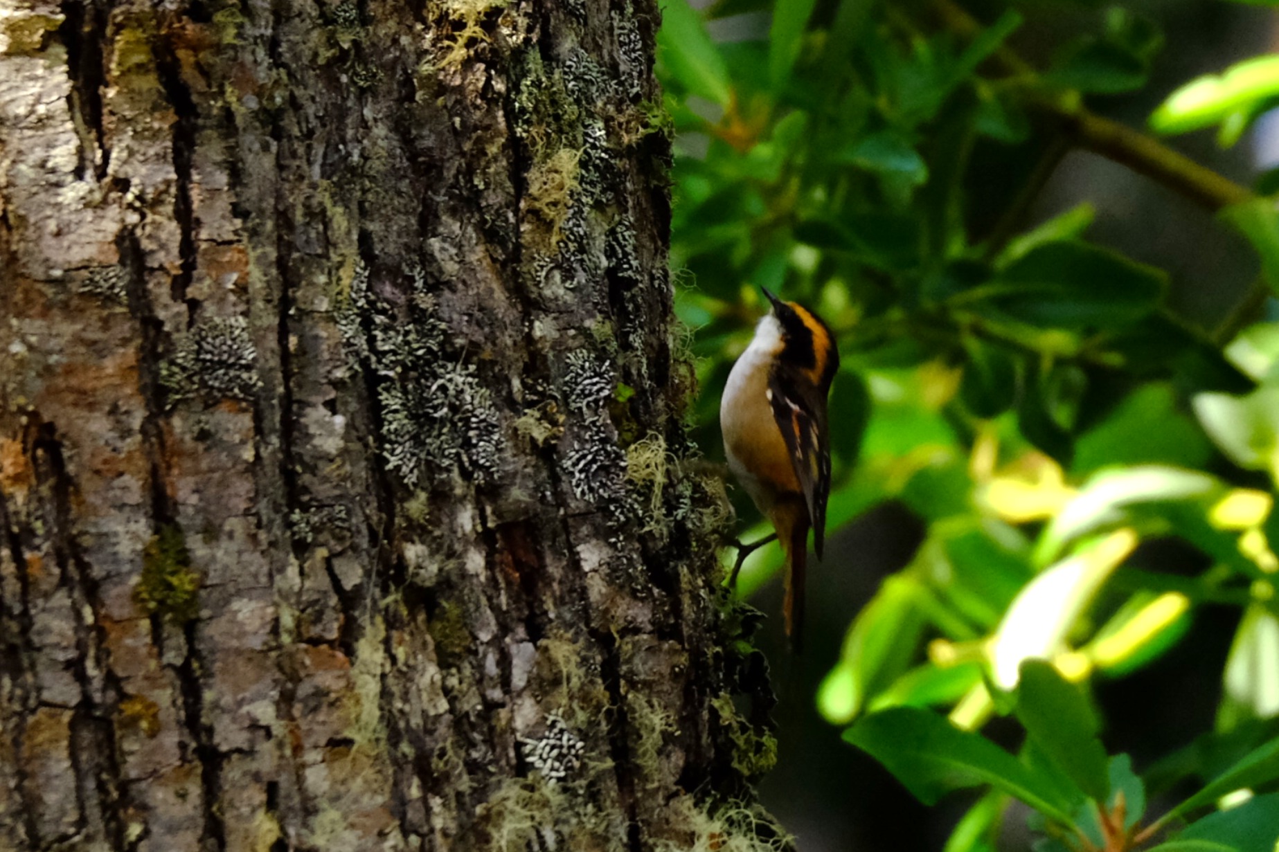
Rayadito or Tachikatchina, photographed in April 2025 in Caleta Borracho (sailing expedition through the Patagonian channels, Chile).
Genetics, speciation and conservation
Genetic analyses show a clear differentiation between A. spinicauda and A. subantarctica, which justifies proposing A. subantarctica as a new emblematic species of subantarctic biodiversity. This distinction, combined with morphological and behavioural differences, places the Diego Ramírez archipelago as a natural laboratory of speciation and conservation, now protected by the Diego Ramírez–Drake Passage Marine Park.
For A. spinicauda, the conservation of old‑growth, cavity‑rich forests and the preservation of the Magellanic woodpecker population are essential to maintain the structure of rayadito populations within the Cape Horn Biosphere Reserve.
Sources :
Rozzi, R. et al. (2022). “The Subantarctic Rayadito (Aphrastura subantarctica), a new bird species on the southernmost islands of the Americas”. Scientific Reports 12, 13957. https://doi.org/10.1038/s41598-022-17985-4
Rozzi, R. et al. (2023). “The subantarctic rayadito (Aphrastura subantarctica), a new bird species on the southernmost islands of the Americas (repositorio UChile version)”. Repositorio UChile. https://repositorio.uchile.cl/handle/2250/194760
Ramírez‑D’Crego, R. (2022). “The Subantarctic Rayadito (Aphrastura subantarctica), a new bird species on the southernmost islands of the Americas”. CECS research‑related article. https://ramirodcrego.com/papers/article29/
Zenodo (2022). Dataset “The Subantarctic Rayadito (Aphrastura subantarctica), a new bird species on the southernmost islands of the Americas”. Morphological and genetic data. https://zenodo.org/records/6983420
Rozzi, R. et al. (2022). “The Subantarctic Rayadito (Aphrastura subantarctica), a new bird species on the southernmost islands of the Americas”. PMC version (NIH‑NIHMS). https://pmc.ncbi.nlm.nih.gov/articles/PMC9418250/
Rozzi, R. et al. (2022). Taxonomic description of Aphrastura subantarctica (Wikispecies).
Marine, R. H. et al. (2022). “The extreme rainfall gradient of the Cape Horn Biosphere Reserve”. Science of the Total Environment ou équivalent (étude de biodiversité et de rayaditos dans les canaux).
Rozzi, R. et al. (2018). “Marine biodiversity at the end of the world: Cape Horn and Diego Ramírez islands”. PLOS ONE ou revue équivalente, décrivant la diversité des îles Diego Ramírez et la contexte écologique.
Rozzi, R. et al. (2017). "Guia Multi-Etnica de Aves de los Bosques Subantarticos de Sudamérica". Ediciones Universidad de Magallanes.
Today we share with you a Yagan story dedicated to the hummingbird, told by Úrsula Calderón and Cristina Calderón in 2001 in Mejillones Bay (Navarino Island, Chile). It was published on pages 170 and 171 of the book Guia Multi-Etnica de Aves de los bosques subantárticos de Sudamérica (2017) and translated from Spanish to English by the Karukinka association.
The Chilean hummingbird Sephanoides sephaniodes
The Yagan story of the hummingbird
“Once, when birds were still humans, a severe drought struck the Cape Horn region and its inhabitants were dying of thirst. The cunning fox (cilawáia, the Magellan fox) found a lagoon and, without telling anyone, built a fence around it with umush branches (calafate in Yagan) so that no one could enter. Hidden there, he drank plenty of water alone, only caring for himself.
After some time, others discovered the lagoon's existence and, as a group, they went to ask cilawáia for some water. But he didn’t even want to listen to their pleas and brusquely expelled them. The people's condition worsened by the moment, and in their despair, they remembered omora. They sent a message to this small occasional visitor who, in similar past shortages, had saved their lives.
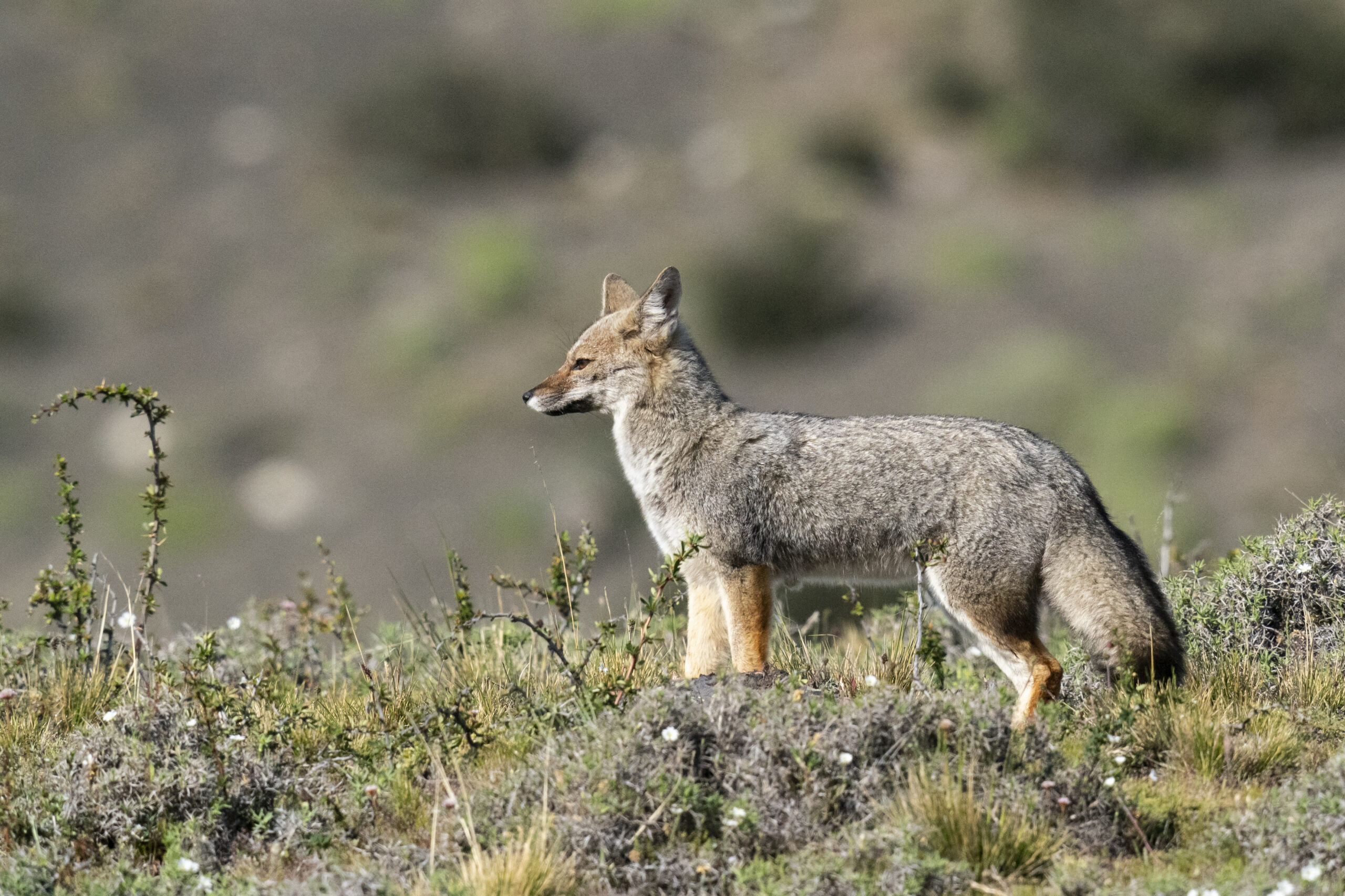
The Magellanic fox (Lycalopex griseus, cilawáia)
The hummingbird, or little omora, was always ready to help and came very quickly. Although weakened, this tiny creature (human or spirit) is braver and more fearless than any giant. Upon arrival, people told him in detail what had happened about the great shortages. Omora, upon hearing what happened, became indignant and flew to the place where cilawáia was. Selfish, the fox confronted him. And omora said: ‘Listen! Is it true what others told me? You have access to a lagoon, and you refuse to share your water with others. Do you know that if you don't give them water, they will die of thirst?’ The fox replied: ‘What do I care? This lagoon has very little water, just enough for me and some close relatives.’
Hearing this, omora became furious and, without answering cilawáia, he returned to the camp.
He thought hard and, hastily, rose holding his staff and returned to where cilawáia was. On the way, omora collected several sharp stones, and when close enough to the fox, he shouted: ‘Will you finally share the water with everyone?’ The selfish cilawáia answered: ‘Let them die of thirst. I can’t give water to each one of them, or else my family and I will starve.’
Omora was so furious he could not restrain himself and leapt with his staff, killing the fox with the first blow.
The others watching came running happily to the place, broke the fence, approached the lagoon, and began to drink to quench their thirst — all of the water. Some birds who arrived late barely managed to wet their throats. Then, the wise little owl sirra (grandmother of omora) said to the birds who had arrived late: ‘Go collect mud from the bottom of the lagoon and fly to the tops of the mountains, above which you must sprinkle.’
The little birds and their balls of mud created vertical springs that originated the watercourses cascading from the mountains, forming small streams and large rivers running through ravines. When everyone saw this, they were extremely happy and all drank large amounts of fresh and pure water, which was much better than the lagoon water that the selfish cilawáia guarded. Now everyone was saved. To this day, all these watercourses flow from the mountains and provide exquisite water. Since then, no one should die of thirst.”
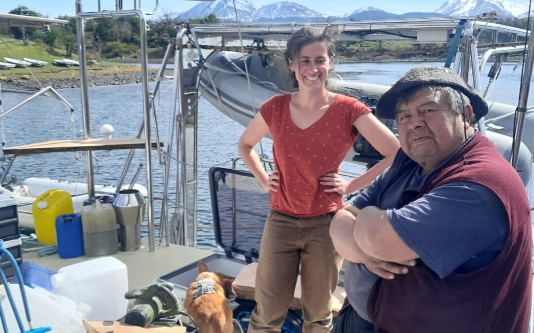
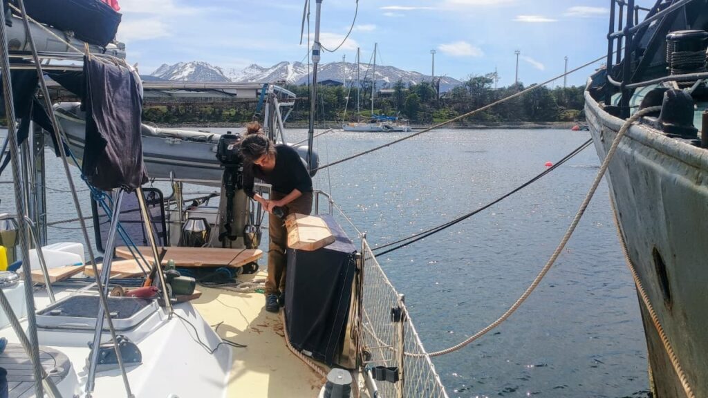
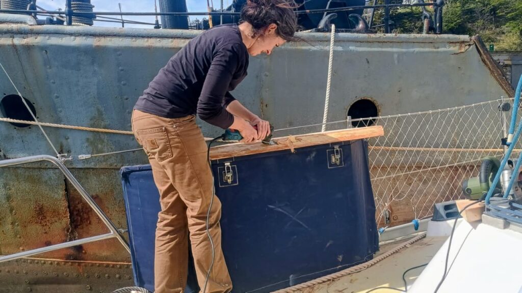
On Monday, October 27, the Milagro resonated with the sound of coigüe wood and tools. With José, crew member and godparent of the boat, we dedicated the day to a traditional woodworking session to craft two new work surfaces from coigüe wood. These new fittings, now installed at the stern of the sailing vessel, will be used to clean fish and lift nets outside, in perfect harmony with the sea and the wind. On board, the scent of freshly cut wood mingled with that of changing tides. The finishing touches were done with an axe, a vibrating saw, and finally a grinder.
Heritage of the Yagan people
Among the Yagans, people of the channels of Tierra del Fuego, woodworking holds an essential place. Originating from a culture intimately linked to water and cold, the Yagans shape wood for everything: canoes, tools, shelters. Their know-how is based on a keen sense of the material, capable of transforming a wet log into a light boat or a rough plank into a durable work surface. By reviving these ancestral gestures, although supplemented by modern tools, we pay homage to this millenary maritime culture, which saw in every piece of wood a fragment of the landscape, a trace of the link between humans and nature.
Lauriane and José aboard Milagro, with a first coigüe wood work surface on the starboard aft balcony.
Coigüe wood, the strength of Southern Chile
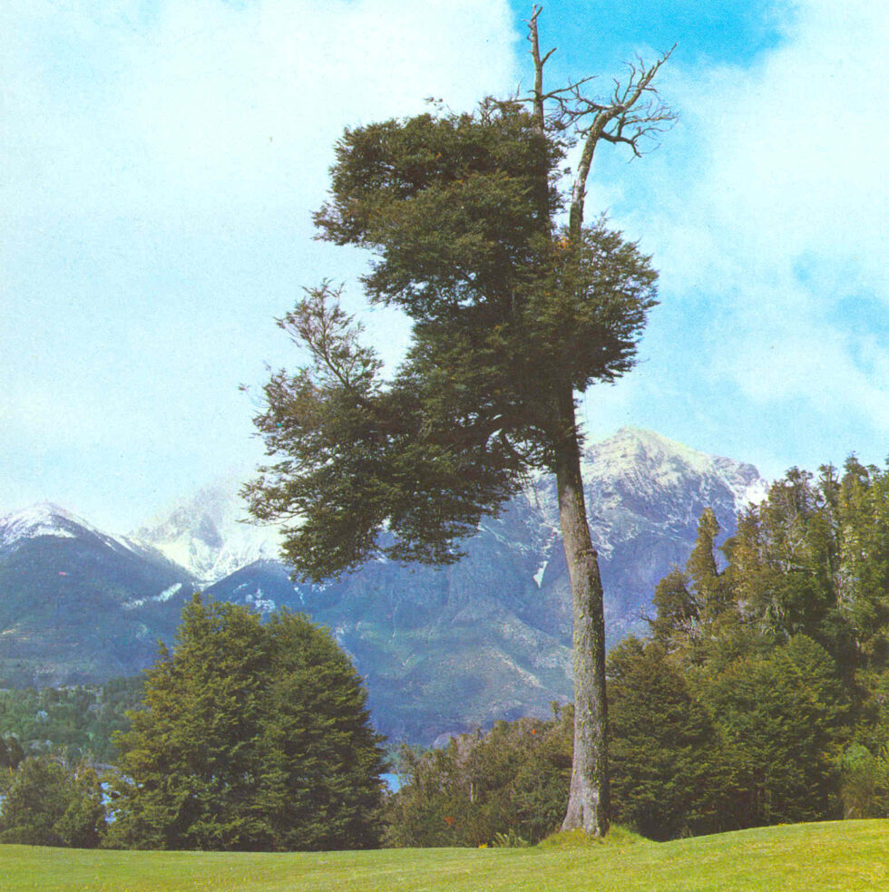
The coigüe (Nothofagus dombeyi) is a emblematic tree of the temperate forests of southern Chile and Patagonia. Its wood, dense and strong, is distinguished by a clear and warm tint, perfect for marine works. It is a species that withstands moisture well and ages gracefully, developing a soft patina over the seasons. Working with coigüe means handling a living material, rooted in the same earth and winds that the Milagro sails through. This noble wood, over 60 years old in the case of what we used, was shaped here in the traditional way so that the boat continues its journey respecting the traditions and nature surrounding it.
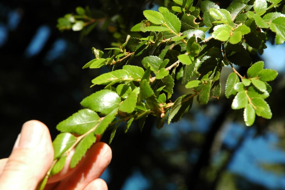
Coigüe leaves (Valerio Pillar de Porto Alegre, Brazil — DSC_7172.JPGUploaded by pixeltoo, CC BY-SA 2.0, https://commons.wikimedia.org/w/index.php?curid=10393830)
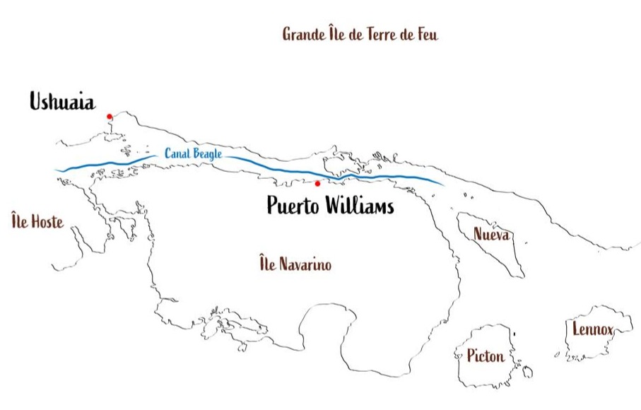
The Beagle Channel, known to the Yaghan people as Onashaga (“channel of the Ona hunters,” i.e., their Selk'nam neighbors from Tierra del Fuego), is one of the planet’s outstanding maritime passages. This interoceanic strait, approximately 270 kilometers long, connects the Atlantic and Pacific oceans at the very southern tip of South America, separating the main island of Tierra del Fuego from an archipelago of smaller islands between 54°50′ and 55°00′ south latitude.
The east part of the Beagle channel (c) Karukinka
For us, who regularly sail these legendary waters, Onashaga—the Beagle Channel—means much more than a simple maritime passage: it’s a world of its own, where two oceans meet and where seven millennia of Yagan navigation still resonate.
Table des matières
The genesis of the landscape: a glacial heritage
When ice sculpted the channels
The formation of the Beagle Channel is a prime example of Quaternary glacial sculpting, which has shaped one of the most spectacular southern hemisphere landscapes. During repeated Pleistocene glaciations, glaciers hundreds of meters thick excavated valleys like Carbajal and Lake Kami (Fagnano), creating the region’s complex topography.
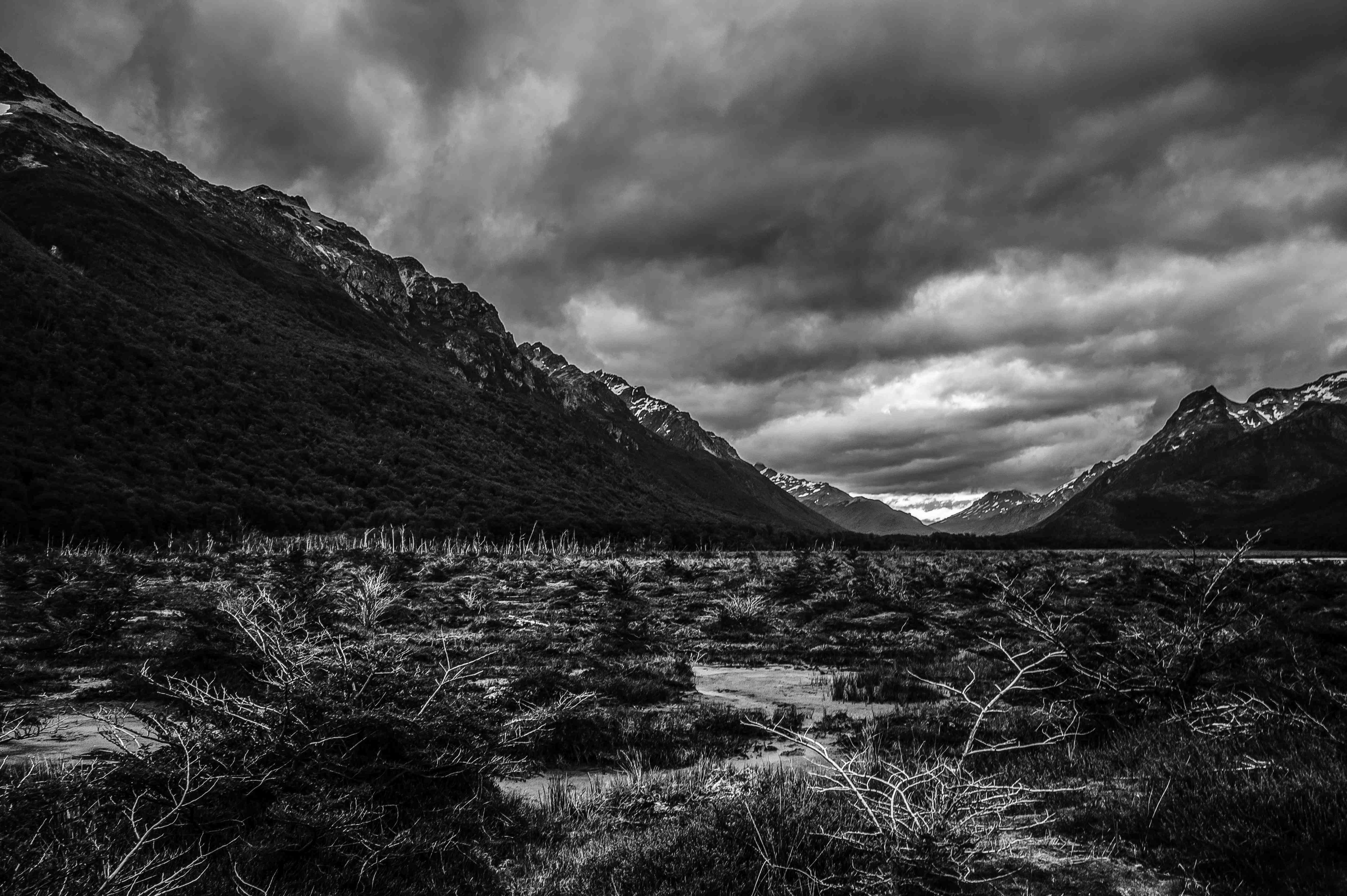
Photography of the Carbajal Valley by Lauriane Lemasson, during the 2013 expedition in Argentine Tierra del Fuego
The glacier responsible for forming the Beagle Canal moved from west to east, fed by the Darwin Range, where glaciers and snowfields—remnants of this genesis—can still be seen today. This glacial process left behind moraine deposits in the shallower areas, especially around Gable Island and off the Ushuaia Bay, creating today's bathymetric complexities.
The tectonic structure underlying the channel is a longitudinal tectonic valley, later modified by glacial action. The combination of tectonic and glacial processes resulted in a morphology with semi-isolated basins as deep as 400 meters, separated by shallow topographic sills that control water mass circulation.
A complex submarine architecture
The Beagle Channel’s bathymetry reveals a complex architecture dominated by a series of shallow sills, dividing the channel into several distinct micro-environments. In the western sector, the Diablo Island sill (approx. 50 meters deep) and the Fleuriais Bay sill (about 100 meters) separate the northwestern and southwestern branches from the central sector.
This bathymetric setup generates a complex circulation system, with sills acting as barriers that limit the exchange of deep water masses, creating micro-environments with distinctive physical, chemical, and biological properties.
It is this diversity of habitats that makes the Beagle Channel such a rich and unique ecosystem, as explained by Centro IDEAL researchers who have studied these waters for years.
East part of the Beagle channel
Hydrographic system
The meeting of oceans
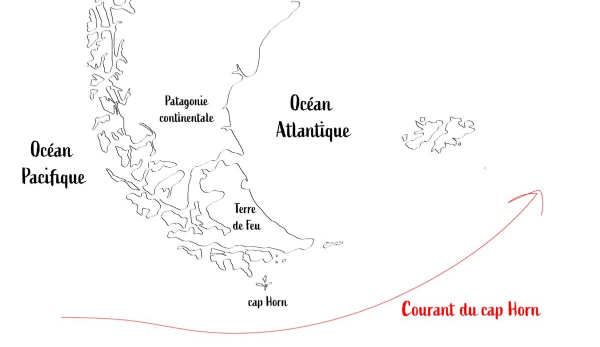
The Beagle Canal acts as an interoceanic corridor that facilitates the transport of surface waters from the Pacific to the Atlantic, a flow mainly driven by the difference in sea level between the two oceans and the influence of strong westerly winds within the Antarctic Circumpolar Current.
The Cape Horn current is the primary source of water entering the channel, bringing subantarctic water (SAAW) at depths greater than 100 meters along the edge of the Patagonian Pacific shelf. This water enters via a submarine canyon at the western mouth of the channel, characterized by temperatures of 8–9°C, salinity above 33, and relatively low oxygen concentrations.
Map illustrating the Cape Horn current (c) Karukinka
Waters that tell the story of the climate
Freshwater input from the Darwin Cordillera icefield generates a two-layer system, with a pronounced pycnocline separating vertical phytoplankton fluorescence. This estuarine water is cold (4–6°C), nutrient-poor, and highly oxygenated.
Time series analyses reveal that the annual cycle explains 75–89% of ocean temperature variability, while the atmospheric cycle explains 53% of its variability.
These data allow us to understand how the channel reacts to climate change, emphasize oceanographers monitoring these waters.
A sanctuary for marine biodiversity
The realm of marine mammals
The channel hosts an exceptional diversity of marine mammals, internationally recognized as an important marine mammal area (IMMA), covering 26,572 km² from the channel to Cape Horn. This area is home to at least eleven primary marine mammal species, plus eight supporting species.
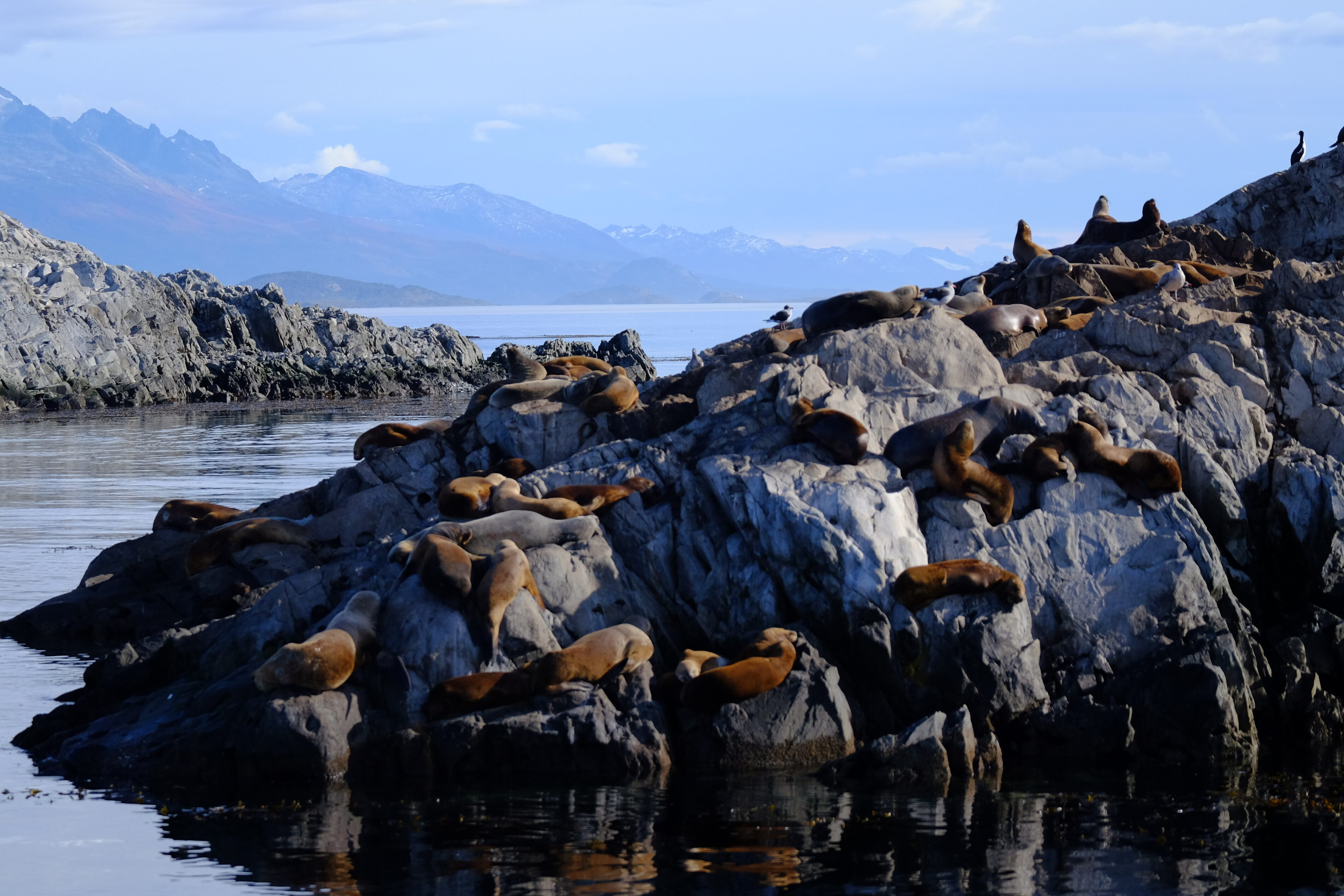
Among the year-round resident species are three small cetaceans: the Peale’s dolphin (Lagenorhynchus australis), the dusky dolphin (L. obscurus), and the Burmeister’s porpoise (Phocoena spinipinnis), along with two pinnipeds: the South American sea lion (Otaria byronia) and the South American fur seal (Arctocephalus australis).
Colony of South American fur seals in the Beagle Channel, near Ushuaia Bay, photographed in April 2025 during a sailing expedition
We have had the chance to observe these Peale’s dolphins during our voyages across Patagonia’s channels, from the channel’s eastern mouth to Cook Bay at its southwestern end. Their close association with kelp forests is fascinating: they undertake 40.5% of their feeding and 14.3% of their hunting behaviors there.
The underwater kelp forests
The underwater forests of Macrocystis pyrifera, locally known as “cachiyuyos,” are among the channel’s most important ecosystems, extending from the Valdés Peninsula to Tierra del Fuego. These forests provide a critical habitat, acting as nursery grounds, refuges, and feeding areas for an exceptionally diverse range of marine species.
Doctoral research by Adriana Milena Cruz Jiménez revealed the complexity of fish assemblages associated with these forests, examining various strata: the lower area at the holdfast and the mid-water area at the fronds.
The ichthyological diversity found in these kelp forests highlights their vital role in marine biodiversity, explains this specialist.
A delicate balance under threat
The pattern of nutrient distribution in the Beagle Channel varies distinctly among its water masses. The system is notably nitrate-limited, with an N:P ratio of 8.42, consistent across all water masses. This directly influences the channel’s primary productivity.
Phytoplankton biomass is generally moderate and limited to the upper pycnocline in the western sector, while mixing over sills disrupts stratification, pushing phytoplankton cells beneath the photic zone, which can limit primary production.
Local scientists insist that understanding these mechanisms is crucial to preserving the unique balance of this ecosystem.
The Yagan cultural heritage: the Onashaga (Beagle) Channel
Seven millennia of navigation
The name Onashaga means “channel of the Ona hunters” in the Yagan language and reflects the profound connection between this maritime people and these waters for around 7,000 years. The Yagan developed a nomadic culture based entirely on exploiting marine resources and constant navigation of the Fuegian archipelago, adapting to an environment Europeans found utterly inhospitable.
When we sail these waters, we still feel the presence of those ancient navigators, as our crew members testify. Their traditional territory extended from the southern coast of the main Tierra del Fuego island (Onaisin) to the Cape Horn archipelago, including the Onashaga. This toponym is one of the many native place names erased from official maps by colonization, which we must now reclaim to restore meaning rooted in the land’s first inhabitants.
The channel as an archaeological witness
Archaeological evidence along the Beagle Channel reveals human occupation stretching back millennia, with shell middens, lithic tool workshops, fish traps, and ancient campsites.
Notable archaeological sites include evidence of ancient Yagan settlement at places like Wulaia Bay on Navarino Island, indicating occupation over 7,000 years ago.
The legacy of great explorations
In the footsteps of Darwin and FitzRoy
The channel is named after HMS Beagle, the British ship that conducted the first hydrographic survey of southern South America’s coasts from 1826 to 1830. The European discovery of the channel occurred in April 1830, when the Beagle was anchored in Orange Bay (southeast Hoste Island).
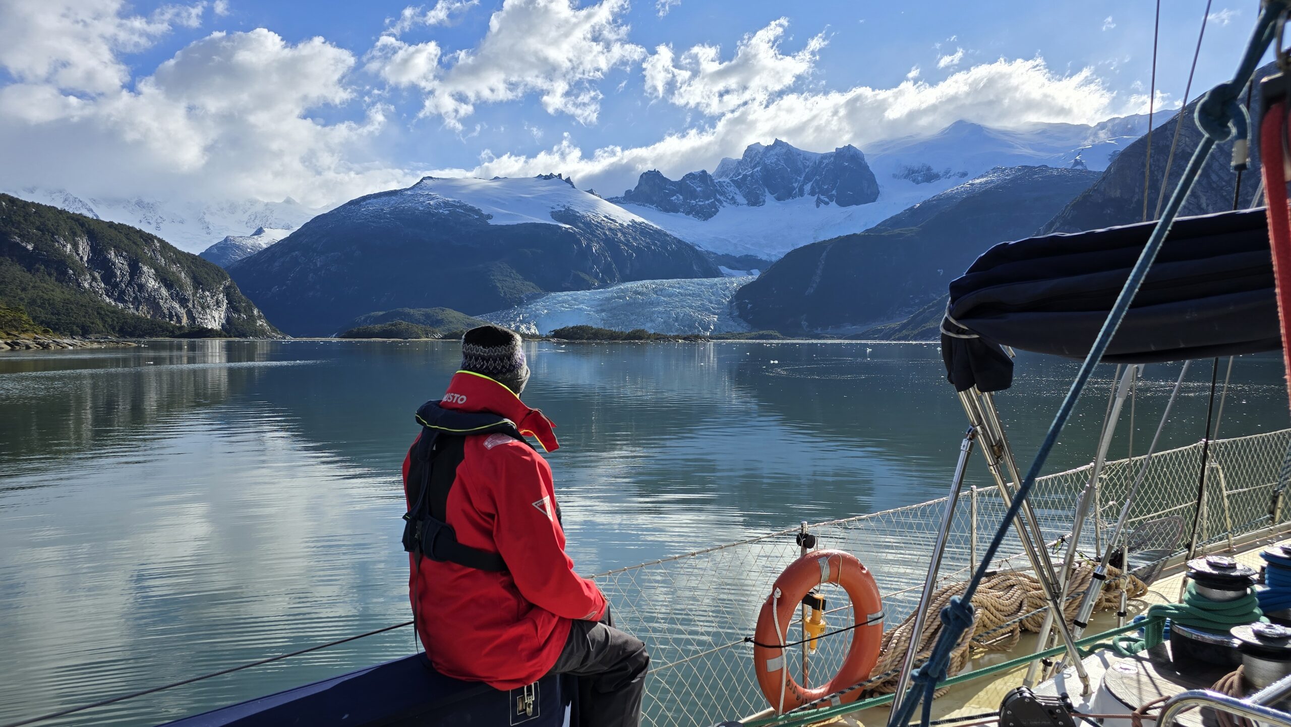
During the second expedition (1831–1836), FitzRoy brought along Charles Darwin as a self-financed naturalist. Darwin saw his first glaciers there in January 1833, writing in his journal: “It is almost impossible to imagine anything more beautiful than the beryl-blue of these glaciers, especially contrasted with the dead white of the upper snow stretches.”
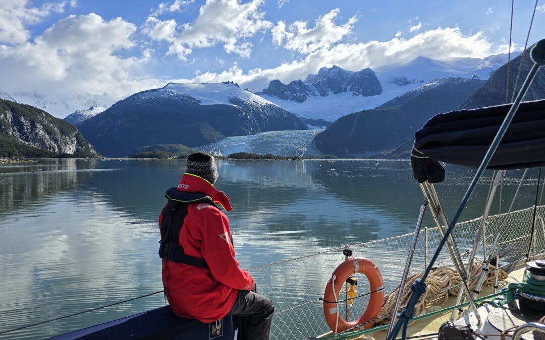
And to travel there regularly... it is always a wonder! Patagonia sailing expedition, February 2025 (Karukinka)
Darwin’s meticulous observations of the region’s geology, fauna, and indigenous populations provided key evidence for his understanding of adaptation and geographic species distribution.
The channel thus became one of the seminal natural laboratories in the history of natural sciences.
From mapping to geopolitical conflict
The hydrographic surveys by Captain FitzRoy and crew laid the groundwork for modern navigation in the region, followed by those from the Cape Horn Scientific Mission. However, this mapping precision also revealed the strategic importance of the channel, which would become a historic source of geopolitical tensions between Chile and Argentina.
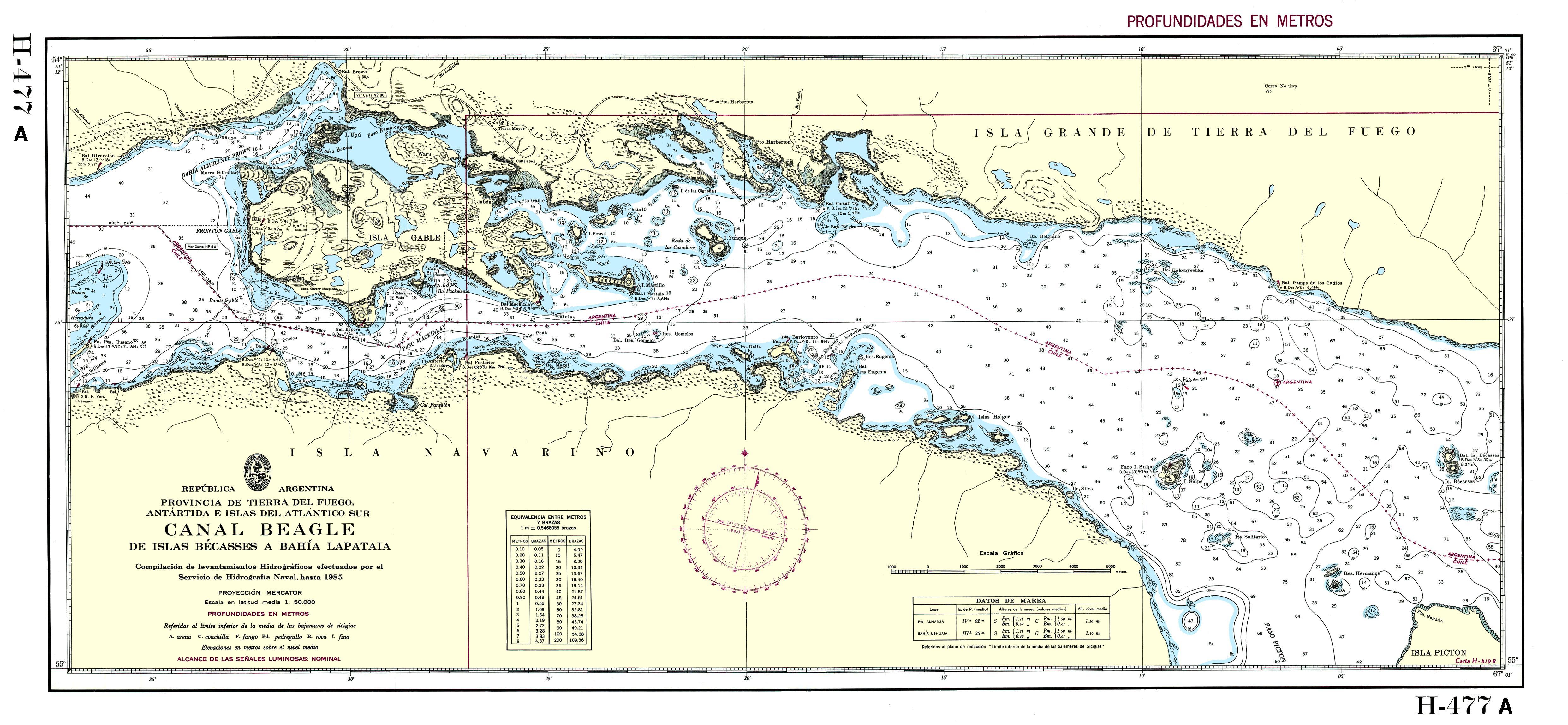
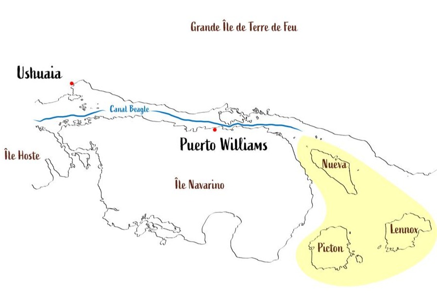
The Beagle conflict of 1978 brought the nations to the brink of war over three small islands—Picton, Lennox, and Nueva—whose sovereignty would determine control over vast maritime territories. The dispute was resolved by papal mediation, with Pope John Paul II playing a crucial role, leading to the treaty of peace and friendship of 1984.
In yellow, the islands involved in the Beagle Conflict of 1978
Modern science in the service of knowledge
A monitored natural laboratory
Today, the channel is one of the best-studied subantarctic marine systems, serving as a comprehensive regional sentinel of global change. Since October 2016, Chile’s Austral University’s Centro IDEAL has conducted annual hydrographic transects from the western end to Yendegaia Bay.
A major milestone was achieved in July–August 2017 with the first complete, high-resolution oceanographic survey along the entire channel, carried out through cooperation between Centro IDEAL and an Argentine expedition on the research vessel Bernardo Houssay. This international collaboration generated, for the first time, a complete hydrographic section of the channel, say the researchers involved.
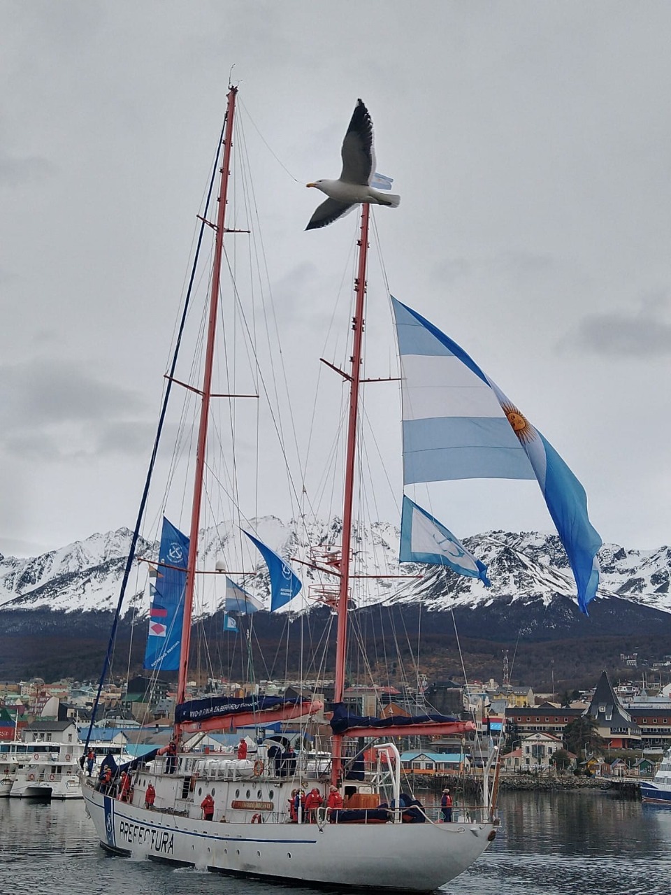
The sailing vessel Bernardo Houssay, of the Argentine Naval Prefecture, upon its arrival at the port of Ushuaia in 2021 (source)
Unique scientific challenges
Research in the Beagle Channel faces unique challenges due to its remote location, complex geomorphology, and shared jurisdiction between Chile and Argentina, historically limiting coordinated research. Future needs include studies on processes within each semi-enclosed basin and implementation of coupled atmosphere-ocean-glacier models to determine residence times.
Such research is crucial to understanding how this ecosystem will respond to future climate change.
Threats and conservation issues
The challenges of climate change
This channel faces unprecedented threats from climate change: rising temperatures, shifting precipitation patterns, and ocean acidification, all threatening the ecosystem’s delicate balance. Glacier retreat has accelerated dramatically in recent decades, altering freshwater contributions and potentially affecting marine productivity.
Changes have already been observed during our expeditions: the retreat of glaciers between 2018 and 2025 left a lasting impression. Scientists closely monitor these changes, using the region as a natural laboratory to understand wider impacts of climate change.
The salmon farming controversy
The expansion of the salmon farming industry into the region has been categorically rejected by organizations grouped within the Forum for the Conservation of the Patagonian Sea, which express concern over potentially catastrophic and irreversible damage to one of the region’s most precious marine ecosystems.
We strongly support this position: the channel’s pristine waters are home to one of the world’s greatest biodiversity reserves, with great heterogeneity in coastal-marine habitats containing numerous understudied marine invertebrates and vertebrates. Introduction of non-native species such as salmon is considered “terrible and risky” for this ecosystem by leading researchers. Fish-farm salmon escapes upstream have led to “wild salmon” appearing in the Cape Horn Biosphere Reserve, now threatening endemic species such as robalo.
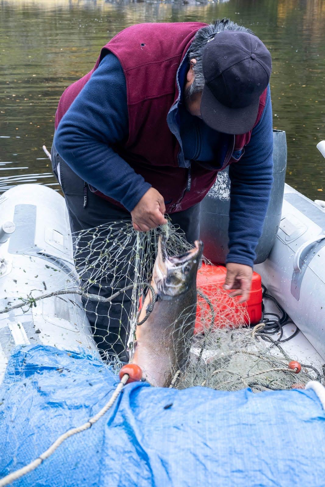
An example of a salmon caught by José near the northern arm of the Beagle Channel during one of our sailing expeditions in 2025 (photo Christine Stein, Karukinka Association
A challenge of international and multicultural preservation and cooperation
Since 2005, in order to preserve this natural marvel, most islands south of the Beagle are part of the Cape Horn Biosphere Reserve, managed by UNESCO, CONAF, and the Chilean Navy. This designation acknowledges the ecosystem's outstanding importance and establishes long-term conservation frameworks.
We believe that preserving Yagan culture and integrating their ancestral knowledge is essential to understanding and protecting this unique ecosystem. Including Yagan traditional ecological knowledge in contemporary environmental management represents an opportunity to develop innovative approaches to conservation. Knowledge of navigation, climate observation, marine resources, and seasonal cycles forms a scientific heritage of great value, complementing modern research methodologies.
Bibliography
Scientific sources
Ferreyra, G. & González, H. “General hydrography of the Beagle Channel, a subantarctic interoceanic passage at the southern tip of South America.” Frontiers in Marine Science, September 30, 2021.
Marine Mammal Protected Areas Task Force. “Beagle Channel to Cape Horn IMMA – Marine Mammal Protected Areas Task Force.” Marine Mammal Habitat, March 18, 2024.
Lodolo, E., Menichetti, M. & Tassone, A. “Shallow architecture of Fuegian Andes lineaments based on marine geophysical data.” Andean Geology, vol. 45, no. 1, 2018.
Institutional publications
Yaghan’s, explorers and settlers.Museo Yaganusi, Government of Chile. PDF document, 2021.
Canal Beagle sin salmoneras.Mar Patagónico, regional declaration, 2024.
The Beagle Channel free from salmon farming.Mar Patagónico, regional statement, 2024.
Phytoplankton biodiversity and water quality in the Beagle Channel, Argentina, 2017–2021.Government of Argentina, PDF document.
Articles
El Rompehielos. “The importance of marine biodiversity in the Beagle Channel.” January 29, 2020.
Radio del Mar. “Beagle Channel is a key research ecosystem for marine biology.” May 22, 2023.
Centro IDEAL. “Scientists unravel the structure of the Beagle Channel.” November 11, 2021.
Audiovisual docs
“Discovery of the Beagle Channel.”YouTube, June 20, 2021.
“The importance of marine biodiversity in the Beagle Channel.”YouTube, January 29, 2020.
Conservation organizations
Rewilding Chile. “Beagle Channel: exploring the end of the world.” September 3, 2023.
Rewilding Chile. “Canal Beagle: explorando el confín del mundo.” September 3, 2023.
The Cabo de Hornos Biosphere Reserve (Cape Horn Nature Reserve), established in 2005, is one of the southernmost and largest protected areas in the world, covering more than 4,884,000 hectares of southern lands and waters. It contains unique terrestrial and marine ecosystems, pristine subantarctic forests, remarkable biodiversity—including over 5% of the world’s bryophyte diversity—and the populations of the Yaghan people, who maintain a millennia-old connection with these extreme landscapes.
Table des matières
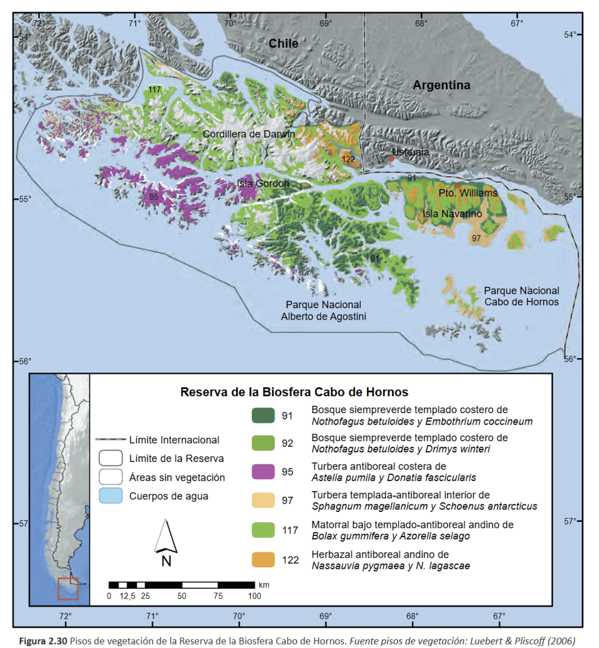
The Cabo de Hornos Biosphere Reserve was included in UNESCO’s “Man and the Biosphere” program in June 2005, becoming both the southernmost and one of the largest biosphere reserves in South America. Spanning about 4,884,274 hectares, it comprises a terrestrial area of 1,917,238 ha and a marine area of 2,967,036 ha, integrating for the first time in Chile both marine and terrestrial ecosystems under a unified conservation status. The Alberto de Agostini and Cape Horn National Parks form the core protected area, where all infrastructure development is strictly prohibited.
1. Geography and zoning of the Cape Horn nature reserve
Geographically, the reserve extends across the Tierra del Fuego archipelago, between 54.1° S and 56.2° S latitude, and 66.1° W and 72.5° W longitude. It includes the Wollaston, Hermite, Navarino, and Hoste islands, as well as channels (including the Beagle Channel), fjords, and currents that form a landscape shaped by glaciations and tectonic activity. The UNESCO MAB Reserve zoning (Cabo de Hornos Biosphere Reserve, i.e., the southern Chilean marine reserve) is structured into three areas:
The core zone (Alberto de Agostini National Park including the Darwin Range, and Cape Horn National Park) is strictly protected.
The buffer zone, where light and sustainable activities are allowed.
The transition zone, including isolated villages like Puerto Williams and limited infrastructure under a sustainable development framework.
The reserve’s subantarctic forests are the southernmost on earth. Dominated by three Nothofagus species—N. pumilio, N. betuloides, and N. antarctica—they form both deciduous and evergreen stands, interspersed with peat bogs and alpine heaths. These forests are among the world’s rare examples of non-fragmented temperate forest. The organic-rich soils support vast carpets of bryophytes, typical of the cool, humid environment; these play a crucial role in the hydrological cycle and carbon sequestration.
2.2 Marine and coastal ecosystems
The marine component of the reserve centers around a complex network of fjords, channels, and underwater plateaus. The Humboldt current and the mixing of cold Pacific and Atlantic waters have fostered the development of kelp forests (Macrocystis pyrifera, Durvillaea antarctica) forming “underwater forests” that host diverse invertebrate fauna and fish communities. Intertidal habitats harbor macroalgae species and numerous endemic invertebrates, while the cold, oxygen-rich waters support populations of seals, sea lions, and several cetacean species.
3. Biological diversity and endemism: subantarctic biodiversity
3.1 Bryophytes and lichens
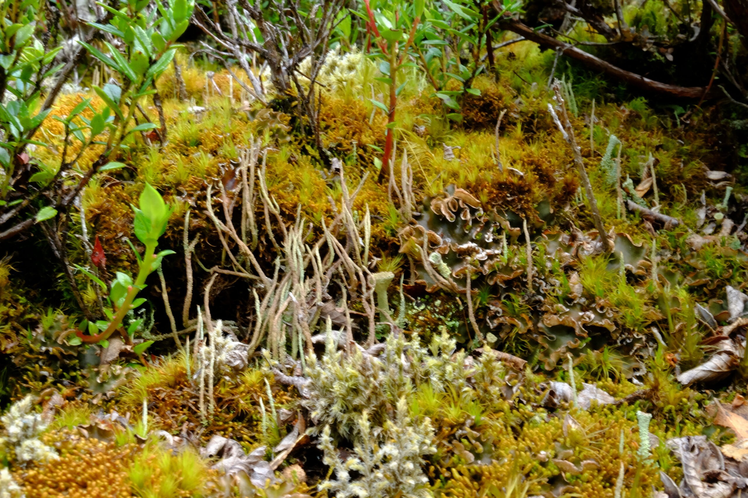
With over 300 species of liverworts and 450 species of mosses, the reserve is a global hotspot for bryophytes, representing more than 5% of global diversity on less than 0.01% of the world’s land surface. These communities, described as “miniature forests,” serve as sentinels for assessing the impacts of climate change and rising UV radiation.
Example of bryophytes / miniature forest (mosses, liverworts, and lichens) from the Cape Horn Biosphere Reserve (MAB-UNESCO); Navarino Island, 2020 (c) Lauriane Lemasson.
3.2 Terrestrial and marine fauna
Terrestrial fauna include the southern river otter (Lontra provocax), the Magellanic woodpecker (Campephilus magellanicus), and other endemic birds. In the marine environment, the surrounding waters are home to black-browed albatross, giant petrels, Magellanic penguins, and stable populations of fur seals and leopard seals, highlighting the ecological importance of this protected area.
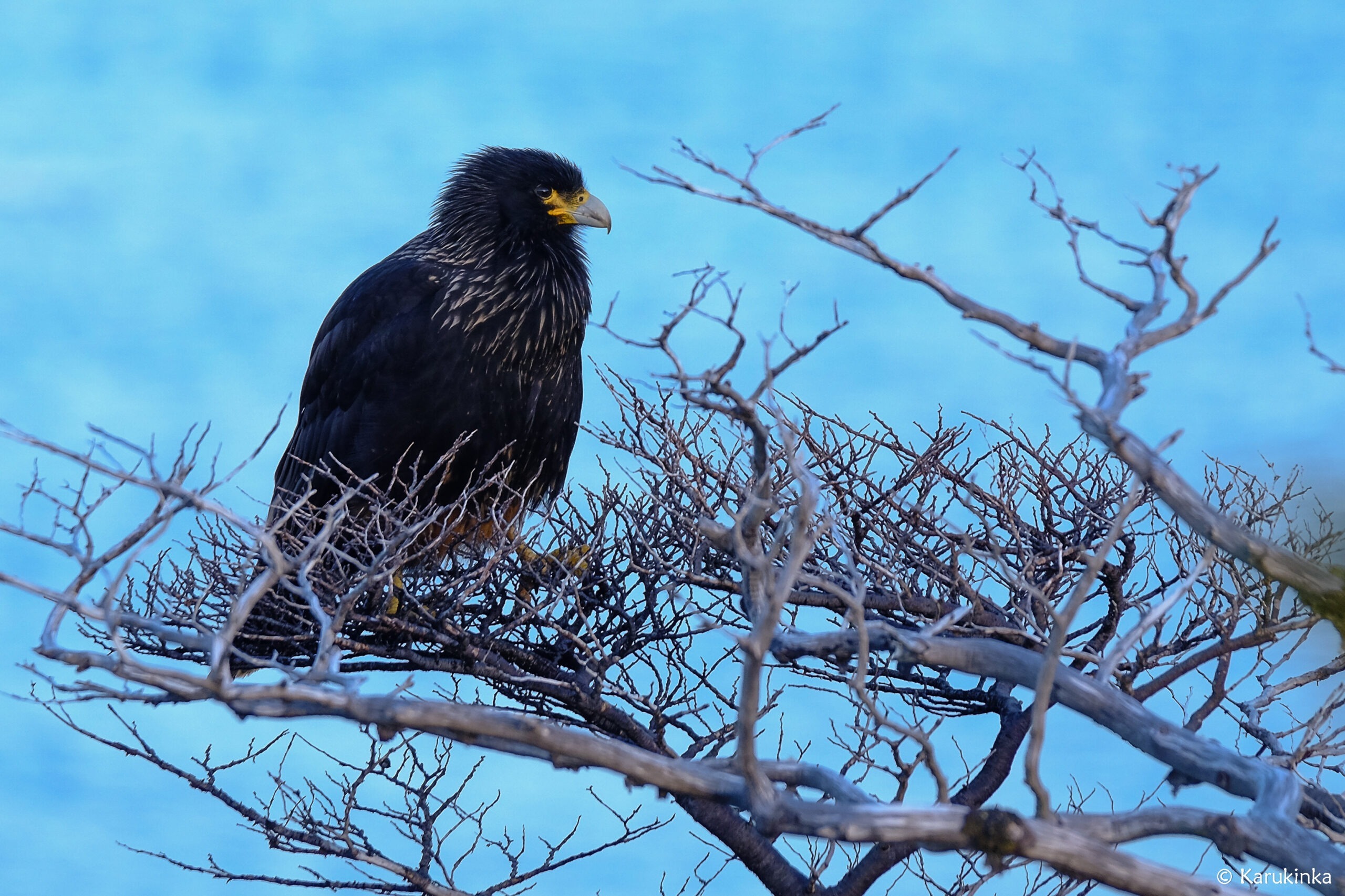
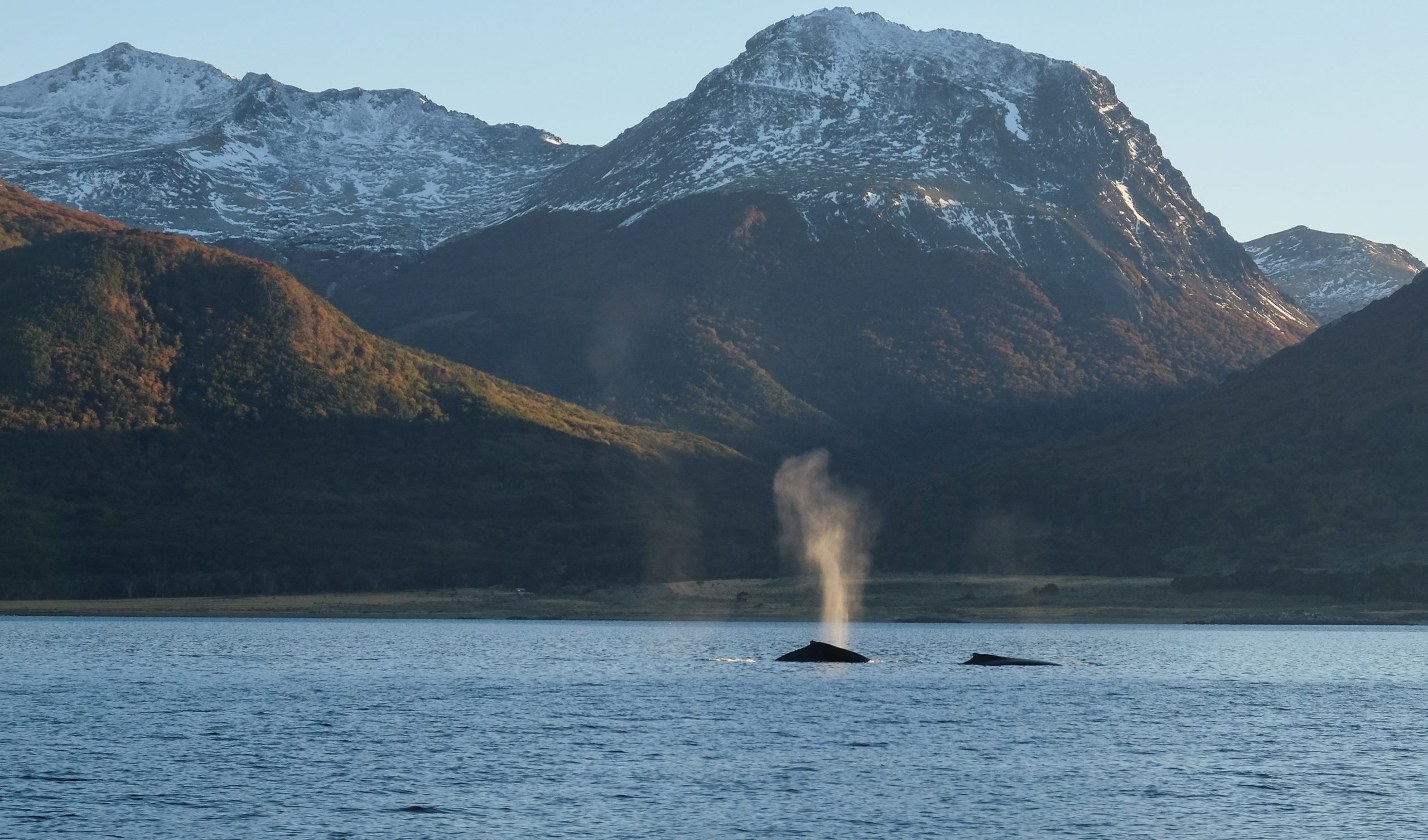
A black Carancho from Martial Bay (Cape Horn Reserve, April 10, 2025, during a sailing expedition at Cape Horn and in the Patagonian channels)Whales in the Beagle Channel during the 2018 expedition (Karukinka Association)
4. Biocultural dimension and Yaghan ethnology
The reserve is also a cultural sanctuary. The Yaghan, nomadic people of the southern channels, are the world’s southernmost indigenous group, with a presence dating back over 7,500 years, as evidenced by archaeological sites on Navarino Island. They continue to possess expert knowledge of canoe navigation and subantarctic ecology, and have actively participated in research within the reserve, particularly through the Omora Ethnobotanical Park near Puerto Williams. Their oral traditions, language, and knowledge of local flora and fauna are incorporated into educational and conservation programs. Ecotourism in Patagonia is also a key activity of the Omora initiative.
5. Governance and management
The reserve is managed by a board chaired by the regional governor, involving public agencies and local organizations. The scientific committee, coordinated by the Omora Park and the University of Magallanes, leads research, ecological monitoring, and participatory conservation efforts. In 2006, the reserve joined UNESCO’s Ibero-MAB network, strengthening transnational cooperation for research and training.
6. Threats and conservation challenges
Despite its isolation, the reserve faces several threats:
Uncontrolled tourism development, particularly southern cruises and increased traffic around Cape Horn, poses risks of pollution and disturbance to marine wildlife.
Intensive salmon farming in northern fjords introduces exotic species and degrades water quality. Salmon now breed in these waters, impacting native species such as the robalo.
The spread of introduced species such as the North American beaver and mink threatens riparian forests, streamside habitats, and shorebird nesting sites.
Long-term monitoring programs, such as the Omora initiative and Long-Term Ecological Research (LTER) stations, assess these pressures and propose adaptive measures. However, monitoring is hampered by the vastness of the reserve and its logistical challenges.
Lake created at the foot of a glacier by beavers, photographed during a sailing expedition in Patagonia (Beagle Channel, Hoste Island, Cape Horn Biosphere Reserve, Chile).
7. Research and education initiatives
7.1 Omora Ethnobotanical Park
Founded in 2000, the Omora Ethnobotanical Park is at the center of a transdisciplinary approach combining ecology, environmental philosophy, and “field philosophy” education. It offers educational trails, including “miniature forests,” to raise public awareness of bryophyte diversity and the link between biodiversity and Yaghan culture.
7.2 Cape Horn International Center (CHIC)
Inaugurated in 2020 in Puerto Williams, CHIC brings together researchers, artists, and indigenous communities to develop a model for biocultural conservation, technical training, and sustainable development. Its programs address the responses of biodiversity to climate change, the management of invasive species, and the formulation of public policy adapted to subantarctic zones.
The Cabo de Hornos Biosphere Reserve remains one of the rare refuges where harmonious coexistence between local inhabitants and ecosystems at the literal edge of the world is fully realized. Securing its future means strengthening participatory governance, managing invasive species, and supervising polar tourism under the banner of responsible ecotourism. Finally, the ongoing integration of Yaghan knowledge in research and education programs will ensure the preservation of both the biological and cultural heritage of this unique subantarctic sanctuary.
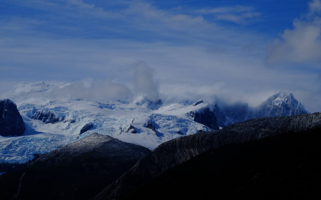
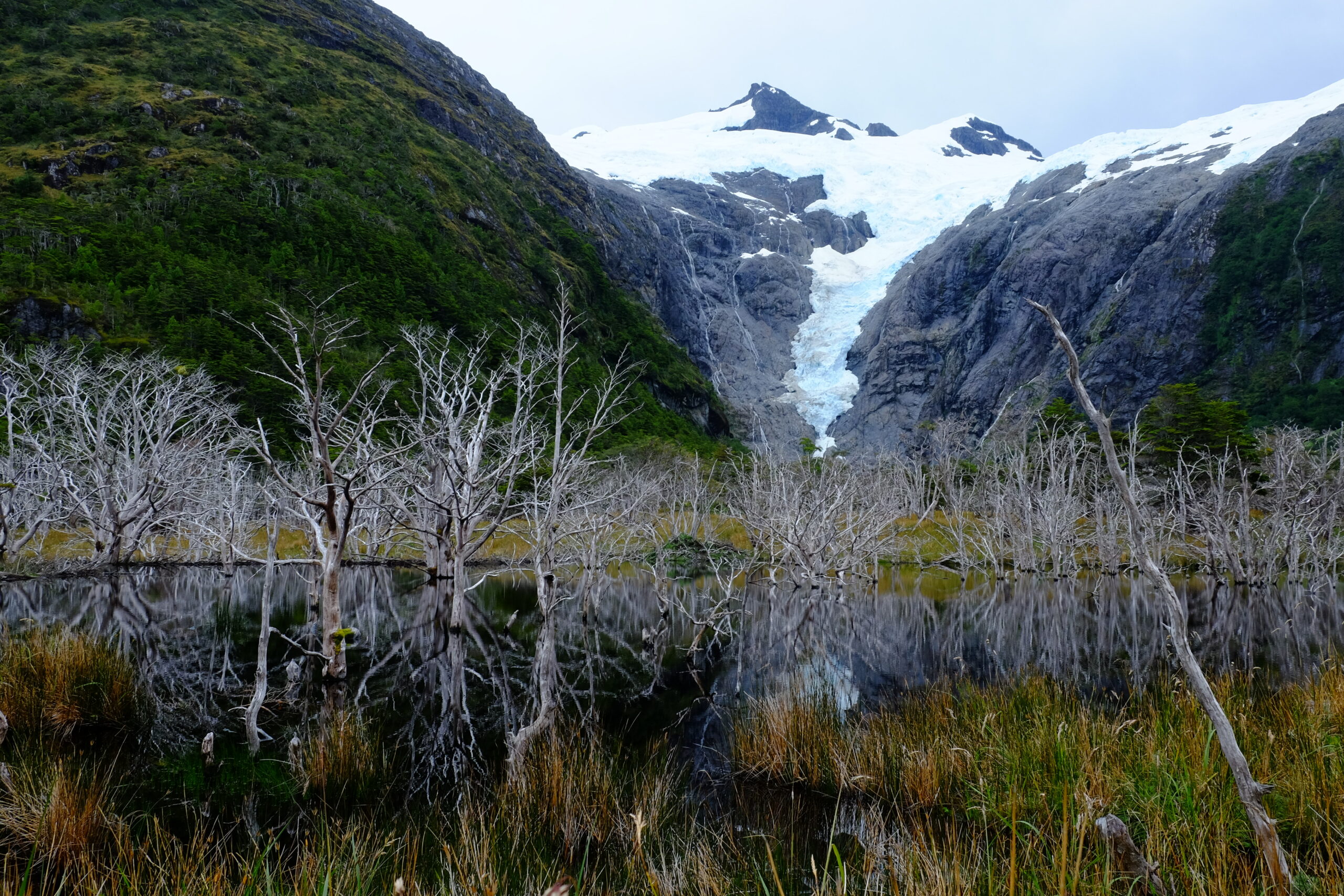
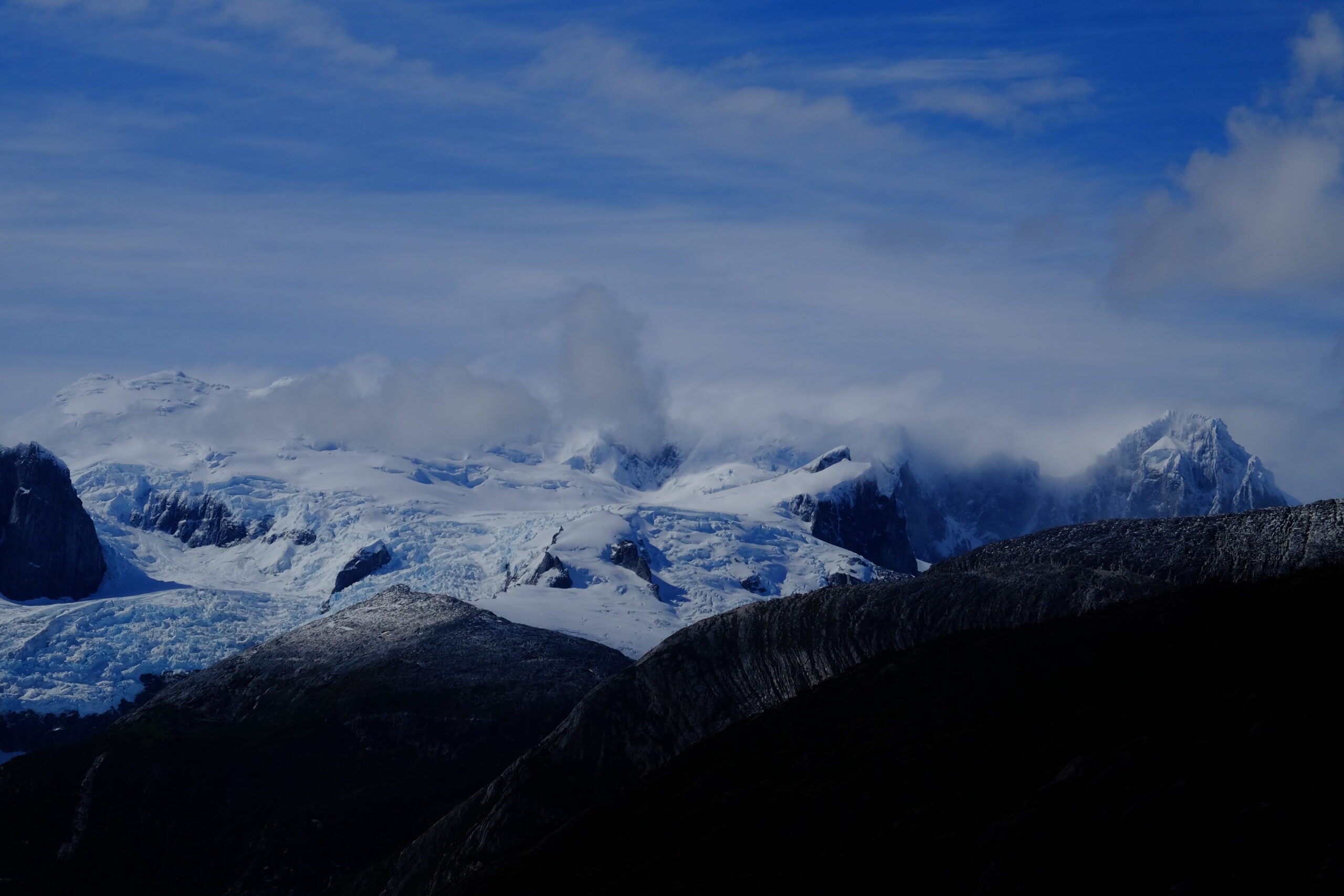
Pia Glacier, Patagonian Channels, Darwin Range, Cape Horn Biosphere Reserve, Magallanes, Chile, 2025
Bibliography
Rozzi, R. et al. (2006). Ten Principles for Biocultural Conservation at the Southern Tip of the Americas: The Cape Horn Biosphere Reserve. Ecology and Society, 11(1). https://www.ecologyandsociety.org/vol11/iss1/art43/
Rozzi, R. et al. (2004). Omora Ethnobotanical Park: A Model for Integrating Biocultural Conservation and Environmental Philosophy in the Cape Horn Biosphere Reserve. Environmental Ethics, 26(2), 131–169. https://doi.org/10.5840/enviroethics200426226
Mittermeier, R. A. et al. (2003). Hotspots: Earth’s Biologically Richest and Most Endangered Terrestrial Ecoregions. Conservation International. https://www.conservation.org
CONAF (Corporación Nacional Forestal). (2023). Reserva de la Biósfera Cabo de Hornos. Gobierno de Chile. https://www.chilebosque.cl
Cape Horn International Center (CHIC). (2021). CHIC Strategic Plan 2021–2026. Universidad de Magallanes. https://www.centrochic.cl
Anderson, C.B. et al. (2011). Exotic ecosystem engineers transform sub-Antarctic forest structure and function. Biological Invasions, 13, 545–561. https://doi.org/10.1007/s10530-010-9841-4
Anderson, C.B. et al. (2019). Cape Horn’s Lessons for Sustainability. Science Advances (UNESCO CHIC/UMAG). https://advances.sciencemag.org/
Rozzi, R. et al. (2010). La Reserva de Biósfera Cabo de Hornos: una propuesta educativa y de desarrollo sustentable en el extremo austral de Chile. Universidad de Magallanes. Disponible sur la bibliothèque CHIC.