Strait of Magellan : Legendary passage between the oceans

Karukinka
4 August 2025

Association Karukinka
Law 1901 - of General Interest
Latest news

Follow us
On 21 October 1520, five ships that had left Seville a year earlier entered an unknown channel. Thirty‑eight days later, they reached an ocean Europeans had never sailed before : the Strait of Magellan. Magellan named the passage Estrecho de Todos los Santos. Only after his death in the Philippines did Charles V give it the name it bears today.
The Selk’nam called it Hatitelen — or Atelili in other transcriptions. They lived on the southern shore of the strait for over ten thousand years. These names re‑emerge today through toponymic work carried out since 2017, drawing on nineteenth‑century French archives.
Table des matières
1. Geography
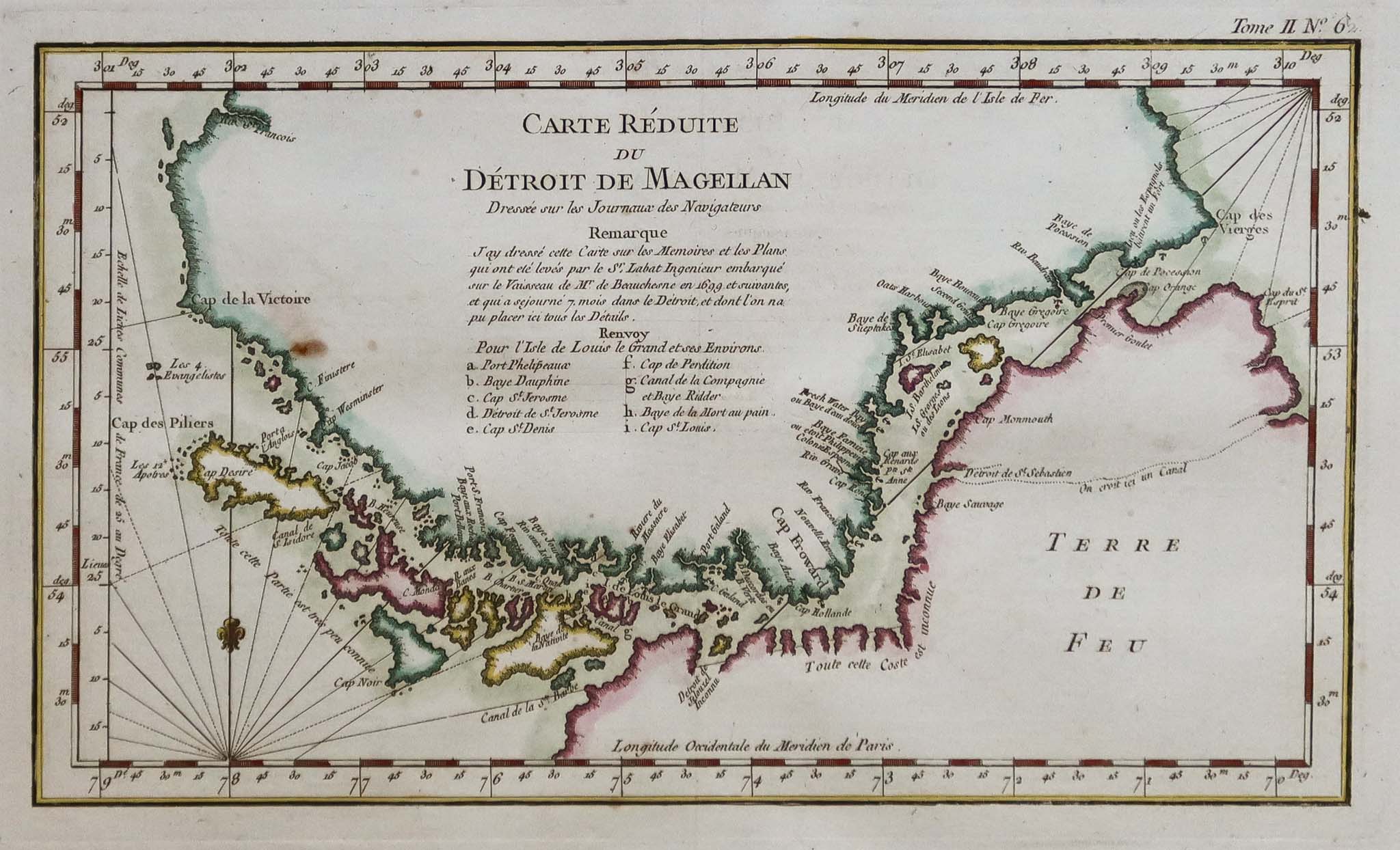
The strait links the Atlantic and Pacific Oceans over 570 kilometres, from Dungeness Point to the Evangelistas islets. Its width ranges from 2 kilometres at its narrowest constriction, near Carlos III Island, to 32 kilometres in its broadest sections. Depths vary from about 28 metres around Magdalena Island to more than 1,000 metres off Cooper Key.
This submarine relief is not random. Late Cretaceous fractures first opened corridors in the Earth’s crust. Pleistocene glaciers then deepened, widened and multiplied these channels. The result is the maze of fjords and passages that still defines Magellanic navigation today.
2. Navigation
Westerly winds dominate for much of the year. Williwaws — katabatic squalls that tumble down the slopes without warning, a Kawésqar word — can exceed 100 knots. Fog, heavy precipitation and visibility reduced to just a few cables make the strait a demanding passage.
Antonio Pigafetta, chronicler of Magellan’s voyage, notes “very safe harbours, excellent water, wood, fish”. His account opened two centuries of gradual hydrographic work.
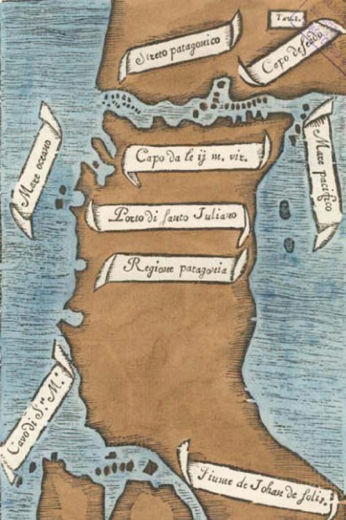
In 1698–1701, the expedition of Jacques Gouin de Beauchesne — commissioned by Louis XIV for the Royal South Sea Company and outfitted by Saint‑Malo shipowner Noël Danycan de L’Épine — produced the most accurate French document on Magellanic geography of its time. The manuscript was kept secret for years to protect French colonial ambitions in the region.
Since 1978, Chilean maritime authorities (DIRECTEMAR) have required all commercial vessels to embark a Chilean pilot at Bahía Posesión, at the eastern entrance.
The explorer initially named the passage "Estrecho de Todos los Santos" ("Strait of All Saints") in reference to the religious feast celebrated on the day of its discovery. It was only after his death in the Philippines that Charles V, King of Spain, renamed the strait in honor of its discoverer.
3. First inhabitants
Three peoples shared these shores long before 1520, each with a very different relationship to water and territory.
The Kawésqar had been travelling these channels in bark canoes for around 6,000 years, between the Gulf of Peñas and the strait. Fishing and hunting marine mammals, they moved in small family groups without permanent settlements. Kawésqar simply means “human being”. Chilean Law 19.253 has recognised them since 1993; the 2017 census records 3,448 people identifying as Kawésqar.
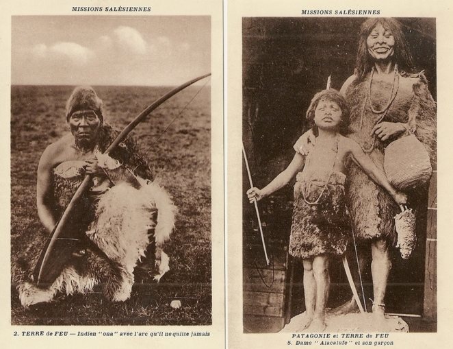
The Aónikenk, the southern branch of the Tehuelche, hunted on foot across the continental steppe between the Santa Cruz River and the strait. Pigafetta, struck by their height — a head taller than Europeans of the time — coined the term Patagón, borrowed from the giant Pathoagon in a chivalric romance. This is how Patagonia got its name.
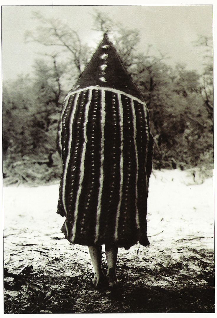
The Selk’nam reached the large island of Tierra del Fuego on foot, before the melting of the ice opened the strait. Their society, structured into lineages (haruwen) and seven exogamous “skies”, created one of the most complex initiation ceremonies in the Southern Hemisphere: the Hain. The shamans (xo’on) entered trance through song to communicate with the powers of the skies.
From the 1870s onwards, the arrival of sheep ranches triggered systematic extermination. Bounties were paid for the ears of Indigenous people killed. In 1896, ethnologist Martin Gusinde estimated the Selk’nam population at more than 3,000. By 1919, it had fallen to 279. Groups were captured and exhibited in European human zoos between 1878 and 1900.
Argentina officially recognized the Selknam in 1994, while Chile did so in 2023 through Law 21,606. The 2010 Argentinian census records 2,761 people identifying as Selknam, with over 294 living in Tierra del Fuego. In Chile, 1,144 people declared themselves Selknam in the 2017 census. The Kawésqar are recognized by Chilean Indigenous Law 19,253 (since 1993) and are organized into 14 Indigenous Communities. According to the 2017 Chilean census, 3,448 people declare themselves Kawésqar.
4. Biodiversity
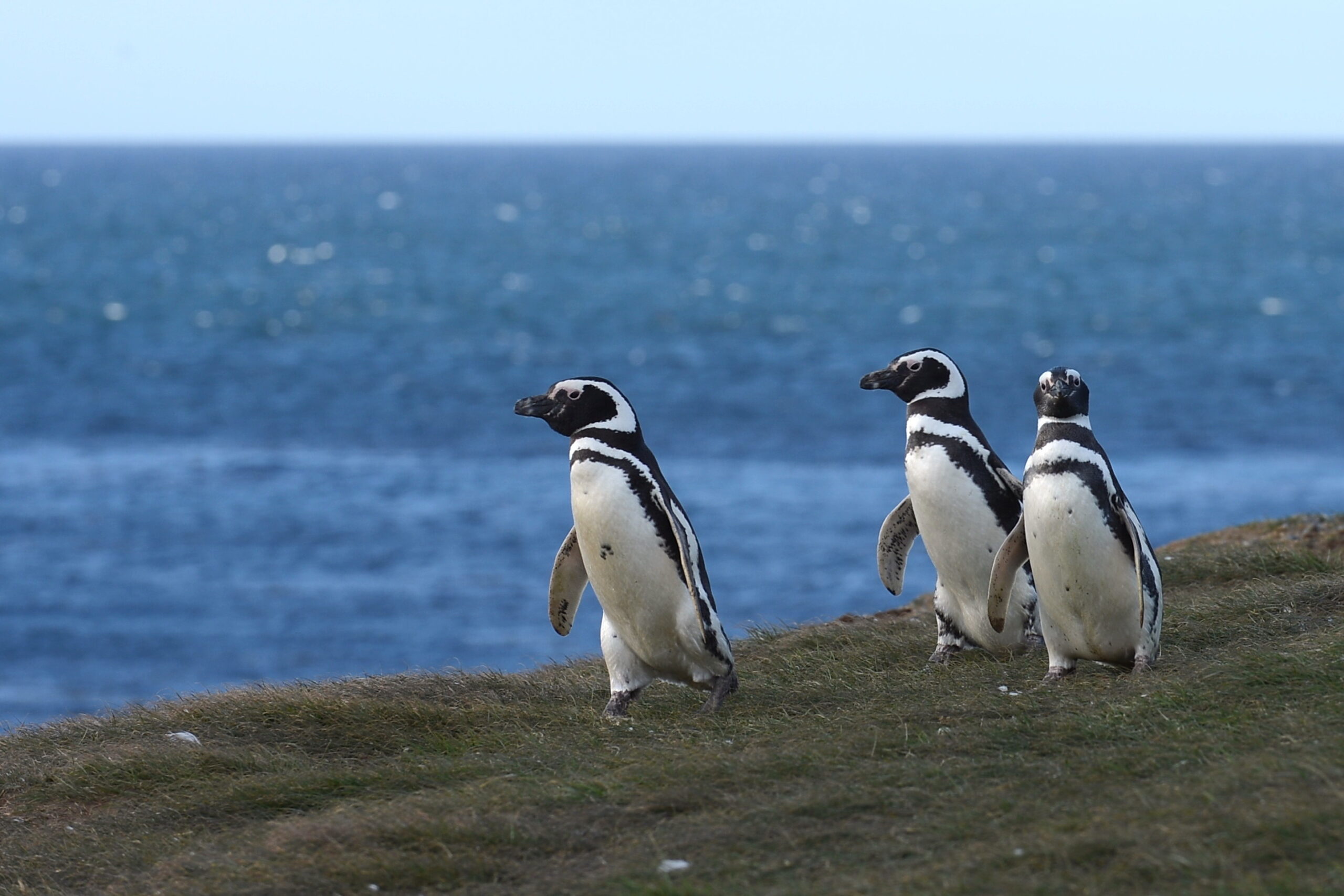
Some 32 kilometres north‑east of Punta Arenas, Magdalena Island is home to around 50,000 breeding pairs of Magellanic penguins (Spheniscus magellanicus). These birds — seen by Magellan himself in 1520, who mistook them for geese — can reach 76 centimetres in height.
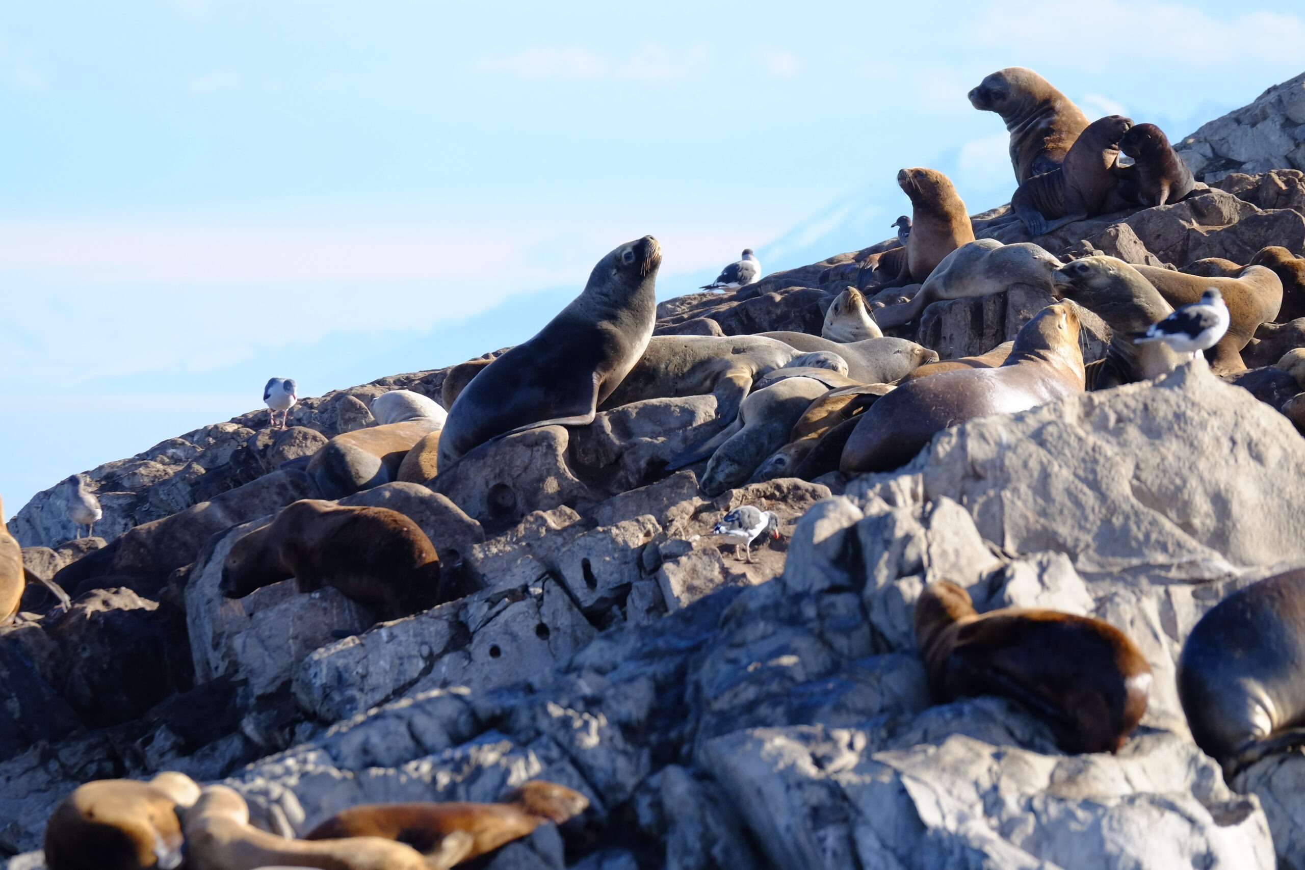
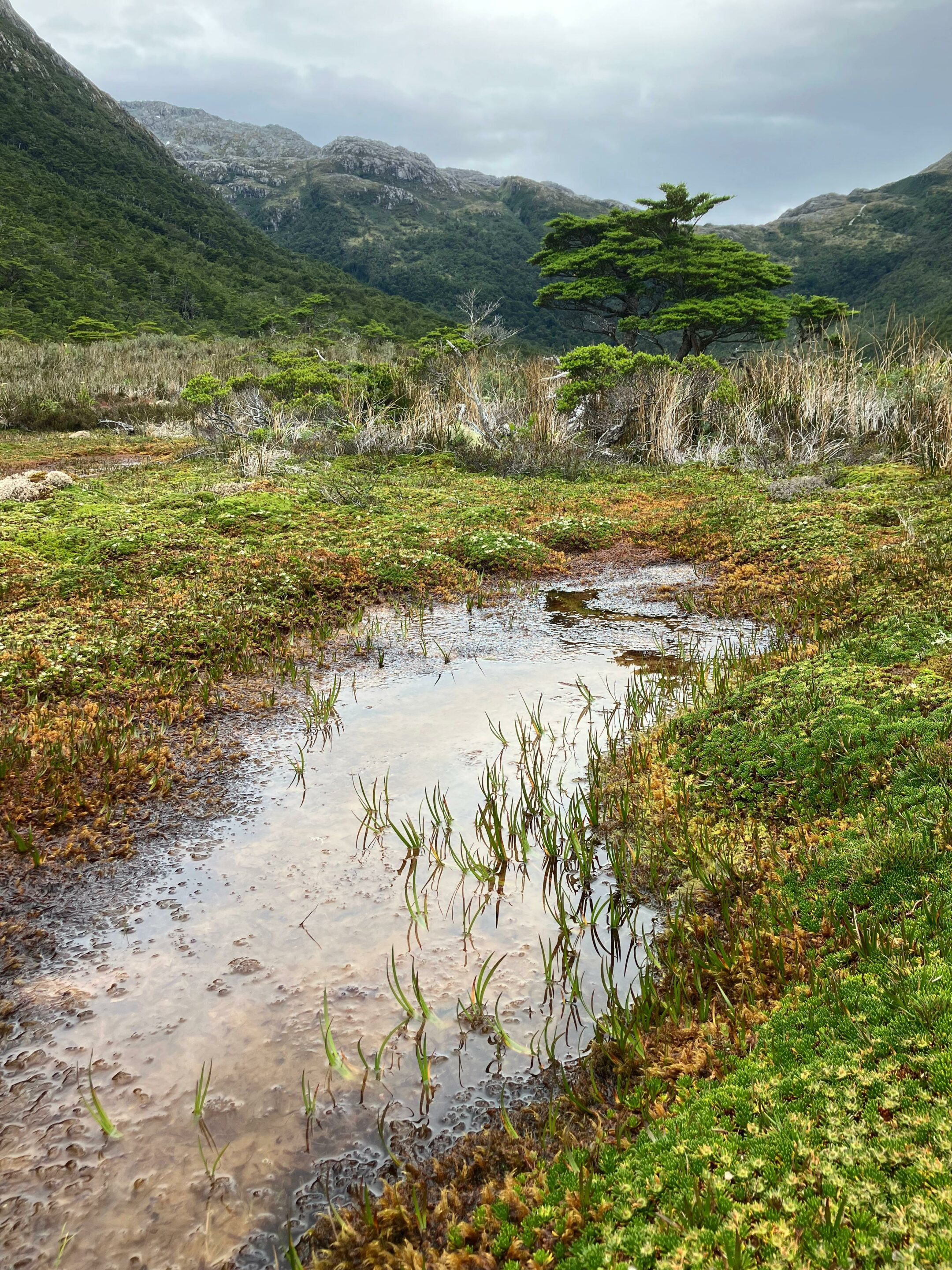
Further west, Francisco Coloane Marine Park, Chile’s first marine park, protects waters where humpback whales regularly winter. South American sea lions and southern elephant seals haul out on rocky islands. Imperial cormorants, black‑browed albatrosses, giant petrels and Andean condors patrol both shores.
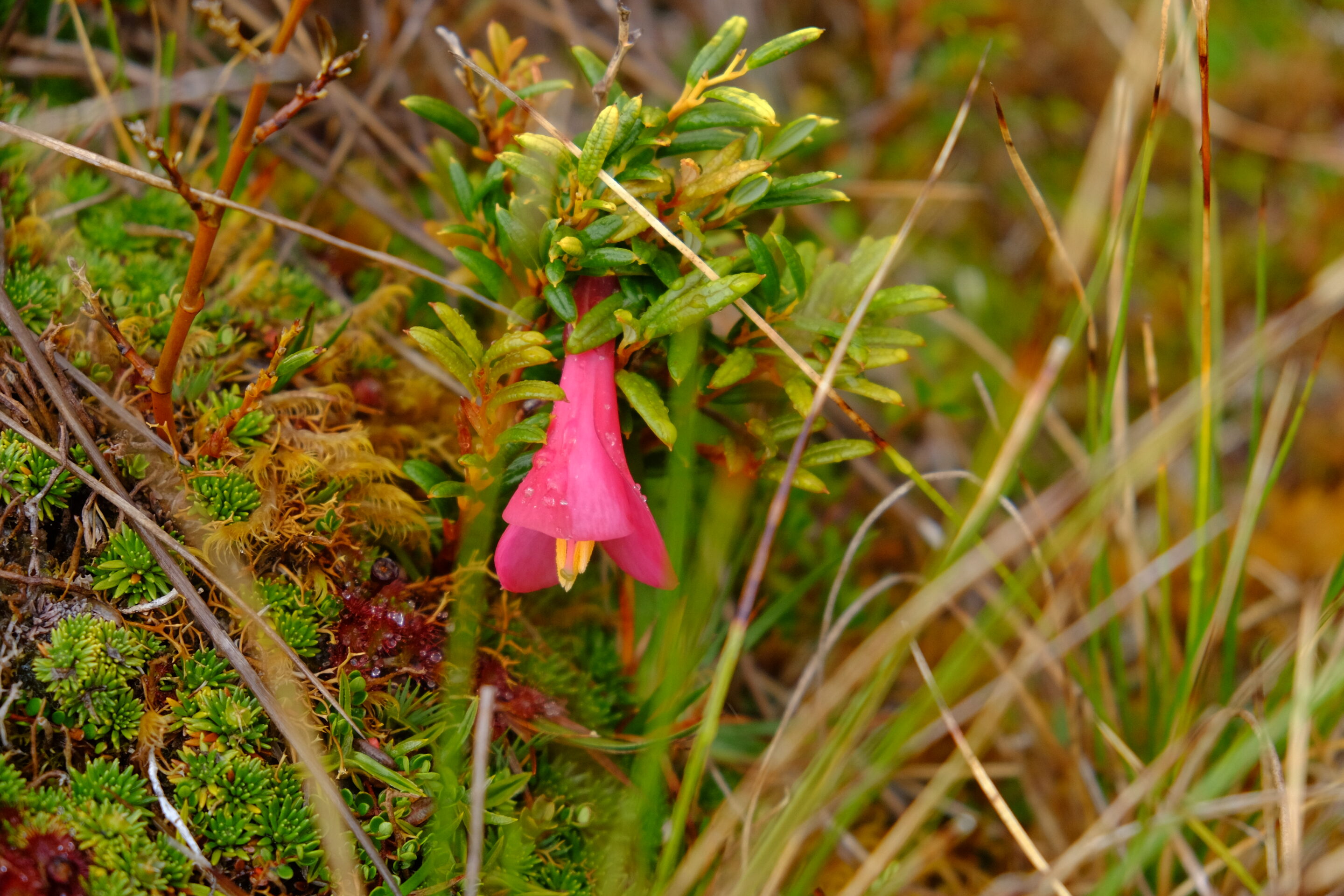
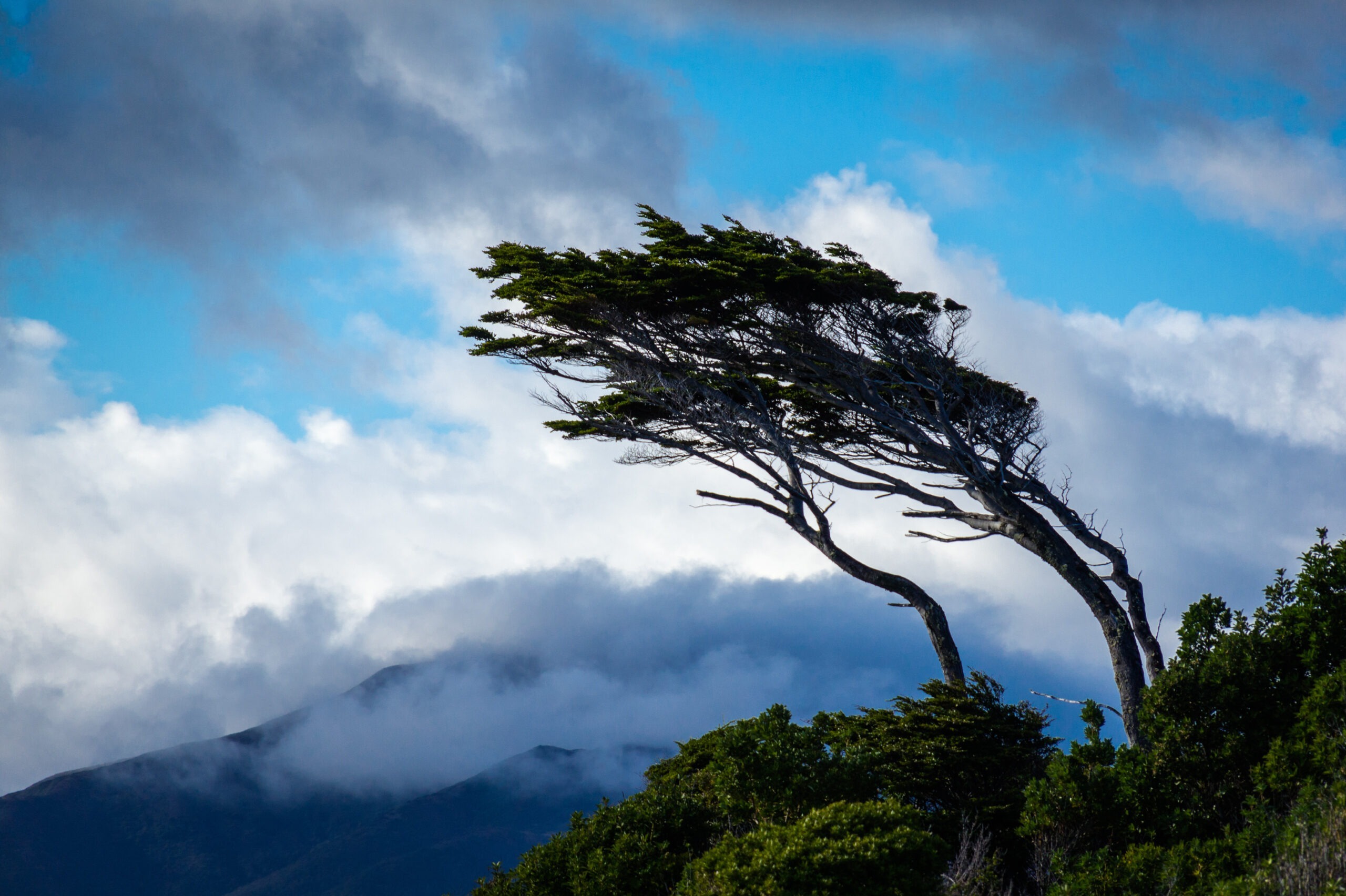
On land, sheltered slopes carry forests of Nothofagus — Magellanic coigüe, lenga and ñirre — sculpted by the wind into leaning silhouettes where they are most exposed. Between the trees, thick bryophyte carpets close the canopy at ground level. These ecosystems connect directly with those of the Cape Horn Biosphere Reserve to the south.
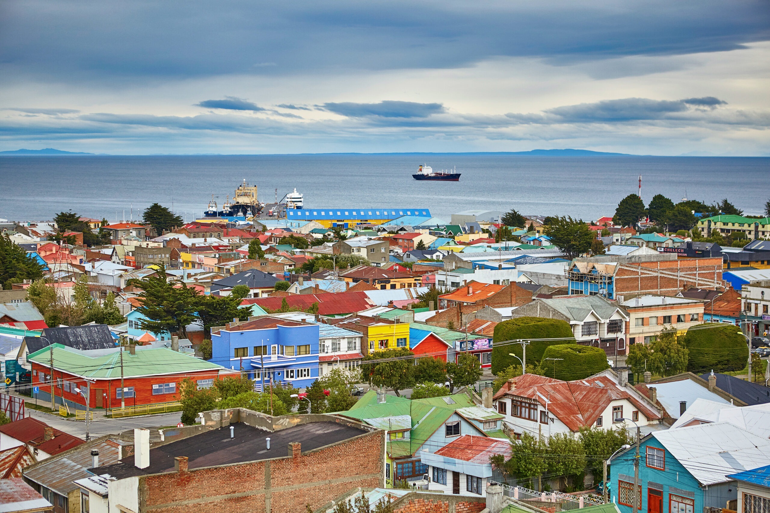
5. The strait today
The opening of the Panama Canal in 1914 gradually diverted commercial traffic away from the strait. Since 2023, the trend has reversed. Prolonged drought limiting the canal’s capacity, geopolitical tensions and the canal’s unsuitability for ultra‑large vessels have revived the Magellanic route. The Chilean Navy reported a 25% increase in traffic in 2024, with projections of up to 70% growth over the full year. The route through the strait is 390 nautical miles longer, but accessible to any draught and free of locks.
At the same time, the Magallanes region is developing a green hydrogen project based on the strait’s exceptional wind potential. Constant winds could theoretically generate seven times Chile’s current electrical capacity. The project remains controversial in its details, but it says something important about what this passage represents today: a strategic corridor once again, five centuries after Magellan
This specialization strengthens the region as a hub for international polar tourism, with infrastructure meeting International Association of Antarctic Tour Operators (IAATO) standards.
Bibliography
Pigafetta, A. (1522). Relazione del primo viaggio intorno al mondo. Critical edition: Dentrecasteaux, 1830.
Gouin de Beauchesne, J. (1701). Relation journalière d’un voyage fait en 1698, 1699, 1700 et 1701. Manuscript. Service Historique de la Défense, Vincennes.
Gusinde, M. (1931–1939). Die Feuerland-Indianer. 3 vols. Mödling bei Wien: Anthropos-Bibliothek.
Museo Chileno de Arte Precolombino. (2021). Cuaderno educativo — Pueblos originarios de Magallanes. Santiago: Museo Chileno de Arte Precolombino.
DIRECTEMAR. (2025). Generalidades del Estrecho de Magallanes. Dirección General del Territorio Marítimo y de Marina Mercante, Chile.
Armada de Chile. (2024). Maritime Traffic Statistics — Estrecho de Magallanes.
Karukinka. (2017–2026). Reconstructing Indigenous Cartographies — Yagan, Selk’nam and Haush Toponyms. Association Karukinka.
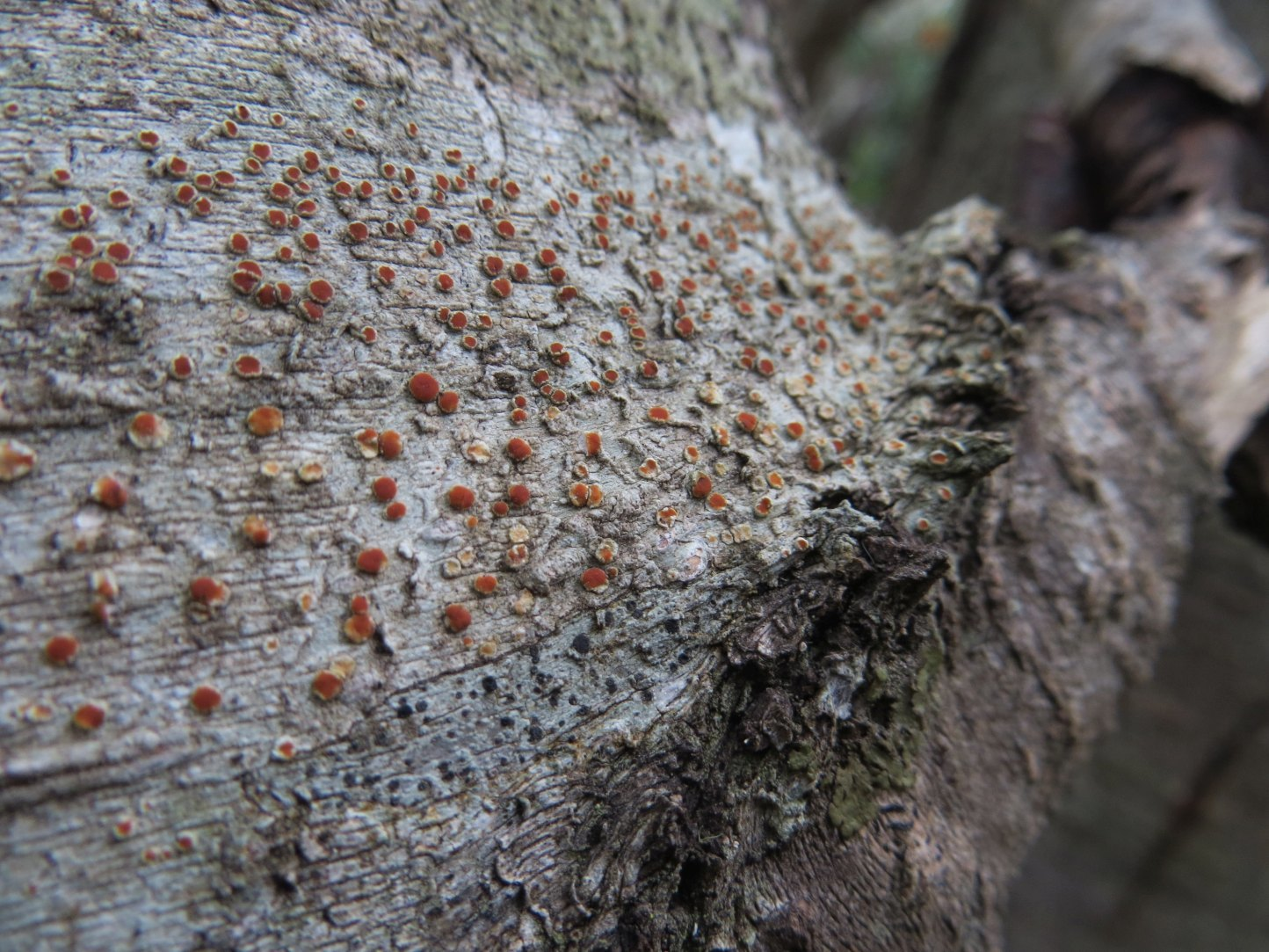
Candelariella magellanica and Sclerococcum nothofagi: two new species discovered on Navarino Island
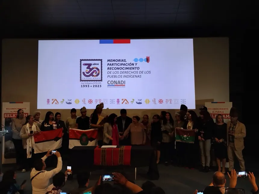
Chile recognises the Selk’nam as a living indigenous people
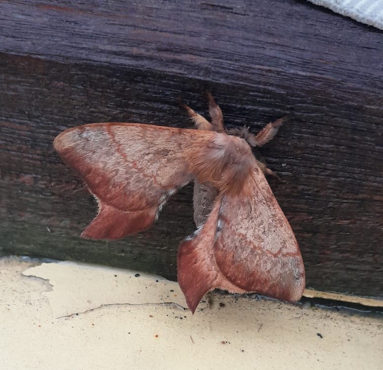
Cercophana frauenfeldii Felder, 1862 (Lepidoptera: Saturniidae): Taxonomy, Ecology and Presence in the Far South of Chile
Peatlands of Tierra del Fuego: peat mosses and liverworts, the silent architects of the austral bogs
Callisphyris leptopus Philippi, a visitor during the southern storms