Table of content : sailing patagonian channels part 1
Tuesday, January 28, 2025: Departure of the sailing expedition in the Chilean Patagonian Channels
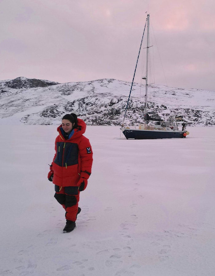
A tough wake-up this morning; the night was short and the previous day was busy, as always before an 18-day sailing expedition in the Cap Horn biosphere reserve, the southern Chilean fjords : provisioning, supply runs… a host of things that, of course, can only be done last minute in Ushuaia!
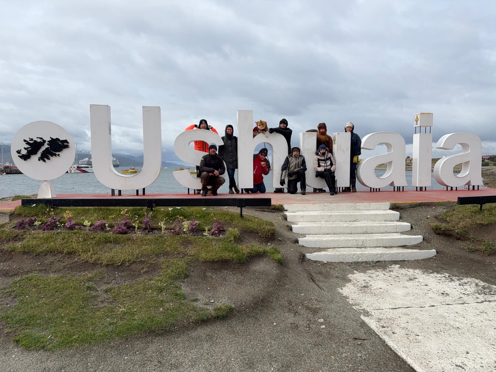
The crew of Milagro, association Karukinka, in Ushuaia (Photo Pascal Madert)
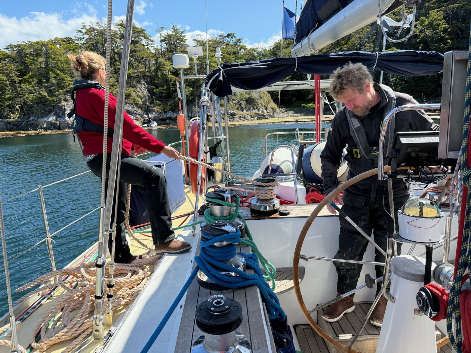
So, 8 a.m., breakfast, and quite a crowd for this breakfast. Yesterday, we welcomed 5 new crewmates: Annick and Jacques, the Gers natives aboard, Pascal from Grenoble, Alain from Vannes, and Françoise from Paris; their common point: they’re all happy retirees! With Aude, who simply refuses to leave the boat, Damien, Lauriane, and myself, that makes 9 crew members!
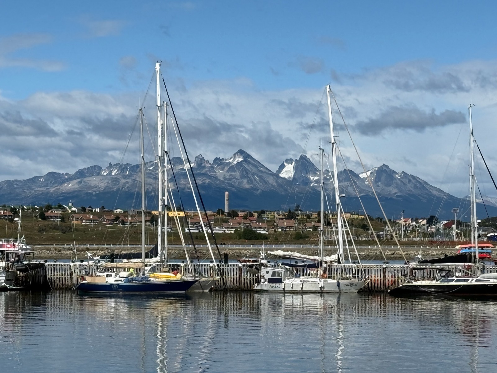
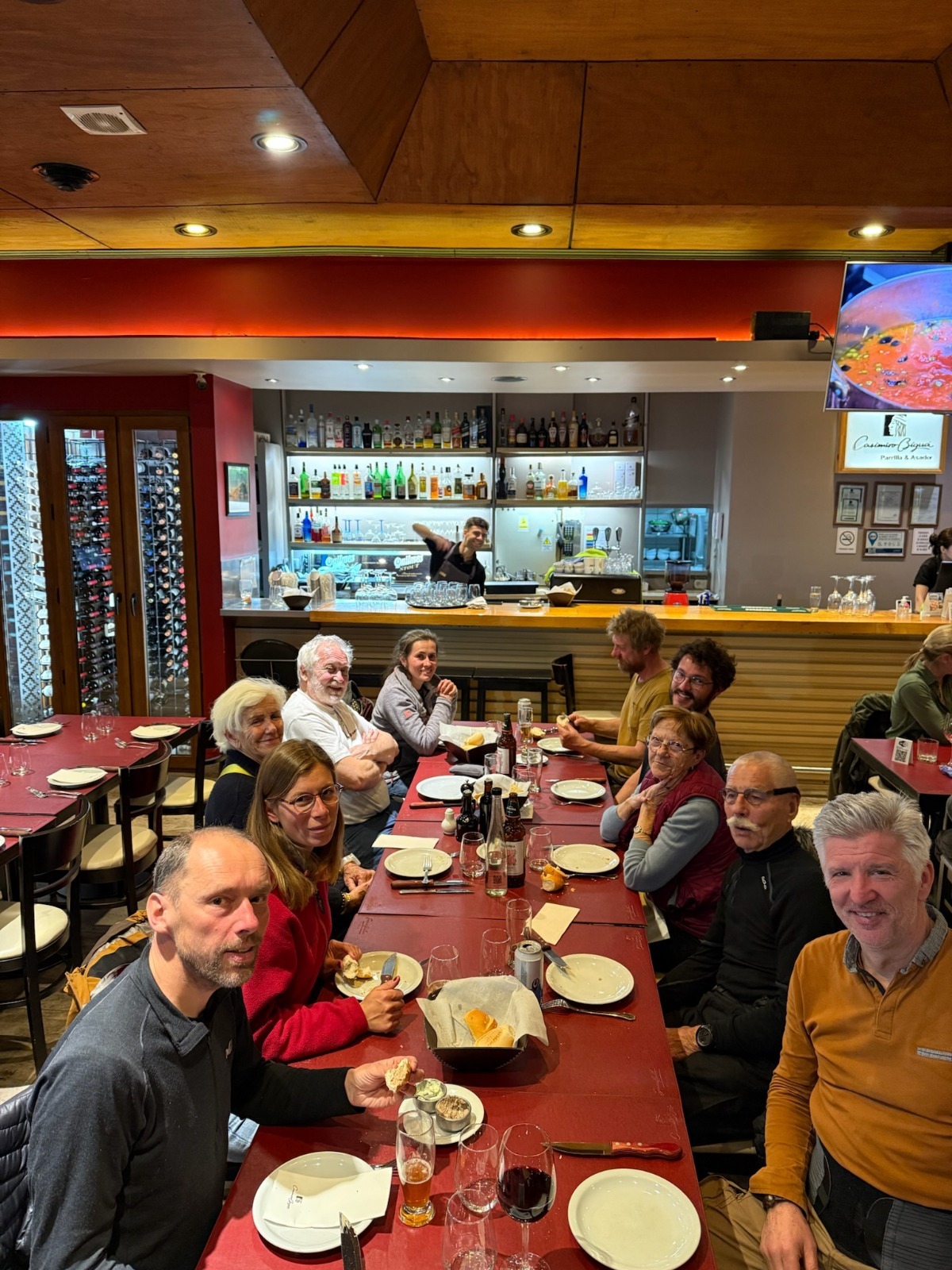
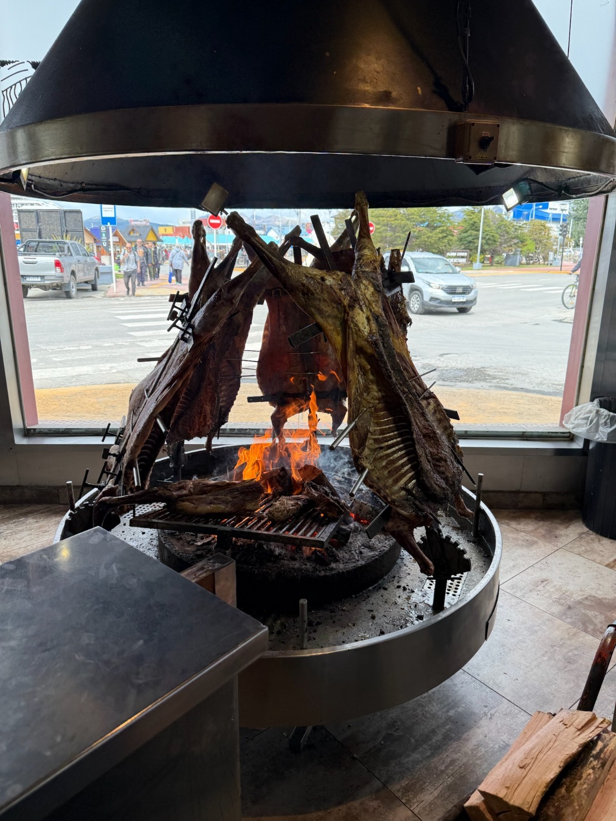
Sailiboats at the pontoon in Ushuaia Nautical club (P. Madert)Departure dinner ! (P. Madert)The traditional fuegian asado (lamb) (P. Madert)
Once everyone is settled, the ritual begins: completing formalities with the local authorities in Ushuaia. For every trip, you have to visit the naval prefecture, immigration, and customs, both on the Argentinian and Chilean side! After this, we get a standard inspection, as often happens, such as at Bahia San Blas during our offshore cruise along the Argentinian Patagonia from Buenos Aires. Usually, it’s mainly a check of the boat’s papers, communication, and safety equipment… and it always goes smoothly!
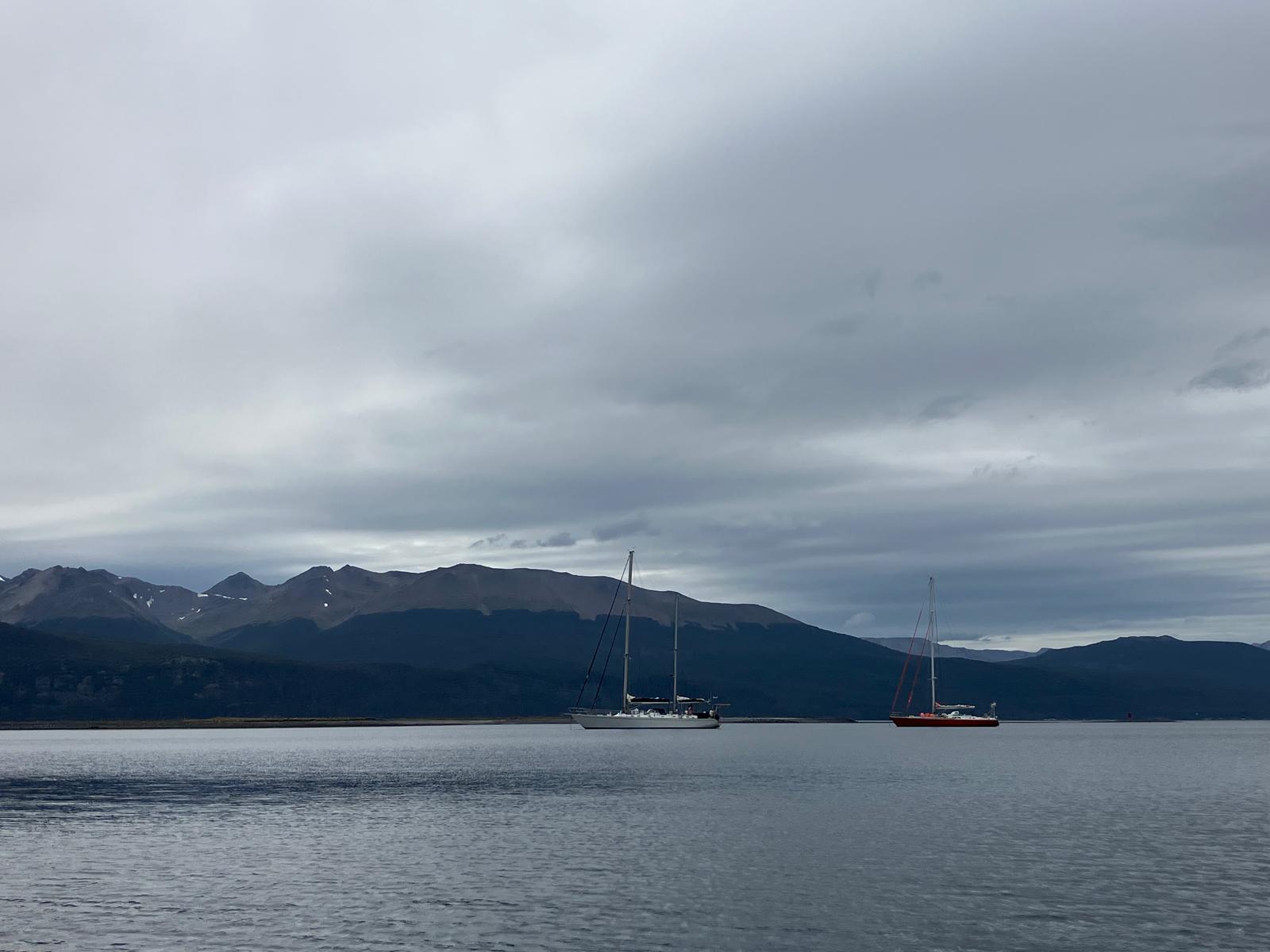
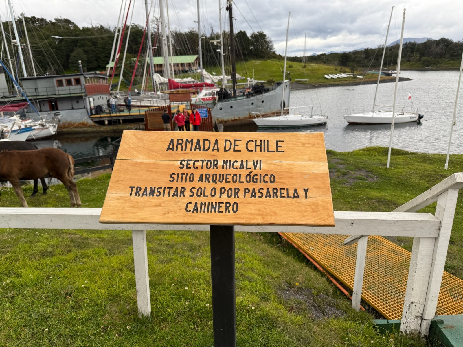
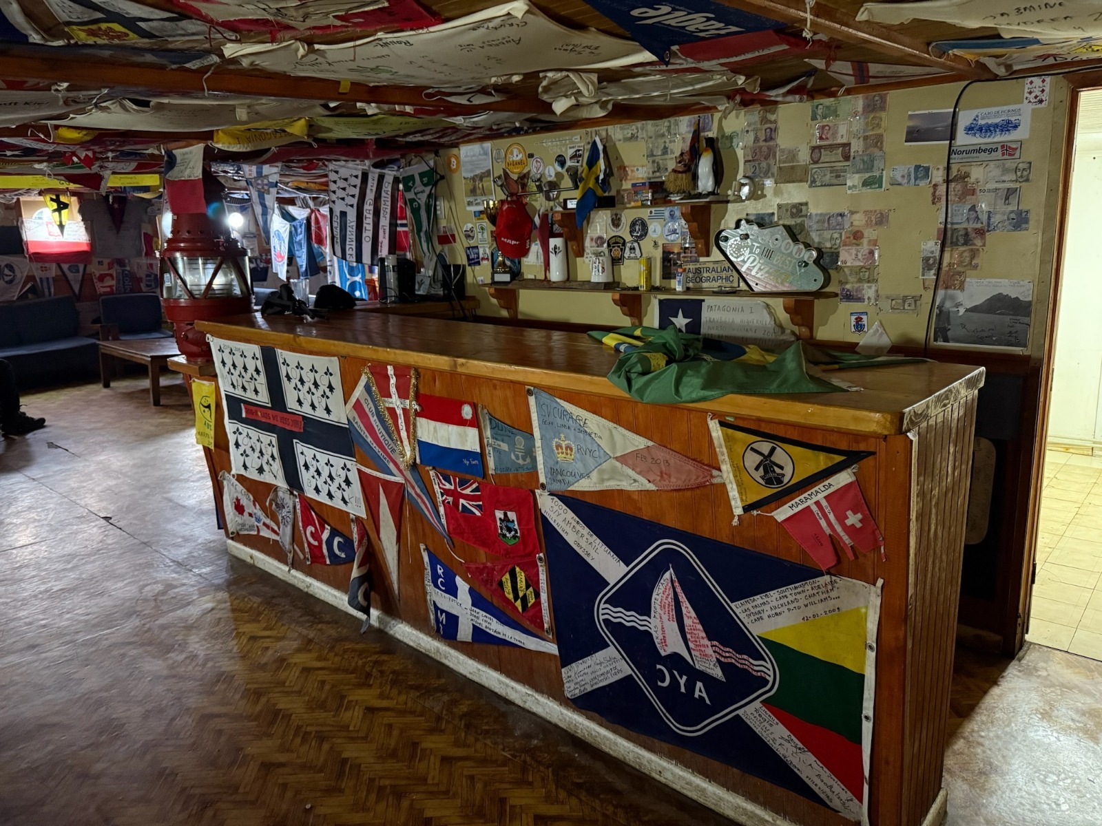
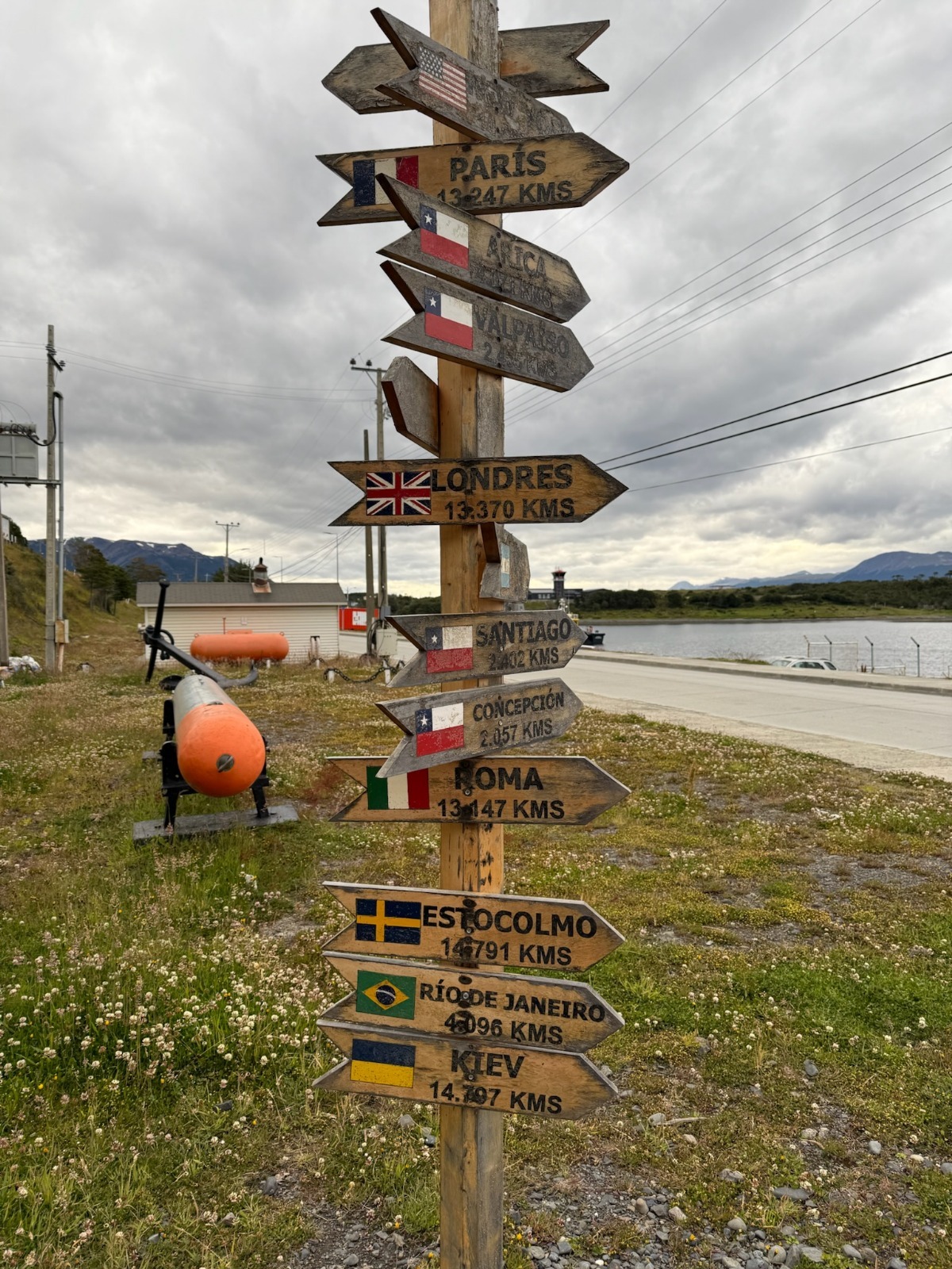
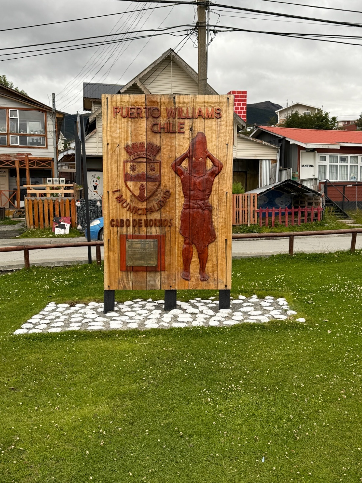
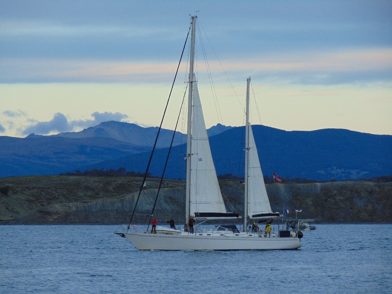
With all these requirements, we don’t leave Ushuaia until 1 p.m., arriving at Puerto Williams, the southernmost city in the world, on Navarino Island (province of Cape Horn and Chilean Antarctic), after a smooth crossing. We anchor in front of the city, as there is no space at the fishing port, and near the famous Micalvi, the pontoon-boat and historic local heritage known to sailors passing through before heading further south. A bit later, another French sailboat, which has been in the region a long time, anchors next to us: the Podorange.
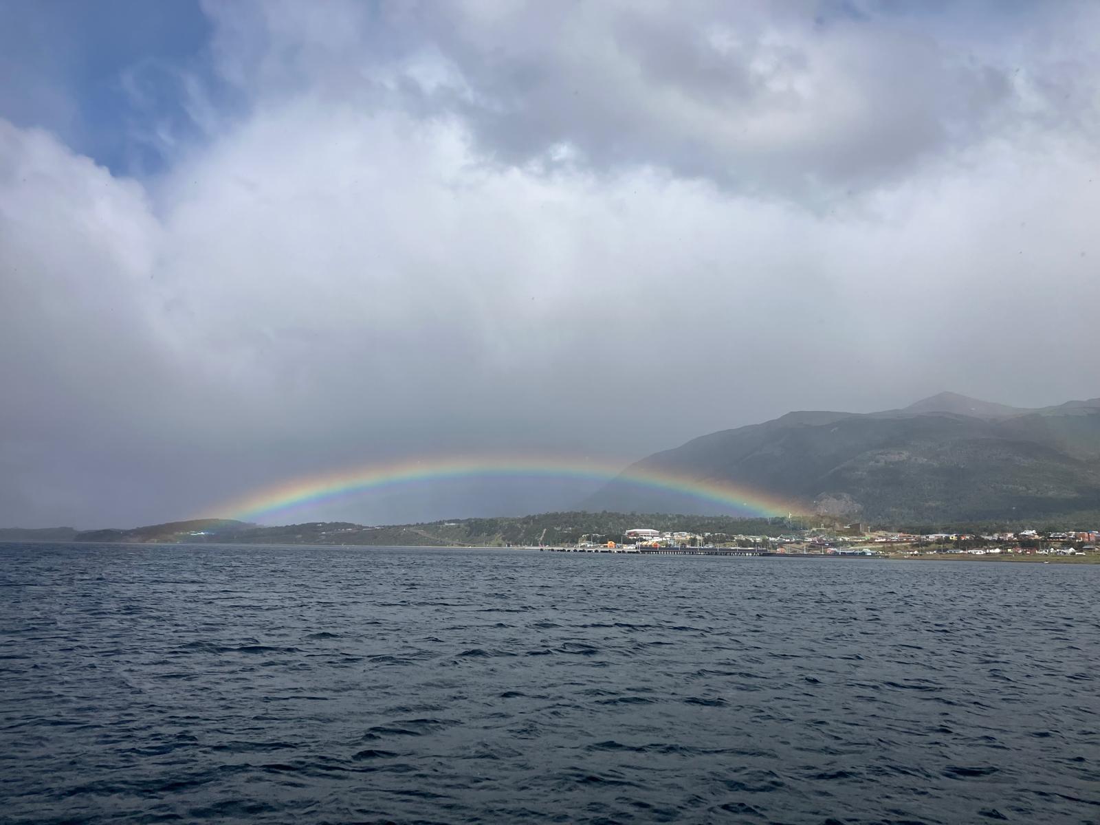
The sailing yachts Milagro and Podorange anchoring in Puerto Williams bay (Cabo de Hornos, Chili)Rainbow over the city of Puerto WilliamsThe Micalvi marina (P. Madert)The inside of the Micalvi, several tens of sailing expeditions represented (P. Madert)The end of the world ! (P. Madert)Puerto Williams, city of the Cape Horn and Chilean Antarctic region (P. Madert)
Wednesday, January 29, 2025: Awaiting formalities → hiking on Navarino Island!
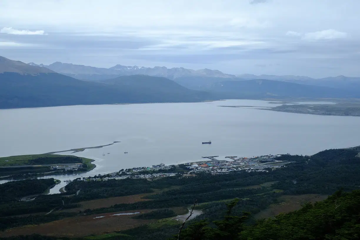
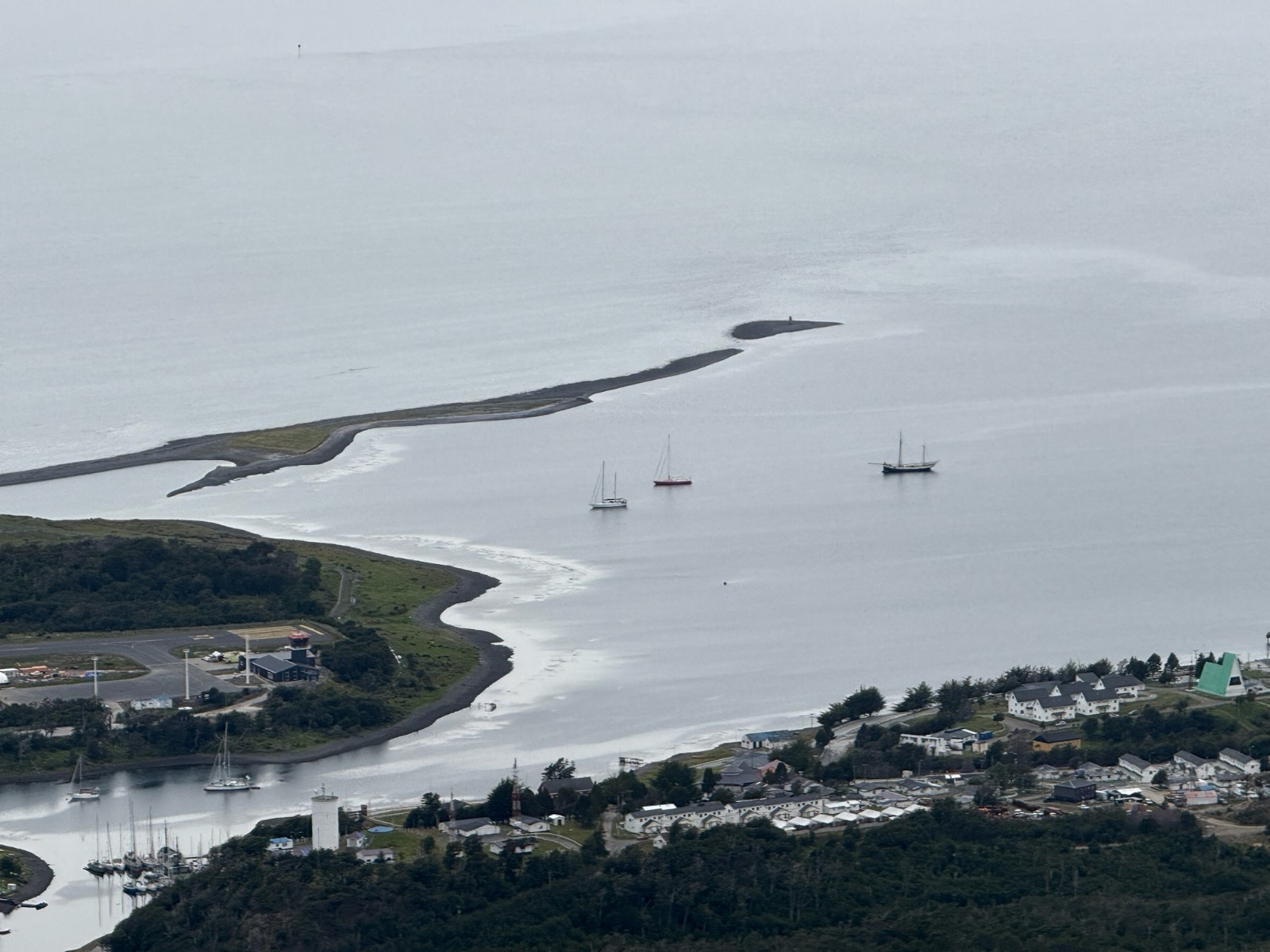
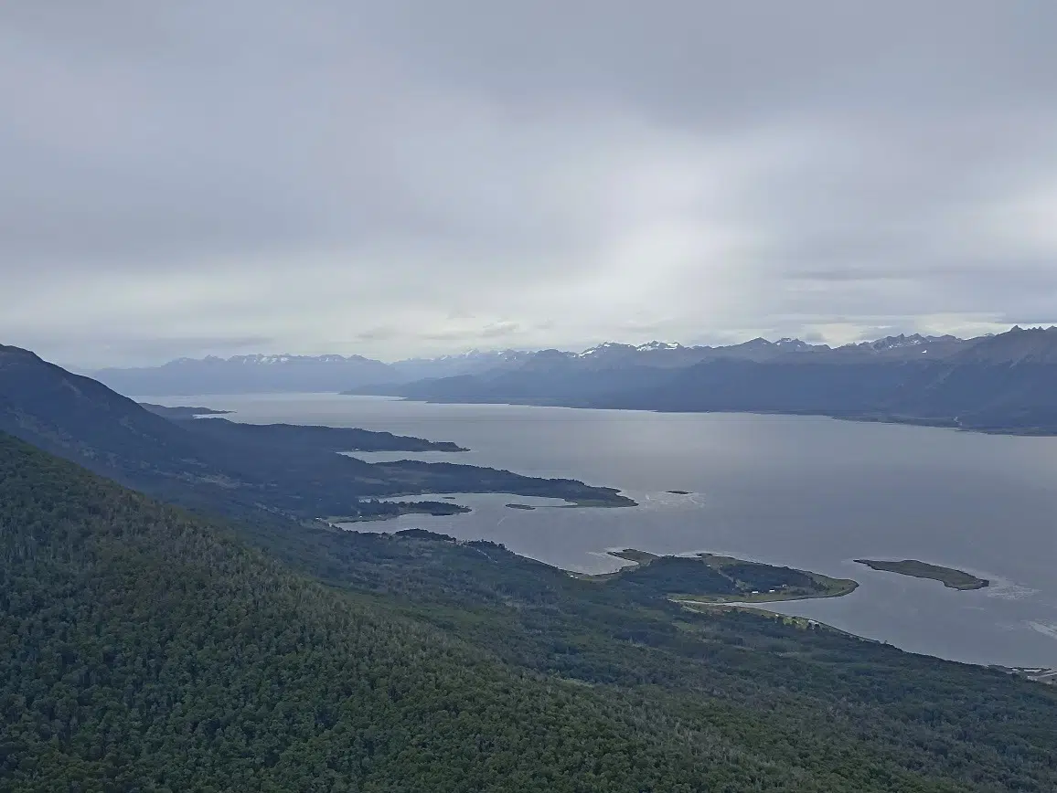
This morning, and since we’re in Chile, it’s back to entry formalities with the various authorities. So, a day on land for everyone: Lauriane and Damien tackle the paperwork marathon, Alain and Annick go for a walk along the Beagle Channel shore, and Pascal, Françoise, Jacques, Aude, and I set out to climb the “school” summit above the village: Cerro Bandera. This 600m peak offers a panoramic view of the surroundings.
Access to this summit is an exception in the region: it’s one of the few with a well-maintained, marked trail, making the climb easy. Most of the time elsewhere, you have to find your own way – nature is everywhere and only reveals itself after real effort!
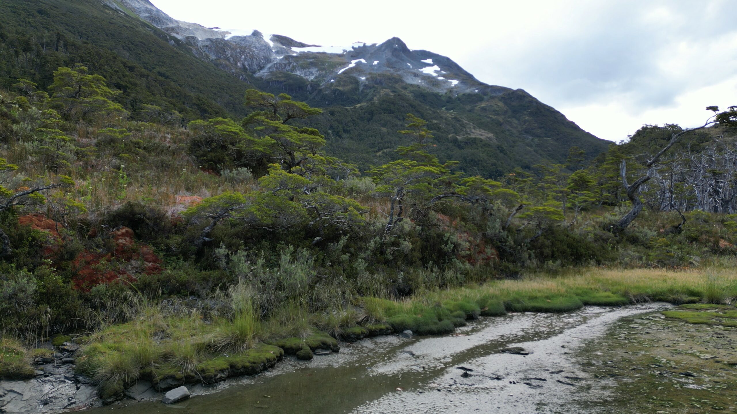
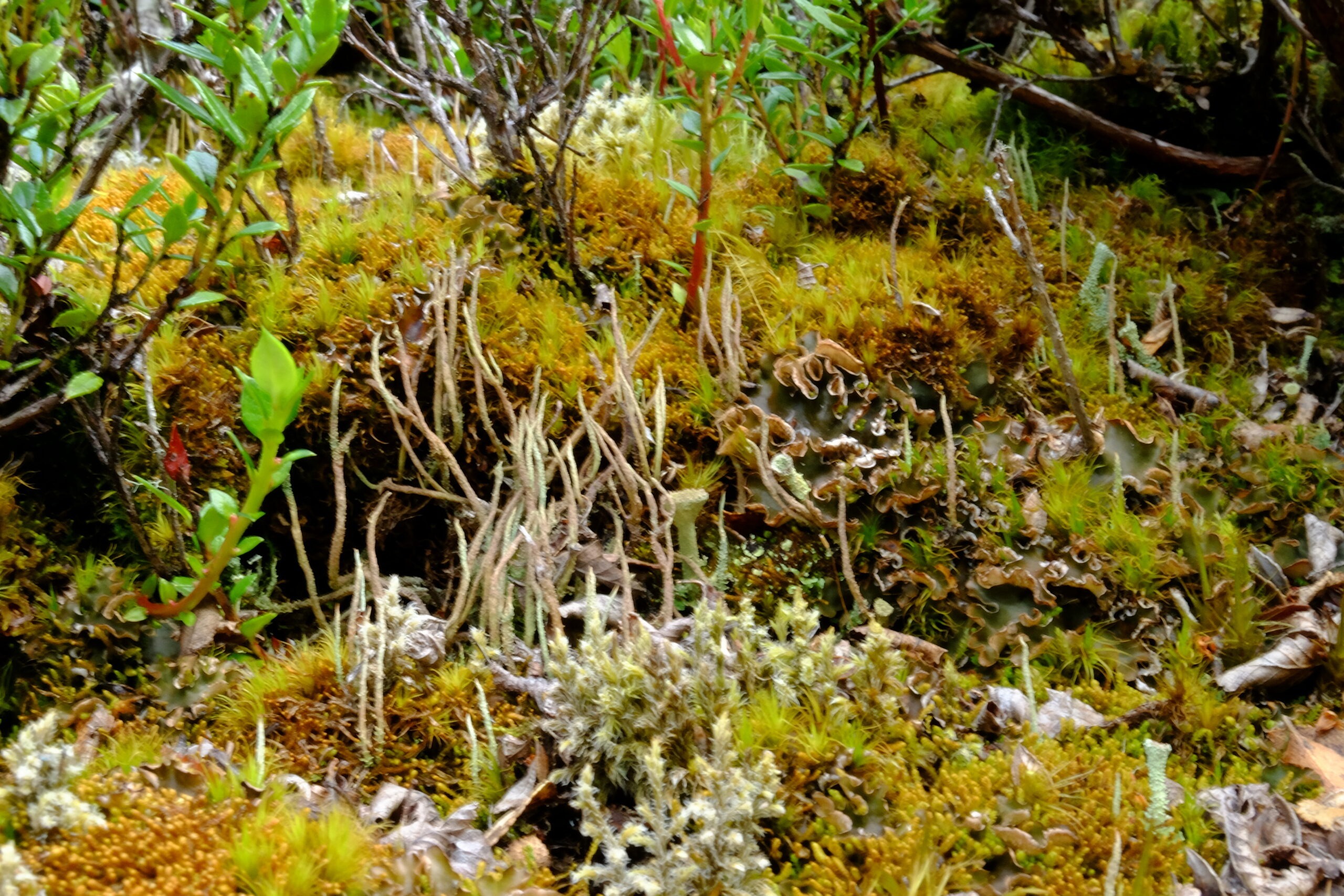
It’s a beautiful ascent, pleasant after leaving a 4x4 track: we cross remarkable Fuegian forest, then low, dense shrubs battered by winds, before reaching the bare mineral zone, where only moss survives – nearing the summit. The sky is overcast but calm, and visibility excellent. From various points, you admire, at different elevations, the channel and surrounding peaks…
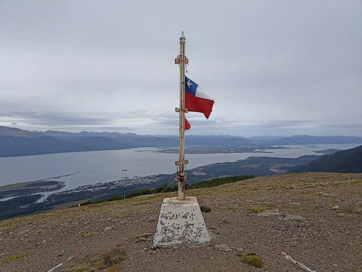
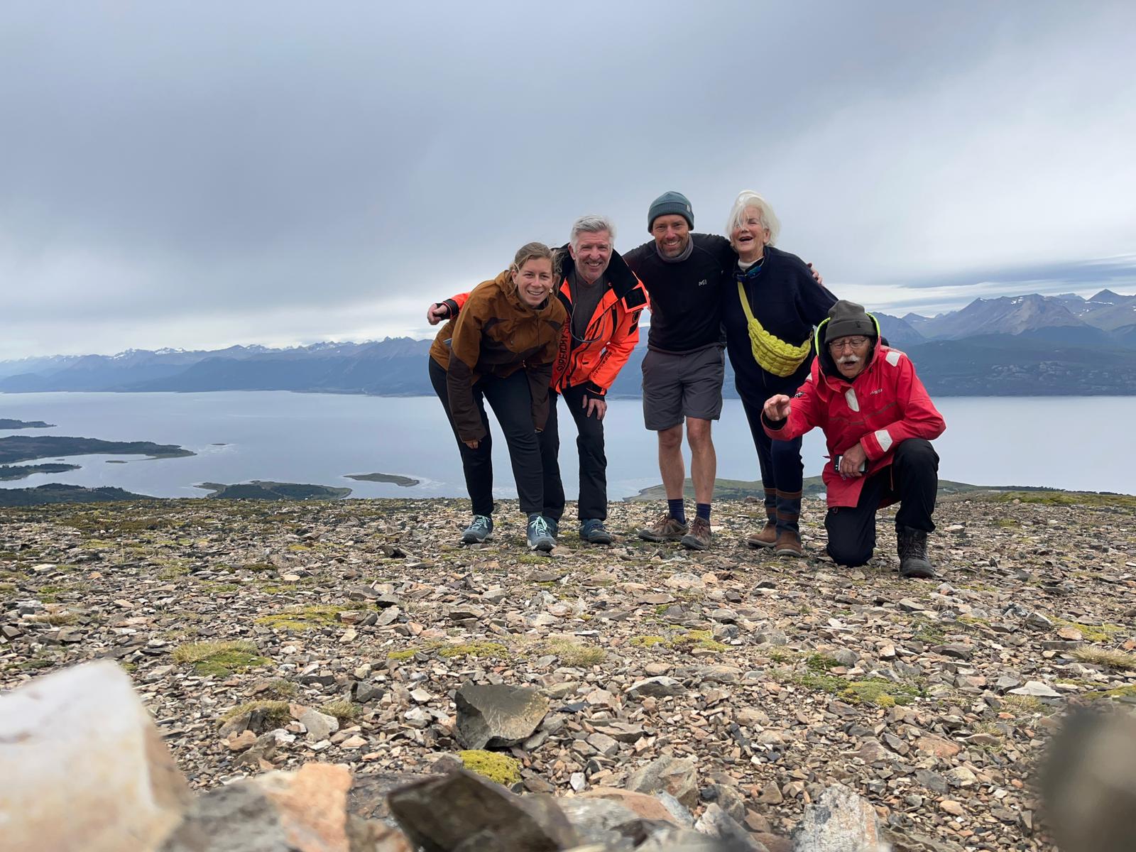
View of Puerto WilliamsIn the middle, on the left side : our Milagro ! (P. Madert)The Onashaga (Beagle channel) separating Navarino island and Tierra del Fuego islandThe summit of the cerro BanderaPart of the crew at the summit of Cerro Bandera (Navarino island, Chile) Photo Aude Grillault-LarocheThe flora on the summit of cerro Bandera (P. Madert)
Everyone climbs at their own pace and meets at the top, marked by a cairn capped with a Chilean flag. From the summit, you see various trails suggesting many multi-day hikes to explore this island; it’s quite stirring…!
The kind weather means we have a picnic and a restorative nap, before heading back down the same way, ending up in a cozy tea room. Back on board by 6:30 p.m. for a quiet evening after a great walk.
Thursday, January 30, 2025: heading west in the Beagle channel, toward Hoste island
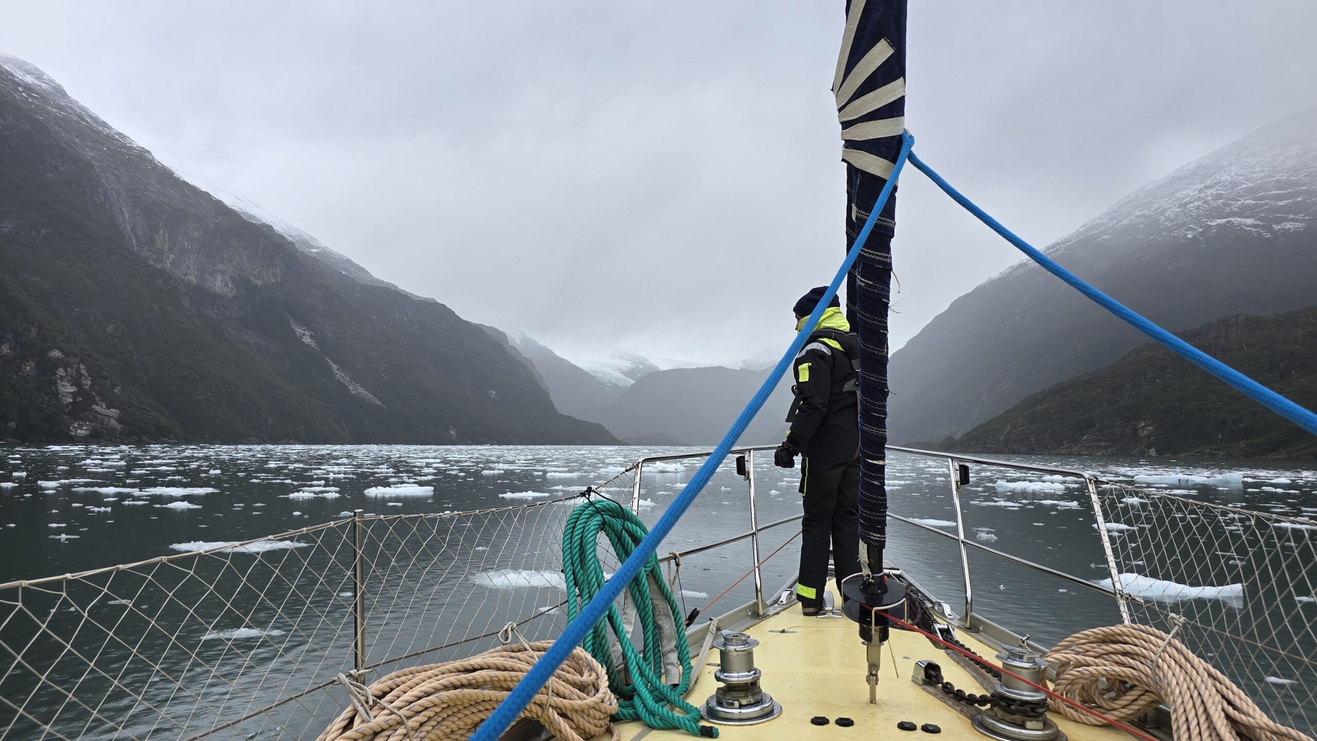
Up at 6 a.m., departing at 7 a.m., we have a long way to go: we head west again, pass Ushuaia and continue to Hoste Island. Sailing is calm, motoring for lack of wind. In early afternoon comes a surprise: the wind picks up, stormy, gusts up to 45 knots, the Beagle Channel reveals its bad-weather face, and it’s impressive. Only one sensible solution instead of motoring head-on: take cover.
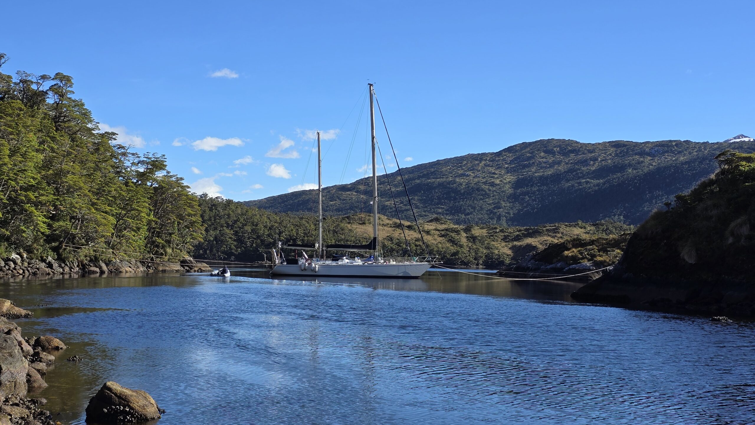
We head for Caleta Letier (Dumas Peninsula, Hoste Island, Chilean fjords). The place is beautiful, a small, well-protected bay with forest trailing right to the shore. Anchoring, though, is less idyllic… The anchor doesn’t catch – so much kelp on the bottom that it’s impossible; it comes up covered with mountains of kelp and a bit of mud. Everything has to be cut away before trying again—exhausting and messy!! Finally, success: Milagro is secure at anchor! Phew!!
Some lines on land to secure the anchoring in the caleta (P. Madert)et on reprend le mou à bord, sans laisser la tension sur le winch en fin de manoeuvre ! (P. Madert)
Good thing too, because the unforecast storm is fierce: gusts at 40 knots, strong and sudden, tip Milagro on its side, sheltering in the bay. In the channel it’s worse: gusts top 50 knots, the water turns white, wave crests are blown into a whiteout over the sea. The Chilean Navy bans navigation for now, and Ushuaia and Puerto Williams ports close.
Anchorage in the caleta Letier (Hoste island, Cape Horn and Chilean Antarctica province, 30/01/2025)
The place is harsh but gorgeous: coves, forest, and mountains everywhere….
Friday, January 31, 2025: First glimpse of the Darwin Cordillera glaciers and anchoring in a bay on Gordon Island
8 a.m.: a morning stroll on deck – magnificent! The wind is down, even the channel is calm. A delicious moment of peace, alone at the end of the caleta.
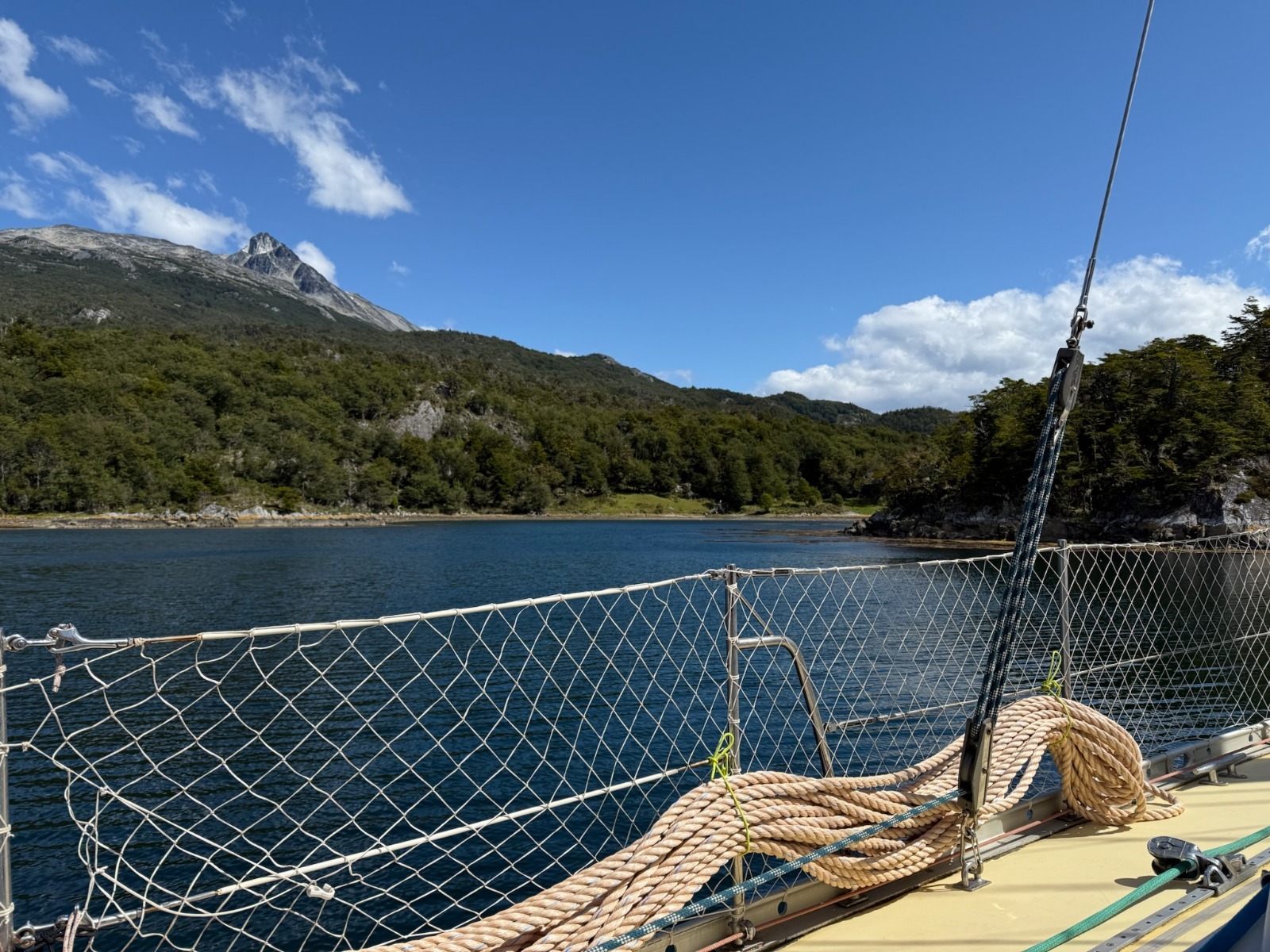
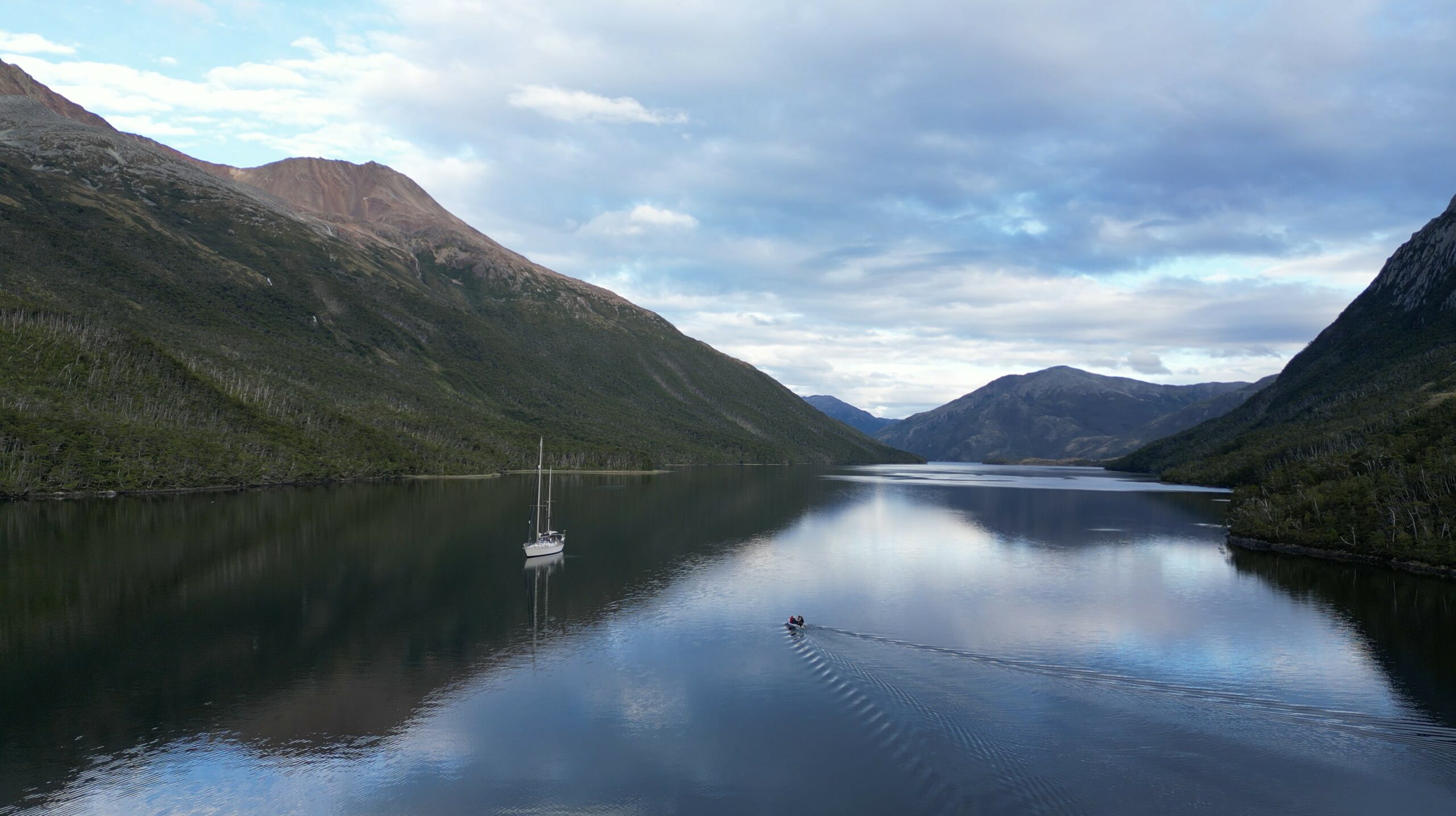
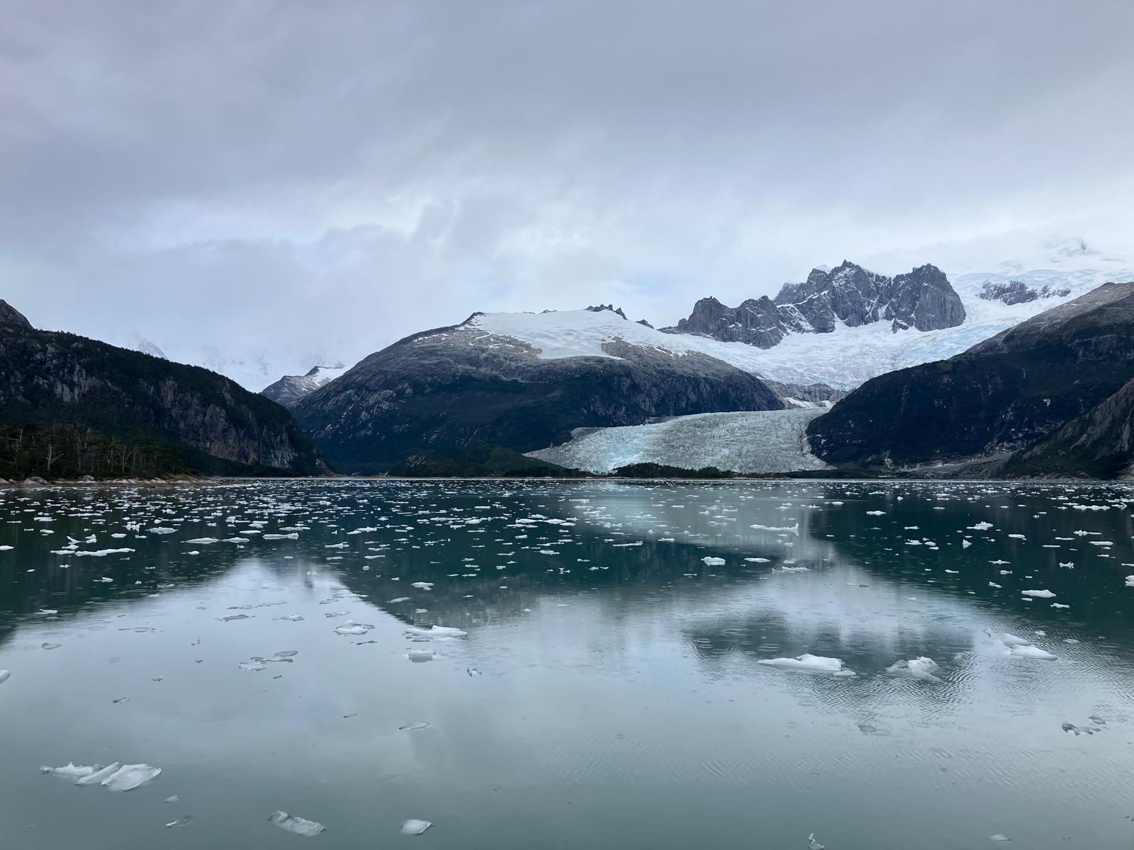
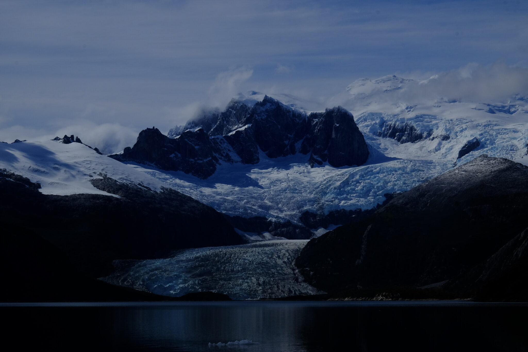
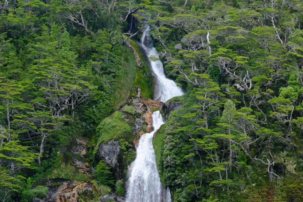
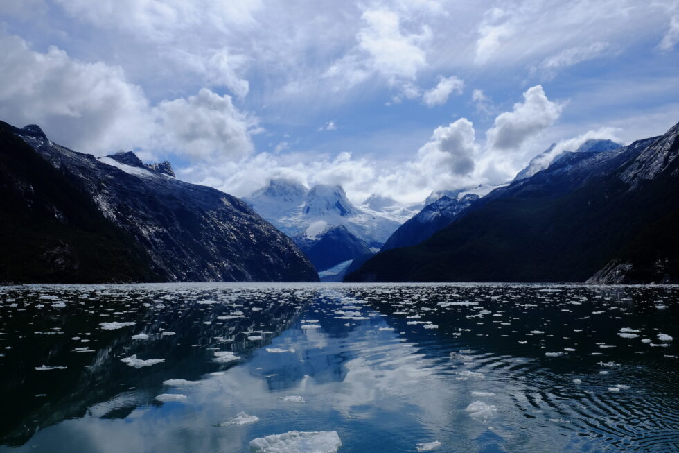
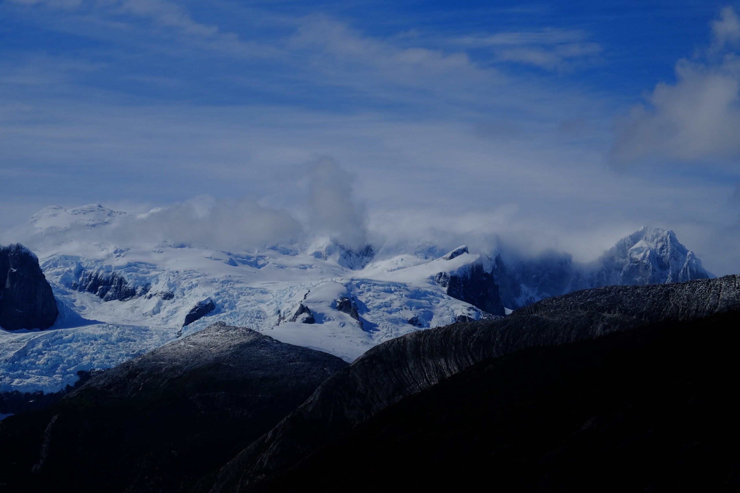
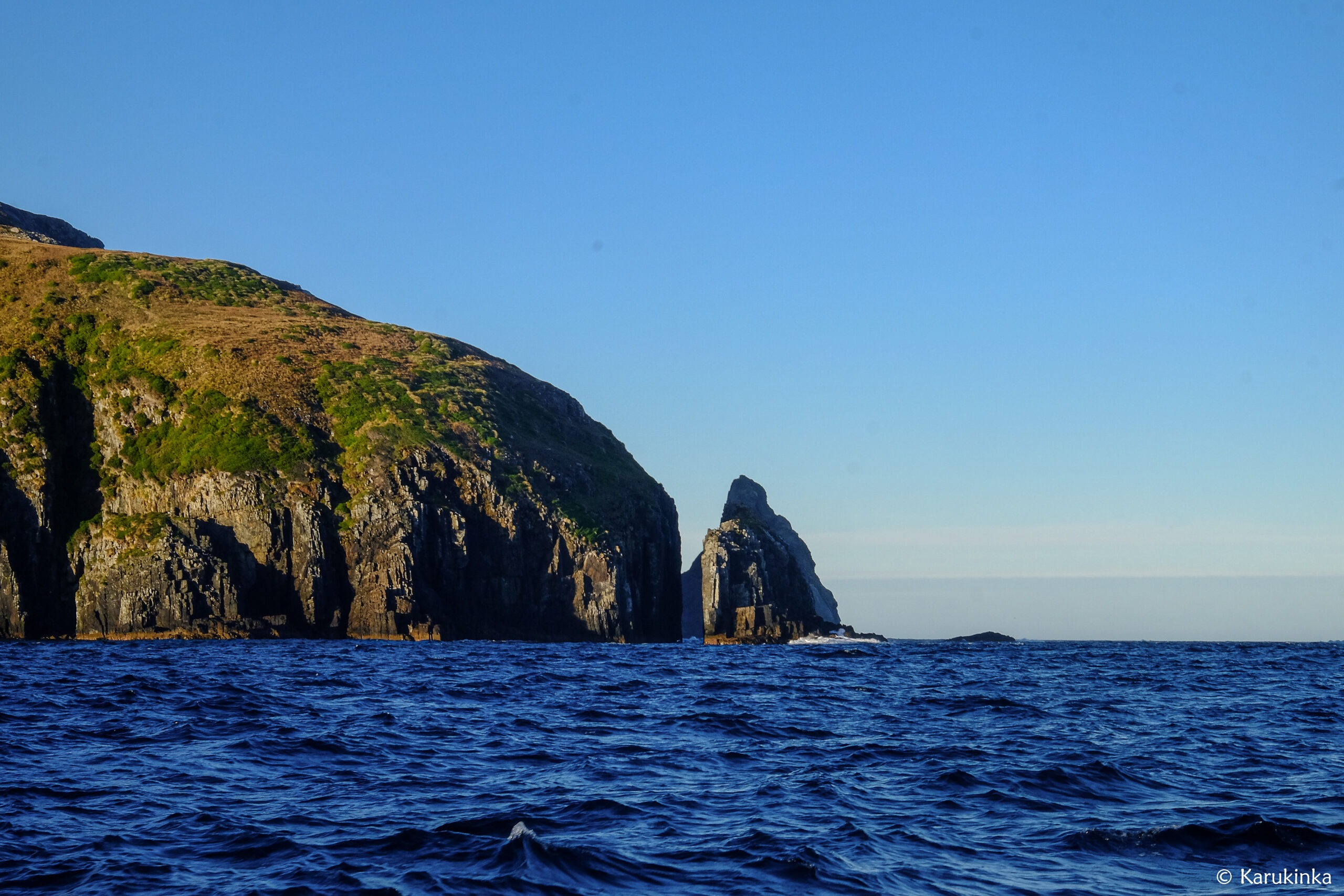
We head west, Hoste Island to port, Tierra del Fuego to starboard, and in the distance, Darwin Range glaciers sparkle in the sun. The scenery is breathtaking – channels bordered by dense Fuegian subantarctic forest, mountains, and glacier-topped peaks. It’s extraordinary to be in one of the last places on Earth where nature reigns and humans are nearly absent.
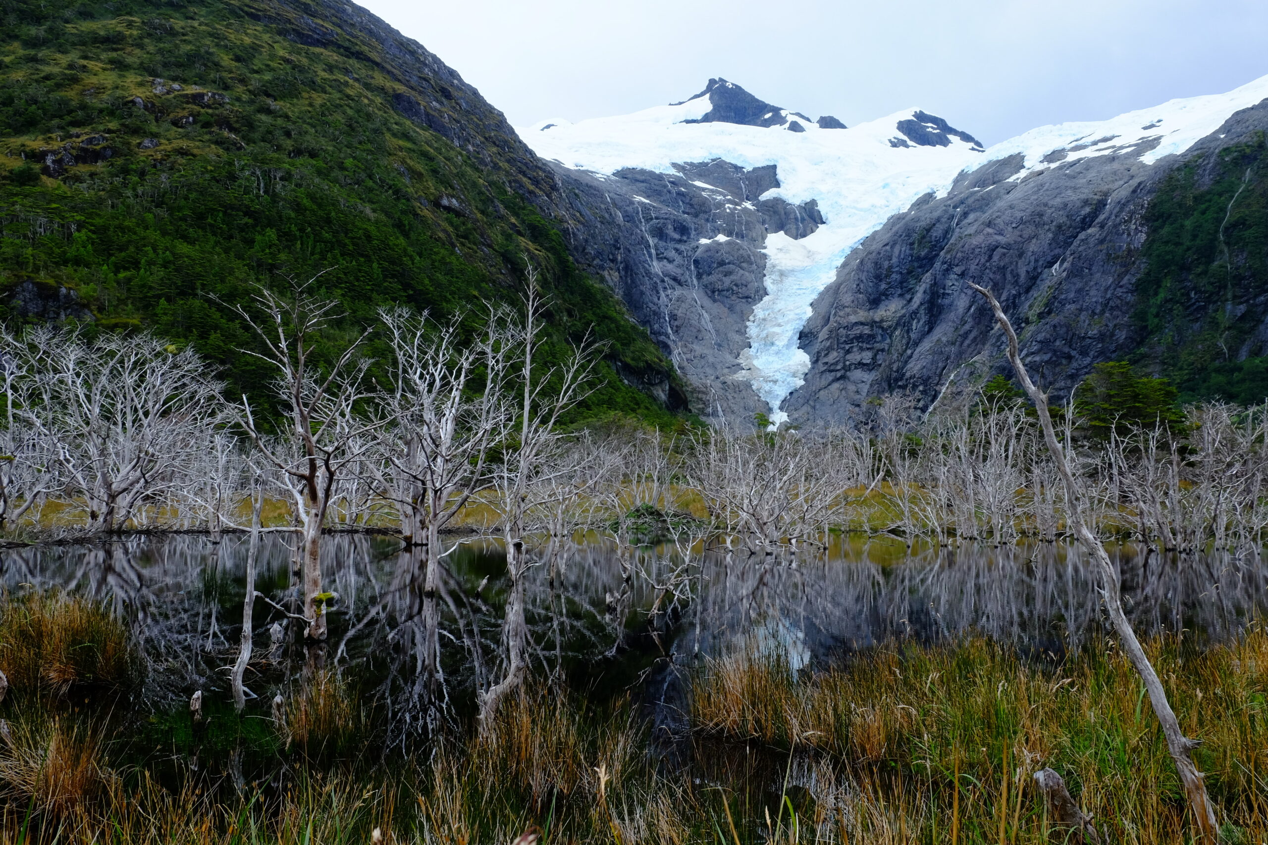
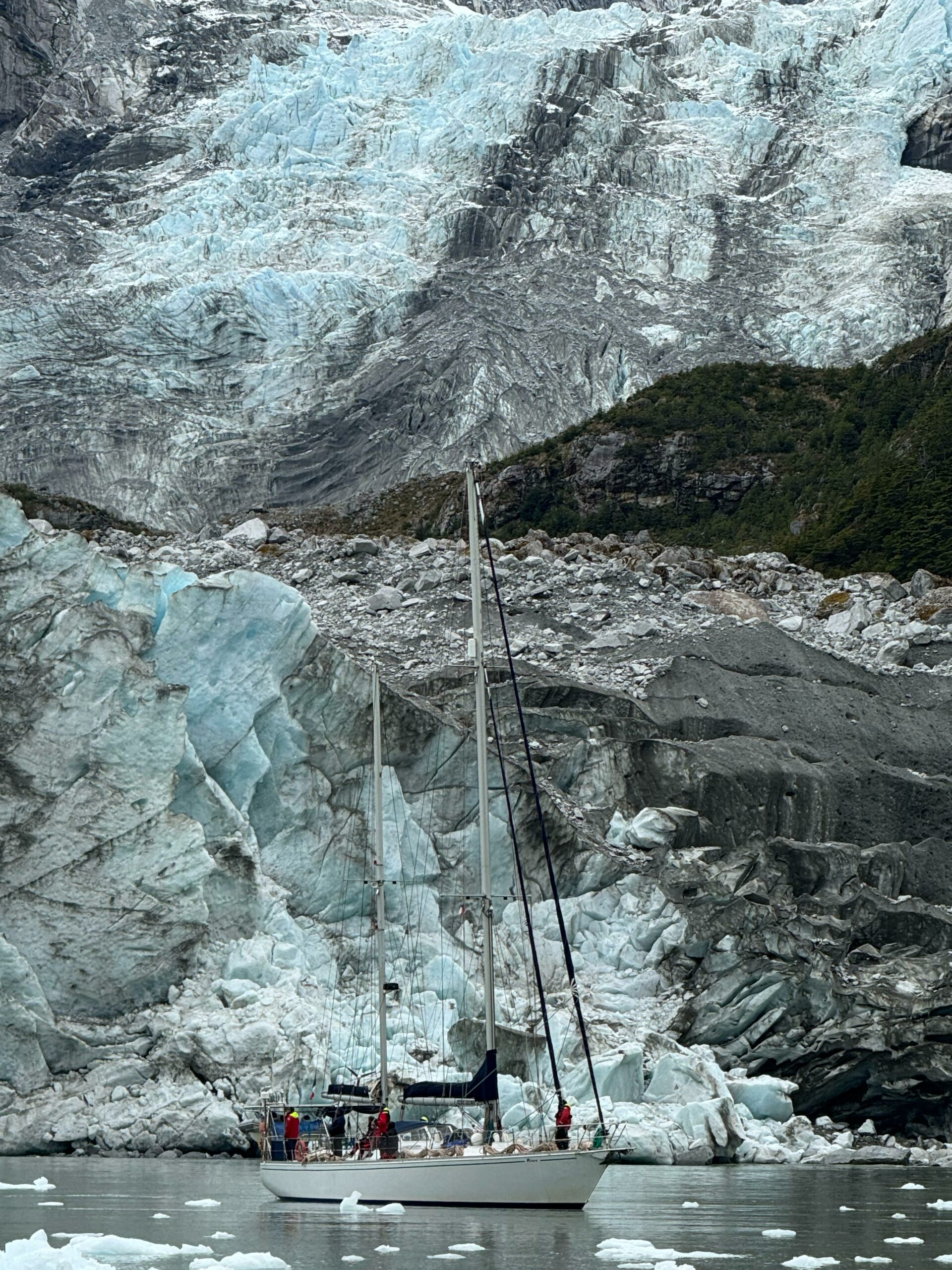
We enter the southern arm of the channel; Hoste Island remains to port, and now, to starboard, the Gordon Island coast follows Tierra del Fuego. We pass tall glaciers, hugely diminished by climate change: like the mountains, polar zones are most affected…. We turn into an unmapped fjord and follow it up several km to anchor at its end, beneath a waterfall and a stream from a melting glacier. The glacier towers above, fresh and grand: we are in Caleta Eva Luna. The place is sublime, and the joy on Lauriane’s face – who recorded sounds and took photos here in 2018 – says it all.
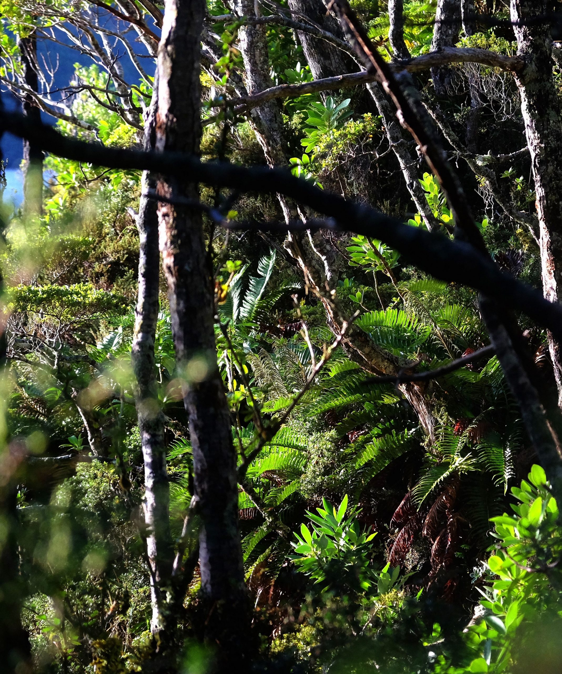
Walking in Eva Luna bay (Gordon island, Chile, 2025)Walk in Eva Luna Bay (Biosphere Reserve of Cape Horn, Chile, 2025)The subantarctic fuegian forest in Eva Luna bay (january 2025)And to see the same place in the middle of autumn photographed by Lauriane (mid-May 2018)
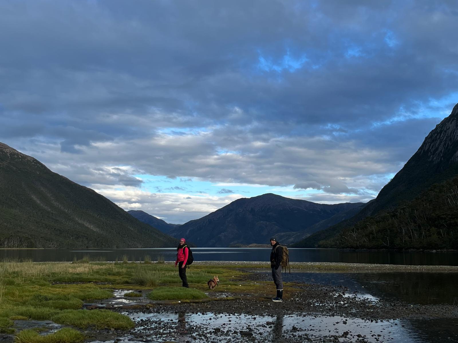
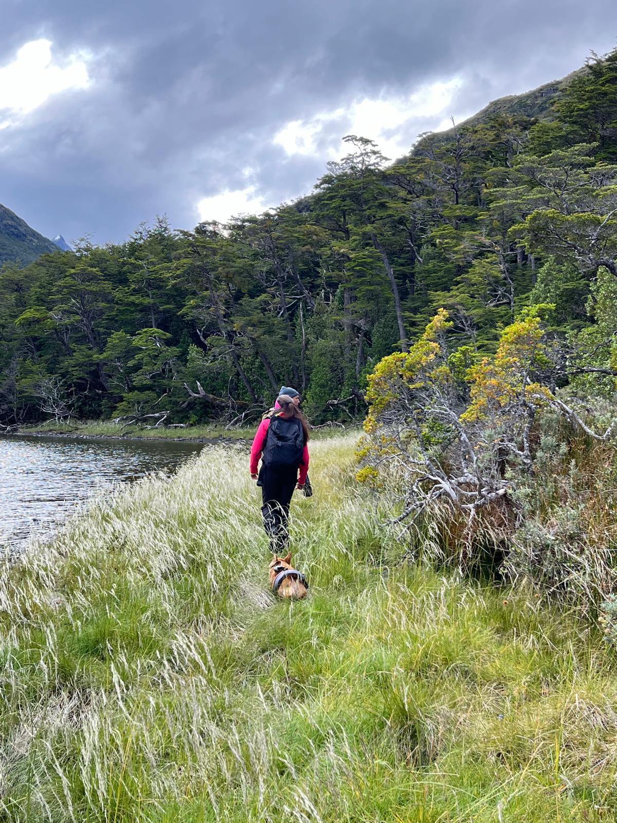
A short walk along the shore takes me back years too: the dense, impenetrable Fuegian forest, the waterlogged boggy ground, all as I remember. Toupie, our faithful four-legged mascot, delights in playing fetch with abundant sticks on the shore!
The sailing yacht Milagro anchored in Caleta Eva Luna, Gordon island, province of cape Horn and Chilean Antarctica, January 2025
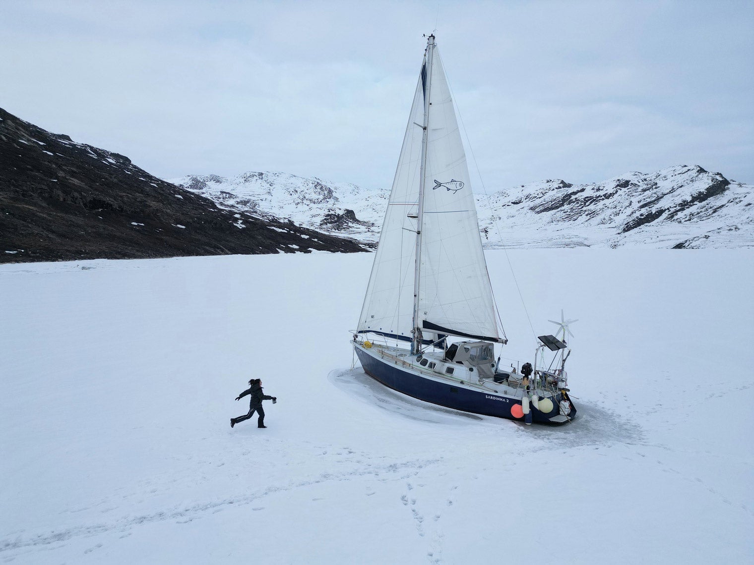
It’s a quiet night; we rest up to keep going west tomorrow… To be continued in the next post ;-)
Karukinka, a non profit organization in Patagonia, invites you to write the next chapters of this unique epic — where maps still read “unmapped.” Joining Karukinka is more than joining an association: it’s embarking on an exceptional human and maritime adventure, reconciling modern exploration with ancestral memory.
Our association now gathers a hundred members of 12 different nationalities, united by a passion for extreme lands and a strong commitment to Indigenous cultural preservation. Whether you are an experienced sailor, scientist, artist, or simply fascinated by wide spaces and just causes, Karukinka offers the unique chance to join sailing expeditions and a cartographic exploration project that will make history.
The Darwin Cordillera represents one of the last wild frontiers of our planet, a mountain range of striking beauty yet formidable hostility, located at the far southwestern tip of Chilean Tierra del Fuego. This mountain chain, known to Europeans in 1832 by Charles Darwin during his historic voyage aboard the HMS Beagle, constitutes the southernmost extension of the Andes Cordillera and remains to this day one of the most extreme and least explored environments on the planet.
A glacier view in Pia fjord, Darwin cordillera, during a sailing expedition in the patagonian channels (February 2025)
Nestled between 54°15′ and 54°50′ south latitude and 69°15′ and 71°30′ west longitude, this "unknown land" extends 170 kilometers from west to east and 60 kilometers from north to south, harboring an ice field of over 2,300 km² – equivalent to the total area of Alpine glaciers. Until 2011, the year of the first complete crossing achieved by the French Military High Mountain Group (GMHM), the Darwin Cordillera remained one of the last "white rectangles" on world maps, testifying to the extreme difficulty its exploration represents.
Geography and geology: an exceptional natural laboratory
Geographic location and configuration of the Darwin range
The Darwin Cordillera occupies a unique geographic position in the world, forming a mountainous peninsula west of the great island of Tierra del Fuego. This mountain chain is surrounded by water on three sides: to the north by the Almirantazgo Canal connected to the Strait of Magellan, to the south by the Beagle Canal, and to the west by the Cockburn Canal opening onto the Pacific Ocean. Only its eastern portion remains connected to the mainland, near the Argentine-Chilean border, making any land access practically impossible.
The massif extends from Mount Sarmiento in the west (2,404 m) to the Yendegaia valley in the east, passing through its highest peak, Mount Shipton (2,469 m), often confused with Mount Darwin (2,429 m). This historical confusion stems from Eric Shipton's 1961 expedition, who believed he had climbed Mount Darwin but had actually reached a higher summit, subsequently named in his honor.
A complex geological structure
The geology of the Darwin Cordillera reveals a complex and fascinating tectonic history. The massif is principally composed of a metamorphic complex comprising high-grade metamorphic rocks, notably crystalline schists containing kyanite and sillimanite. These minerals testify to extreme pressure and temperature conditions during the mountain chain's formation.
Panoramic view of Marinelli Glacier with snow-capped peaks and growlers (Darwin Cordillera, wikipedia)
The high-grade metamorphism observed in the Darwin Cordillera is directly related to the closure of the Rocas Verdes basin during the Cretaceous, a major geological event that shaped the region's current structure. This metamorphic complex constitutes the only ensemble of its kind in the southern Andes presenting amphibolite rocks with kyanite and sillimanite, making the Darwin Cordillera a unique geological laboratory for understanding the tectonic evolution of South America's southern tip.
The progressive separation of South America and Antarctica during the Cenozoic transformed local tectonics into a transpressive regime characterized by transform faults. The opening of the Drake Passage 45 million years ago also contributed to shaping the region's current geomorphology.
The ice field and its characteristics
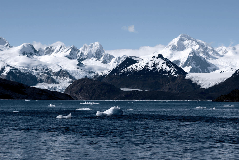
The Darwin Cordillera ice field covers an impressive area of 2,300 km², rivaling the planet's largest non-polar glacier systems. This ice mantle feeds a multitude of glaciers flowing toward the sea, creating a landscape of deep fjords and spectacular glacial walls.
Among the most remarkable glaciers, the Marinelli Glacier occupies a particular position as the most active and most studied glacier of the cordillera. Located in Alberto de Agostini National Park, this glacier extends several kilometers from the Darwin Cordillera to Ainsworth Bay in Almirantazgo Fjord. The Marinelli Glacier is recognized for its significant retreat rate, documented over several decades, making it a significant witness to climate change in the region.
Extreme climate: the Roaring Fifties
Dantesque meteorological conditions
The climate of the Darwin Cordillera ranks among the most extreme on the planet, shaped by its position in the dreaded Roaring Fifties. This region experiences direct influence from successive cyclonic depressions, fed by the temperature difference between the relatively warm waters of the Southern Ocean and Antarctic ice masses.
Wind constitutes the most characteristic and most formidable climatic element of the Darwin Cordillera. The average annual wind speed reaches 70 km/h, but gusts can exceed 250 km/h during phenomena called willywaws or ayayema according to indigenous Kawésqar and Yaghan peoples' terminology. These winds of extraordinary violence were meticulously described by Admiral FitzRoy during his exploration with Darwin, who considered them a "wicked divinity" capable of unleashing without warning.
One of the glaciers of the Cordillera Darwin during a sailing expedition in the Patagonian channels (Karukinka Association, Chile, 2025)
Precipitation and seasonal variability
Precipitation in the Darwin Cordillera is abundant and nearly constant, feeding the vast glacier system. The region receives an average of over 3,000 mm of annual precipitation, principally as snow at altitude and rain in coastal zones. This constant humidity, combined with violent winds, creates frequently reduced visibility conditions that considerably complicate any attempt at exploration.
Average temperature varies between 0 and 5°C during the cold season (southern winter) and between 5 and 10°C during the warm season (southern summer). These relatively slight thermal variations reflect the moderating influence of the ocean, but mask the constant cooling effect of wind that considerably lowers the perceived temperature.
Biodiversity: a unique subantarctic ecosystem
Terrestrial and marine Fauna
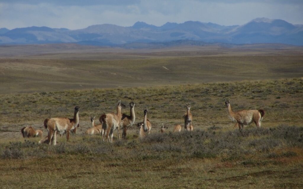
Herd of guanacos (Lama guanicoe) during an expedition of the Karukinka association in Tierra del Fuego (2018)
The Darwin Cordillera harbors remarkable biodiversity, adapted to the extreme conditions of this subantarctic region. Among terrestrial mammals, the guanaco (Lama guanicoe) constitutes the emblematic species of steppes and mountainous zones, evolving in herds in the least hostile sectors. These wild camelids, perfectly adapted to violent winds and cold temperatures, represent an important food source for the region's predators.
The region also harbors several canid species adapted to southern conditions, notably the Magellanic fox (Lycalopex culpaeus) and the gray fox (Lycalopex griseus), which occupy various habitats ranging from forests to rocky zones.
Particular mention must be made of Canadian beavers (Castor canadensis), introduced in the 1940s and subsequently become a major invasive exotic species. These semi-aquatic rodents, whose population today reaches several tens of thousands of individuals, profoundly modify the local ecosystem by constructing dams that disrupt the natural hydrology of watercourses.
Beaver dam on Hoste Island (Cape Horn Biosphere Reserve, Chile, autumn-winter expedition 2018)
Avifauna: masters of the southern sky
The avian diversity of the Darwin Cordillera testifies to this region's ecological richness. Over 90 bird species have been recorded, distributed between terrestrial and marine species. The Andean condor (Vultur gryphus), with its impressive wingspan reaching up to 3 meters, dominates the cordillera's skies and constitutes one of the most striking spectacles for rare observers.
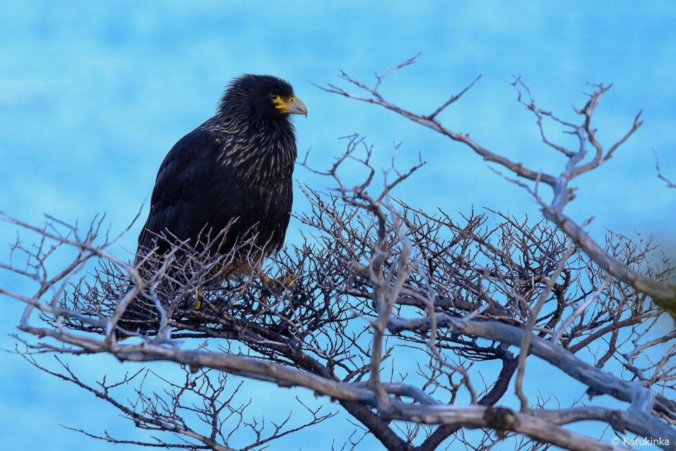
Raptors are well represented with caracaras and chimangos. In wooded zones, the Magellanic woodpecker, comesebos, and rayaditos enliven the Magellanic forest with their characteristic songs.
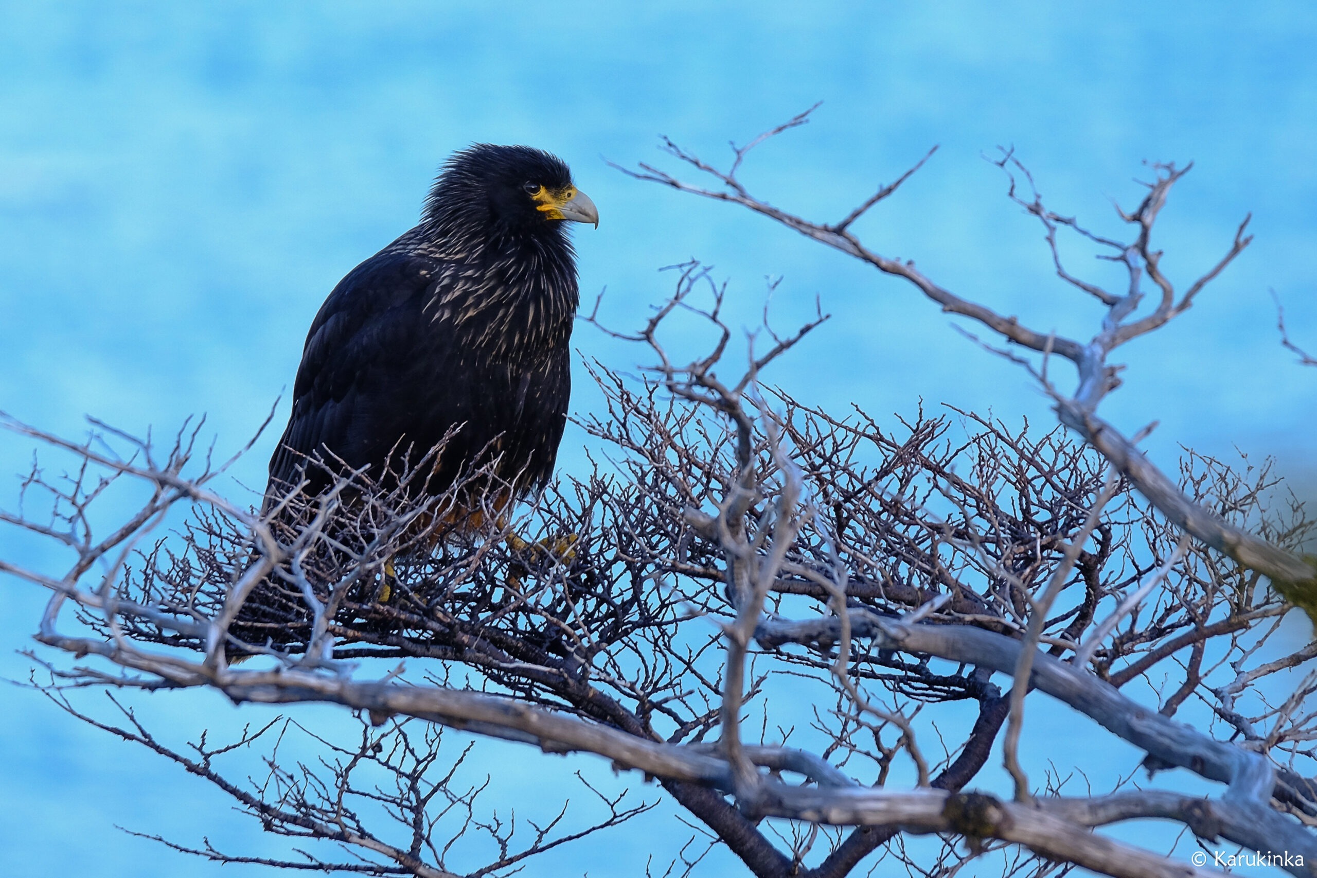
A black Carancho (Reserve of Cape Horn, April 10, 2025, during a sailing expedition at Cape Horn and in the Patagonian channels)
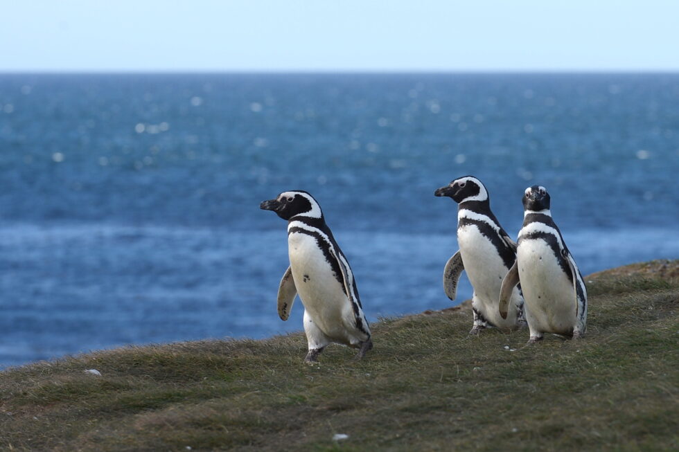
Aquatic and coastal environments harbor exceptional marine fauna. The waters of the Beagle Canal and surrounding fjords serve as habitat for colonies of Magellanic penguins (Spheniscus magellanicus), an emblematic species of the region. More remarkably, the Darwin Cordillera harbors the only colony of king penguins (Aptenodytes patagonicus) located outside Antarctica and subantarctic islands, testifying to this ecosystem's exceptional character.
Small group of Magellanic penguins (pingüinos) in insular Patagonia
Marine mammals of Patagonian fjords
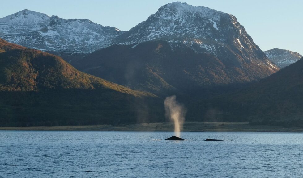
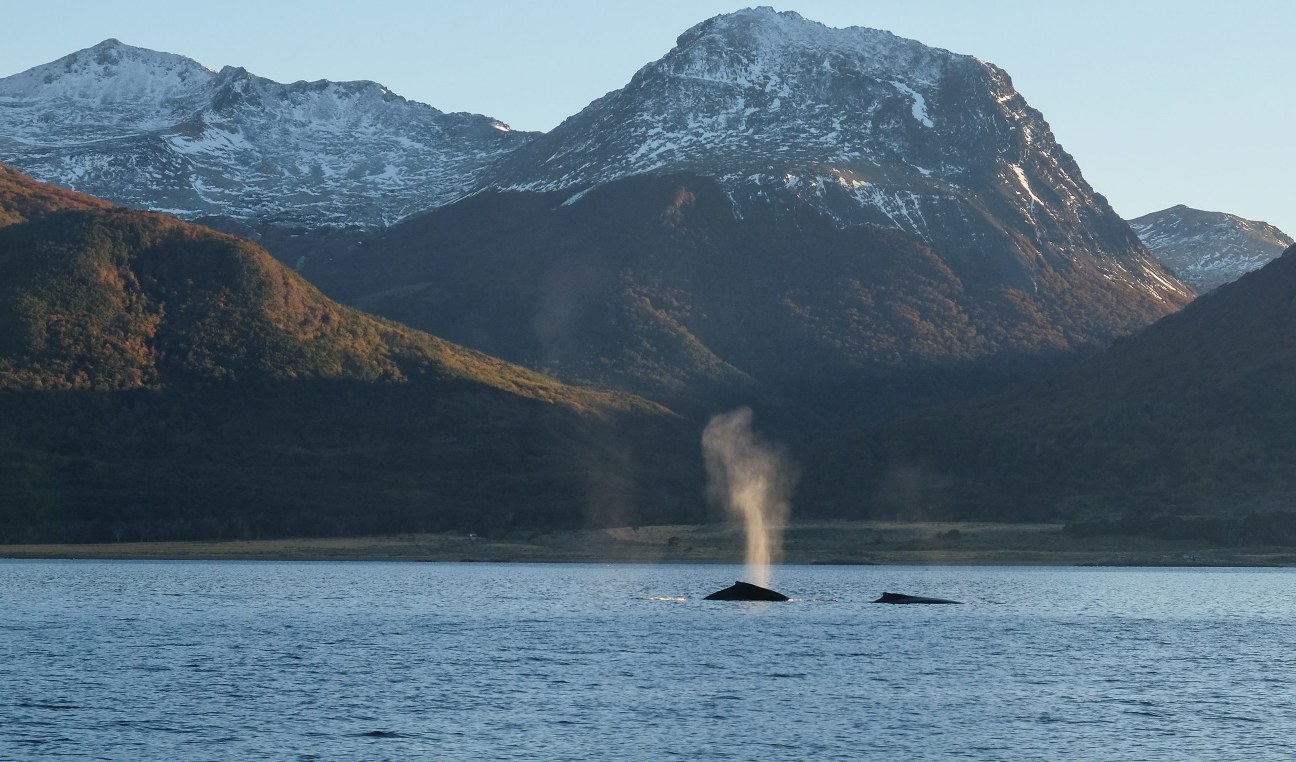
The waters surrounding the Darwin Cordillera constitute a sanctuary for numerous marine mammal species. Southern right whales (Eubalaena australis) and humpback whales (Megaptera novaeangliae) regularly frequent these nutrient-rich waters. Leopard seals find refuge in protected fjords, profiting from the region's fish wealth.
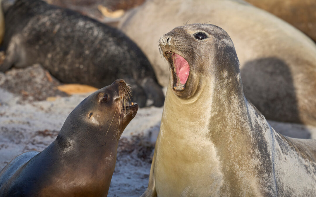
Elephant seals (Mirounga leonina) form temporary colonies on certain isolated beaches, particularly in the Marinelli Glacier zone where an endangered population still subsists. South American sea lions (Otaria flavescens) are also present in large numbers, creating noisy colonies on rocky islets of the fjords.
Colony of fur sea lions in the Beagle Channel (Karukinka sailing expedition 2025)
Flora: Magellanic forests and their adaptation
The subantarctic forest ecosystem
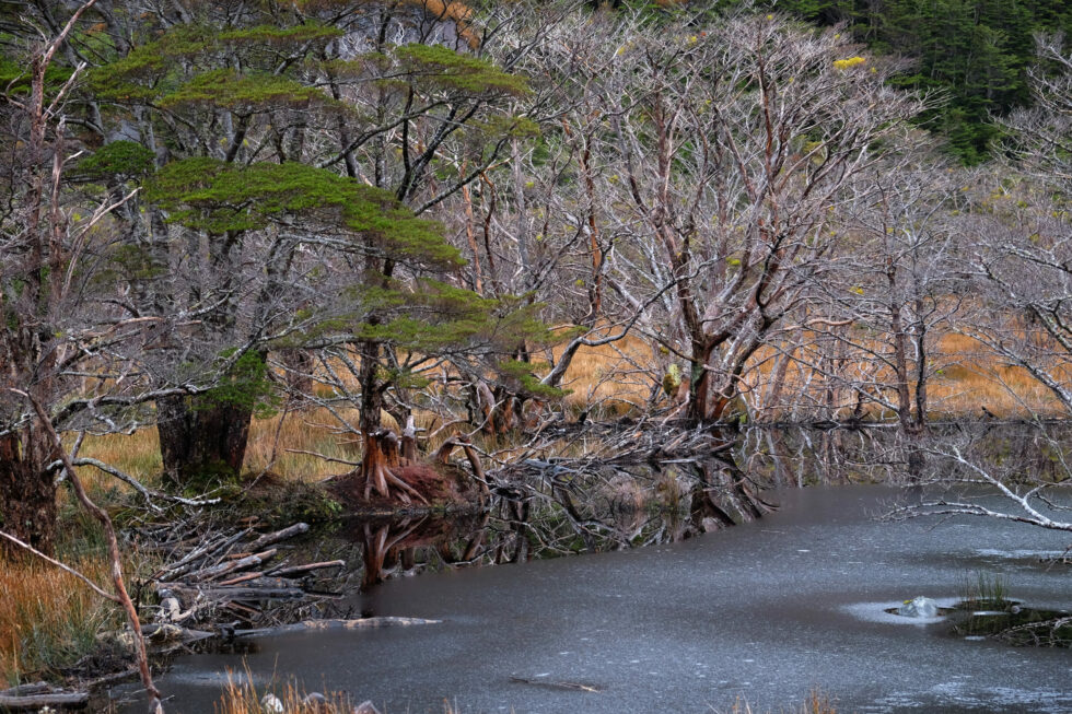
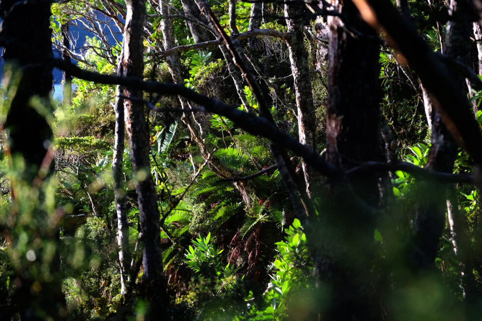
The vegetation of the Darwin Cordillera is characterized by the presence of subantarctic Magellanic forests, also called Fuegian forests. These ecosystems unique to the world are dominated by species of the genus Nothofagus, perfectly adapted to the region's extreme climatic conditions.
Magellanic forest photographed during a sailing expedition in Patagonia (Beagle Channel, Cape Horn Biosphere Reserve, Chile, 2025)
The lenga (Nothofagus pumilio) constitutes the most characteristic and most widespread forest species of the Darwin Cordillera. This deciduous tree, capable of resisting violent winds and freezing temperatures, forms dense stands up to 700 meters altitude. Its remarkable adaptation capacity allows it to survive in conditions where few other arboreal species can thrive.
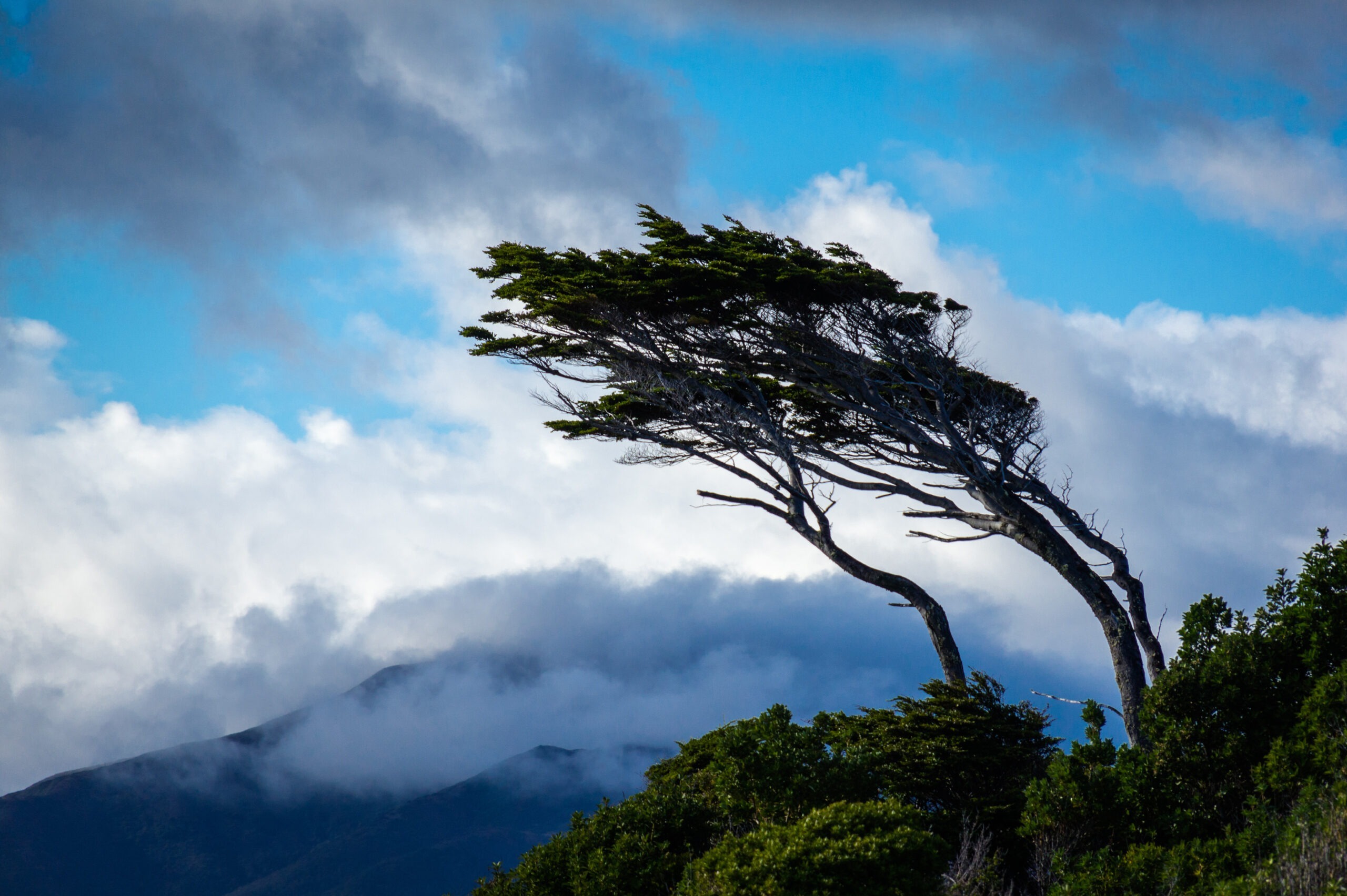
The coihue (Nothofagus betuloides) and ñire (Nothofagus antarctica) complete the southern beech cortege that dominates the forest landscape. These species, associated with canelo (Drimys winteri), form a dense and complex forest ecosystem, shaped by violent winds that literally sculpture tree silhouettes.
Adaptation to the extreme: dwarf lengas and tundra
Beyond 700 meters altitude, conditions become too rigorous to maintain normally sized forests. In this transition zone, a remarkable adaptation phenomenon is observed: the formation of dwarf lengas, trees of the same species but whose growth is considerably slowed and size reduced by extreme conditions.
Tundra landscape in the Cape Horn Biosphere Reserve (winter expedition 2018)
This transition zone marks the boundary between the forest tier and the alpine tier, where vegetation consists principally of mosses and lichens capable of resisting desiccating winds and negative temperatures. This Magellanic tundra constitutes a unique ecosystem, harboring highly specialized plant species.
Specialized flora and endemism
The understory of Magellanic forests harbors remarkable floristic diversity, adapted to conditions of constant humidity and low light. Among remarkable species, drosera uniflora, a small carnivorous plant, perfectly illustrates extraordinary adaptations developed by local flora to survive in this nutrient-poor environment.
Vegetation of the Magellanic forest (Cape Horn Biosphere Reserve, 2018)
Shrubs bearing berries occupy an important place in the ecosystem, notably calafate, Darwin's barberry, and Magellan currant. These species constitute a precious food source for local fauna and testify to the complex interconnection of trophic networks in this extreme environment.
Herbaceous flora includes remarkable endemic species such as Magellan primrose, Magellan avens, various orchid species, and yellow violet. The flowering period, concentrated on southern spring (September to December), briefly transforms landscapes into a kaleidoscope of colors contrasting with the environment's usual harshness.
Historical discovery by Charles Darwin
The modern history of the Darwin Cordillera begins on February 12, 1834, when Captain Robert FitzRoy names this mountain chain in honor of Charles Darwin's 25th birthday. This naming occurs during the HMS Beagle's second voyage, a British hydrographic expedition that revolutionizes geographical and scientific understanding of Tierra del Fuego.
Darwin himself, then 25 years old, discovers these mountains with a mixture of fascination and apprehension. In his writings, he describes a landscape of striking beauty but formidable hostility, already sensing the considerable challenges that exploring this region would represent. FitzRoy had initially named a canal southwest of the mountain "Darwin Canal" to honor the young naturalist's courage in rescuing the ship's boats threatened by falling ice.
The era of first attempts
For more than a century after its discovery, the Darwin Cordillera remains largely unexplored, defying the most audacious exploration attempts. Rare incursions limit themselves to the eastern and western extremities of the chain, leaving the massif's core in near total mystery.
Father Alberto de Agostini, an Italian missionary and explorer, counts among the first to seriously penetrate the region in the early twentieth century. His expeditions, conducted between 1910 and 1960, permit identification and mapping of several summits and glaciers, notably Mount Italia and Mount Francés. His photographs and accounts constitute the first visual testimonies of the Darwin Cordillera's interior, revealing to the world the magnificence of these glacial landscapes.
Alberto de Agostini and his climbing companions, pioneers of mountaineering in the Cordillera Darwin at the beginning of the 20th century.
The exploit of alpinist Eric Shipton (1961)
The year 1961 marks a turning point in the Darwin Cordillera's exploration history with the expedition led by Eric Shipton, one of the twentieth century's greatest British explorers. Accompanied by three Chilean alpinists – Eduardo Garcia, Francisco Vivanco, and Cedomir Marangunic – Shipton achieves what he believes to be the first ascent of Mount Darwin.
This expedition reveals a geographic confusion that persists until 1970. Shipton's team actually climbs a summit located northwest of the true Mount Darwin, culminating 40 meters higher than the latter. This error will be clarified by a New Zealand expedition in 1970, proposing to name the summit climbed by Shipton Mount Shipton, a proposal accepted by Chilean geographic authorities.
Shipton's expedition nonetheless marks a crucial stage in Darwin Cordillera knowledge, demonstrating the feasibility of high-altitude alpinism in this extreme region. Shipton's detailed descriptions reveal extraordinary difficulties posed by climate, with winds of such violence that alpinists must crawl on all fours to progress.
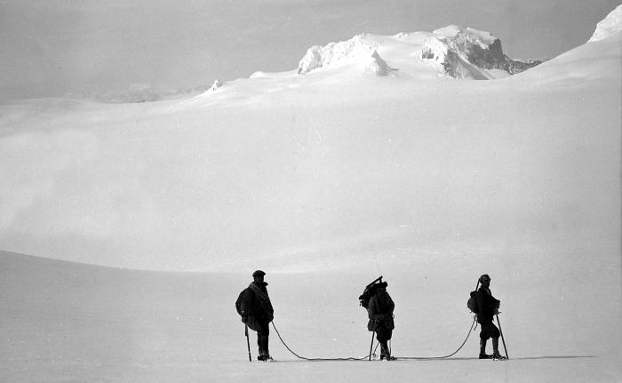
The first complete crossing by GMHM alpinists (2011)
October 6, 2011 marks the completion of one of the last great terrestrial exploration exploits of the twenty-first century. Six members of the Military High Mountain Group (GMHM) from Chamonix successfully complete the first integral crossing of the Darwin Cordillera, a sporting and human feat long considered impossible.
The expedition team named "on Darwin's edge," directed by Captain Lionel Albrieux and composed of Lieutenant Didier Jourdain, Master Sergeant Sébastien Bohin, Staff Sergeant François Savary, Corporal Sébastien Ratel, and civilian climber Dimitri Munoz, traverses 150 kilometers in a straight line (250 actual kilometers) in complete autonomy during 29 days.
This historic expedition requires meticulous preparation lasting an entire year. Each member carries 75 kilograms of equipment, including 40 kilograms of freeze-dried food, all hauled on pulkas (sledges) specially tested in Norway. The absence of reliable cartography – the latest dating from 1954 – obliges the team to rely on an unconventional GPS system associated with aerial photographs.
The conditions encountered exceed everything the French alpinists could have imagined. Facing Mount Darwin, the team must negotiate a 5-kilometer sharp ridge, oscillating between 40 centimeters and 1.5 meters wide. Winds regularly reach 150 km/h, forcing explorers to progress on all fours or even lying down to avoid being swept away.
The success of this expedition definitively transforms the Darwin Cordillera from a "terra incognita" into accessible territory, opening the way to future scientific and sporting explorations. The documentary film "On Darwin's Edge," created from images filmed by the team, testifies to this exceptional exploit and reveals to the general public the wild beauty of this region.
Conservation and protection status
Alberto de Agostini National Park
Protection of the Darwin Cordillera is principally articulated around Alberto de Agostini National Park, created on January 22, 1965 by Supreme Decree No. 80 of Chile's Ministry of Agriculture. With an area of 1,460,000 hectares, this park constitutes Chile's third largest protected area and encompasses the majority of the Darwin Cordillera.
The national park bears the name of Father Alberto María De Agostini (1883-1960), a Salesian missionary, explorer, photographer, geographer, and Italian ethnologist who devoted much of his life to exploring and documenting Patagonia and Tierra del Fuego. His pioneering works, including an important photographic collection and approximately twenty books on the region, constitute inestimable scientific and cultural heritage.
The park extends across three Chilean provinces: Magallanes, Tierra del Fuego, and Chilean Antarctica, illustrating the administrative complexity of this border region. It includes numerous islands (Gordon, Londonderry, part of Hoste Island), the entirety of the Darwin Cordillera with its glaciers, as well as numerous fjords.
International recognition and UNESCO Biosphere Reserve
In 2005, Alberto de Agostini National Park obtains major international recognition by integrating UNESCO's Cabo de Hornos (Cape Horn) Biosphere Reserve. This designation underscores the region's global ecological and cultural importance and places the Darwin Cordillera among the planet's 24 most pristine ecoregions.
One of the many fjords of Alberto de Agostini National Park (sailing expedition, Patagonian Channels, Chile, 2025)
Biosphere reserve status implies long-term conservation commitment, associated with scientific research programs and sustainable development. This recognition also fosters responsible ecotourism development, permitting visitors to discover this exceptional region while contributing to its preservation.
The Darwin Cordillera also benefits from protection offered by various international conventions, notably those concerning wetland and migratory species protection. Its unique geographic position makes it an essential corridor for numerous marine bird and marine mammal species transiting between the Atlantic and Pacific.
Current conservation challenges
Despite its protection status, the Darwin Cordillera faces several significant conservation challenges. Climate change constitutes the most concerning threat, with documented retreat of most glaciers in the region. The Marinelli Glacier, in particular, experiences accelerated retreat testifying to global warming's impact on these fragile ecosystems.
The introduction of exotic species, notably Canadian beavers, poses a major ecological challenge. These ecosystem engineers profoundly modify local hydrology by constructing dams, disrupting natural habitats and compromising Magellanic forest integrity.
Tourist pressure, though limited by the region's difficult accessibility (only by maritime access), requires careful management to prevent degradation of the most sensitive sites. The development of specialized cruises toward the Darwin Cordillera's glaciers requires a delicate balance between public accessibility, hazard awareness (avoiding fire due to wind and Yagan archaeological sites present on the coast) and environmental preservation.
Scientific research and contemporary issues
Climate change laboratory
This cordillera constitutes an exceptional natural laboratory for studying climate change and its impacts on subantarctic ecosystems. The region's glaciers, particularly the Marinelli Glacier, have been subject to continuous scientific monitoring for several decades.
Research conducted reveals a concerning trend of generalized glacier retreat. The Marinelli Glacier, which was one of the region's most stable glaciers until the 1960s, now presents retreat rates among the world's highest. This rapid evolution makes it a privileged indicator of climatic modifications at regional and global scales.
Geomorphological and climatological studies conducted in the Darwin Cordillera also contribute to understanding ocean, atmosphere, and cryosphere interaction mechanisms in southern high latitudes. This research holds particular importance for global climate prediction models.
Biodiversity and evolutionary adaptation
The Darwin Cordillera's unique geographic position, at the interface between temperate and subantarctic domains, makes it privileged terrain for understanding adaptation and species evolution mechanisms under extreme environmental conditions.
Research on marine fauna reveals the region's importance as a biological corridor between Atlantic and Pacific oceans. Marine mammal populations frequenting the Darwin Cordillera's fjords present particular genetic characteristics, testifying to these ecosystems' relative isolation.
Two southern right whales in the Beagle Channel (2018)
Study of Magellanic flora contributes to understanding vegetation adaptation mechanisms to extreme wind conditions and water stress. The dwarf forms developed by certain arboreal species constitute a study model for understanding organism phenotypic plasticity facing environmental constraints.
Ecosystem vulnerability and resilience
The cordillera's ecosystems present particular vulnerability to external disturbances, due to their geographic isolation and already extreme environmental conditions. This intrinsic fragility renders adaptive conservation strategy development all the more crucial.
Research on Magellanic forest resilience facing climate changes reveals variable adaptation capacities depending on species and sites. Some lenga populations show signs of increasing stress, while others appear to maintain vitality despite environmental modifications.
The impact of introduced species on local ecological balance undergoes thorough study, notably concerning Canadian beavers whose proliferation radically modifies aquatic and forest habitat structure. This research contributes to developing invasive species management strategies adapted to the Darwin Cordillera's specific conditions.
A world heritage to preserve
The Darwin Cordillera remains today one of the planet's last wild sanctuaries, a territory where nature still reigns as absolute master despite mounting pressure from human activities. This exceptional mountain chain, shaped by millions of years of geological and climatic evolution, constitutes natural heritage of inestimable value for all humanity.
The feat achieved by GMHM in 2011 has certainly lifted the veil on this "terra incognita," but it has also revealed the fragility of these unique ecosystems facing twenty-first century challenges. Accelerated glacier retreat, introduced species impact, and global climate change pressures threaten this natural jewel's integrity.
Preserving the Darwin Cordillera requires a global approach combining strict protection, cutting-edge scientific research, and responsible ecotourism development. This extraordinary region reminds us that certain territories of our planet merit preservation in their wild state, not only for their intrinsic beauty, but also for their irreplaceable role in understanding fundamental mechanisms governing our biosphere.
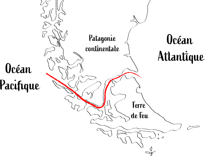
At the heart of Chilean Patagonia stretches one of the planet’s most emblematic sea passages: the Strait of Magellan. This 570-kilometre natural waterway, separating continental Patagonia from Tierra del Fuego, forms the main bi-oceanic corridor linking the Atlantic and Pacific Oceans. Inhabited for millennia by the Selknam, Kawésqar and Tehuelche peoples and discovered more than 500 years ago by Ferdinand Magellan, this strategic passage continues to fascinate thanks to its exceptional history, unique geography and remarkable biodiversity.
Table des matières
History and European discovery: in the footsteps of Magellan
The historic expedition of 1520
October 21, 1520, marks a crucial date in the history of global navigation. On this day, the Spanish expedition led by the Portuguese navigator Ferdinand Magellan discovered the eastern entrance of the strait that would bear his name. Departing from Seville in September 1519 with five ships and 237 men, Magellan was searching for a passage to the Molucca.
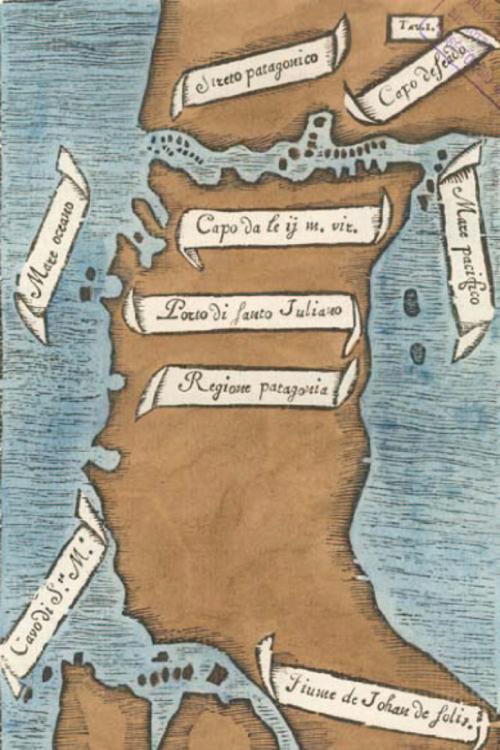
Map of the Strait by Antonio Pigafetta (Ferdinand Magellan expedition, 1520)
The explorer initially named the passage "Estrecho de Todos los Santos" ("Strait of All Saints") in reference to the religious feast celebrated on the day of its discovery. It was only after his death in the Philippines that Charles V, King of Spain, renamed the strait in honor of its discoverer.
A perilous and revolutionary navigation
Crossing the strait proved particularly difficult for Magellan’s expedition. The sailors faced violent winds, unpredictable currents, and a maze of channels bordered by snow-capped mountains. Antonio Pigafetta, the expedition’s chronicler, described the passage as being "110 leagues long" (about 440 miles) with "very safe harbors, excellent waters, cedar wood
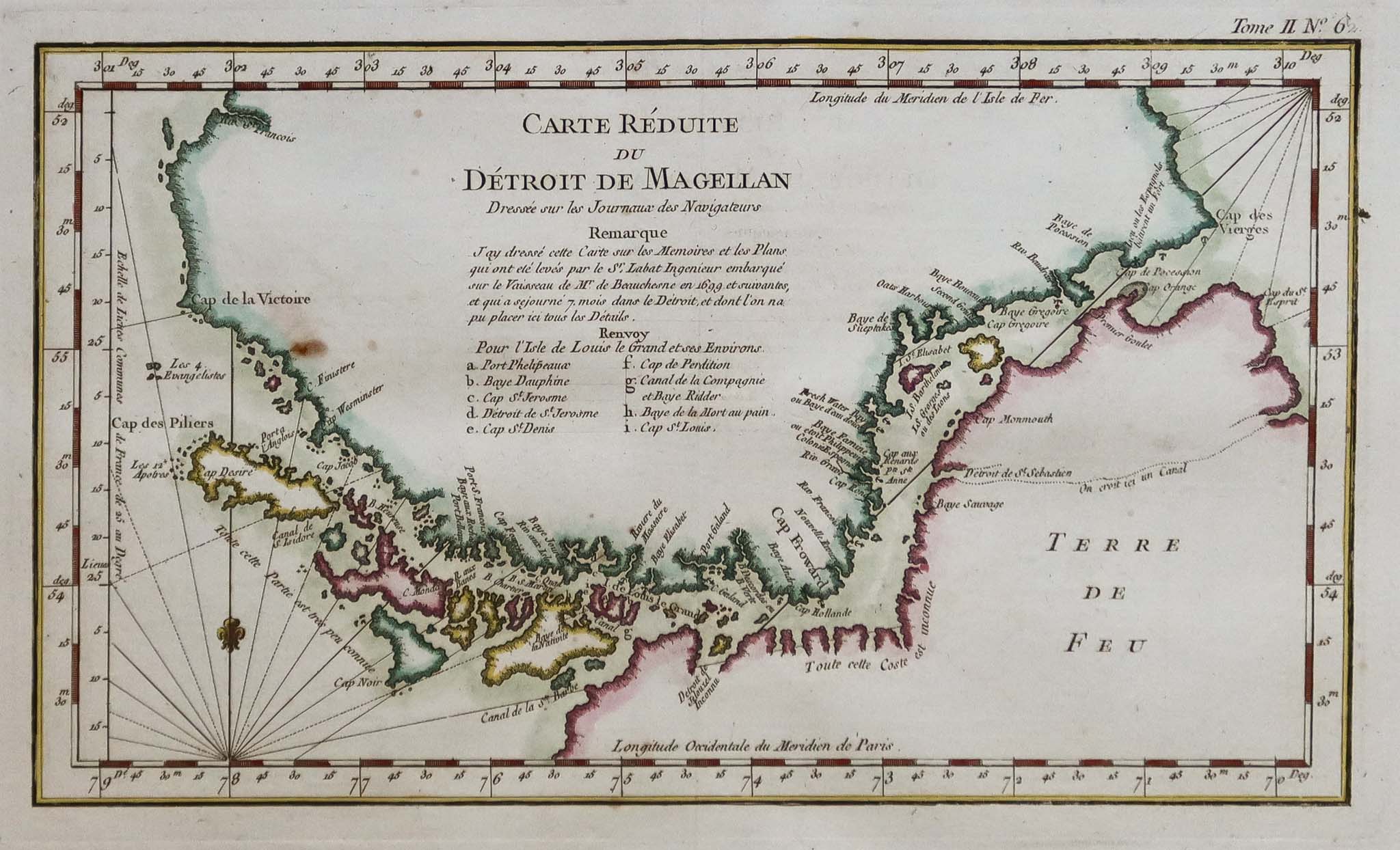
This discovery revolutionized global navigation by providing an alternative to the treacherous Cape Horn passage. Numerous expeditions were conducted to advance hydrographic knowledge to improve navigation safety; among these was the Beauchesne expedition. Before the opening of the Panama Canal in 1914, the Strait of Magellan quickly became the main maritime route connecting Europe to the Pacific coasts of the Americas.
Map of the Strait of Magellan (1699) based on observations from the French Beauchesne expedition
Geography and physical characteristics
Dimensions and configuration
The Strait of Magellan stretches 570 kilometers from Punta Dungeness in the east to the Evangelistas islets in the west. Its width varies greatly: it narrows to just 2 kilometers at its narrowest point near Carlos III Island and can widen to 32
The strait's depths are remarkable, ranging from a minimum of 28 meters near Magdalena Island to a maximum of 1,080 meters at the Cooper Key lighthouse. This complex geological configuration is the result of millions of years of tectonic and glacial activity that have shaped the Patagonian landscape.
Geological formation
The strait's origin dates back to the Late Cretaceous, about 80 million years ago. Earth movements created fractures with flat walls, giving rise to the Patagonian channels. During the Pleistocene, 1.5 million years ago, glacial action (glacial geology) deepened and widened these natural passages.
This geological history explains the strait’s unique morphology, characterized by deep fjords, rocky islands, and winding channels forming a true maritime labyrinth.
Climate and navigation conditions
This historic maritime passage poses particularly challenging weather conditions for navigation. The sub-antarctic climate features persistent westerly winds, often called “williwaw” (a Kawésqar word), which can exceed speeds of 100 knots (185km/h).
These winds, descending from coastal mountains (katabatic winds), create violent and unpredictable gusts, making navigation perilous. Temperatures generally range from -5°C to 15°C, with frequent precipitation and visibility often reduced by fog.
Indigenous Peoples: first guardians of the Strait
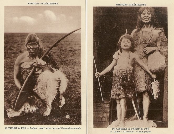
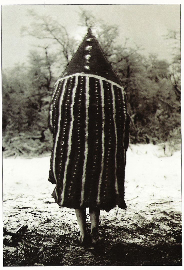
Long before Ferdinand Magellan discovered this maritime passage in 1520, the strait and its surroundings had been inhabited for over 11,000 years by different indigenous peoples. These first inhabitants developed complex and diverse cultures, perfectly adapted to the extreme conditions of southern Patagonia. Three main ethnic groups coexisted in this region: the Kawésqar, the Tehuelche (Aónikenk), and the Selknam.
Salesian archive photos: a seated Selknam man with his bow, and a Kawésqar woman with her son
These natives peoples had a deep knowledge of the land and were already navigating these difficult waters centuries before the arrival of Europeans. It was, in fact, their campfires, seen by Magellan's expedition, that gave the name “Tierra del Fuego” ("Land of Fire").
Before being called the “Strait of Magellan” and as part of indigenous cartography reconstruction activities by the Karukinka association, one Selknam transcription for this passage between the continent and Tierra del Fuego is Hatitelen.
The Kawésqar: nomads of the channels
The Kawésqar or Kawashkar, also incorrectly called Alacalufs by European navigators, are one of the peoples of the Patagonian channels. Sea nomads, they traveled the channels and fjords between the Gulf of Penas and the Strait of Magellan by canoe for about 6,000 years.
Lifestyle and territory
The Kawésqar territory covered a vast area, including the western part of the strait, Wellington Island, Santa Inés Island, and Desolación Island. Exceptional navigators, they lived mainly on their boats—canoes built from tree bark allowing movement through the Patagonian channel labyrinth.
Their society was organized into small family groups constantly moving in search of marine resources. They fed mainly on sea lions, shellfish, fish, and also collected cholgas (giant mussels up to 17cm). Their name literally means “person” or “human being” in their language.
Spirituality and rituals
The Kawésqar had a belief system centered on Xólas, an omnipresent and celestial creator being. Their complex rituals included ceremonies where women assembled in specialized huts, with their bodies painted, to commune with spiritual forces.
The use of body paint was central to their culture, especially during religious ceremonies and initiation rituals. These practices reflected a sophisticated worldview adapted to their extreme maritime environment.
The Tehuelche (Aónikenk): giants of the continental steppe
The Aónikenk, the southernmost branch of the Tehuelche group, inhabited the vast Patagonian steppes between the Santa Cruz River and the Magellanic strait. These nomadic hunter-gatherers were the first indigenous people encountered by Magellan’s expedition in 1520.
The “Patagonian Giants”
European navigators were amazed by the imposing stature of the Aónikenk, who generally measured over 1.80 meters, quite remarkable compared to Europeans of the time (under 1.65 meters). This physical difference gave rise to the myth of the “Patagonian giants” and the very name Patagonia.
The term “Patagón” was coined by Antonio Pigafetta, referring to the giant Pathoagon, a character from a chivalric novel, thus captivating the European imagination. The Aónikenk called themselves “aonek’enk,” meaning “people of the south.”
Social organization and territory
Aónikenk society was fundamentally egalitarian, organized in bands of hunter-gatherers who moved on foot across their hunting grounds. They possessed detailed environmental knowledge and set up their camps (aike) in strategic places.
Their territory was divided into family hunting zones with clearly established boundaries. Transgressing these could cause conflicts, highlighting the importance of spatial organization in their society.
The Selknam: guardians of Tierra del Fuego
The Selknam, also called Onas by their Yagan neighbors, inhabited the large island of Tierra del Fuego and represented one of the region’s most sophisticated cultures. They arrived on the island on foot before the end of the last glaciation, when the strait was still closed by ice, and developed a complex society with elaborate rituals.
Territorial and social organization
Selknam society was structured around lineages inhabiting communal territories called haruwen. The island was divided into several such territories, grouped into seven "cielos" (skies), major exogamous divisions requiring members to marry those from other groups.
This complex organization revealed a highly stratified society where every natural element was associated with mythical ancestors and specific spiritual territories.
The Hain ceremony
The most remarkable Selknam ritual was the Hain ceremony, a complex male initiation that could last several months. It served to initiate young men into adulthood while maintaining male dominance through sophisticated theatrical performance.
During the Hain, adult men disguised themselves as spirits using elaborate body paintings and masks, terrifying women who had to believe in these supernatural manifestations. The Selknam used only three colors: black (charcoal and ash), white (white clay), and red (ochre).
Tanu, one of the deities/spirits represented during the Hain, Selknam male initiation ritual; photo by Martin Gusinde
Shamanism and spirituality
Selknam shamans, called xo’on, enjoyed great prestige. They entered trances through extended chants, their souls attempting to ascend to one of the “skies” to obtain spiritual power. These shamanic practices reflected a complex spirituality connected to their territorial worldview.
Impact of colonisation and genocide
The arrival of European colonization in the 19th century marked the start of an unprecedented human tragedy for these peoples. Chilean and Argentinian colonization, with the establishment of sheep ranches and whaling, unleashed a true genocide against indigenous populations.
Systematic extermination
Between 1870 and 1900, Chilean and Argentinian authorities organized extermination campaigns against Patagonian and Fuegian peoples. Ranchers paid bounties for the ears of killed natives, making manhunt a profitable activity.
The Selknam population, estimated at over 3,000 in 1896, dropped dramatically to 279 in 1919 (Martin Gusinde, ethnologist), then to just 25 in 1945 (official figures). These numbers must be treated with caution, as they reflect the period’s filters, including intermixing and the need to hide indigenous identity for self-protection.
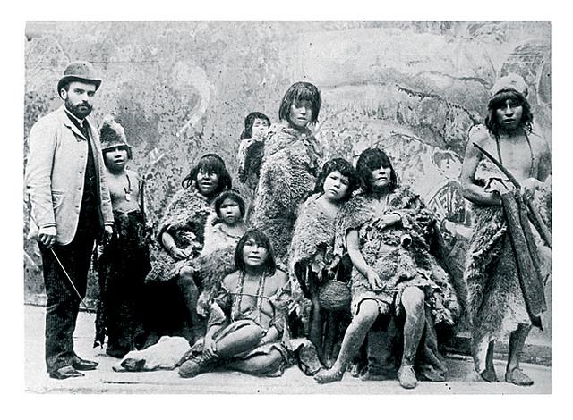
Human exhibitions
Humiliation culminated with the exhibition of native groups in European and South American “human zoos.” From 1878 to 1900, representatives of the Tehuelche, Selknam, and Kawésqar were captured to be displayed as curiosities. Many did not survive these dehumanizing exhibitions, some of the most degrading manifestations of colonialism and foundational acts of racism.
M. Maître and several captured Selknam, exhibited as part of human zoos in Europe, 1889
Renaissance and contemporary recognition
Despite assassination attempts, these peoples are not extinct. In recent decades, a remarkable cultural and political revival has taken place.
Official recognition
Argentina officially recognized the Selknam in 1994, while Chile did so in 2023 through Law 21,606. The 2010 Argentinian census records 2,761 people identifying as Selknam, with over 294 living in Tierra del Fuego. In Chile, 1,144 people declared themselves Selknam in the 2017 census.
The Kawésqar are recognized by Chilean Indigenous Law 19,253 (since 1993) and are organized into 14 Indigenous Communities. According to the 2017 Chilean census, 3,448 people declare themselves Kawésqar.
Research and rehabilitation
Chilean universities, notably the Universidad de Magallanes and the Universidad Católica Silva Henríquez, conduct research to document the true history of these peoples. Their findings show the Selknam were more numerous than previously thought and challenge colonizer-imposed historical narratives.
This cultural revival bears witness to these peoples’ extraordinary resilience, who, despite systematic genocide, keep their identity alive and claim their place in the history of the Strait of Magellan.
Patagonia wildlife : an exceptional marine fauna
The Strait of Magellan harbors remarkable marine biodiversity, ranking among the richest areas of the Southern Hemisphere. Its cold, nutrient-rich waters support a unique ecosystem with numerous endemic species.
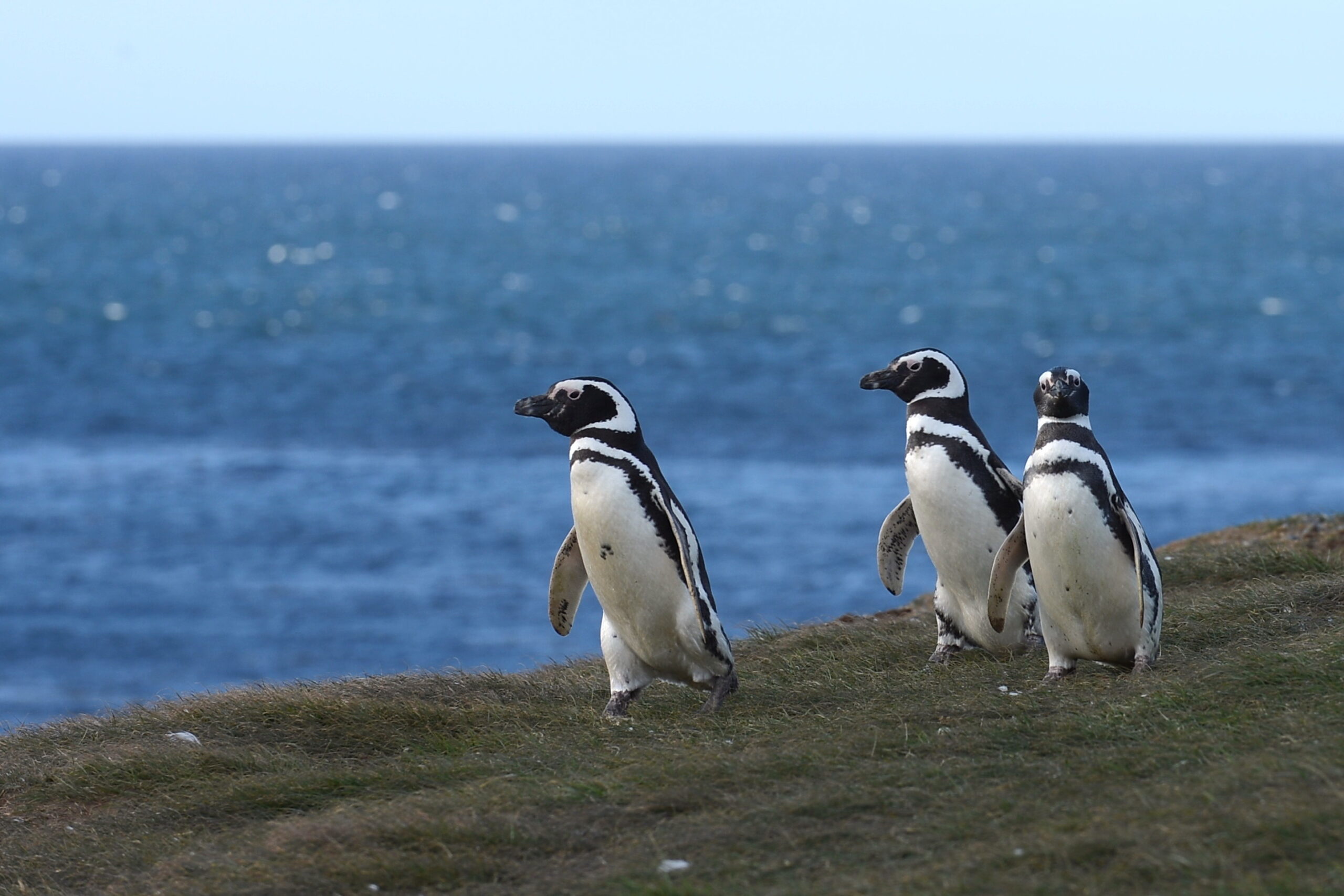
Magellanic penguins
Magellanic penguins on Magdalena Island (Magellan Strait, Magallanes province, Chile)
Magdalena Island, 32km northeast of Punta Arenas, hosts the strait’s largest Magellanic penguins colony (Spheniscus magellanicus) colony—about 50,000 breeding pairs gather there each year (October to March) for the breeding season.
Named in honor of Ferdinand Magellan, who saw them in 1520, these penguins reach up to 76cm and weigh 2.7–6.5kg, and are distinguished by two characteristic black bands on their chest.
Marine mammals
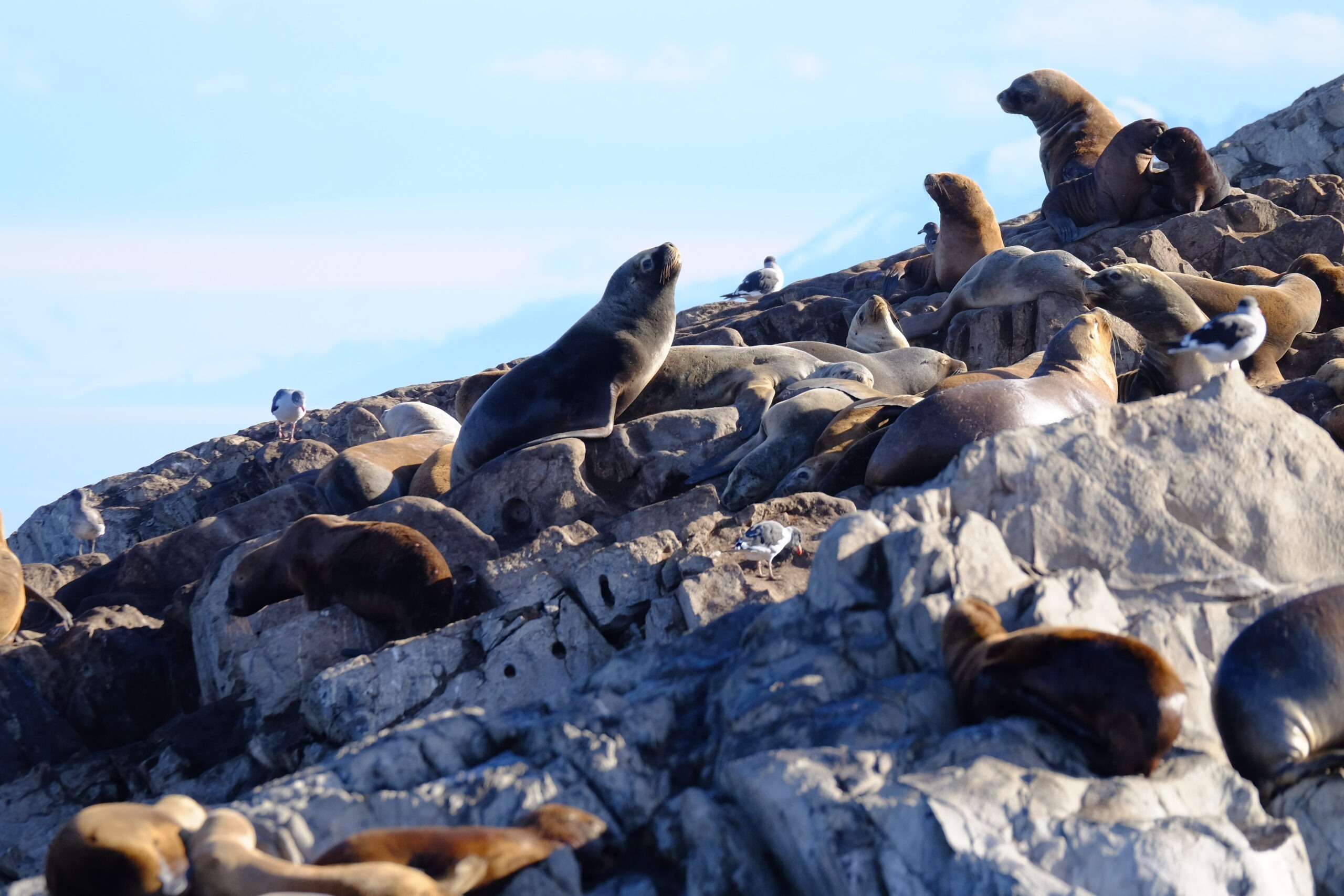
The strait supports a rich population of marine mammals. Humpback whales are especially frequent in the Francisco Coloane Marine Protected Area, created for their conservation—one of the world’s best whale-watching spots.
South American sea lions (Otaria flavescens) and southern elephant seals establish colonies on the strait's rocky islands. Marta Island, near Magdalena, is home to over 1,000 sea lions and various seabird species.
Small fur seal colony, Patagonian channels, Chile
Bird diversity
The strait’s waters attract many seabird species: imperial cormorants, black-browed albatrosses, southern giant petrels, and the majestic Andean condors.
Terrestrial flora and coastal ecosystems
Coastal vegetation from the strait to Cape Horn reflects the flora’s remarkable adaptation to Patagonia’s extreme climate. Nothofagus forests—Magellan’s beech (Nothofagus betuloides), lenga (Nothofagus pumilio), and ñirre (Nothofagus antarctica)—dominate wind-shaped wooded areas.
Patagonian beech bent by the wind, Estrecho de Magallanes, Chile
More exposed zones feature matorrals composed of romerillo (Chiliotrichum diffusum), chaura (Pernettya pumila), and the iconic calafate (Berberis microphylla), a small fruit shrub. The region also boasts an exceptional diversity of mosses and lichens, miniature bryophyte forests emblematic of these subantarctic ecosystems.
Magellan Strait navigation and modern strategic importance
Mandatory piloting and Chilean maritime navigation rules for safety
Since 1978, navigation in the Strait of Magellan, as a cape Horn alternative, has required mandatory piloting for all commercial vessels, a measure by Chilean maritime authorities to ensure safety in these challenging waters and protect the exceptional marine environment.
Pilots generally board at Bahia Posesión for the eastern entrance and guide ships to the western exit near the Evangelistas islets, backed by a network of lighthouses and maritime traffic control stations along the strait.
Economic and geopolitical renaissance
Contrary to pessimistic predictions after the Panama Canal opened, the Strait of Magellan is experiencing a major strategic renaissance. Chilean Navy reports a 25% maritime traffic increase in 2024 over the previous year and projects a 70% increase for the year overall.
This growth results from several converging factors: global geopolitical tensions, the Panama Canal’s limitations for large ships, and Asia-Pacific’s emergence as a global economic hub. The strait route is 390 nautical miles shorter than via Cape Horn, saving about 32 navigation hours.
Green hydrogen development Magallanes
Magallanes is emerging as a major green hydrogen player, thanks to its exceptional climate. Constant, strong winds provide wind energy potential capable of producing seven times Chile’s current electrical capacity.
This controversial development would turn the strait into a strategic energy corridor for global green hydrogen supply. Chinese and Japanese investments reflect growing international interest in this new economic activity.
Tourism and discovery
Cruises and wildlife observation tours
The Strait of Magellan has become a premier tourist destination, attracting nearly 77,691 passengers for the 2024–2025 season. Punta Arenas, the region’s main port, hosts 175 cruises from 47 different ships, establishing the area as Chile’s leading cruise tourism port system.
Excursions to Magdalena Island are the highlight, with half-day trips for visitors to observe Magellanic penguins and whales in their natural habitat, guided by specialists who share insights about the birds’ and whales’ biology and behavior.
Antarctic gateway for tourism
The strait is a preferred gateway to Antarctica: Over 60% of cruise passengers (47,222) choose Antarctic programs, making Punta Arenas and Puerto Williams the main departure points for polar expeditions via the Drake Passage.
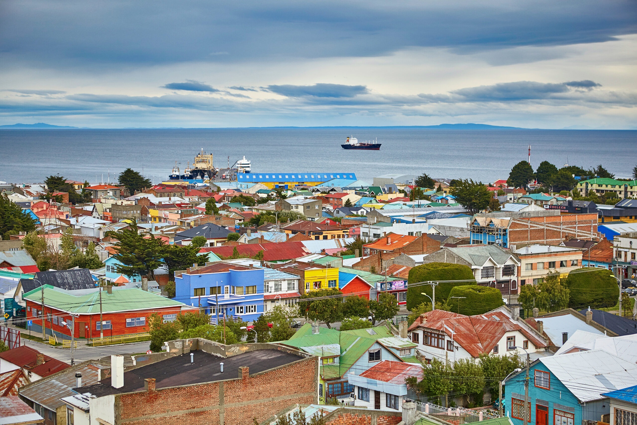
View of Punta Arenas, a stopover for international maritime transit, Magallanes Province, Chile, South America
This specialization strengthens the region as a hub for international polar tourism, with infrastructure meeting International Association of Antarctic Tour Operators (IAATO) standards.
Conservation and environmental challenges
Marine protected areas
Conservation of the strait’s unique ecosystem relies on several marine protected areas. The Francisco Coloane Marine Park is Chile’s first marine park, created to protect whales and their habitat.
The Los Pingüinos Natural Monument, established in 1982, protects Magdalena and Marta islands and their exceptional fauna. These measures aim to maintain ecological balance while allowing sustainable tourism.
Climate challenges
Climate change presents a major challenge for the strait’s ecosystem. Altered ocean currents, changing temperatures, and shifts in species distribution require constant scientific monitoring.
The Magallanes region is studied intensively to understand climate change’s impact on subantarctic biodiversity. This research informs broader understanding of environmental changes in polar regions.
A passage for the Future
The Strait of Magellan perfectly embodies the meeting of history and future, preservation and development. This legendary passage, discovered over five centuries ago, is regaining strategic importance in a world in energy and geopolitical transition.
A unique bi-oceanic corridor and sanctuary for exceptional biodiversity, the Strait of Magellan stands out as one of the planet’s most fascinating places. Its ability to unite economic development, environmental preservation, and tourist appeal could make it a model for polar regions in the 21st century.
For travelers seeking extraordinary discoveries, this maritime passage offers an unforgettable experience at Patagonia’s far south, with one continental shore and one insular. Between maritime history, extraordinary wildlife, and magnificent landscapes, this legendary passage continues to write the greatest chapters of human adventure at the world’s southern edge.
The Cabo de Hornos Biosphere Reserve (Cape Horn Nature Reserve), established in 2005, is one of the southernmost and largest protected areas in the world, covering more than 4,884,000 hectares of southern lands and waters. It contains unique terrestrial and marine ecosystems, pristine subantarctic forests, remarkable biodiversity—including over 5% of the world’s bryophyte diversity—and the last populations of the Yaghan people, who maintain a millennia-old connection with these extreme landscapes.
Table des matières
The Cabo de Hornos Biosphere Reserve was included in UNESCO’s “Man and the Biosphere” program in June 2005, becoming both the southernmost and one of the largest biosphere reserves in South America. Spanning about 4,884,274 hectares, it comprises a terrestrial area of 1,917,238 ha and a marine area of 2,967,036 ha, integrating for the first time in Chile both marine and terrestrial ecosystems under a unified conservation status. The Alberto de Agostini and Cape Horn National Parks form the core protected area, where all infrastructure development is strictly prohibited.
1. Geography and zoning of the Cape Horn nature reserve
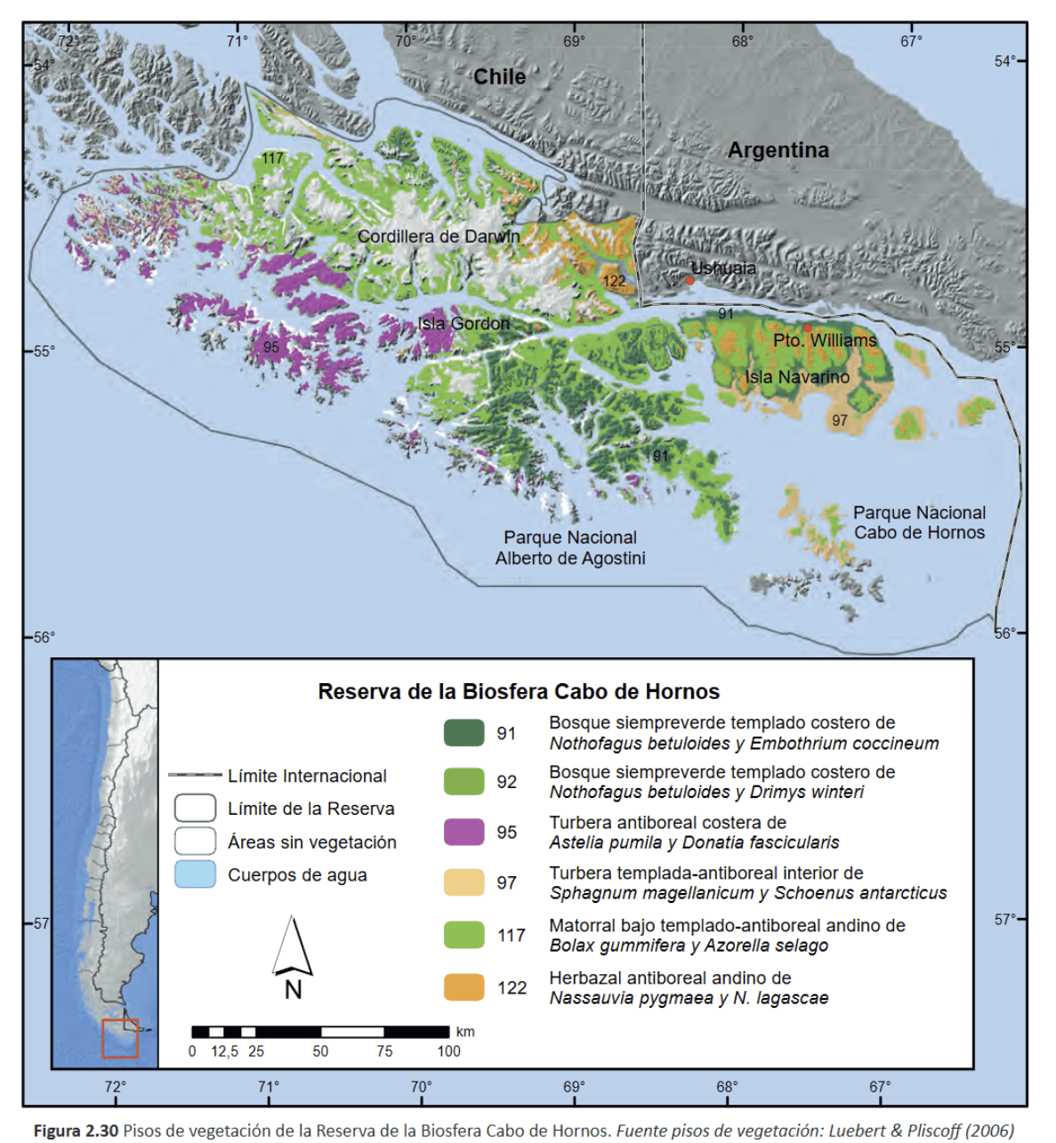
Geographically, the reserve extends across the Tierra del Fuego archipelago, between 54.1° S and 56.2° S latitude, and 66.1° W and 72.5° W longitude. It includes the Wollaston, Hermite, Navarino, and Hoste islands, as well as channels (including the Beagle Channel), fjords, and currents that form a landscape shaped by glaciations and tectonic activity. The UNESCO MAB Reserve zoning (Cabo de Hornos Biosphere Reserve, i.e., the southern Chilean marine reserve) is structured into three areas:
The core zone (Alberto de Agostini National Park including the Darwin Range, and Cape Horn National Park) is strictly protected.
The buffer zone, where light and sustainable activities are allowed.
The transition zone, including isolated villages like Puerto Williams and limited infrastructure under a sustainable development framework.
The reserve’s subantarctic forests are the southernmost on earth. Dominated by three Nothofagus species—N. pumilio, N. betuloides, and N. antarctica—they form both deciduous and evergreen stands, interspersed with peat bogs and alpine heaths. These forests are among the world’s rare examples of non-fragmented temperate forest. The organic-rich soils support vast carpets of bryophytes, typical of the cool, humid environment; these play a crucial role in the hydrological cycle and carbon sequestration.
2.2 Marine and coastal ecosystems
The marine component of the reserve centers around a complex network of fjords, channels, and underwater plateaus. The Humboldt current and the mixing of cold Pacific and Atlantic waters have fostered the development of kelp forests (Macrocystis pyrifera, Durvillaea antarctica) forming “underwater forests” that host diverse invertebrate fauna and fish communities. Intertidal habitats harbor macroalgae species and numerous endemic invertebrates, while the cold, oxygen-rich waters support populations of seals, sea lions, and several cetacean species.
3. Biological diversity and endemism: subantarctic biodiversity
3.1 Bryophytes and lichens
With over 300 species of liverworts and 450 species of mosses, the reserve is a global hotspot for bryophytes, representing more than 5% of global diversity on less than 0.01% of the world’s land surface. These communities, described as “miniature forests,” serve as sentinels for assessing the impacts of climate change and rising UV radiation.
Example of bryophytes / miniature forest (mosses, liverworts, and lichens) from the Cape Horn Biosphere Reserve (MAB-UNESCO); Navarino Island, 2020 (c) Lauriane Lemasson.
3.2 Terrestrial and marine fauna
Terrestrial fauna include the southern river otter (Lontra provocax), the Magellanic woodpecker (Campephilus magellanicus), and other endemic birds. In the marine environment, the surrounding waters are home to black-browed albatross, giant petrels, Magellanic penguins, and stable populations of fur seals and leopard seals, highlighting the ecological importance of this protected area.
A black Carancho from Martial Bay (Cape Horn Reserve, April 10, 2025, during a sailing expedition at Cape Horn and in the Patagonian channels)Whales in the Beagle Channel during the 2018 expedition (Karukinka Association)
4. Biocultural dimension and Yaghan ethnology
The reserve is also a cultural sanctuary. The Yaghan, nomadic people of the southern channels, are the world’s southernmost indigenous group, with a presence dating back over 7,500 years, as evidenced by archaeological sites on Navarino Island. They continue to possess expert knowledge of canoe navigation and subantarctic ecology, and have actively participated in research within the reserve, particularly through the Omora Ethnobotanical Park near Puerto Williams. Their oral traditions, language, and knowledge of local flora and fauna are incorporated into educational and conservation programs. Ecotourism in Patagonia is also a key activity of the Omora initiative.
5. Governance and management
The reserve is managed by a board chaired by the regional governor, involving public agencies and local organizations. The scientific committee, coordinated by the Omora Park and the University of Magallanes, leads research, ecological monitoring, and participatory conservation efforts. In 2006, the reserve joined UNESCO’s Ibero-MAB network, strengthening transnational cooperation for research and training.
6. Threats and conservation challenges
Despite its isolation, the reserve faces several threats:
Uncontrolled tourism development, particularly southern cruises and increased traffic around Cape Horn, poses risks of pollution and disturbance to marine wildlife.
Intensive salmon farming in northern fjords introduces exotic species and degrades water quality. Salmon now breed in these waters, impacting native species such as the robalo.
The spread of introduced species such as the North American beaver and mink threatens riparian forests, streamside habitats, and shorebird nesting sites.
Long-term monitoring programs, such as the Omora initiative and Long-Term Ecological Research (LTER) stations, assess these pressures and propose adaptive measures. However, monitoring is hampered by the vastness of the reserve and its logistical challenges.
Lake created at the foot of a glacier by beavers, photographed during a sailing expedition in Patagonia (Beagle Channel, Hoste Island, Cape Horn Biosphere Reserve, Chile).
7. Research and education initiatives
7.1 Omora Ethnobotanical Park
Founded in 2000, the Omora Ethnobotanical Park is at the center of a transdisciplinary approach combining ecology, environmental philosophy, and “field philosophy” education. It offers educational trails, including “miniature forests,” to raise public awareness of bryophyte diversity and the link between biodiversity and Yaghan culture.
7.2 Cape Horn International Center (CHIC)
Inaugurated in 2020 in Puerto Williams, CHIC brings together researchers, artists, and indigenous communities to develop a model for biocultural conservation, technical training, and sustainable development. Its programs address the responses of biodiversity to climate change, the management of invasive species, and the formulation of public policy adapted to subantarctic zones.
The Cabo de Hornos Biosphere Reserve remains one of the rare refuges where harmonious coexistence between local inhabitants and ecosystems at the literal edge of the world is fully realized. Securing its future means strengthening participatory governance, managing invasive species, and supervising polar tourism under the banner of responsible ecotourism. Finally, the ongoing integration of Yaghan knowledge in research and education programs will ensure the preservation of both the biological and cultural heritage of this unique subantarctic sanctuary.
Pia Glacier, Patagonian Channels, Darwin Range, Cape Horn Biosphere Reserve, Magallanes, Chile, 2025
Bibliography
Rozzi, R. et al. (2006). Ten Principles for Biocultural Conservation at the Southern Tip of the Americas: The Cape Horn Biosphere Reserve. Ecology and Society, 11(1). https://www.ecologyandsociety.org/vol11/iss1/art43/
Rozzi, R. et al. (2004). Omora Ethnobotanical Park: A Model for Integrating Biocultural Conservation and Environmental Philosophy in the Cape Horn Biosphere Reserve. Environmental Ethics, 26(2), 131–169. https://doi.org/10.5840/enviroethics200426226
Mittermeier, R. A. et al. (2003). Hotspots: Earth’s Biologically Richest and Most Endangered Terrestrial Ecoregions. Conservation International. https://www.conservation.org
CONAF (Corporación Nacional Forestal). (2023). Reserva de la Biósfera Cabo de Hornos. Gobierno de Chile. https://www.chilebosque.cl
Cape Horn International Center (CHIC). (2021). CHIC Strategic Plan 2021–2026. Universidad de Magallanes. https://www.centrochic.cl
Anderson, C.B. et al. (2011). Exotic ecosystem engineers transform sub-Antarctic forest structure and function. Biological Invasions, 13, 545–561. https://doi.org/10.1007/s10530-010-9841-4
Anderson, C.B. et al. (2019). Cape Horn’s Lessons for Sustainability. Science Advances (UNESCO CHIC/UMAG). https://advances.sciencemag.org/
Rozzi, R. et al. (2010). La Reserva de Biósfera Cabo de Hornos: una propuesta educativa y de desarrollo sustentable en el extremo austral de Chile. Universidad de Magallanes. Disponible sur la bibliothèque CHIC.
Cape Horn (Cabo de Hornos in Spanish, Kaap Hoorn in Dutch, Loköshpi in the Yaghan language) is far more than just a geographic point. Located at 55°58′ south latitude and 67°16′ west longitude, this rocky promontory at 425 meters above sea level marks the southernmost point of the Tierra del Fuego archipelago and symbolically marks the meeting of the Atlantic and Pacific Oceans. At 965 kilometers from the Antarctic continent and just 138 kilometers from Ushuaia, Cape Horn rises as the ultimate sentinel of the Americas before the vastness of the Southern Ocean.
Table des matières
Geographical Position of Cape Horn
Location within the Fuegian archipelago
Cape Horn is situated on Horn Island (Isla Hornos), the southernmost island of the Hermite archipelago, itself part of the vast island complex of Tierra del Fuego. This modestly sized island (approximately 6 km by 2 km) is administratively part of the commune of Cabo de Hornos, in the Antarctic Province, within the Magallanes and Chilean Antarctic Region.
Contrary to popular belief, Cape Horn is not the southernmost point of the South American continent — that title belongs to the Diego Ramírez Islands, located 105 kilometers to the west-southwest. However, Cape Horn remains the southernmost of the great historical sailing capes and the most symbolic nautical waypoint in the Southern Hemisphere.
Precise Coordinates and Strategic Distances
With exact coordinates of 55°58′28″ south latitude and 67°16′10″ west longitude, Cape Horn lies at a unique geographical intersection where the major oceans of the Southern Hemisphere converge:
Distance from Ushuaia (Argentina): 138 km to the north-northwest
Distance from Puerto Williams (Chile): 56 km to the north
Distance from the Antarctic continent: 965 km to the south
Distance from the geographic South Pole: 2,535 km
Geographic map showing Cape Horn at the southern tip of South America, adjacent waters including Drake Passage, and nearby islands located in the Pacific, Atlantic, and Southern Oceans. (Source : Wikipedia)
Geological Formation and Geomorphology
Regional geological context
The Cape Horn region is embedded in the complex geological history of Tierra del Fuego, shaped by Andean orogeny and Quaternary glaciations. The archipelago was formed through a process of collapse and fragmentation of the southern tip of the Andes, amplified by glacial erosion and rising sea levels following the last Ice Age.
The geological formations of Horn Island consist mainly of sedimentary and volcanic strata from the Upper Cretaceous period, bearing witness to the intense tectonic activity related to the closure of the Rocas Verdes marginal basin and the early stages of Andean compression. This explains the rugged topography of the region, characterized by moderate elevations but extremely fragmented coastlines.
Coastal Morphology
To sailors, Cape Horn appears as a 425-meter cliff dropping directly into the ocean. This distinctive coastal morphology is the result of marine erosion, Quaternary glacial-interglacial cycles, and ongoing tectonic activity.
The Magellan-Fagnano Fault, a left-lateral strike-slip fault running east–west through Tierra del Fuego, indirectly influences the geomorphology of the Cape Horn region. With a movement rate of approximately 6.4 mm/year, this fault is a reminder of the continuous tectonic activity that shapes this part of the world.
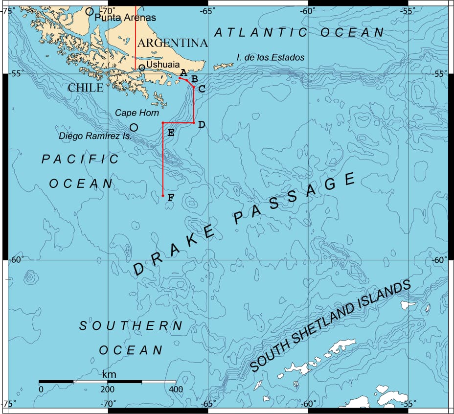
Cape Horn marks the northern boundary of the Drake Passage, an 809-kilometer-wide strait separating South America from the Antarctic Peninsula. This strait represents the shortest distance between Antarctica and any other continental landmass, only 135 kilometers wide at its narrowest point, between Cape Horn and Snow Island in the South Shetlands.
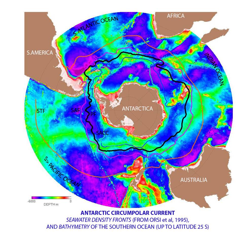
Map of the Antarctic Circumpolar Current and Seawater Density Fronts Around Antarctica, Showing Ocean Depth and Main Fronts Near the Southern Ocean and Surrounding Continents (source : Wikipedia)
Antarctic Circumpolar Current
The Drake Passage is the point of maximum constriction of the Antarctic Circumpolar Current (ACC) — the most powerful ocean current on Earth. The ACC transports an average of 150 million cubic meters of water per second — nearly 100 times the combined flow of all the world’s rivers. Its strength peaks at Cape Horn.
This oceanographic phenomenon is the main driver of the extreme weather conditions in the region. With no continental barriers, the ACC fuels the relentless west winds known as the “Roaring Forties” and “Furious Fifties”.
Subpolar Oceanic Climate
Cape Horn enjoys a subpolar oceanic climate, with relatively stable yet cold year-round temperatures. Average temperatures hover around 5°C, and the area receives up to 2,000 mm of rainfall annually, with nearly 278 days of rain per year.
Wind is the dominant climatic factor, averaging 30 km/h but frequently exceeding 100 km/h during storms. These conditions are directly linked to Cape Horn’s position within the zone of the Furious Fifties — a corridor of uninterrupted westerly winds that circle the Southern Hemisphere.
Biodiversity and Conservation Status
Cape Horn Biosphere Reserve (UNESCO)
Since 2005, Cape Horn has been part of the Cabo de Hornos Biosphere Reserve, recognized by UNESCO under the Man and the Biosphere Programme (MAB). The reserve spans 4,884,273 hectares, encompassing a core area of 1,347,417 hectares composed of the Alberto de Agostini National Park and Cape Horn National Park.
The southernmost part of Horn island during a sailing expedition to cape Horn with SY Milagro (Association Karukinka, 2025)
Cabo de Hornos National Park
The Cabo de Hornos National Park, created on April 26, 1945, spans 63,093 hectares and includes the Wollaston and Hermite archipelagos. It is the southernmost protected area on the planet, hosting unique subantarctic ecosystems adapted to harsh climatic conditions.
Exceptional Biodiversity
The Cape Horn region is home to the southernmost forest ecosystem in the world and harbors 5% of the planet’s bryophyte species (mosses and liverworts).
The flora comprises Magellanic subpolar forests, dominated by Nothofagus species (southern beeches), alongside rich communities of mosses, lichens, and ferns adapted to extreme cold and humidity.
Primary forest in Tekenika Bay (Cape Horn Biosphere Reserve, Karukinka Expedition, 2018)
The marine fauna is equally impressive: humpback whales, southern dolphins, South American sea lions, elephant seals, and orcas are frequently observed. The birdlife is dominated by black-browed albatrosses, giant petrels, Magellanic penguins, imperial cormorants, and even Andean condors.
Whales observed during a sailing expedition through the Patagonian channels (Chile) autumn 2018 (c) Karukinka
Maritime History and European Discovery
The Discovery of 1616
Cape Horn was discovered on January 29, 1616, during a Dutch expedition led by Willem Schouten and Jacob Le Maire. They sought an alternative to the Strait of Magellan to bypass the trade monopoly of the Dutch East India Company.
The cape was named in honor of the Dutch town of Hoorn, the expedition’s port of origin. This discovery profoundly altered maritime trade routes by offering a new corridor — broader than the Strait of Magellan, but vastly more dangerous.
A Historic Trade Route
For nearly three centuries, Cape Horn was a crucial maritime passage for global trade routes. Large sailing ships — known as “Cape Horners” — traversed these waters carrying goods between Europe, the Americas, and Asia: including nitrate, grain, wool, and gold from Australia.
The era of the great sailing ships ended with the opening of the Panama Canal in 1914. The last commercial sailing vessel to round the Horn was the Pamir, in 1949, marking the close of a legendary chapter in maritime history.
One of the many maps produced during the French Cape Horn Mission (1882–1883) led by Commander Martial
Indigenous Context and Cultural Memory
The First Inhabitants
Before European colonization (1860–1920), the Cape Horn region was solely inhabited by the Yaghan people (also Yámana) — marine nomads who navigated these waterways in bark canoes. These hunter-gatherers developed an extraordinary maritime culture adapted to the severe subantarctic climate.
The Cape Horn promontory was called Loköshpi in the Yaghan language, reflecting a rich indigenous toponymy. According to research by Karukinka Association, over 3,000 indigenous place names (in Yaghan, Haush, and Selk’nam) have been recorded in the area, revealing a detailed and sensitive knowledge of the landscape.
Preservation and Memory Work
For over a decade, the Karukinka Association, founded by Lauriane Lemasson in 2014, has worked to archive, preserve, and honor the memory of the indigenous cultures of the Cape Horn region. Their expeditions in the Patagonian channels, from Tierra del Fuego to Cape Horn, have contributed to sound archives, toponymic mapping, and cultural education.
This work is all the more crucial when one considers that these peoples experienced cultural genocide in the early 20th century, their population declining from over 10,000 individuals to fewer than 500 by 1920.
Contemporary Challenges and Futures
Tourism and Conservation
Cape Horn now attracts a growing number of expedition cruises, mostly departing from Ushuaia or Punta Arenas. While weather constraints limit visitor numbers, increased traffic poses conservation challenges for fragile ecosystems.
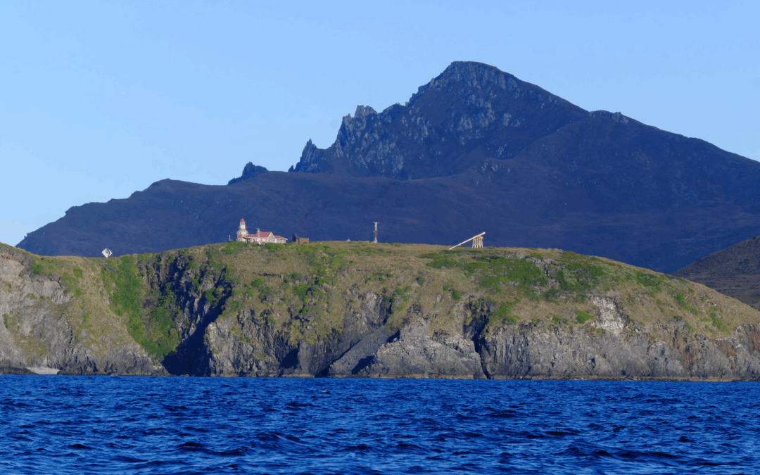
Chile maintains a military base on Horn Island, with a garrison, a chapel, and a lighthouse. The lighthouse keeper and their family constitute the only permanent inhabitants of this isolated place.
The Cape Horn lighthouse with the Cape promontory in the background during the rounding of Cape Horn by sailboat in April 2025 (Karukinka Expedition, sailing vessel Milagro)
Scientific Research
Cape Horn continues to be a site of important scientific research, particularly regarding climate change, oceanography, and subantarctic biodiversity. The work of the Karukinka Association and its partners contributes to the growing body of knowledge on extreme ecosystems undergoing rapid transformation.
Conclusion
Cape Horn occupies a unique place on the globe — both physically and symbolically. Situated at the southern tip of Horn Island in the Hermite archipelago, at 55°58′ South and 67°16′ West, it marks the symbolic point of convergence between the Atlantic and Pacific Oceans, between the Americas and Antarctica.
Its geographic position explains its extreme oceanographic and climatic conditions, forged over millennia of tectonic, glacial, and atmospheric dynamics. The Antarctic Circumpolar Current, the furious westerly winds, and the legendary nature of the Drake Passage make this one of the most dangerous maritime zones in the world.
Yet beyond the physical landscape lies a story of human history, resilience, tragedy, and conservation — from the Yaghan navigators to the Dutch explorers, from the age of sail to the fight to protect its fragile ecosystems.
To understand Cape Horn is to grasp the essence of a place where extremity meets universality, and where the end of the world becomes a mirror of the planet’s past, present, and future.
An outbreak of avian flu in 2023 hammered a colony of southern elephant seals in Chile’s Tierra del Fuego region, leading to a 50% decline in its population.
But over the 2024-2025 breeding season, the colony’s population recovered, with 33 pups being born.
An alliance between the Chilean branch of the Wildlife Conservation Society and the regional environmental department has been monitoring this particular colony for years, braving the remoteness and extreme weather at the southern tip of the Americas.
Experts posit that the site, Jackson Bay, may serve as a natural refuge from the avian flu because it’s geographically isolated as a fjord.
Year after year, a colony of elephant seals arrives in Jackson Bay, on the islands of Tierra del Fuego at the southern tip of Chile, to molt and breed. However, in 2023, an outbreak of avian flu devastated the region, and the colony’s population dropped by half.
In 2020, when avian flu caused devastating losses in seabird colonies in Europe and Southern Africa, experts initially thought the virus’s spread to mammals would be limited to terrestrial carnivores. However, during the outbreak in 2021 and 2022, the virus affected seals and whales in both Europe and North America. In 2023, when the virus arrived on the South American coast, the pathogen showed that it was capable of causing large-scale mortality among marine mammals. The southern elephant seal (Mirounga leonina) was one of the most heavily impacted species.
But good news arrived in April 2025, when researchers found that the elephant seal population in Jackson Bay had doubled to 200 individuals, including 33 pups.
“It is great news for the conservation of the species, because Jackson [Bay], by being in inland waters of fjords and canals, may act as a protective barrier against pandemics,” says Cristóbal Arredondo, a veterinarian and terrestrial program coordinator for the Wildlife Conservation Society (WCS) Chile,. Since 2008, WCS Chile has monitored this colony alongside the environmental department of the Magallanes region, which encompasses Tierra del Fuego.
Elephant seals in Jackson Bay. Image courtesy of Francisco Brañas.
A refuge from the virus
Jackson Bay is home to “the largest elephant seal colony in Chile,” according to Javiera Constanzo, a veterinarian and the One Health approach manager for WCS Chile. The bay is located between two protected areas: the Multiple Use Marine and Coastal Protected Area Seno Almirantazgo, or Admiralty Sound, which is administered by the Ministry of the Environment, and Karukinka Natural Park, which is a private conservation initiative administered by WCS Chile.
Karukinka Natural Park is a vast natural refuge that spans approximately 300,000 hectares (741,000 acres) of diverse ecosystems. Admiralty Sound, which surrounds the coasts of Karukinka, receives freshwater from several glaciers in the Cordillera Darwin, an ice-capped mountain range. Since Admiralty Sound is a large fjord — a deep, narrow valley with glacial origins that has been filled with seawater — it’s mix of freshwater and saltwater makes it highly productive. And as a government-protected area, Admiralty Sound is vital for the elephant seal population, Constanzo says, by prohibiting activities that could affect the species.
Above all, Jackson Bay’s isolation might make it a refuge for the colony of elephant seals. This hypothesis is still being studied, but “what is being observed is very positive for the conservation of the species,” Constanzo says.
During the most recent season, 33 pups were born. Image courtesy of WCS.
Successful monitoring after 2023 avian flu
Data from satellite transmitters show that some of the Jackson Bay elephant seals stay put while others migrate from different places, coming from the Pacific Ocean or traveling in the Atlantic until they reach the Valdés Peninsula in the central Argentine Patagonia.
In 2023, during the highly pathogenic avian flu outbreak, there was a mass die-off of elephant seals in Argentina: according to a study published in Nature Communications, approximately 17,000 of the animals died.
At Jackson Bay, researchers recorded only about 100 individuals in the colony that year, less than half of the number recorded in prior years.
“We eagerly hoped that in the following season, the colony’s numbers would recover,” Arredondo says. And they did. The 2024-2025 season resolved any doubt: 200 elephant seals were seen in Jackson Bay in December, which is the month when the colony’s population normally peaks. Researchers also recorded the births of more than 30 elephant seal pups, the same number as recorded in 2023.
Researchers from WCS Chile and the Magallanes regional department of the environment in Jackson Bay. Image courtesy of Francisco Brañas.
The colony in Jackson Bay has “now recovered its numbers after the avian flu,” Constanzo says.
Experts attribute the rapid reestablishment of the elephant seal colony in Jackson Bay to several factors. For one, its location in the inland waters of fjords and canals, far from other affected colonies, may have served as a natural barrier against avian flu, reducing the risk of contagion.
The researchers suggest that elephant seals that contracted the highly pathogenic avian flu virus may not have managed to return to Jackson Bay, likely dying before reaching their destination.
About 200 elephant seals were seen in Jackson Bay in December 2024. Image courtesy of WCS.
Monitoring in an extreme area
Wind speeds in Jackson Bay can hit up to 120 kilometers per hour (75 miles per hour), presenting significant challenges for researchers as they disembark. However, this didn’t stop marine biologist Marina Maritza Sepúlveda from traveling to Jackson Bay in 2023 with a team of Chilean and British scientists. They fitted satellite transmitters on several elephant seals arriving in Jackson Bay, part of an ongoing project that WCS Chile is supporting.
Sepúlveda says the transmitters help scientists track the colony as it travels along the Cape Horn Current, one of the “least-studied and [least-]known currents in Chile,” and one that is “extremely important to understand.”
WCS Chile has also joined the team to monitor the colony of elephant seals. Given the high logistical cost of reaching the area, every opportunity to collect data is taken advantage of.
“The opportunity to have the animals there lets us maximize the chance to gather valuable scientific data,” Sepúlveda says. For example, veterinarians like Arredondo and Constanzo collect nasal and anal swabs to study the elephant seals’ microbiome, including their bacteria and virus loads.
Jackson Bay is located in an area where wind speeds can hit up to 120 km/h. Image courtesy of WCS.
The researchers also gather data by using an ultrasound to measure the elephant seals’ fat layers, which allows for an assessment of their body condition. They extract whiskers and fur samples to analyze the seals’ trophic ecology and check for the presence of heavy metals, and they collect droppings to test for parasites.
During the most recent season, researchers also collected samples to confirm the presence of avian flu in the colony. Those samples are now being processed.
“Teamwork allows us to optimize resources, share knowledge and ensure the collection of valuable data that contribute to the understanding and conservation of this colony of elephant seals,” Arredondo says.
Researchers have been monitoring the elephant seal colony in Jackson Bay as a long-term project for more than 16 years.
Every year between October and April, a small team hikes across the entire beach and coastal area. During these inspections, the researchers categorize the elephant seals by age and sex, which helps them understand the population composition of the colony. However, depending on a seal’s position on the ground, some individuals can’t be identified; in those cases, scientists put them into the “sex not determined” category, Constanzo says.
Every year between October and April, a small team of researchers travels across the entire beach and coastal area to gather information about elephant seals. Image courtesy of WCS.
Elephant seals spend most of their lives in the water and only travel onto land to breed and molt, in a process that takes about one month. During this time, they don’t enter the water for food. This means that any change that increases their energy consumption is a problem, according to Arredondo. That’s why the researchers ensure they maintain a safe distance from the seals that “does not disrupt” their behavior.
In addition to counting elephant seals in person, they also used drones to map the area. These help researchers collect detailed images of the locations of the elephant seals.
Francisco Brañas, an expert with the protected areas unit of the regional environmental department, says processing these images can allow researchers to obtain additional information, such as individual measurements. Researchers can estimate the elephant seals’ body weight and evaluate their physical condition to determine whether they have sufficient food, according to Brañas.
“The images captured by the drones provide us with a more complete and precise view of the colony,” he says.
Regular monitoring has been key to evaluating the recovery of the colony, which was first described in 2006. That year, 46 individuals were recorded. Since then, the numbers have grown overall.
The striking increase in the elephant seal population in Jackson Bay is not only a testament to the species’ resilience, but it also reflects the collaborative efforts that are crucial to carrying out this monitoring work in a remote and extreme-weather area.
Elephant seals spend most of their lives in the water and only travel onto land to breed and molt. Image courtesy of Pablo Lloncón.
Banner image of an elephant seal in Jackson Bay, courtesy of Francisco Brañas.
This story was first published here in Spanish on May 1, 2025.
The Pacification of Araucania: a comprehensive analysis of invasion, dispossession, and Mapuche genocide
Chile's history contains a chapter written with euphemisms and blood: the misnamed "Pacification of Araucania." This article delves into the details of this process (1861-1883), deconstructing the official narrative to reveal a complex operation of military conquest, legal dispossession, and forced colonization that redefined the destiny of the Chilean state and the Mapuche people, leaving a legacy of conflict that persists to this day.
1. Historical context: autonomous Wallmapu and the expansionist Chilean state
In the mid-nineteenth century, the southern frontier of Chile was clearly delineated by the Biobío River. South of it extended Wallmapu, the ancestral territory of the Mapuche people, a de facto independent nation that had resisted Spanish conquest for more than 300 years. Mapuche society was organized into a complex social and political structure based on the lof (family clan), the ayllarewe (federation of lofs), and the butalmapus (large territorial alliances).
For the Chilean state, consolidated after the wars of independence and under the influence of European ideas of progress, this autonomy was a problem. Political and economic elites, under the presidencies of Manuel Montt (1851-1861) and then José Joaquín Pérez (1861-1871), viewed occupation as necessary to:
Appropriate resources: the lands of Araucania were considered the "granary of Chile."
Unify territory: connect the central zone to colonies in Valdivia and Llanquihue.
Assert sovereignty: eliminate the internal frontier and project an image of a modern nation.
2. Key actors in the conflict
This historical process was led by figures and groups with radically opposed interests.
Category
Main Actors
Role in the Conflict
Chilean State (Officials)
José Joaquín Pérez, Federico Errázuriz Z., Aníbal Pinto, Domingo Santa María
Presidents who drove the occupation policy
Chilean State (Military)
Col. Cornelio Saavedra, Gen. Gregorio Urrutia, Col. Basilio Urrutia
Chilean and European settlers, Orélie Antoine de Tounens
Occupied lands, pretext for conquest
3. The State's plan: Cornelio Saavedra's proposal
In 1861, Colonel Cornelio Saavedra Rodríguez presented to the Chilean Congress a detailed plan for the "Pacification of Araucania." He proposed abandoning the policy of treaties for material occupation, based on three axes:
Advance the military frontier from the Biobío to the Malleco, with forts.
Subdivide and sell "secured" lands.
Promote the settlement of Chilean and foreign settlers to "Chilenize" the region.
The plan sparked debate but was approved by Congress, triggering the invasion.
4. Military execution: phases of an asymmetric war
Military conquest unfolded in several phases, interrupted by Mapuche uprisings and the War of the Pacific.
First Phase (1861-1868): Advance and Fortification Foundation of forts (Angol, Mulchén, etc.), immediate Mapuche resistance, "scorched earth" tactics applied by the army.
Second Phase (1869-1881): Diplomatic Pause and Consolidation Slowdown in advance, territorial consolidation, introduction of telegraph and railroad.
Third Phase (1881-1883): The Final Offensive Last major Mapuche uprising in 1881, massive military repression, founding of Temuco, military end of the "Pacification."
5. Legal dispossession: how laws annihilated Mapuche property
Military conquest was inseparable from legal conquest.
Radicación Law of 1866:
Definition of "vacant lands": any land not "continuously occupied" by indigenous peoples becomes state property.
Imposition of individual private property, foreign to Mapuche culture.
Creation of radicación commissions, a process rife with abuses and corruption.
"Títulos de Merced": Confinement in Reductions
Attribution of small portions of land (approximately 6 hectares per person), insufficient for traditional economy.
Loss of over 90% of Mapuche territory.
Social fragmentation and isolation of communities.
6. Directed colonization: land for some, dispossession for others
Treatment of the Mapuche People: confinement in reductions, lack of state support, status of "minors" under guardianship.
Treatment of European/Chilean Settlers: large parcels, state support (travel, tools, animals, medical assistance), status as full citizens.
7. The human catastrophe and the genocide debate
The "Pacification" was a human catastrophe that decimated the Mapuche population, fueling a debate about the term "genocide" according to the UN definition (1948).
Destruction of economy, dispossession of land, confinement in uninhabitable zones, massive famines and epidemics.
Ethnocide: destruction of culture through prohibition of language, religion, and autonomous education.
Historiographical Perspectives
Traditional: inevitable process for Chilean unification.
Revisionist: imperialist conquest, systematic violence, labeled ethnocide or genocide.
Mapuche: invasion of a sovereign country, beginning of a persistent colonial relationship.
Demographic Collapse
Between 20,000 and 30,000 Mapuche died of hunger and disease between 1881 and the early twentieth century.
The Mapuche population, estimated at half a million before conquest, suffered a demographic collapse from which it did not recover for more than a century.
8. Total impact: disarticulation of Mapuche society
The "Pacification" caused a structural rupture in all aspects of Mapuche life:
Political: loss of authority of the lonkos.
Economic: transition from a prosperous society to poverty.
Social: fragmentation and forced migration to cities.
Cultural: forced assimilation, threat to Mapuche language and worldview.
9. Mapuche resistance and resilience
Despite devastating circumstances, Mapuche resistance endured, transforming into political and legal struggles in the twentieth century. Memory and cultural identity survived clandestinely, testifying to remarkable resilience.
10. Legacy and historical debt: roots of current conflict
The "Pacification of Araucania" is the direct source of current conflict in Chile. The territorial and autonomy claims of the Mapuche movement rest on this historical dispossession. The "historical debt" is central to public debate, and recommendations for reparation remain largely unimplemented.
11. Comparative analysis: Araucania, the Argentine "Desert," and the American West
The Chilean process was not isolated:
Conquest of the Desert (Argentina, 1878-1885): similar ideological justification, total war tactics, objective of freeing lands for livestock.
Indian Wars (United States, nineteenth century): westward expansion, reservations, similar dispossession and violence.
In all cases, nation-states used their military superiority and a legal framework to dispossess indigenous peoples, leaving a legacy of trauma and struggle for justice.
Conclusion: a history to reclaim
The "Pacification of Araucania" was a war of conquest that dispossessed a people of their territory and sought to annihilate their culture. Understanding it in all its complexity is a duty for any society aspiring to justice. Recognizing this past is not reopening wounds, but beginning to heal them on the basis of truth and reparation.
The new vessel, Milagro, serves as a cornerstone for Karukinka’s operations. More than a means of transportation, this 20-meter steel ketch is a fully equipped, autonomous floating base that allows Karukinka to carry out ambitious scientific, artistic, and cultural expeditions in Patagonia, Cape Horn, and even Antarctica #patagonia sailing
A versatile floating base camp in insular Patagonia
Milagro is an expedition sailboat acquired by the Karukinka Association in 2023 thanks to the support of its members. This 20‑metre (64ft) Bruce Roberts steel ketch plays a fundamental role in the implementation of our association’s activities. Built in Sweden and having already completed two circumnavigations, the Milagro is a true “floating base camp” able to host a range of initiatives — artistic, scientific, or sporting.
With its tailored technical features (length 20 m, beam 5.25 m, draft 2.30 m, Cummins 180 HP engine, 180 m² upwind sail area and 295 m² downwind), the Milagro provides a robust, well‑adapted platform for our expeditions in polar and subpolar regions, Karukinka’s primary fields of activity.
The sailing vessel Milagro at the foot of a glacier in the Darwin Range, Tierra del Fuego, Patagonian Channels, Chile (Photograph: Diego Quiroga, from the sailing yacht Pic La Lune, Ushuaia)
A support vessel for the logistics of our scientific, sporting, and artistic expeditions
An infrastructure adapted to field research
The Milagro is an essential logistical support for Karukinka’s scientific and artistic expeditions. Fully equipped and insulated, the vessel can host up to 12 people (10 for projects lasting more than a week) in five cabins (four doubles and one quadruple). This large capacity facilitates the creation of multidisciplinary teams, in line with our association’s goal of bringing together sporting, artistic, and scientific expertise.
Her considerable autonomy (1,500 L of diesel, 1,000 L of water + desalination system, generator, solar panels…) allows her to reach remote areas and remain on site long enough to complete our work. The vessel is also equipped for telecommunications in zone A4 and has internet access, ensuring safety and connectivity even in the most isolated regions such as the Patagonian channels (Tierra del Fuego, Darwin Range, Cape Horn, Antarctica).
Exploration of a fjord in the Darwin Range (Tierra del Fuego) where one of Patagonia’s many glaciers flows (sailing vessel Milagro, Chilean Fjords, March 2025)
A tool for ambitious projects
Thanks to Milagro, Karukinka has greatly expanded its activities, enabling truly independent scientific and artistic research expeditions and residencies. The vessel is crewed by a volunteer professional team of two to three holders of the French State Sailing Certificate and Merchant Navy qualification.
The acquisition of this yacht made possible, among others, the North Cape to Cape Horn Expedition (2023‑2025), a major project supported by the French Ministry of Culture’s “Mondes Nouveaux” programme. This voyage, linking Norway’s North Cape to Cape Horn under sail, concluded with arrival in Tierra del Fuego on 24 January 2025, after travelling over 15,000 nautical miles and rounding Cape Horn under sail in March and April 2025.
Milagro at anchor in one of the many bays of the Cape Horn Biosphere Reserve (2025)
Funding the association’s activities
A sailing section for self‑financing
Since 2023, Karukinka has had a sailing section affiliated with the French Sailing Federation. The association offers sailing courses reserved for its members, which help fund its actions in support of indigenous peoples and ensure the delivery of ambitious projects.
Given the budget required to maintain and operate a 20‑metre yacht — and the scope of the association’s long‑term projects (digitising documents and archives, creating online databases, funding travel to Europe for members of indigenous communities) — Karukinka’s Annual General Assembly sets the membership fee needed to take part in the various sailing activities and thus sustain its work.
Sailing in the Patagonian Channels with our members from Scotland and Belgium: Norena, David, Morag, and Morgan (Beagle Channel, Chile, February 2025)
Supporting independent research
Aware of the difficulties laboratories and researchers face in obtaining funding for work in polar and subpolar regions, Karukinka does everything it can to support projects of a scientific, artistic, sporting, or humanistic nature. The Milagro plays a crucial role in this self‑financing and independent research‑support strategy.
Artisanal fishing in the Patagonian Channels with José Germán Gonzalez Calderón (fisherman and Yagan craftsman, honorary member of Karukinka and godfather of the vessel, from Navarino Island)
The association also offers services for field missions aboard Milagro to laboratories, institutes, and groups of researchers and/or artists. This approach allows resources to be pooled and makes difficult‑to‑reach study areas more accessible.
A tool of freedom for future projects
The acquisition of Milagro has greatly broadened the horizons of our association. Thanks to this vessel, we now have full freedom to continue our actions and research south of the Strait of Magellan, from 2025 to 2030 and beyond.
The yacht allows the association to conduct multidisciplinary projects in hard‑to‑reach regions such as the Patagonian Channels, Antarctica, and South Georgia. It also facilitates the continuation of work with the Selk’nam, Haush, and Yagan indigenous peoples of southern Patagonia, one of the association’s main areas of focus.
Arrival of the sailing vessel Milagro in the Beagle Channel, Patagonia, after 15,000 nm (photograph by José Germán González Calderón, near Ukika Puerto Williams, Navarino Island, Cape Horn region, Chile, 2025)
The Milagro represents far more than just a means of transport and is not an end in itself, but a means. It is an essential strategic tool, allowing the association to fully carry out its mission of exploration, scientific research, and artistic creation in polar and subpolar regions.
Thanks to this vessel, Karukinka can undertake ambitious projects, self‑finance its activities, support independent research, and continue its collaboration with indigenous peoples. The Milagro thus embodies the association’s philosophy: independence, goodwill, and commitment to knowledge and the preservation of the cultures and environments of our planet’s extreme regions.
Departure of the expedition sailing vessel Milagro from the fishing port of Puerto Williams with an international crew (Argentina, Chile, and France): Aude, Lauriane, Sébastien, Clément, Alejandro, Shenü, Damien, Mirtha (godmother of the vessel), Alicia, Maria, and Vaïna, filmed by José, the godfather of Milagro (January 2025).
The closing ceremony of "EMUSH 2025" [International Muralists Meeting in Ushuaia] took place in the Niní Marshall Hall of the House of Culture. The eleven participating artists added their works to the more than 350 murals currently found in the city.
The Secretariat of Culture and Education of the Municipality of Ushuaia organized the closing ceremony of the 6th International Muralists Meeting at the End of the World "EMUSH 2025," held in the Niní Marshall Hall of the House of Culture.
During the event, which was attended by the city's mayor, Walter Vuoto, the works created by the 11 selected artists were showcased, and each of them received a certificate of participation in the Meeting.
On this occasion, the works of Antonela Gualla and Rodrigo Crespo from Ushuaia, Enrique Jorge Bernard and Sofía Hst from Río Grande, Julia Anahí Tiscornia from Río Negro, Adrián Cola and Martín Agazzi from Buenos Aires, Agustina Cantoni from San Juan, Soledad Moisas from Ayacucho, Lucas Artola from La Plata, as well as guest artist Sebastián Daels, were presented, alongside participants including muralists and artists from the city, graduates of the Polivalente de Arte, and Agustín, a young person with a disability who specializes in watercolor and accompanied the work at various locations throughout the city.
“We are proud to share this closing ceremony with the community, continuing this great challenge of an integrated public cultural policy entrusted to us by Mayor Walter Vuoto,” said Ushuaia’s Secretary of Culture and Education, Belén Molina, who confirmed that “Emush now has 60 artistic interventions to its credit, depicting aspects of our identity on our walls.”
The official thanked “all those who made this new edition of Emush possible, the artists and residents who donated their walls, the participants who collaborated and supported the process, as well as Ushuaia’s ambassador and ambassadress, María José Pazos and Omar Lemul, who supported the process throughout.”
Tamara Klink, with sparkling eyes and a generous spirit, is one of those people who take us along with on their journey, and inspire us to awaken our childhood dreams.
In 2024, Tamara Klink, a 27-year-old Brazilian sailor, drops anchor in a deserted Greenland fjord, voluntarily “imprisoned” in the ice for the eight months of a daring wintering, alone in the middle of the Arctic. A dreamlike adventure that redraws the boundaries of what is possible, and whose uniqueness lies as much in the journey as in the quest.
The travel tales of her father, the famous navigator Amyr Klink, lulled young Tamara to sleep. The icy silence and polar bears that reigned there nurtured her dreams of tomorrow.
When her father took her on board, she discovered the Arctic and her imagination met reality. “It was as if I'd discovered that magic really did exist. Back home, I couldn't live a normal life knowing that this place was real." Later, it was her turn to set off on her own.
She learned French “above all to read the navigation books, most of which were written in the language of Molière”. After studying naval architecture in Nantes, she settled in Lorient: “Being around people for whom this way of life was normal inspired me. A bit like someone who dreams of being in the mountains and settles in Chamonix”. In Norway, she bought her first boat for the price of a bicycle, which her grandmother named Sardinhia 1, and made her first solo Transatlantic crossing. “The craziest thing about all this wasn't that I was the youngest person to have sailed in the Arctic, it was that I did it with a weekend boat, not at all made for that!”
One book and several conferences later, her dream of returning to the ice never left her. She bought a second boat, Sardinhia 2, and embarked on the preparation of this rather crazy project: an 8-month wintering, alone, in the Arctic, surrounded by ice. “Anyone who's seen Titanic knows: sailing among icebergs is a challenge”. In the Arctic, we face the unknown: obsolete nautical charts, uncharted seabeds, and the omnipresent threat of polar bears. It's also a technical challenge: for this, Millet accompanies her with equipment designed for polar latitudes, notably its MXP range. She had to think of everything, “right down to the number of tubes of toothpaste!" Nothing superfluous in her luggage. She slipped in the books Into the wild by Jon Krakauer and Les femmes aussi sont du voyage by Lucie Azéma.
The boat is ready, Tamara is ready: it's time to leave.
At first, she comes up against a few Greenlanders who take a dim view of the arrival of Europeans, who often reduce them to folklore, a stereotype mythologized by colonial history. But they also share the same fears as those around her: spending eight months alone on the ice floe is not serious. For them, Tamara is too thin, too Brazilian, too... womanly. The Arctic has always been a man's terrain, “women were thought to bring bad luck on boats”. Suffering was romanticized, virility was praised. Today, women are writing their own stories, and Tamara is “more afraid of men than polar bears”.
Tamara finds her place, moves “in time and not in space”, and “being just happy to be there”. She discovers a previously unknown rhythm and finds refuge in her solitude. When the thaw came, Tamara withdrew, strengthened by the journey that had changed her forever.
Although she was said to be “imprisoned” by the ice, Tamara experienced unparalleled freedom. She found happiness on the ice floe, despite the dangers. An ice pack that she will continue to defend in 2025, the year of the glaciers, so threatened is it by climate change. And if you listen to Tamara, you can bet she'll still be answering the call of the ice.

![[Sailing Patagonian channels] Sébastien’s Logbook part 1](https://karukinka.eu/wp-content/uploads/2025/08/Caleta-eva-luna_012025_Karukinka4-1080x675.jpg)