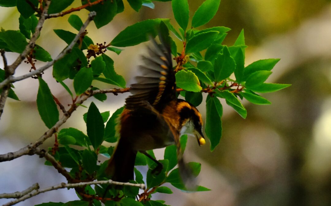
The genus Aphrastura (family Furnariidae) groups together small insectivorous passerines endemic to the southwestern part of South America. It historically comprises two species: the thorn‑tailed rayadito (Aphrastura spinicauda, synallaxis rayadito or espinoso rayadito), widely distributed in the temperate forests of Chile and southern Argentina, and the Masafuera rayadito (Aphrastura masafuerae), microendemic to Alejandro Selkirk Island in the Juan Fernández Archipelago.
Rayadito (Aphrastura spinicauda) photographed during a Karukinka expedition in the channels of the Cape Horn Biosphere Reserve (Chile, April 2025).
The rayaditos (in Yagán: tachikatchina) play a central role in the biology of southern temperate forests, where A. spinicauda is one of the most abundant tree‑cavity birds (and one of the most vocal!) in the Nothofagus forests, up to the southernmost limits of the Cape Horn Biosphere Reserve.
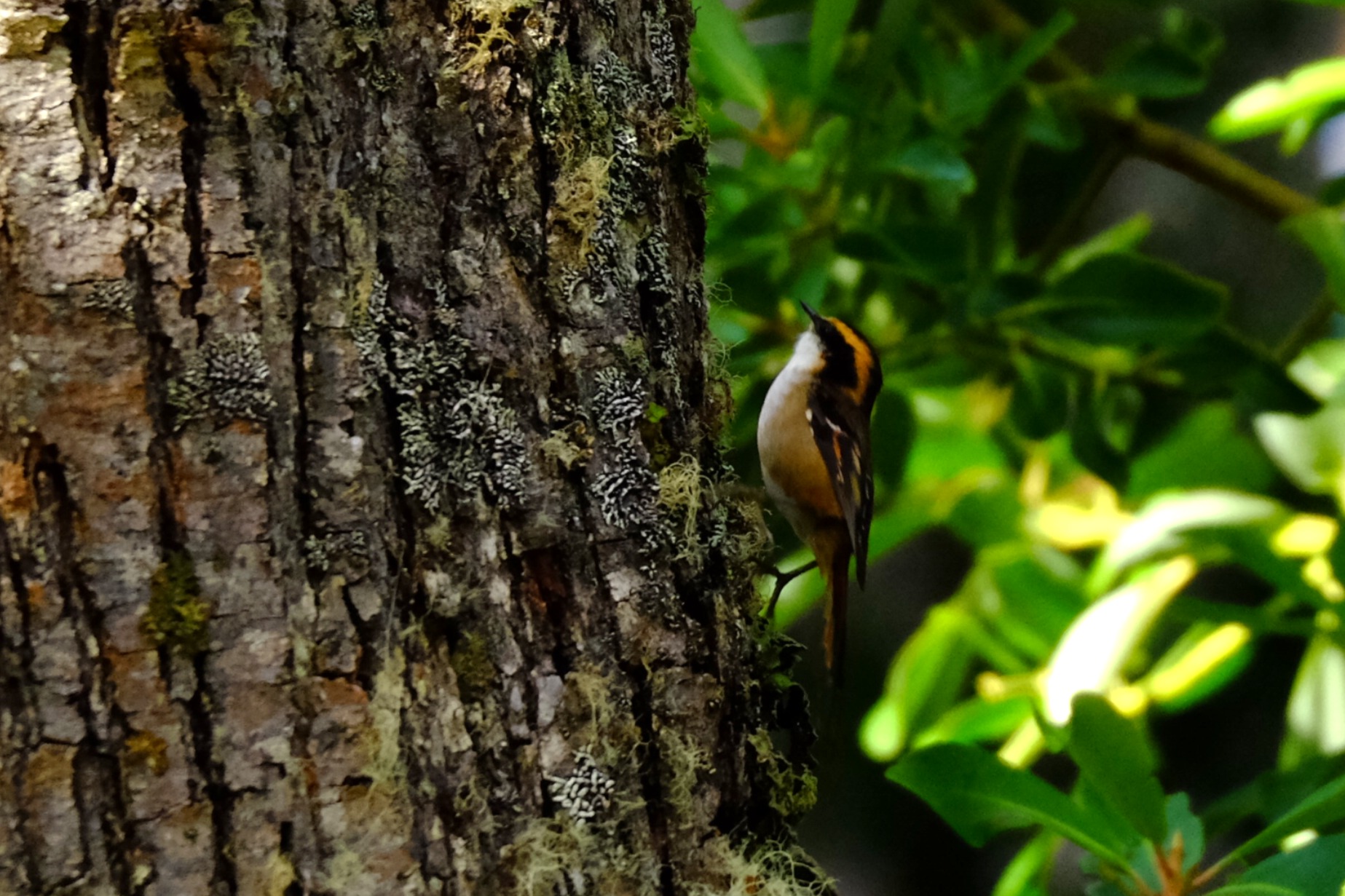
Within this subantarctic context, the recent discovery of the subantarctic rayadito (Aphrastura subantarctica) in the Diego Ramírez archipelago, to the southwest of Cape Horn, has revealed a remarkable case of island diversification within a treeless environment.
Table of contents
Distribution, diversity and ecosystems
Recent studies on the community of cavity‑using birds show that A. spinicauda is one of the most abundant passerines in southern temperate forests, with densities exceeding 9 individuals per hectare and a strong dependence on cavities excavated by the Magellanic woodpecker (Campephilus magellanicus). In contrast, A. subantarctica inhabits an herbaceous archipelago dominated by Poa flabellata and uses ground cavities or the structures of seabird nests for breeding, in the absence of terrestrial mammalian predators.
Morphology, ecology and behaviour
A. spinicauda is a small passerine of about 12 g, with a long, slender tail employed in its acrobatic movements on trunks and branches. Its streaked, brown‑reddish plumage provides excellent camouflage against bark and foliage, and it feeds primarily on insects and larvae, exploring bark and understory vegetation.
A. subantarctica, on the other hand, averages 16 g, with a longer bill, heavier legs, a shorter tail and a behaviour focused close to the ground, reflecting adaptation to a wind‑exposed, herbaceous habitat.
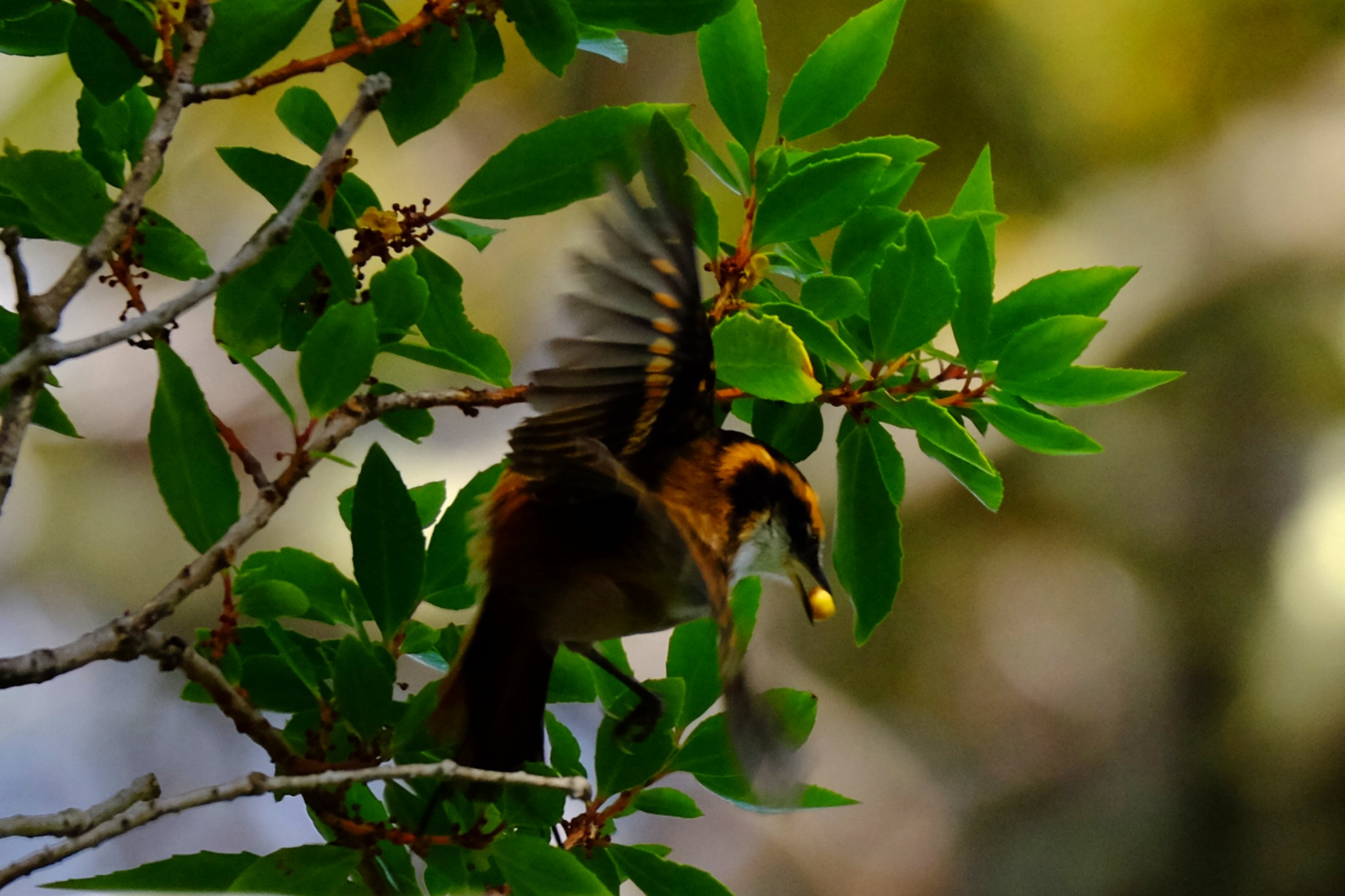
The behaviour of the rayadito in Yagán territory is illustrated by these words from Ursula Calderon: “Tachikatchina is a bird that sings in the mountains during the day, warning that someone is hidden: a wicked man, a sorcerer. It thus announces to the walker the presence of these people, or of a dog, of a cat… in short, of someone hidden. Its calls, when they sing together, are frightening, tsch‑tsch‑tsch, since they do not announce anything good” (p. 70, réf. 10).
Rayadito or Tachikatchina, photographed in April 2025 in Caleta Borracho (sailing expedition through the Patagonian channels, Chile).
Genetics, speciation and conservation
Genetic analyses show a clear differentiation between A. spinicauda and A. subantarctica, which justifies proposing A. subantarctica as a new emblematic species of subantarctic biodiversity. This distinction, combined with morphological and behavioural differences, places the Diego Ramírez archipelago as a natural laboratory of speciation and conservation, now protected by the Diego Ramírez–Drake Passage Marine Park.
For A. spinicauda, the conservation of old‑growth, cavity‑rich forests and the preservation of the Magellanic woodpecker population are essential to maintain the structure of rayadito populations within the Cape Horn Biosphere Reserve.
Sources :
Rozzi, R. et al. (2022). “The Subantarctic Rayadito (Aphrastura subantarctica), a new bird species on the southernmost islands of the Americas”. Scientific Reports 12, 13957. https://doi.org/10.1038/s41598-022-17985-4
Rozzi, R. et al. (2023). “The subantarctic rayadito (Aphrastura subantarctica), a new bird species on the southernmost islands of the Americas (repositorio UChile version)”. Repositorio UChile. https://repositorio.uchile.cl/handle/2250/194760
Ramírez‑D’Crego, R. (2022). “The Subantarctic Rayadito (Aphrastura subantarctica), a new bird species on the southernmost islands of the Americas”. CECS research‑related article. https://ramirodcrego.com/papers/article29/
Zenodo (2022). Dataset “The Subantarctic Rayadito (Aphrastura subantarctica), a new bird species on the southernmost islands of the Americas”. Morphological and genetic data. https://zenodo.org/records/6983420
Rozzi, R. et al. (2022). “The Subantarctic Rayadito (Aphrastura subantarctica), a new bird species on the southernmost islands of the Americas”. PMC version (NIH‑NIHMS). https://pmc.ncbi.nlm.nih.gov/articles/PMC9418250/
Rozzi, R. et al. (2022). Taxonomic description of Aphrastura subantarctica (Wikispecies).
Marine, R. H. et al. (2022). “The extreme rainfall gradient of the Cape Horn Biosphere Reserve”. Science of the Total Environment ou équivalent (étude de biodiversité et de rayaditos dans les canaux).
Rozzi, R. et al. (2018). “Marine biodiversity at the end of the world: Cape Horn and Diego Ramírez islands”. PLOS ONE ou revue équivalente, décrivant la diversité des îles Diego Ramírez et la contexte écologique.
Rozzi, R. et al. (2017). "Guia Multi-Etnica de Aves de los Bosques Subantarticos de Sudamérica". Ediciones Universidad de Magallanes.
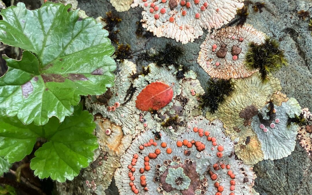
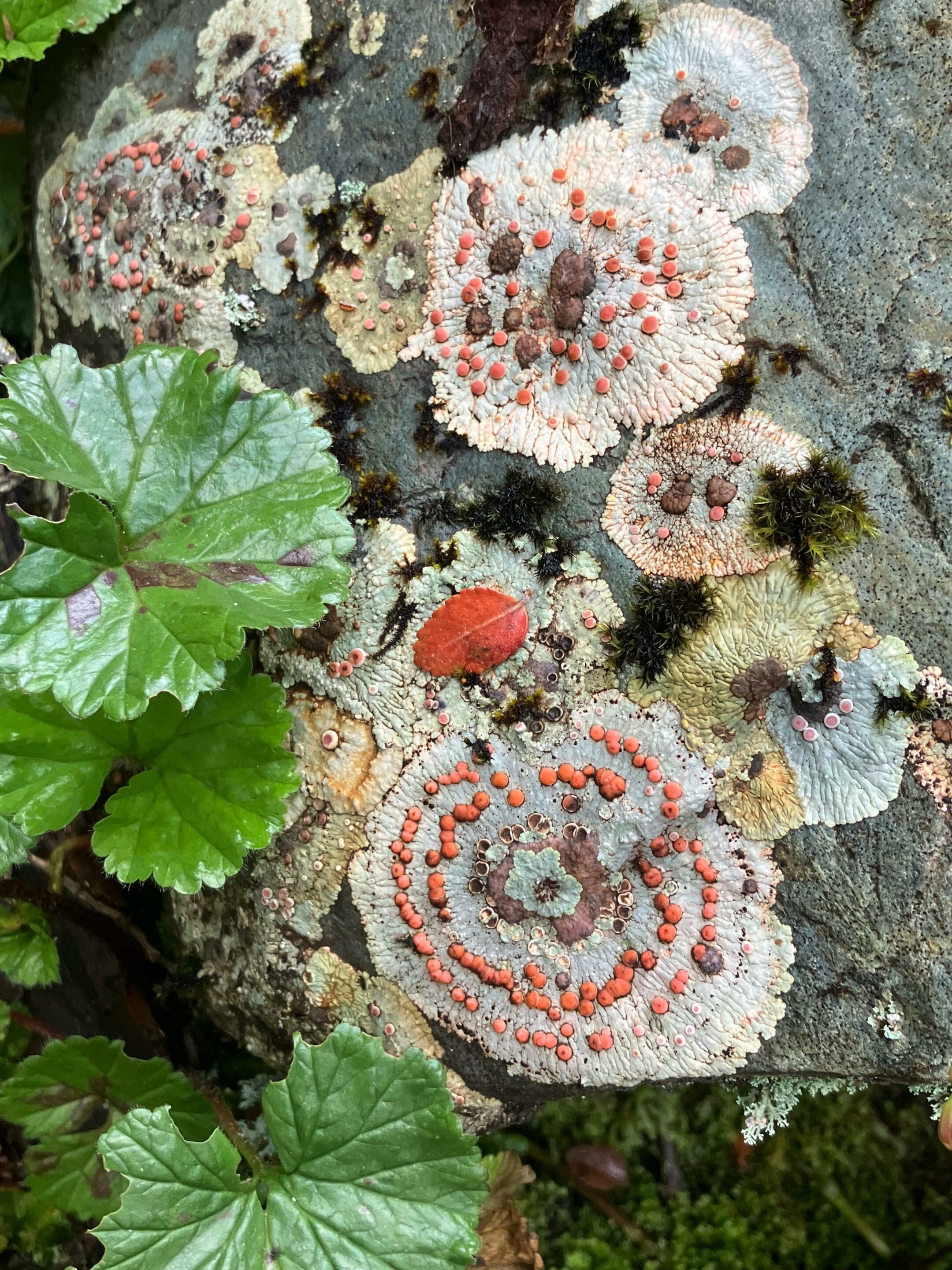
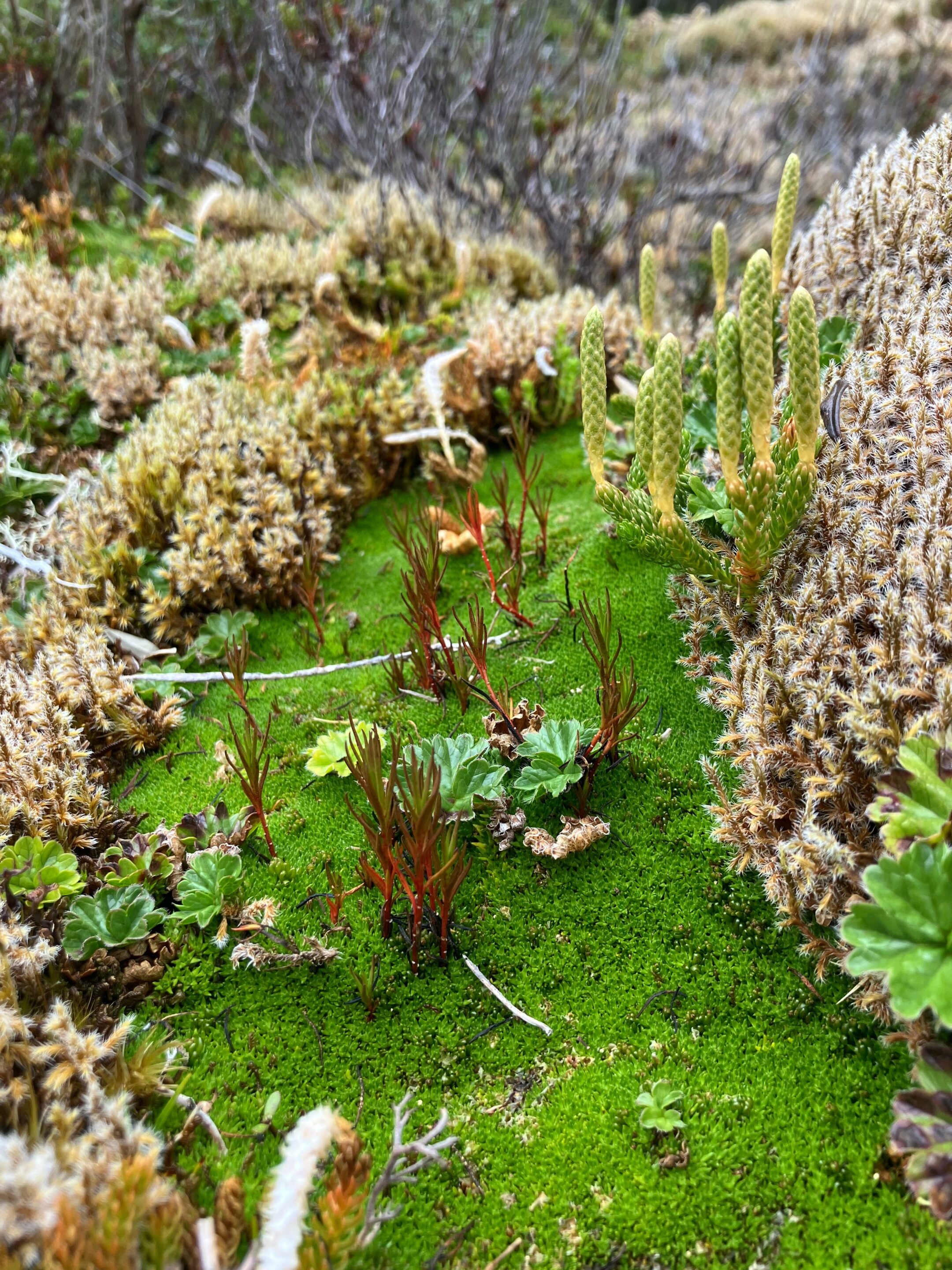
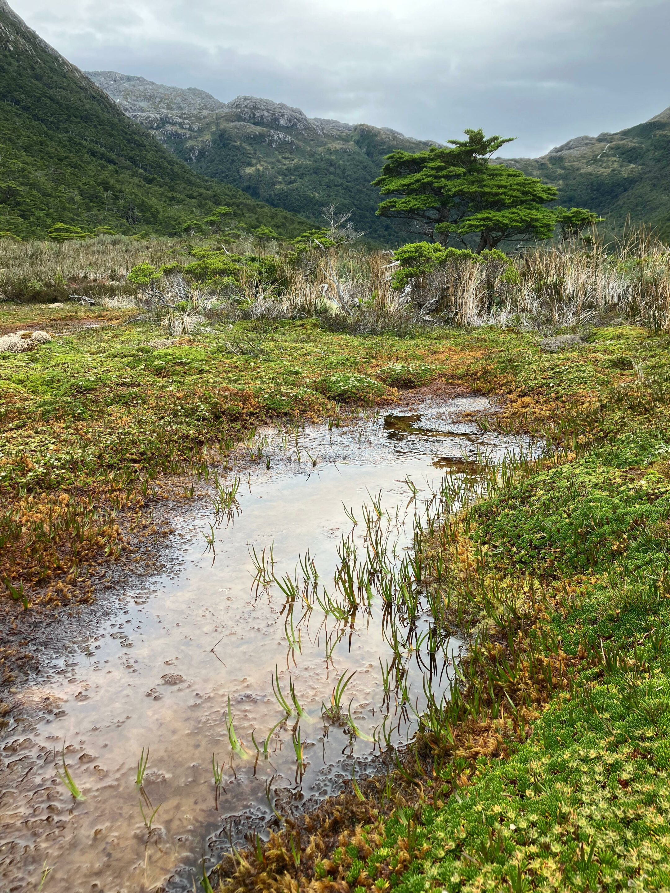
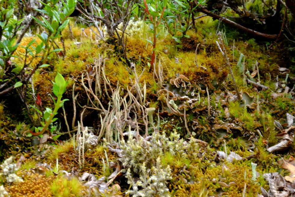
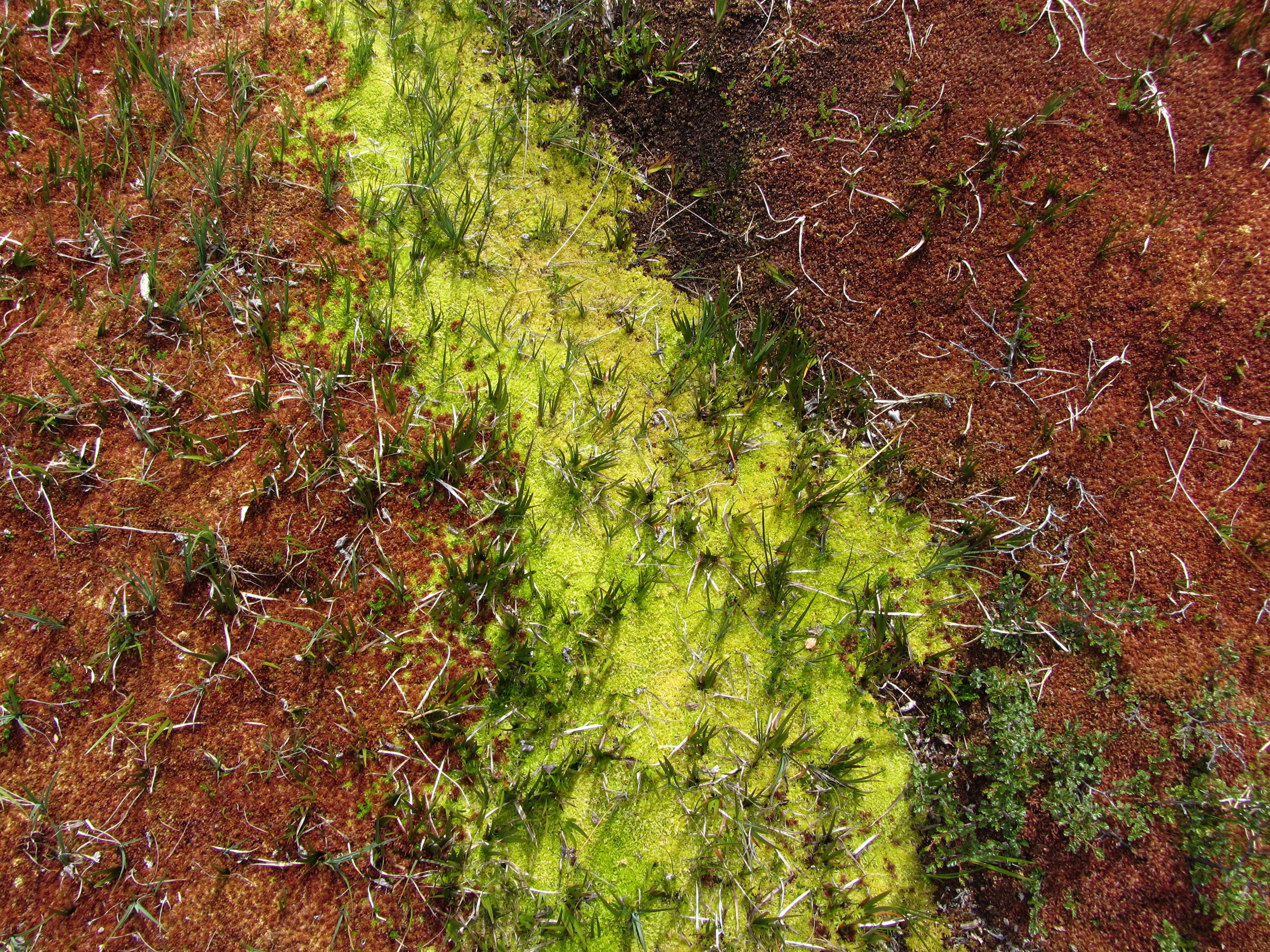
In southern Patagonia, within the Cape Horn Biosphere Reserve, lichens and bryophytes turn trunks, rocks, and peat bogs into true “miniature forests” that can only be discovered by leaning in with a hand lens.
This cryptogamic diversity reaches an exceptional level on Navarino Island, where work carried out by the Omora Ethnobotanical Park team has shown that more than 5% of the world’s bryophyte species are concentrated on less than 0.01% of the Earth’s surface, including a large proportion of endemic species. To this richness in mosses and liverworts is added a remarkable lichen flora, recently inventoried, which confirms the status of the Cape Horn Biosphere Reserve as a global hotspot for non-vascular organisms.
Placopsis lambii and Gunnera magellanica, seen in one arm of Tres Brazos bay (Karukinka's expedition "Biosphere Reserve of cape Horn", February 2026)
A hotspot at the end of the world
Navarino Island and the subantarctic region of Magallanes lie in a zone of humid temperate forests swept by winds, where abundant rainfall and cool temperatures favor the proliferation of mosses, liverworts, and lichens. This ecoregion has been identified as a global center of bryophyte diversity, with about 818 species recorded in the Magallanes region, which play a key role in nutrient regulation and water quality. Lichens also reach remarkable diversity there: an intensive floristic study on Navarino Island recorded 416 taxa of lichens and related fungi, including species new to science.
The forests of Navarino are located in one of the cleanest-rain regions on the planet, and the abundance of lichens sensitive to air pollution reflects the low contaminant load of the local air. This sensitivity makes lichens good bioindicators of air quality, a point often emphasized in the educational activities of Omora Park and in communication about the Biosphere Reserve.
Even in this relatively preserved region, bryophyte and lichen communities remain vulnerable to repeated trampling, hydrological changes, and the long-term effects of climate change on precipitation and temperature regimes. Disturbances caused by introduced species, such as the North American beaver, which profoundly modifies waterways and peat bogs in the region, can indirectly alter the substrates and microclimatic conditions needed by these miniature forests.
Bunodophoron patagonicum (Expedition Karukinka February 2026, Gordon island, Biosphere Reserve of cape Horn)
Bryophytes and lichens: discreet but essential protagonists
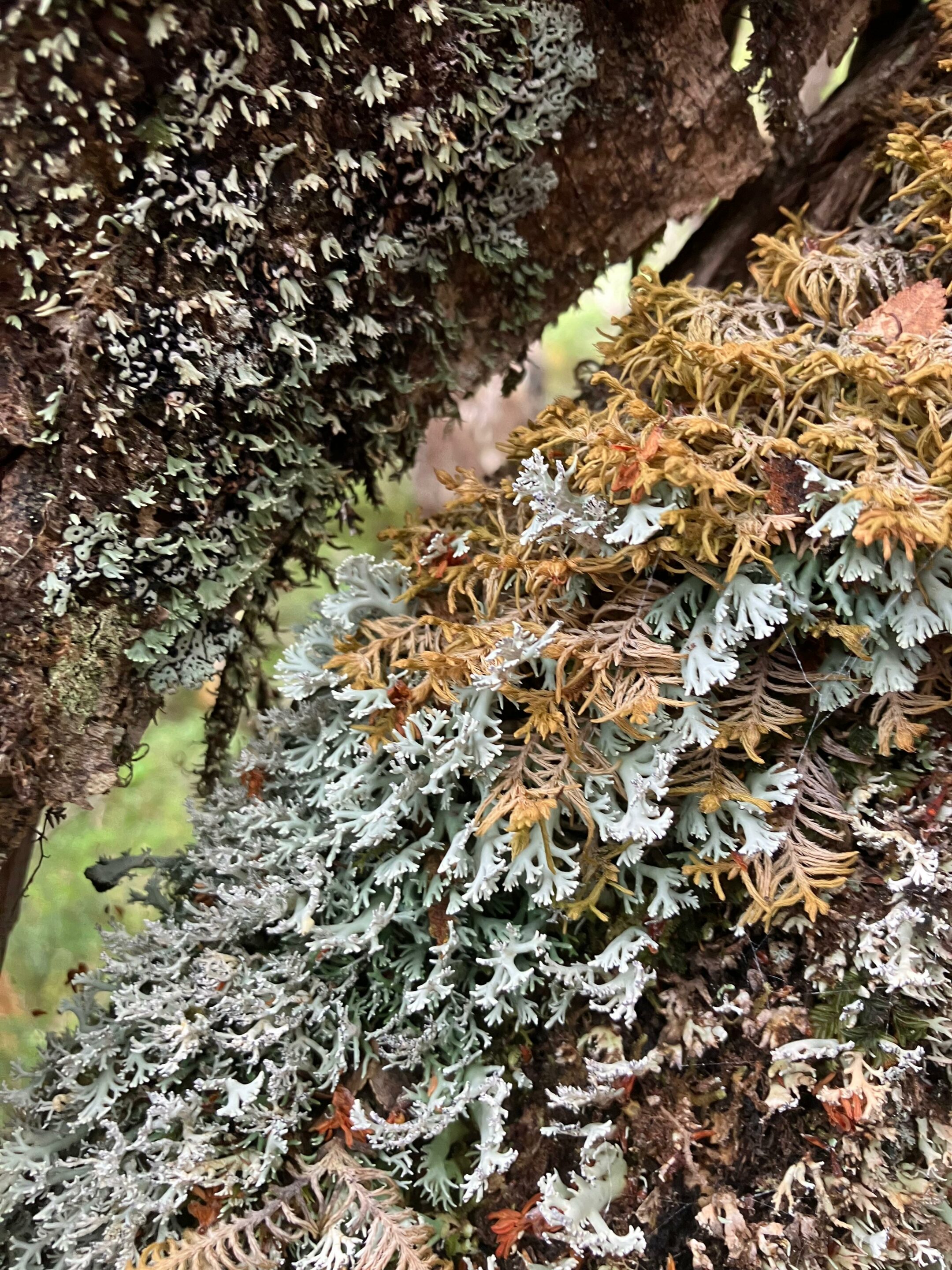
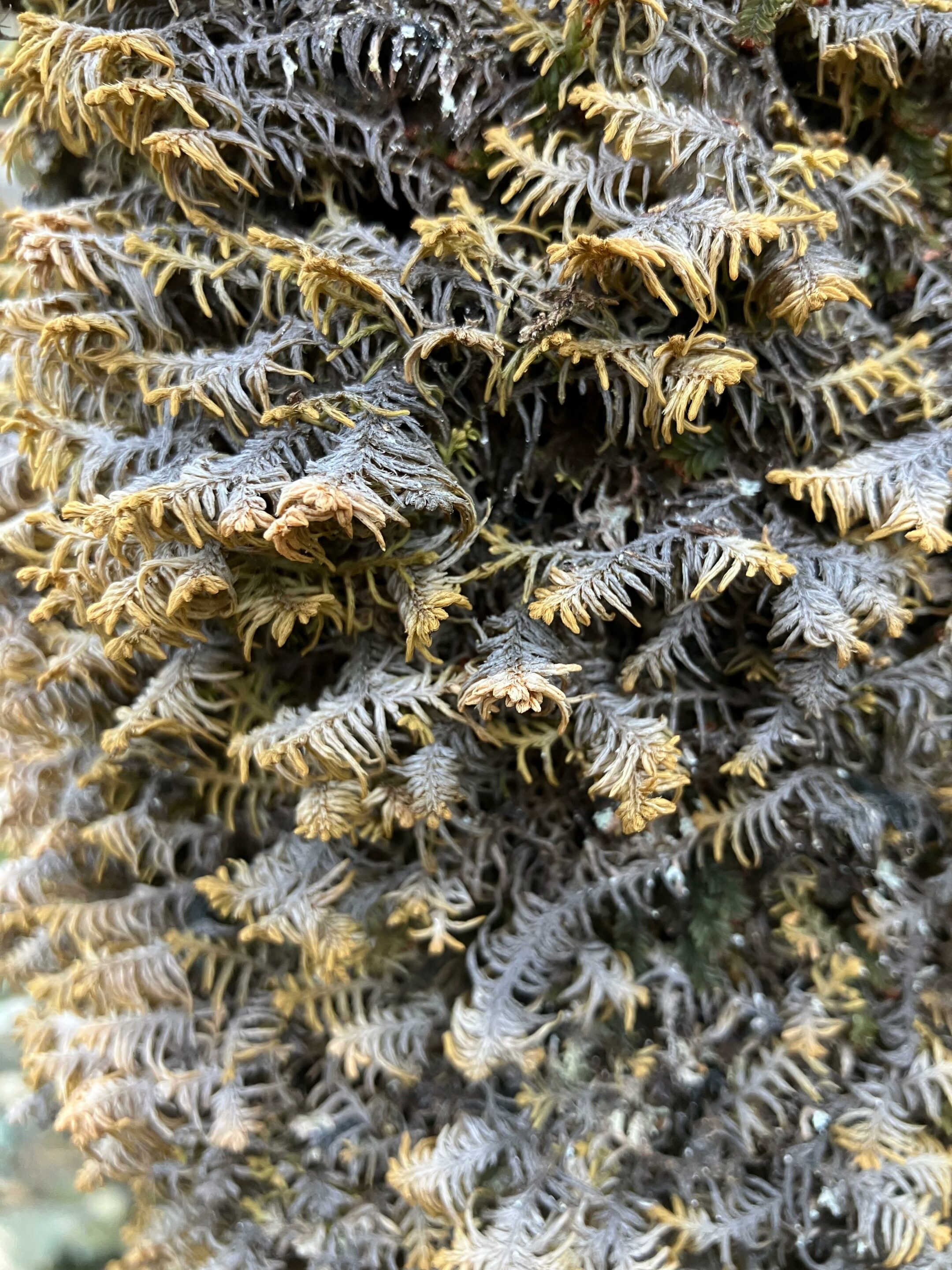
Bryophytes—mosses, liverworts, and hornworts—are small non-vascular plants, lacking roots and complex conducting tissues, yet they colonize trunks, soils, and rocks extensively in subantarctic forests. Lichens, long-lasting symbioses between a fungus and an alga or cyanobacterium, form crusts, leafy rosettes, or shrubby tufts that cover Nothofagus bark, dead wood, stones, and even moss cushions already in place. Together, these two groups make Cape Horn one of the places with the highest densities of non-vascular organisms in the world, to the point where a single tree can host more than a hundred epiphytic species.
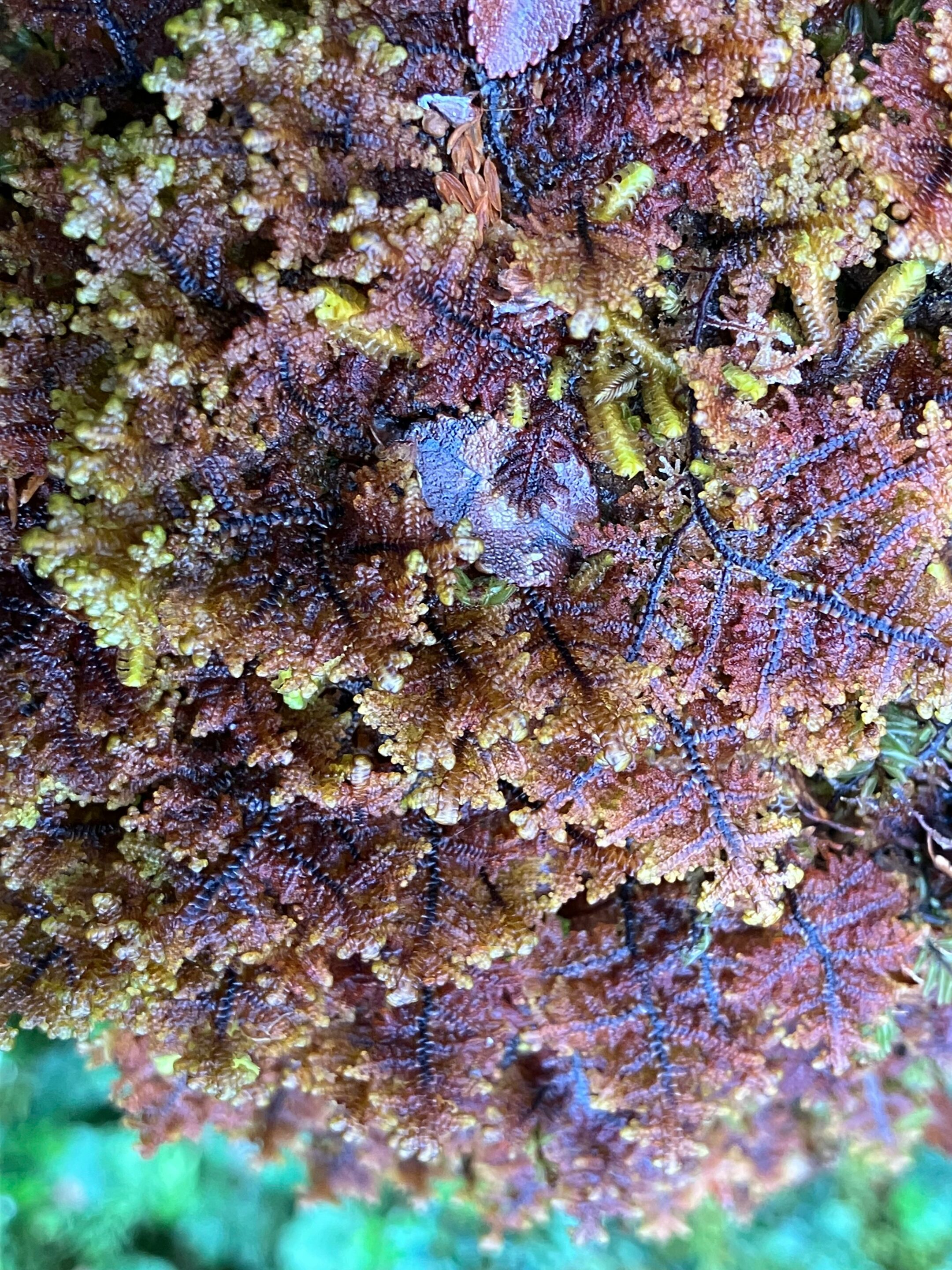
Gunnera magellanica, Lepidozia chordulifera and Blechnum pennamarina, photographed during an expedition Karukinka in Tres Brazos Bay (Gordon island, Cape Horn Biosphere Reserve, Chile, February 2026)Plagiochila elata (expedition Karukinka February 2026, cape Horn province, Chile)
Bryophytes and lichens in southern Patagonia are poikilohydric, meaning they tolerate strong drying and can suspend their metabolism, resuming it rapidly once rehydrated, which makes them especially resistant to freeze–thaw cycles. Many species develop protective pigments and thick structures that reduce damage from UV radiation, wind, and direct exposure, especially in Magellanic tundra and coastal environments. These functional traits explain why, at the highest elevations of Navarino or on wind-swept shores, the dominant organisms are moss cushions and crustose or shrubby lichens.
Miniature forests
To make this richness perceptible beyond scientific circles, Ricardo Rozzi and colleagues proposed the metaphor of the “bosques en miniatura del Cabo de Hornos,” miniature forests formed by mosses, liverworts, lichens, and the microfauna that lives there. The practice of observing these small landscapes with a hand lens, pausing for a long time in front of a trunk or rock, turns a walk into a detailed natural history exploration of worlds that are usually invisible.
Lypocodium s.l. on the right (Tres Brazos bay, Cape Horn Biosphere Reserve, expedition Karukinka February 2026)
Miniature forests are not only vegetal: they also shelter a diverse microfauna of insects, mites, nematodes, and other invertebrates that feed, reproduce, and take refuge in moss and lichen cushions. These organisms contribute to the fragmentation of organic matter, the mineralization of nutrients, and sometimes the dispersal of spores and propagules, adding several trophic levels to what, to the naked eye, looks like a simple green or gray carpet.
Ecological roles in forests and bogs
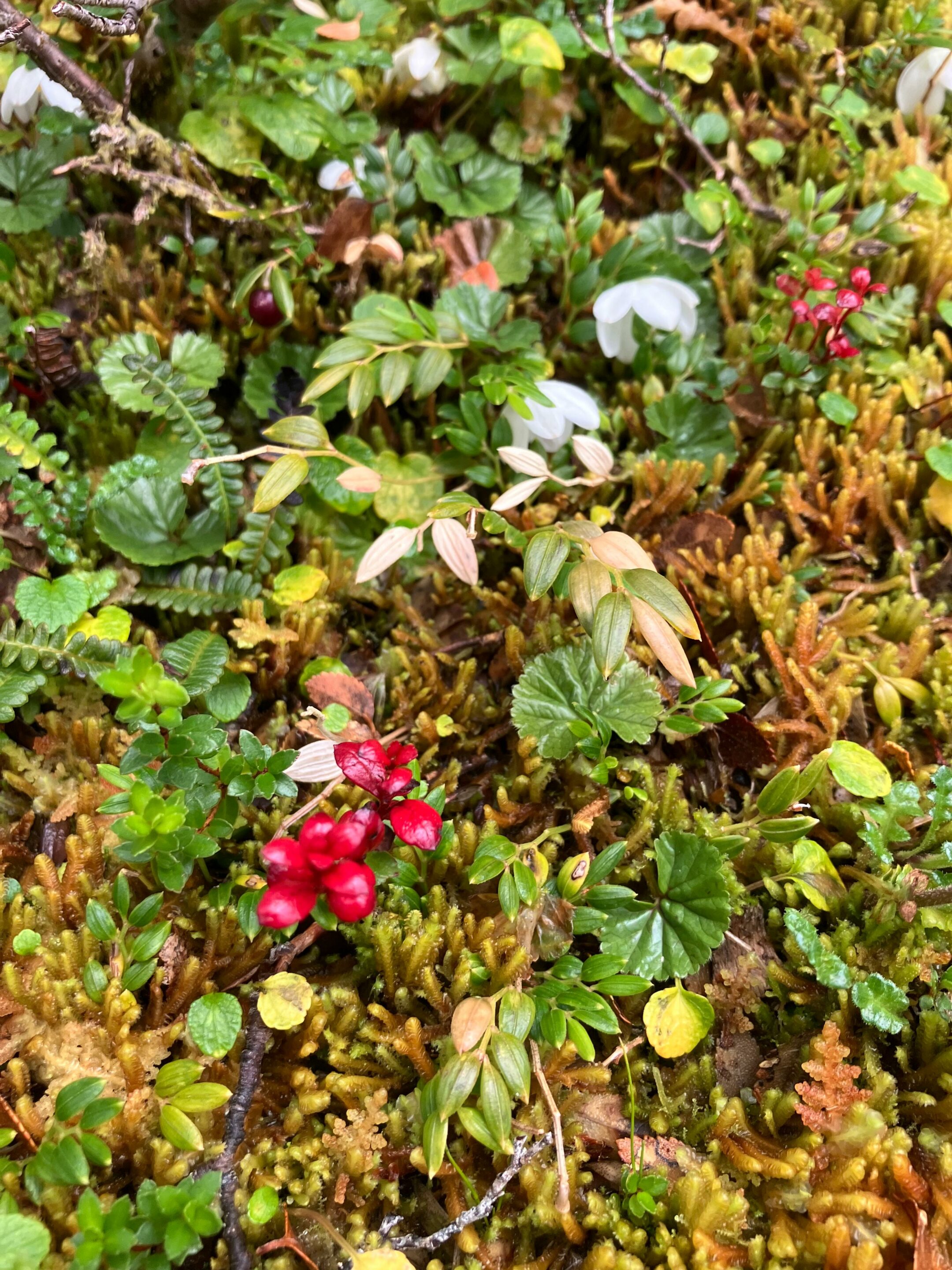
In humid subantarctic forests, bryophytes and lichens form thick mantles on trunks, rocks, and the ground, capable of retaining large amounts of water and regulating local humidity. This water-retention capacity makes them natural sponges that soften the impact of frequent rainfall, limit erosion, and stabilize microhabitats for many invertebrates and microorganisms.
In peat bogs, bryophytes—especially sphagnum-type mosses and related forms—structure the matrix that accumulates organic matter in saturated environments, storing both water and large amounts of carbon.
Sphagnum, Baie Tres Brazos (cape Horn biosphere reserve, fueguian channels, Chile, expedition Karukinka, February 2026)
Lichens also play a pioneering role on bare rocks, glacial moraines, and coastal outcrops, where they initiate soil formation by physically and chemically altering the substrate. By retaining particles and moisture, these pioneer communities gradually create micro-niches favorable to the later establishment of mosses and then vascular plants.
Emblematic mosses and lichens
Among bryophytes, the moss Lepyrodon lagurus is often cited as an emblematic species of Omora Park, where it forms velvety mats on tree trunks and contributes to the luxuriant appearance of humid forests. This type of epiphytic moss retains rainwater, offers micro-refuges to a variety of invertebrates, and sometimes hosts lichens that settle on its surface, further increasing the complexity of the miniature forest.
Among lichens, the large tufts of Usnea, the “old man’s beards” hanging from Nothofagus branches, clearly illustrate the relationship between air purity and the vigor of lichen populations. The cushions and small trumpets of Cladonia that cover some soils or dead wood, as well as newly described species such as Candelariella magellanica, testify to the originality of Navarino’s lichen flora.
Miniature forest photographed during a trekking between Lëm and Wulaia (Navarino island, Chile) in February 2020 (Lauriane Lemasson)Sphagnum and liverworts (expedition in Tierra del Fuego, Lauriane Lemasson, March 2013)
Hand-lens ecotourism
To highlight and protect this discreet biodiversity, the Omora Park team developed the concept of “Ecoturismo con lupa,” a hand-lens ecotourism that places the discovery of mosses, liverworts, and lichens at the center of the experience. Coined by Ricardo Rozzi and colleagues, the term refers to a niche tourism practice in the Cape Horn Biosphere Reserve, where visitors are invited to observe the “miniature forests” and understand their ecological role. Marked trails welcome small groups equipped with hand lenses, accompanied by guides who combine natural history, ecology, and ethical reflection on biocultural conservation.
This ecotourism model has been supported by projects aimed at developing scientific and educational tourism in the region, seeking to connect local economic benefits, environmental education, and the protection of subantarctic ecosystems. The documentary Viaje Invisible. Ecoturismo con Lupa illustrates this approach by following guided visits that immerse the public in the detailed contemplation of Cape Horn’s miniature forests.
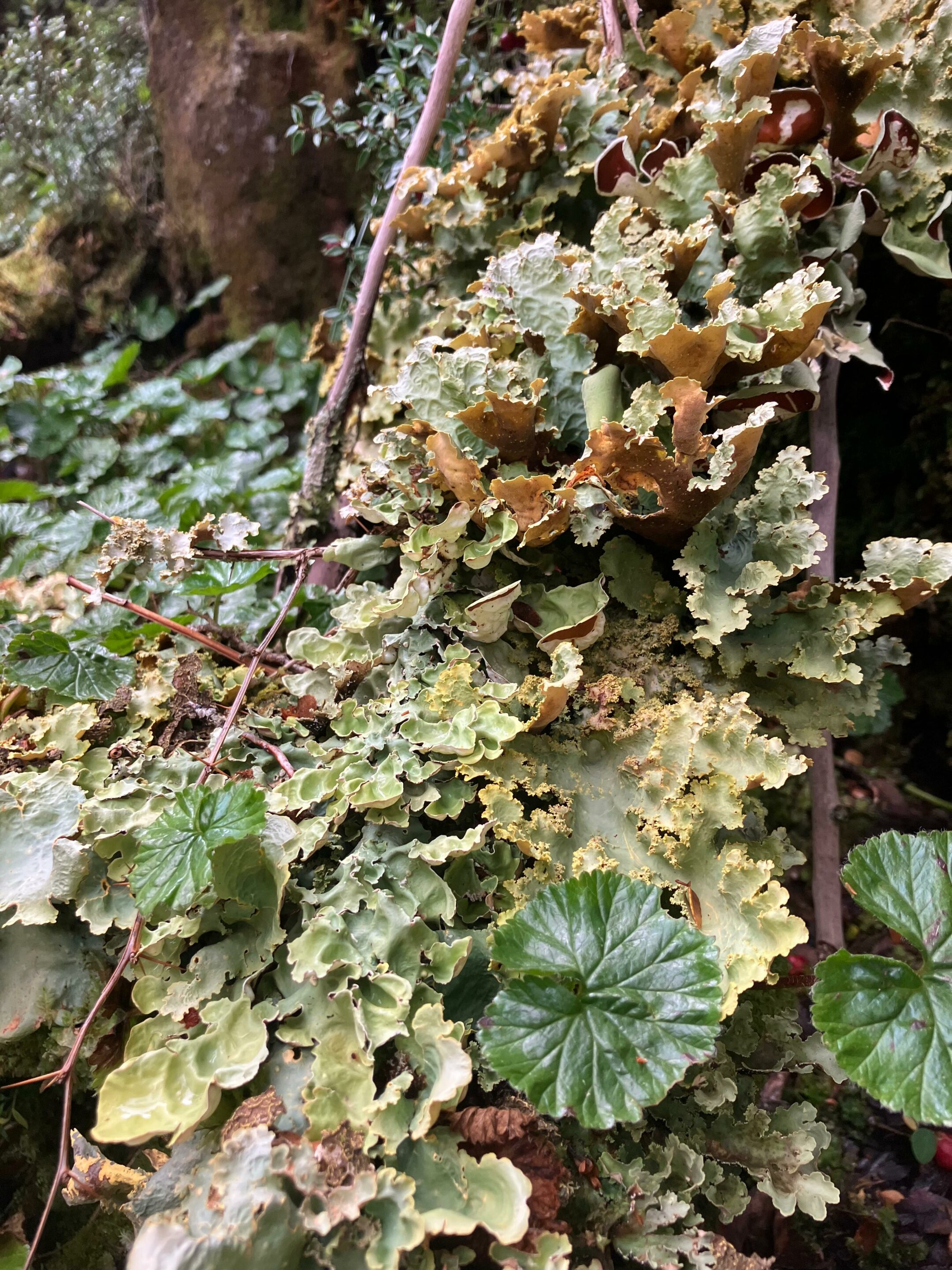
Gackstroemia magellanica (Endemic liverwort of the Cape Horn Biosphere Reserve (Karukinka expedition, February 2026))Gunnera magellanica – lichens Pseudocyphellaria berberina, Pseudocyphellaria frecineti, and Pseudocyphellaria granulata – Nephroma antarcticum (Karukinka expedition, Tres Brazos Bay, Cape Horn Biosphere Reserve, February 2026)
Biocultural conservation and education
Omora Park and its partners defend a “biocultural conservation” approach, linking biodiversity protection to the recognition of local cultures, especially Yaghan tradition and the communities of Puerto Williams. Bryophytes and lichens then become mediators for reflecting on the links between ways of life, environmental ethics, and responsibility toward ecosystems, notably through the “field environmental philosophy” proposed by Rozzi and colleagues.
Schools in Puerto Williams include the observation of miniature forests in their educational activities so that children recognize the global value of the biodiversity in their territory. This local appropriation helps counter “biocultural homogenization,” a concept that refers to the tendency to forget discreet organisms and lose the cultural knowledge and meanings associated with them.
Our thanks to Ricardo Rozzi and José German Gonzalez Calderon for their help in identifying the bryophytes from our images.
Short bibliography
Etayo, J., Sancho, L. G., Gómez-Bolea, A., Søchting, U., Aguirre, F., & Rozzi, R. (2021). Catalog of lichens (and some related fungi) from Navarino Island, Cape Horn Biosphere Reserve, Chile. Anales del Instituto de la Patagonia, 49.
Goffinet, B., Rozzi, R., Massardo, F., et al. (2012). Miniature Forests of Cape Horn: Ecotourism with a Hand Lens. University of North Texas Press.
Rozzi, R. (coord.) (n.d.). Ecoturismo con lupa en el Parque Omora. Universidad de Magallanes. Editorial presentation and book notice.
Cape Horn Center (CHIC). Ecoturismo con lupa: a way to discover the miniature forests of lichens and mosses.
Instituto de Ecología y Biodiversidad / Universidad de Magallanes. Omora Ethnobotanical Park – institutional presentation of the biological station.
Rozzi, R., et al. (2008). Patterns of species richness in sub-Antarctic plants and implications for conservation.
Documentary Viaje Invisible. Ecoturismo con Lupa. Omora Ethnobotanical Park, 2013.
Cultivating a Garden of Names in the Cape Horn Biosphere Reserve. Study on biocultural conservation, bryophytes and lichens, and environmental education.
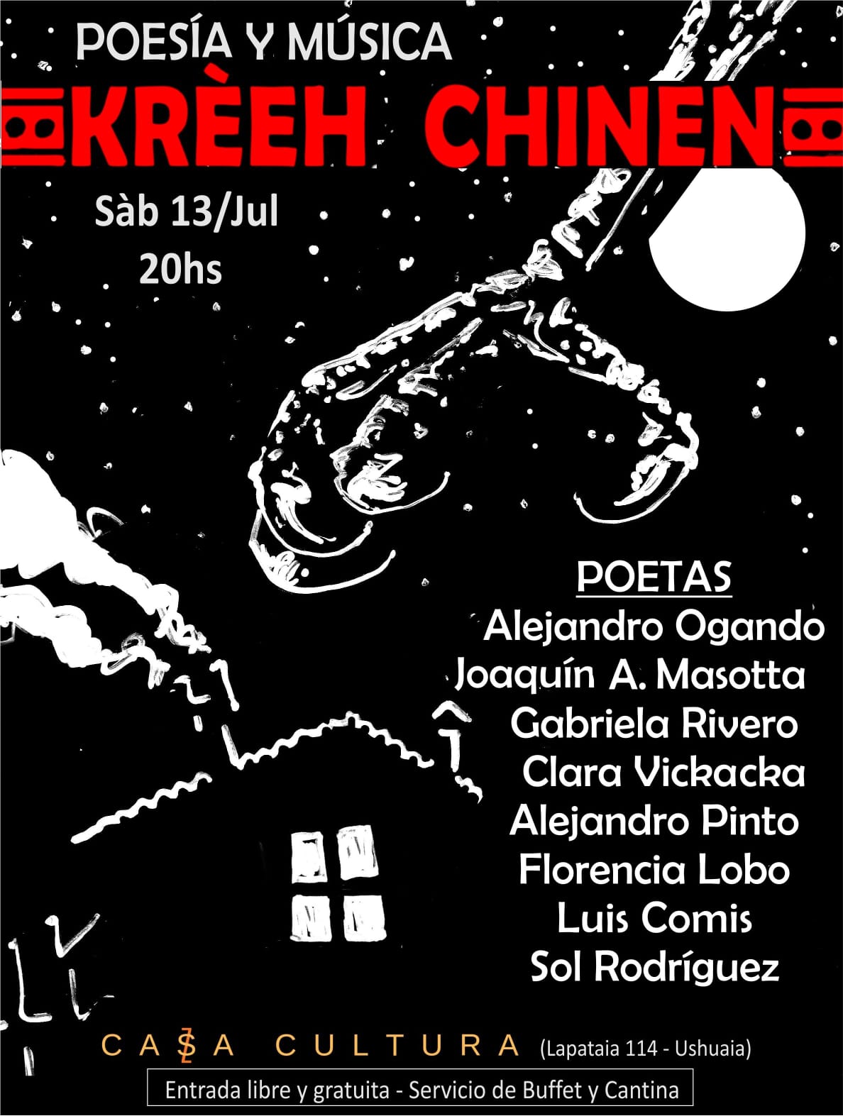
The crew of Milagro will be present, as a partner, at the 5th edition of the Kreeh Chinen Festival!
This event, which we have supported since its creation, will be held on November 29 at Restobar Punto de Encuentro in Tolhuin (province of Tierra del Fuego, Argentina).
The Festival: a place of artistic gathering
The Kreeh Chinen Festival, a Selk'nam word meaning "clinging to the moon" according to its founders, aims to bring together artists, poets, writers, musicians, and painters from throughout Tierra del Fuego province. Each of the three major cities in the province is represented, and the initiative was designed to foster independent, solidarity-based artistic exchange open to local initiatives: producers, artisans, and small organizations are invited to participate. The previous edition, already supported by Karukinka, underscores this collective and ambitious dimension: "The idea is to make visible the regional, environmental, and cultural themes of indigenous peoples," explain in unison two of the organizers, Lauriane Lemasson, a French researcher, and Alejandro Pinto, writer and poet from Río Grande.
Why Karukinka is associated with it
The Karukinka Association, founded with the ambition to "build the missing bridge between Europe and Tierra del Fuego," has been committed for many years to indigenous peoples and heritage projects in the region. The partnership with Kreeh Chinen thus naturally aligns with its mission:
To promote cultural expressions from southern Argentina (Tierra del Fuego) in their authenticity, independence, and diversity.
To strengthen connections between local actors (artists, artisans, indigenous communities) and a broader public, beyond borders.
To contribute to an event that highlights not only art but also environmental, cultural, and heritage themes linked to the indigenous peoples of the region.
What is planned for November 29, 2025
At Restobar Punto de Encuentro in Tolhuin, you will be able to discover:
Musicians coming from throughout Tierra del Fuego province,
Poets and writers sharing stories, voices, and local imaginaries,
Painters and visual artists displaying their works,
A moment of sharing and encounter, in the spirit of Kreeh Chinen, which values both art, local engagement, and cooperation.
This 5th edition of the Kreeh Chinen Festival will once again allow us to celebrate art, culture, and solidarity in Tierra del Fuego. We will share more details about this event with you soon!
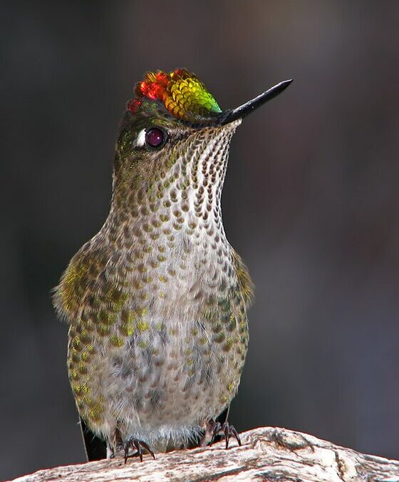
Today we share with you a Yagan story dedicated to the hummingbird, told by Úrsula Calderón and Cristina Calderón in 2001 in Mejillones Bay (Navarino Island, Chile). It was published on pages 170 and 171 of the book Guia Multi-Etnica de Aves de los bosques subantárticos de Sudamérica (2017) and translated from Spanish to English by the Karukinka association.
The Chilean hummingbird Sephanoides sephaniodes
The Yagan story of the hummingbird
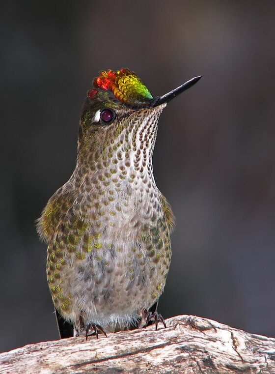
“Once, when birds were still humans, a severe drought struck the Cape Horn region and its inhabitants were dying of thirst. The cunning fox (cilawáia, the Magellan fox) found a lagoon and, without telling anyone, built a fence around it with umush branches (calafate in Yagan) so that no one could enter. Hidden there, he drank plenty of water alone, only caring for himself.
After some time, others discovered the lagoon's existence and, as a group, they went to ask cilawáia for some water. But he didn’t even want to listen to their pleas and brusquely expelled them. The people's condition worsened by the moment, and in their despair, they remembered omora. They sent a message to this small occasional visitor who, in similar past shortages, had saved their lives.
The Magellanic fox (Lycalopex griseus, cilawáia)
The hummingbird, or little omora, was always ready to help and came very quickly. Although weakened, this tiny creature (human or spirit) is braver and more fearless than any giant. Upon arrival, people told him in detail what had happened about the great shortages. Omora, upon hearing what happened, became indignant and flew to the place where cilawáia was. Selfish, the fox confronted him. And omora said: ‘Listen! Is it true what others told me? You have access to a lagoon, and you refuse to share your water with others. Do you know that if you don't give them water, they will die of thirst?’ The fox replied: ‘What do I care? This lagoon has very little water, just enough for me and some close relatives.’
Hearing this, omora became furious and, without answering cilawáia, he returned to the camp.
He thought hard and, hastily, rose holding his staff and returned to where cilawáia was. On the way, omora collected several sharp stones, and when close enough to the fox, he shouted: ‘Will you finally share the water with everyone?’ The selfish cilawáia answered: ‘Let them die of thirst. I can’t give water to each one of them, or else my family and I will starve.’
Omora was so furious he could not restrain himself and leapt with his staff, killing the fox with the first blow.
The others watching came running happily to the place, broke the fence, approached the lagoon, and began to drink to quench their thirst — all of the water. Some birds who arrived late barely managed to wet their throats. Then, the wise little owl sirra (grandmother of omora) said to the birds who had arrived late: ‘Go collect mud from the bottom of the lagoon and fly to the tops of the mountains, above which you must sprinkle.’
The little birds and their balls of mud created vertical springs that originated the watercourses cascading from the mountains, forming small streams and large rivers running through ravines. When everyone saw this, they were extremely happy and all drank large amounts of fresh and pure water, which was much better than the lagoon water that the selfish cilawáia guarded. Now everyone was saved. To this day, all these watercourses flow from the mountains and provide exquisite water. Since then, no one should die of thirst.”
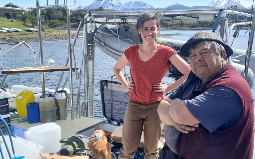
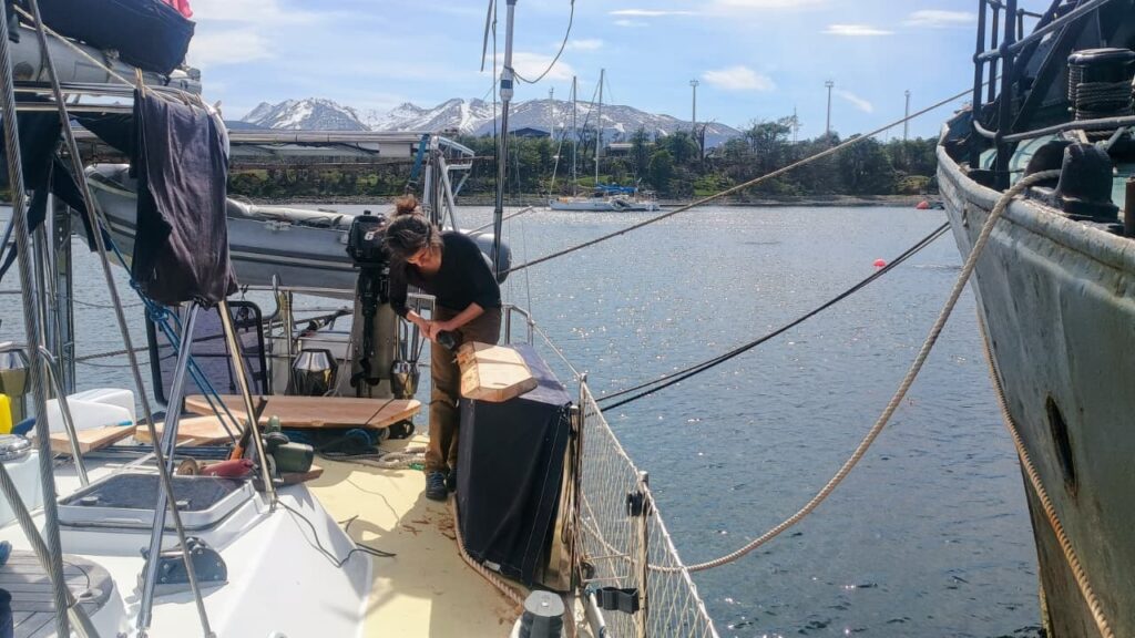
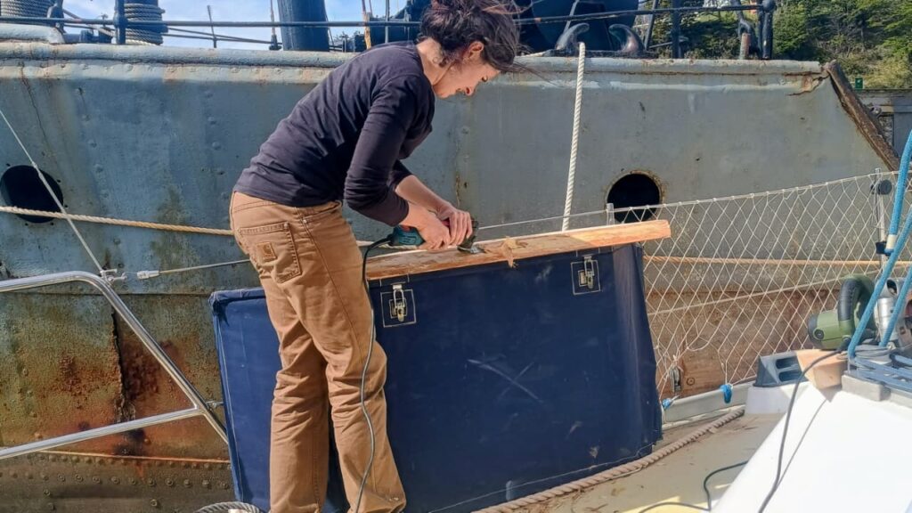
On Monday, October 27, the Milagro resonated with the sound of coigüe wood and tools. With José, crew member and godparent of the boat, we dedicated the day to a traditional woodworking session to craft two new work surfaces from coigüe wood. These new fittings, now installed at the stern of the sailing vessel, will be used to clean fish and lift nets outside, in perfect harmony with the sea and the wind. On board, the scent of freshly cut wood mingled with that of changing tides. The finishing touches were done with an axe, a vibrating saw, and finally a grinder.
Heritage of the Yagan people
Among the Yagans, people of the channels of Tierra del Fuego, woodworking holds an essential place. Originating from a culture intimately linked to water and cold, the Yagans shape wood for everything: canoes, tools, shelters. Their know-how is based on a keen sense of the material, capable of transforming a wet log into a light boat or a rough plank into a durable work surface. By reviving these ancestral gestures, although supplemented by modern tools, we pay homage to this millenary maritime culture, which saw in every piece of wood a fragment of the landscape, a trace of the link between humans and nature.
Lauriane and José aboard Milagro, with a first coigüe wood work surface on the starboard aft balcony.
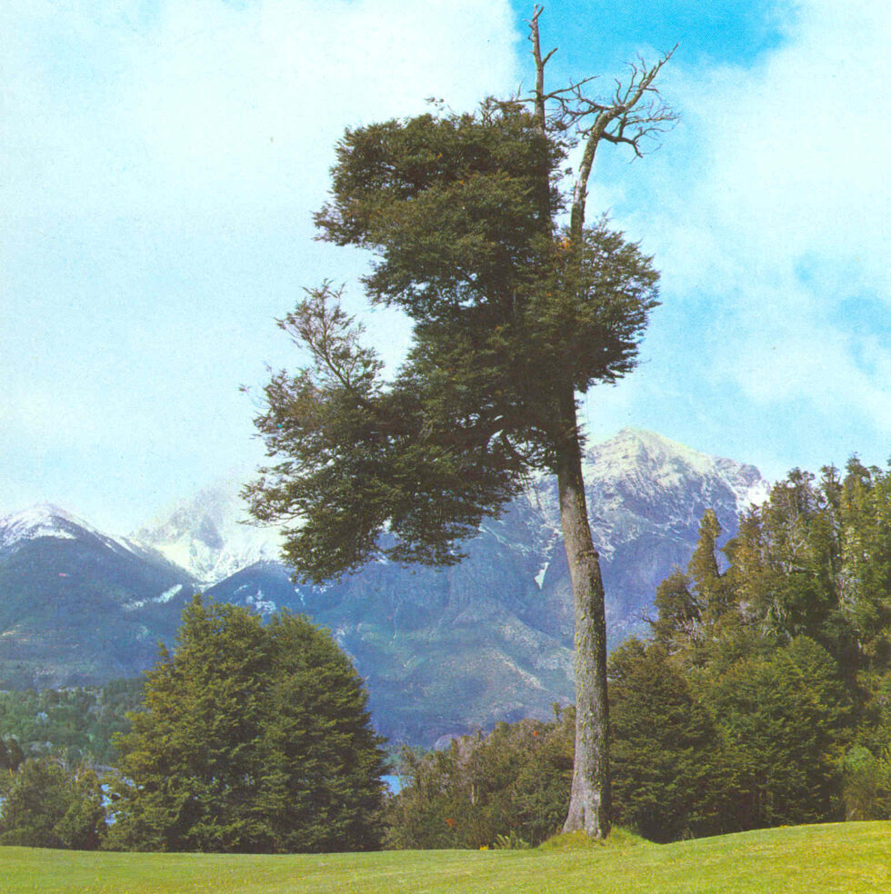
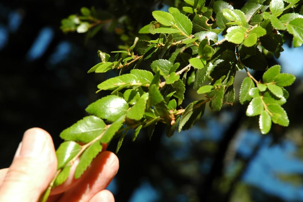
Coigüe wood, the strength of Southern Chile
The coigüe (Nothofagus dombeyi) is a emblematic tree of the temperate forests of southern Chile and Patagonia. Its wood, dense and strong, is distinguished by a clear and warm tint, perfect for marine works. It is a species that withstands moisture well and ages gracefully, developing a soft patina over the seasons. Working with coigüe means handling a living material, rooted in the same earth and winds that the Milagro sails through. This noble wood, over 60 years old in the case of what we used, was shaped here in the traditional way so that the boat continues its journey respecting the traditions and nature surrounding it.
Coigüe leaves (Valerio Pillar de Porto Alegre, Brazil — DSC_7172.JPGUploaded by pixeltoo, CC BY-SA 2.0, https://commons.wikimedia.org/w/index.php?curid=10393830)